Uncharted Lands
A report on an unforgettable journey through Scoresby Sund in East Greenland.
Off to Greenland for the second time!
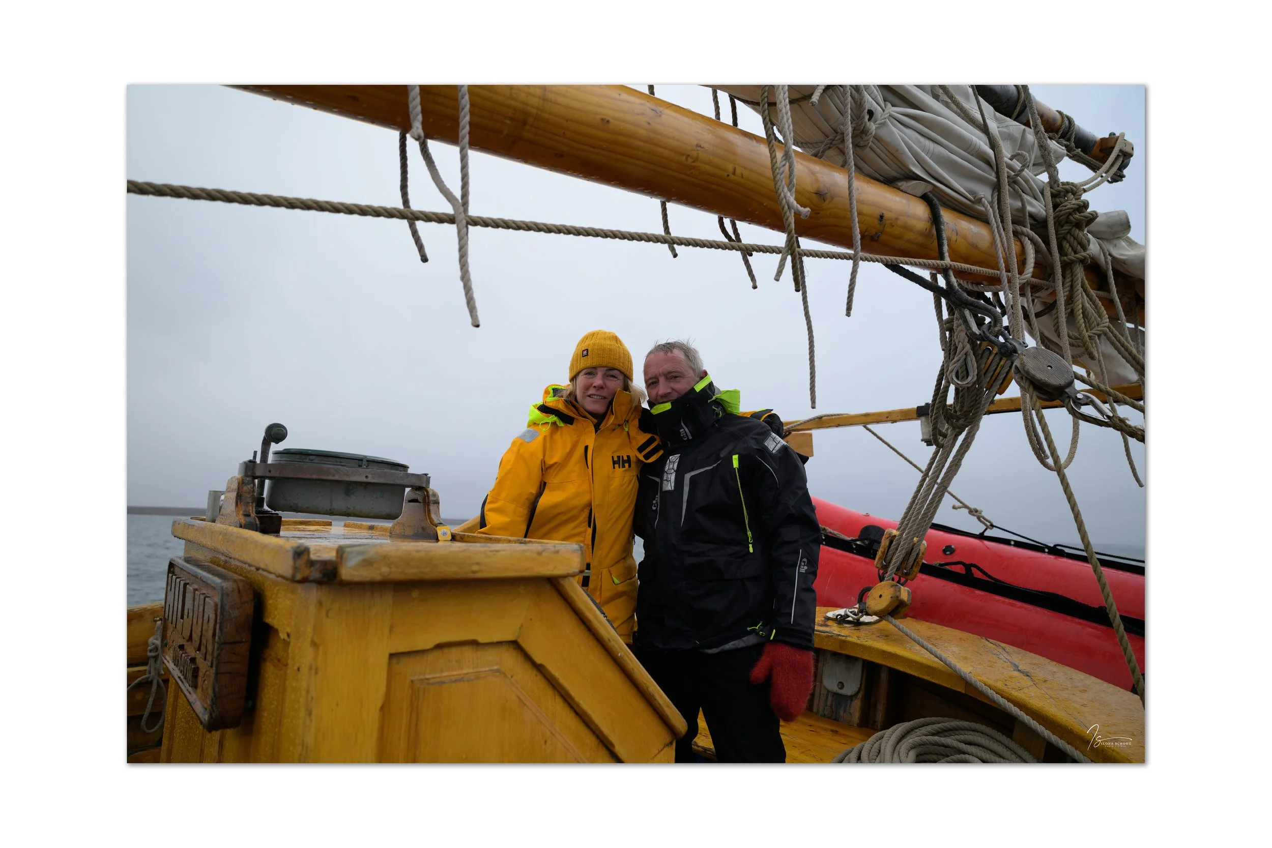
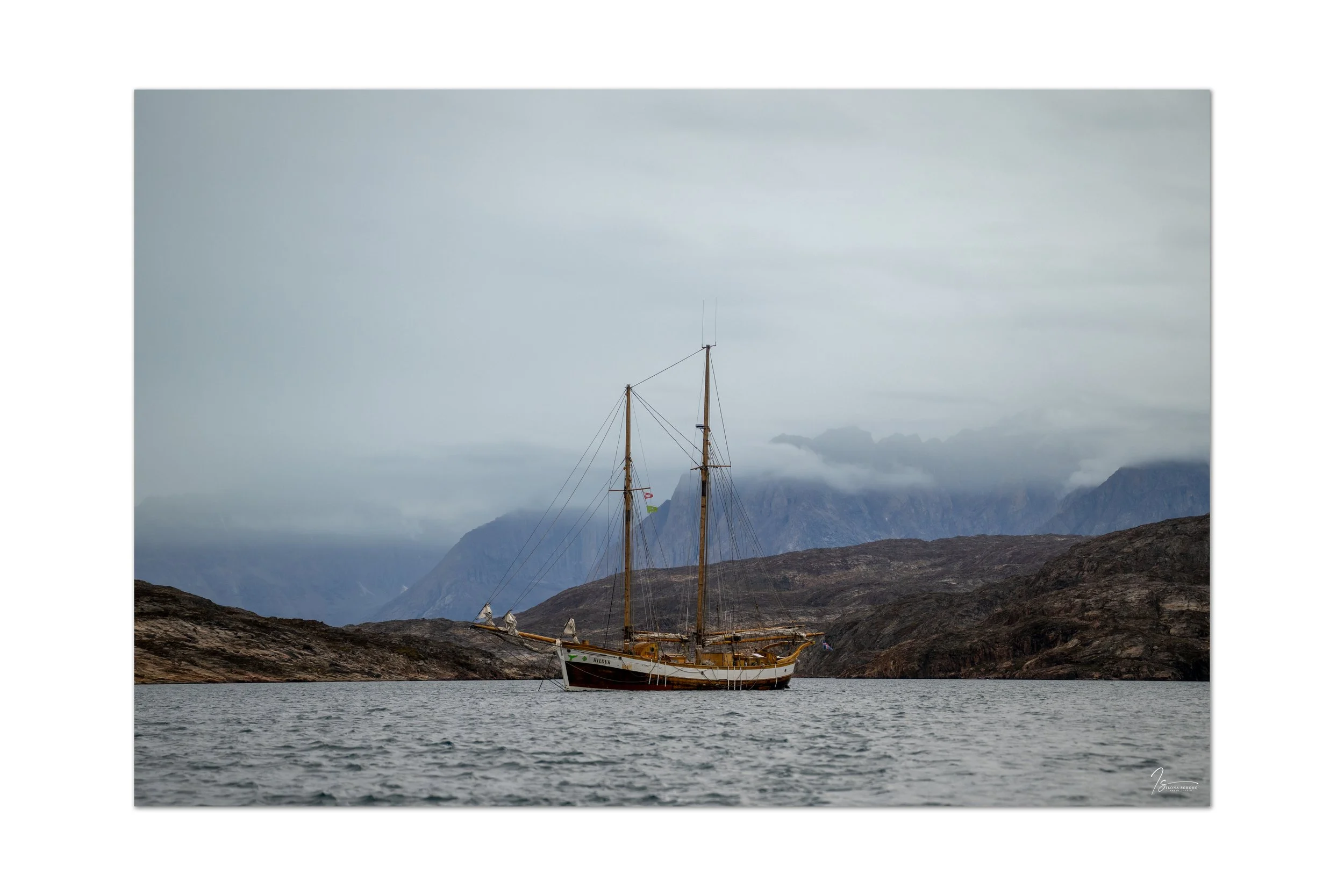
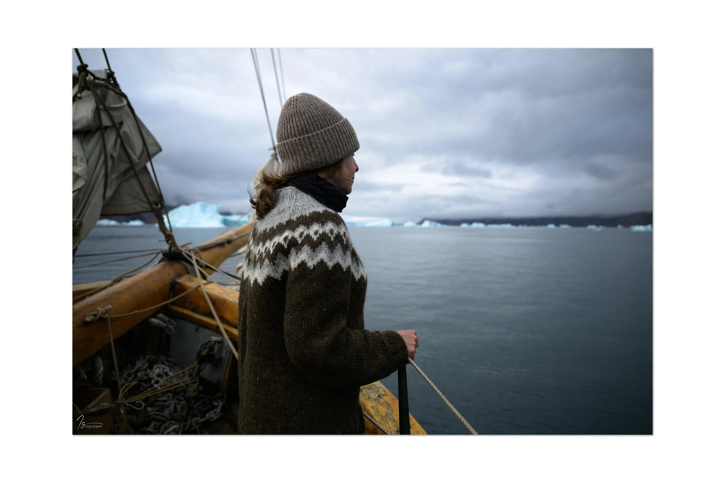
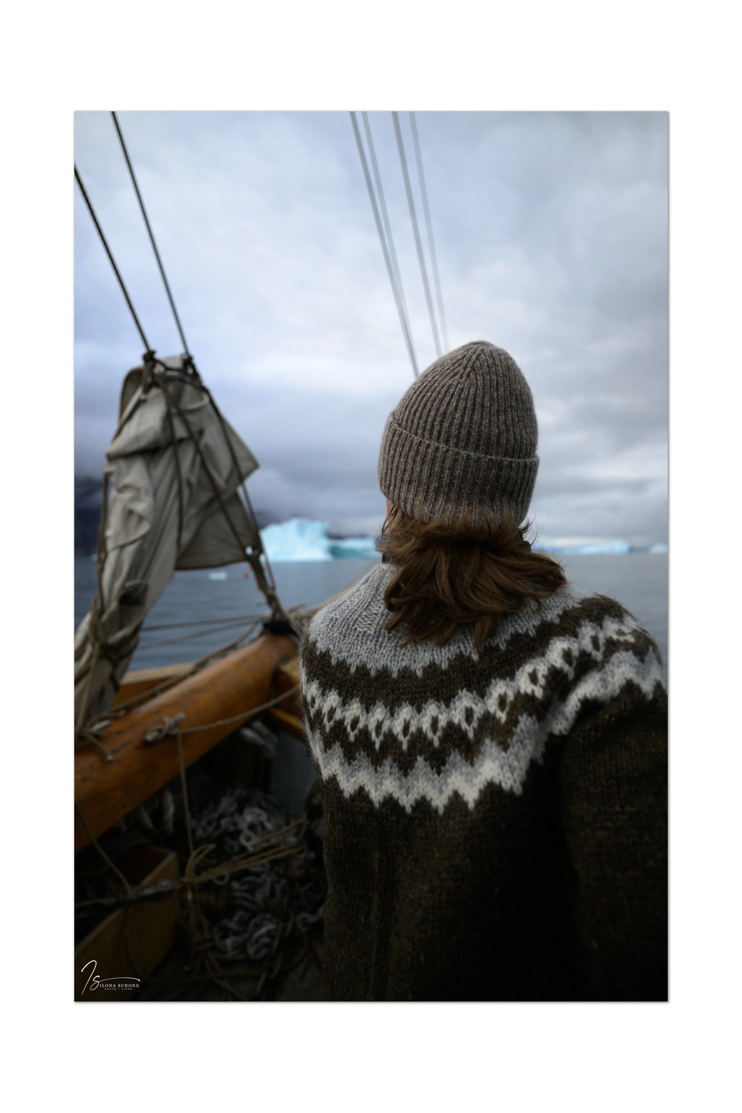
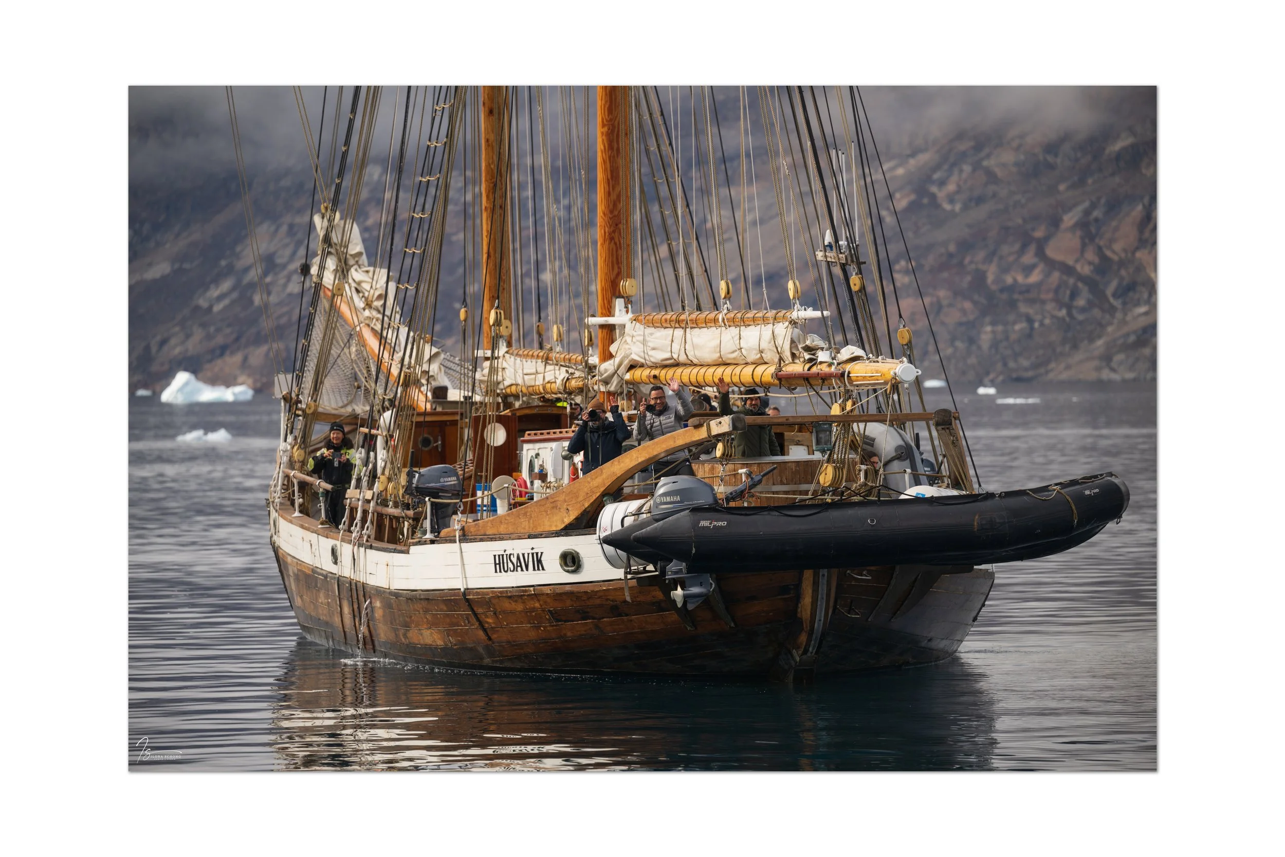
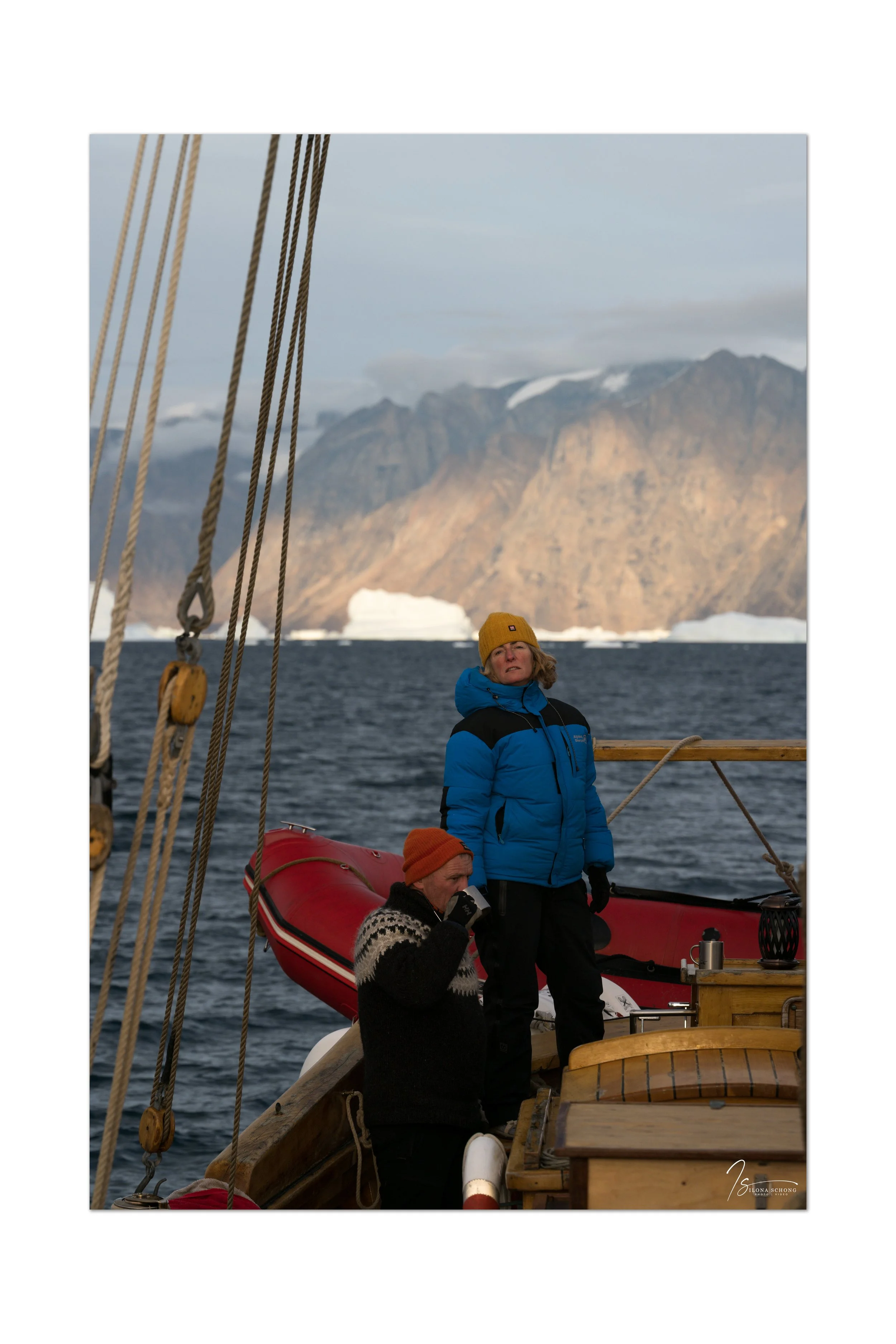
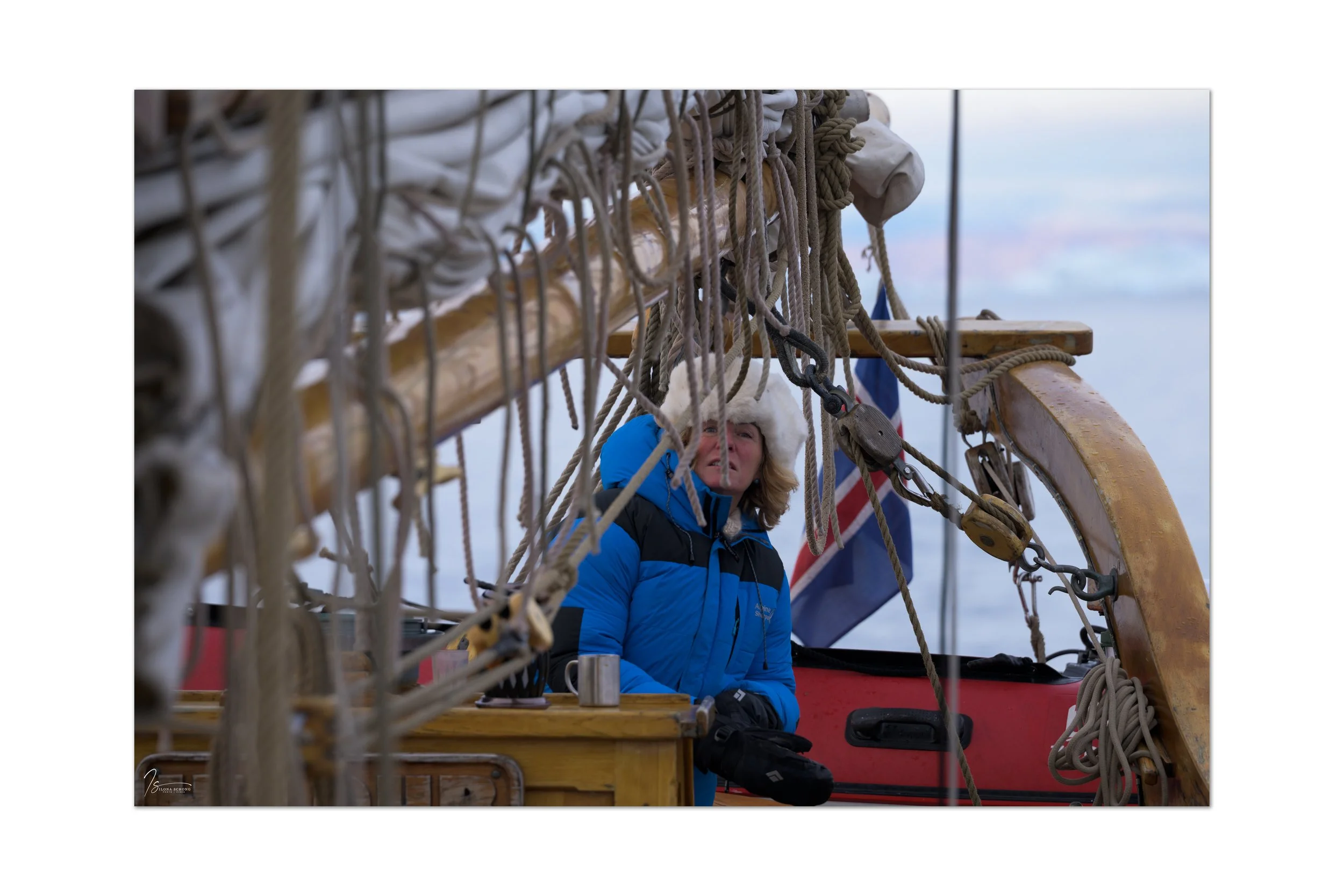
My third photography-focused trip in 2025 was fast approaching. On September 1, I flew via Brussels to Keflavik and then took a small plane from Reykjavik Domestic Airport to Constable Point, in eastern Greenland. Having been on my own up until then, I met my fellow travelers for the first time at this small airport. Thirty-one people in total, divided among three boats: the Hildur (my boat), the Ópal, and the Tilvera. That might seem like a large group, but in reality, you hardly ever run into each other, and the eight fellow travelers on the Hildur and the four crew members from North Sailing became my new family for the coming week.
The Constable Point airport (if you can even call it that) is officially named Nerlerit Inaat Airport. It consists of a gravel runway for takeoff and landing, with a two-kilometer-long dirt road leading to the bay, where ships can anchor. There are a number of wooden barracks; one serves as a hotel to accommodate stranded travelers in case of emergency (and, unbeknownst to me at the time, I would end up being one of them), another houses the terminal, and a third has office space and a cafeteria. Constable Point serves the settlement of Ittoqqortoormiit (“the place with the big houses”), located 45 km to the southwest, a village with 350 inhabitants and the most remote village in the world. There are no roads leading there; Ittoqqortoormiit can be reached from Constable Point by boat in the summer (a 5-hour trip), by snowmobile in the winter, or by helicopter year-round.
The weather at Constable Point wasn’t great. Given the gravel runway and the sand the plane has to taxi over, there’s a high chance of flight cancellations when it rains. It gets too muddy. We were lucky that we were the second-to-last plane allowed to land that day; after that, the airport was closed for a few days.
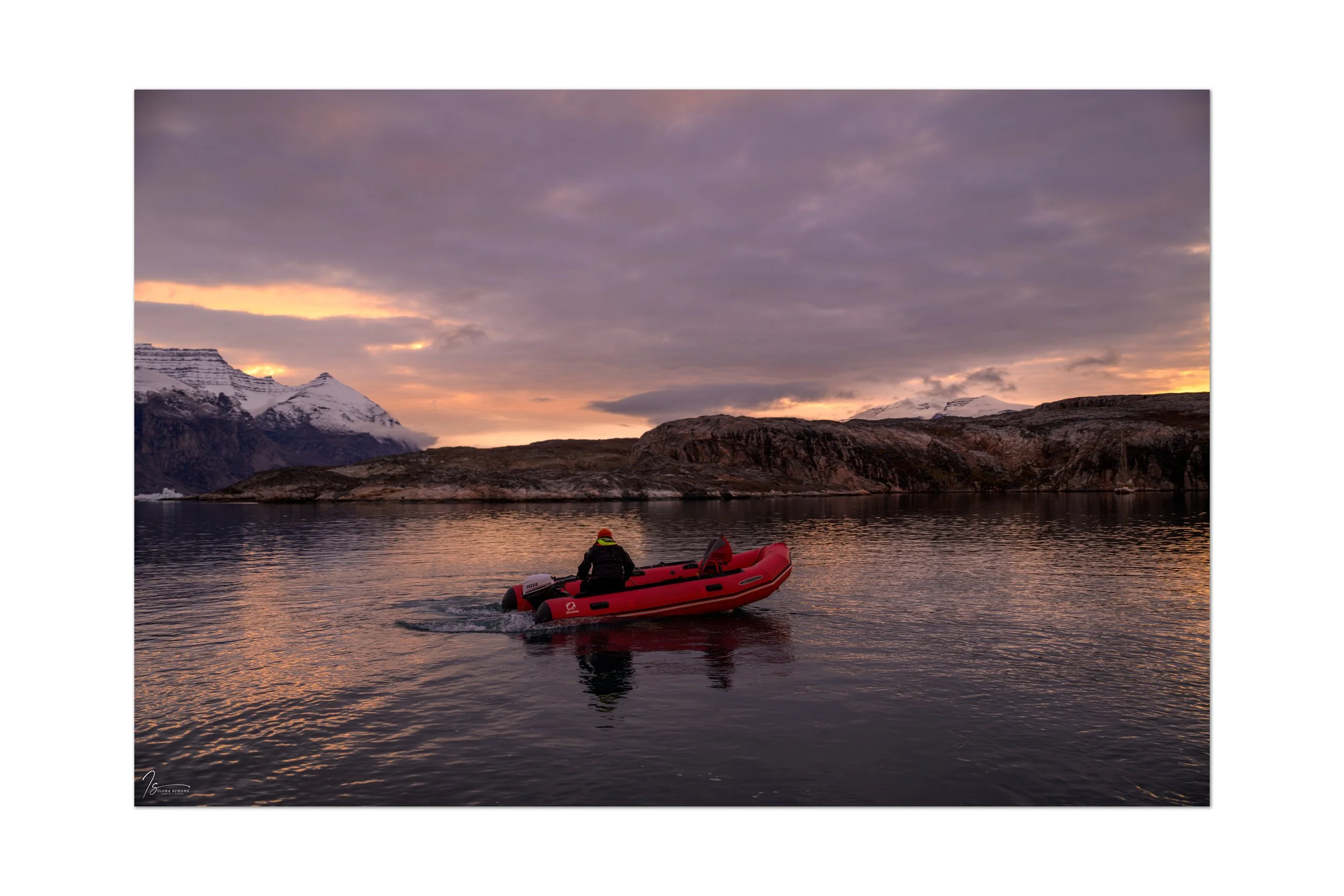
After we landed, we walked along the dirt road toward the boats. Zodiacs brought luggage and passengers on board. During the safety briefing, a revised itinerary was shared. To avoid the bad weather and the storm along the Volquart Boons Coast, we would be traveling the route in reverse this week and visiting Ittoqqortoormiit at the end of the trip.
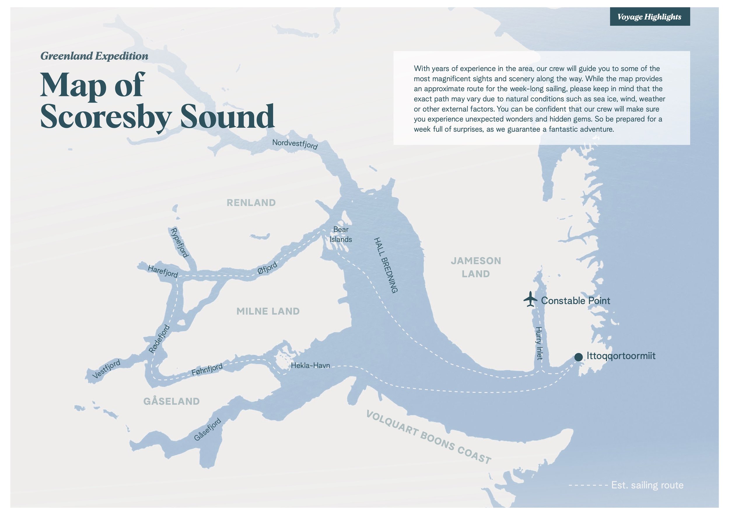
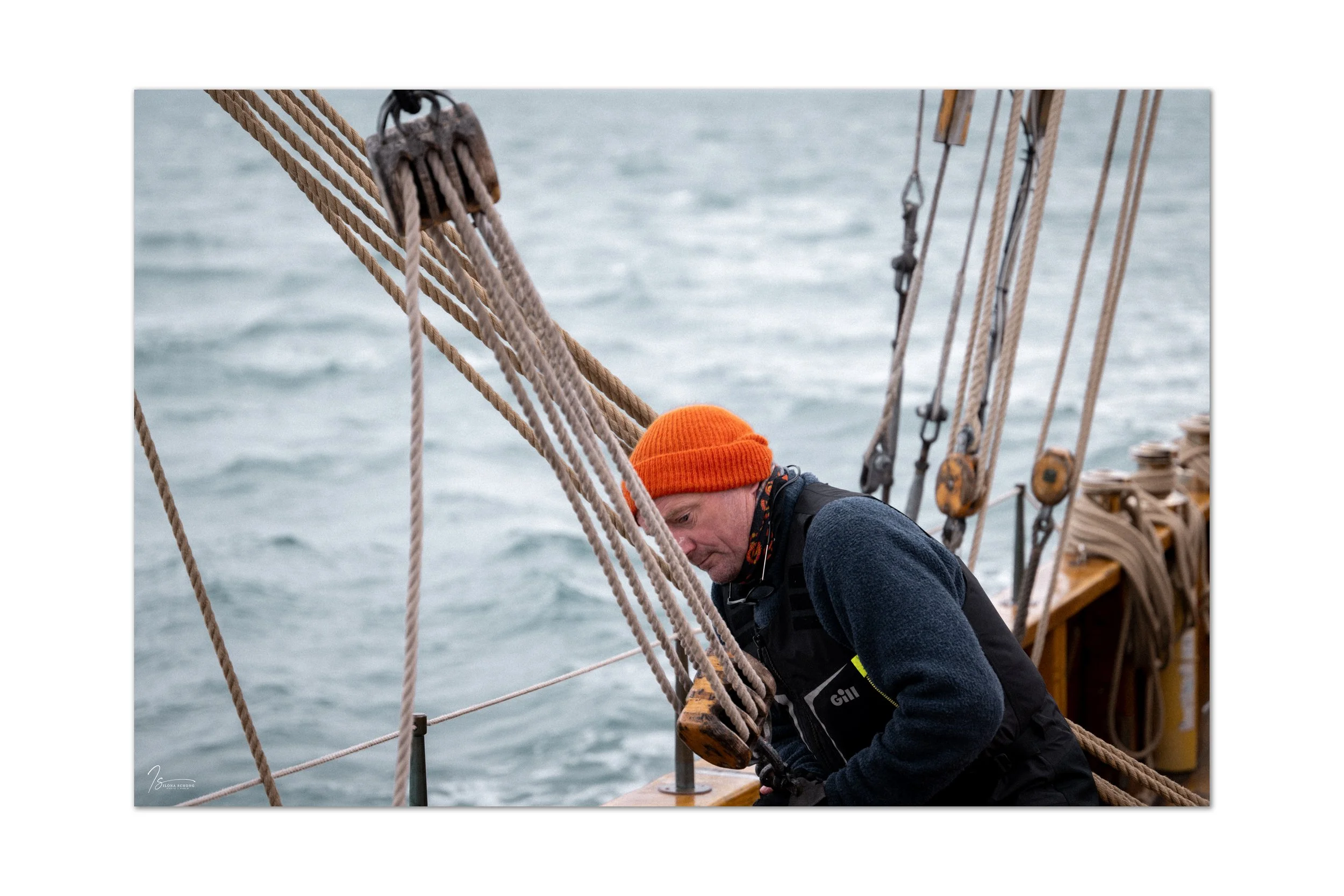
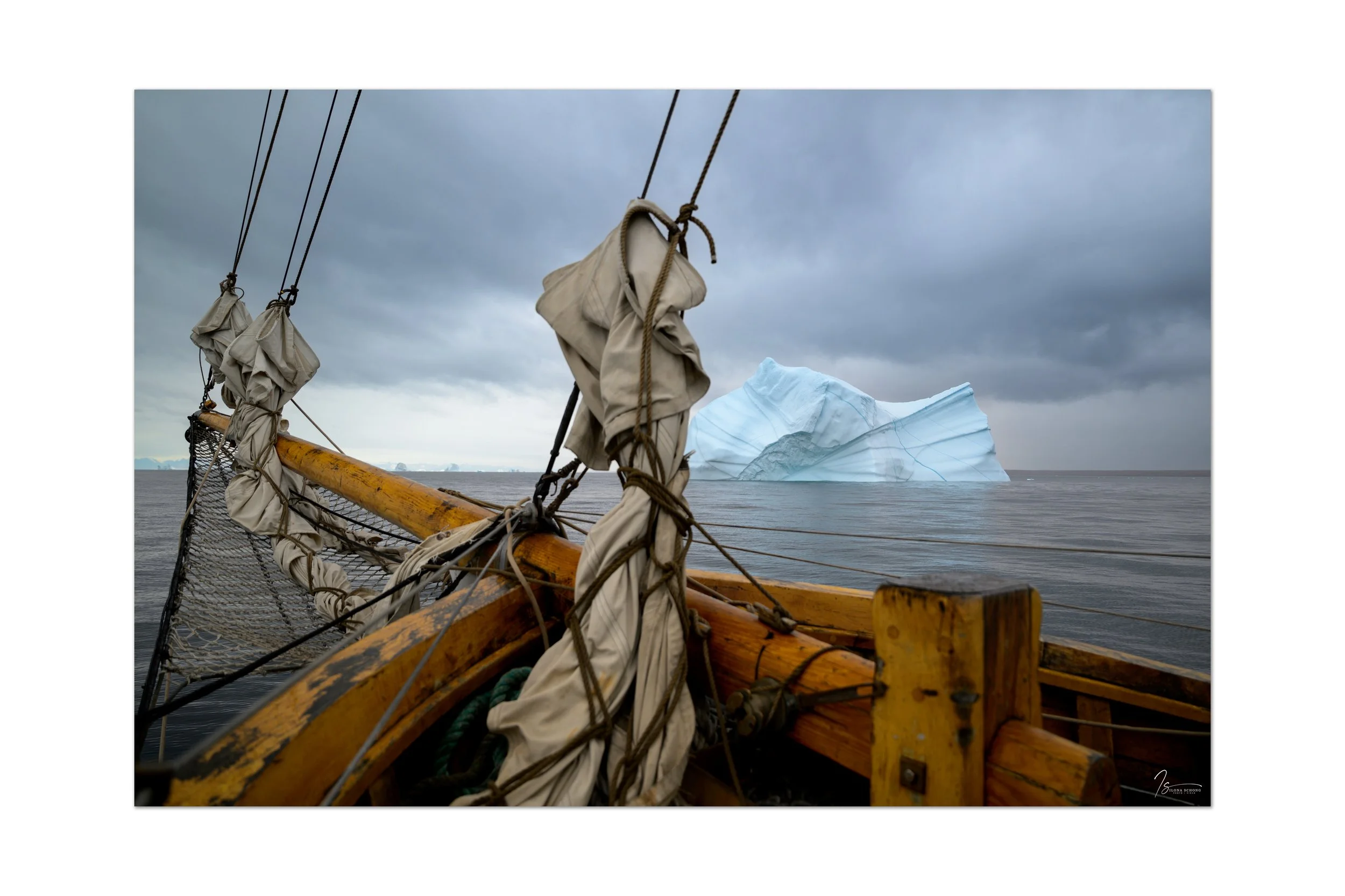
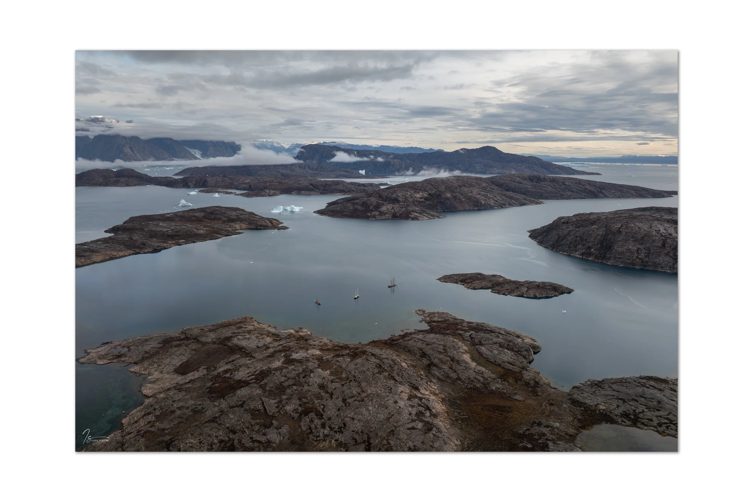
The anchor was raised, and we set off on our first voyage: out of Hurry Inlet, heading toward Hall Bredning, where we anchored southwest of Jameson Land late in the evening. It was immediately clear: I was on a sailing trip, with everything that entails, including strong winds on the open sea. This was certainly not going to be a leisurely cruise on calm waters.
Day two dawned and got off to an early start. A long voyage to the Bear Islands was on the schedule, and fortunately we managed to stay ahead of the rain that was chasing us. Distances in Scoresby Sund are deceptively long. It was certainly an eleven-hour sail. Now, after the open sea, the first mountains and the landscape of Scoresby Sund came into view, along with the many icebergs. How magnificent.
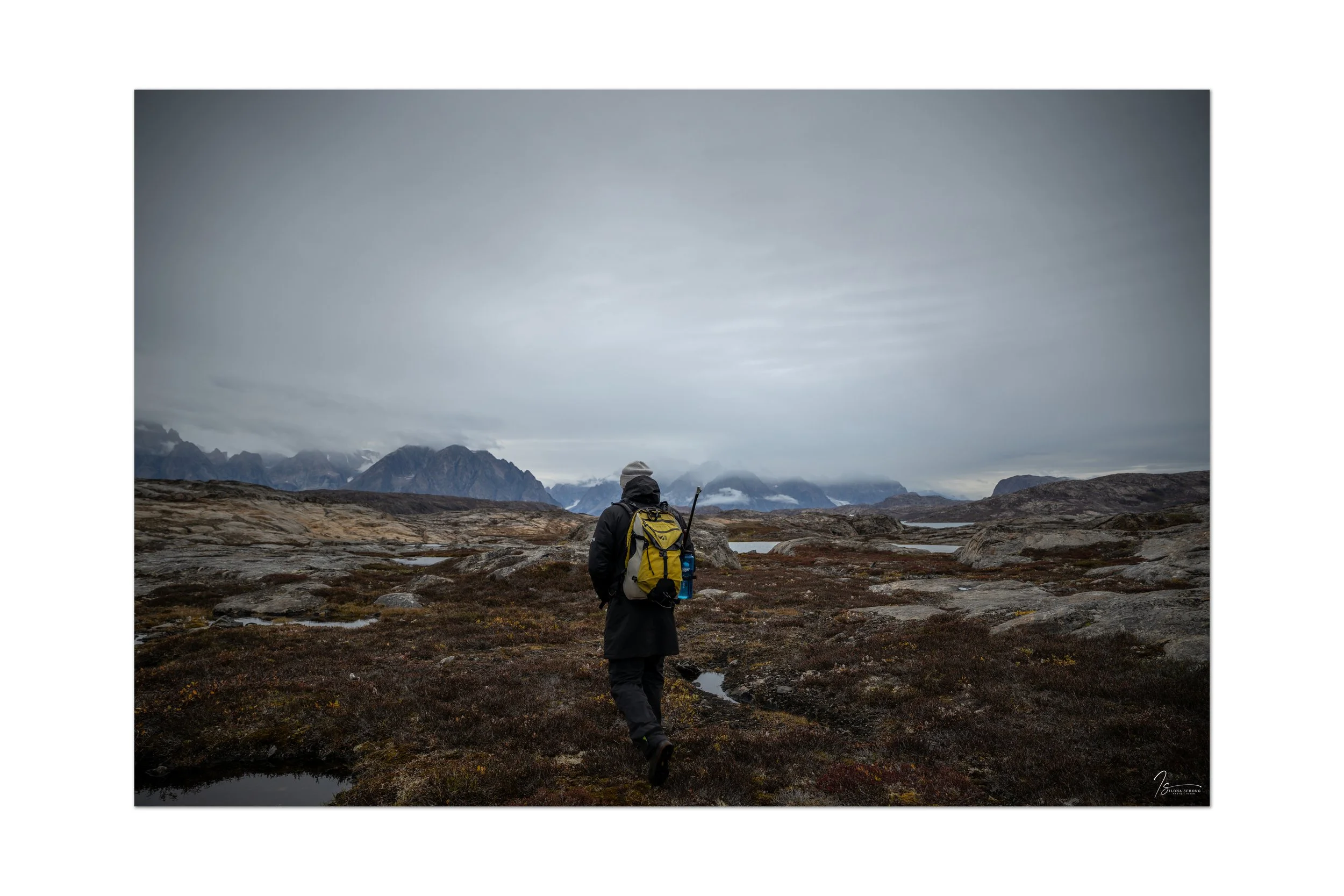
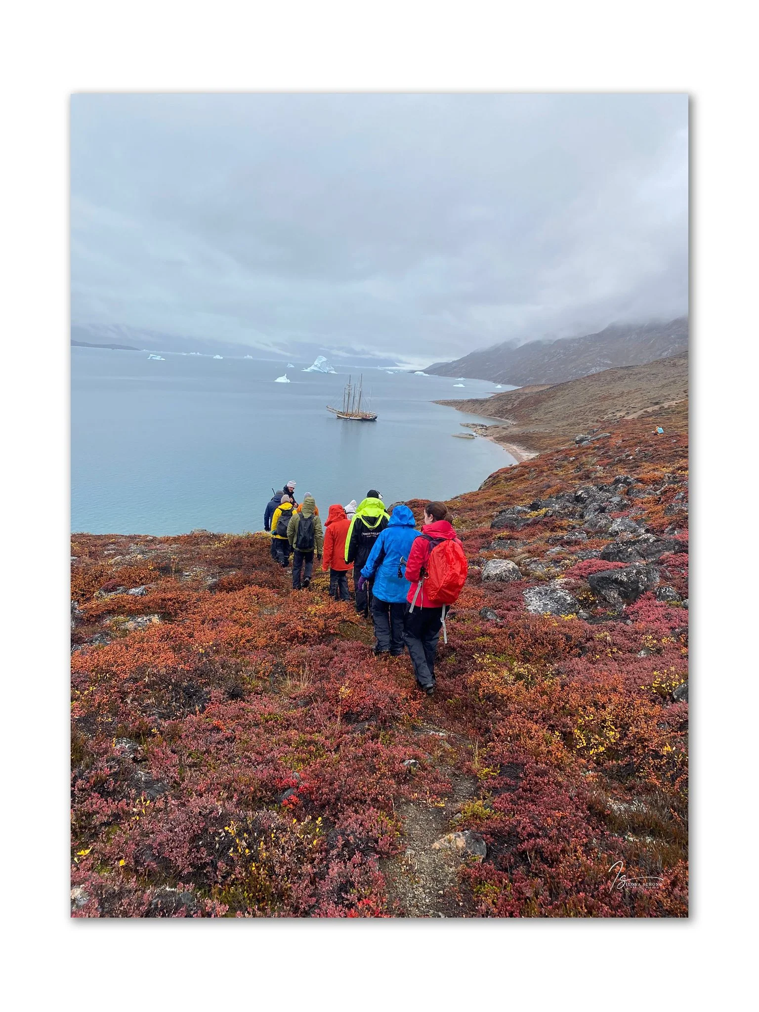
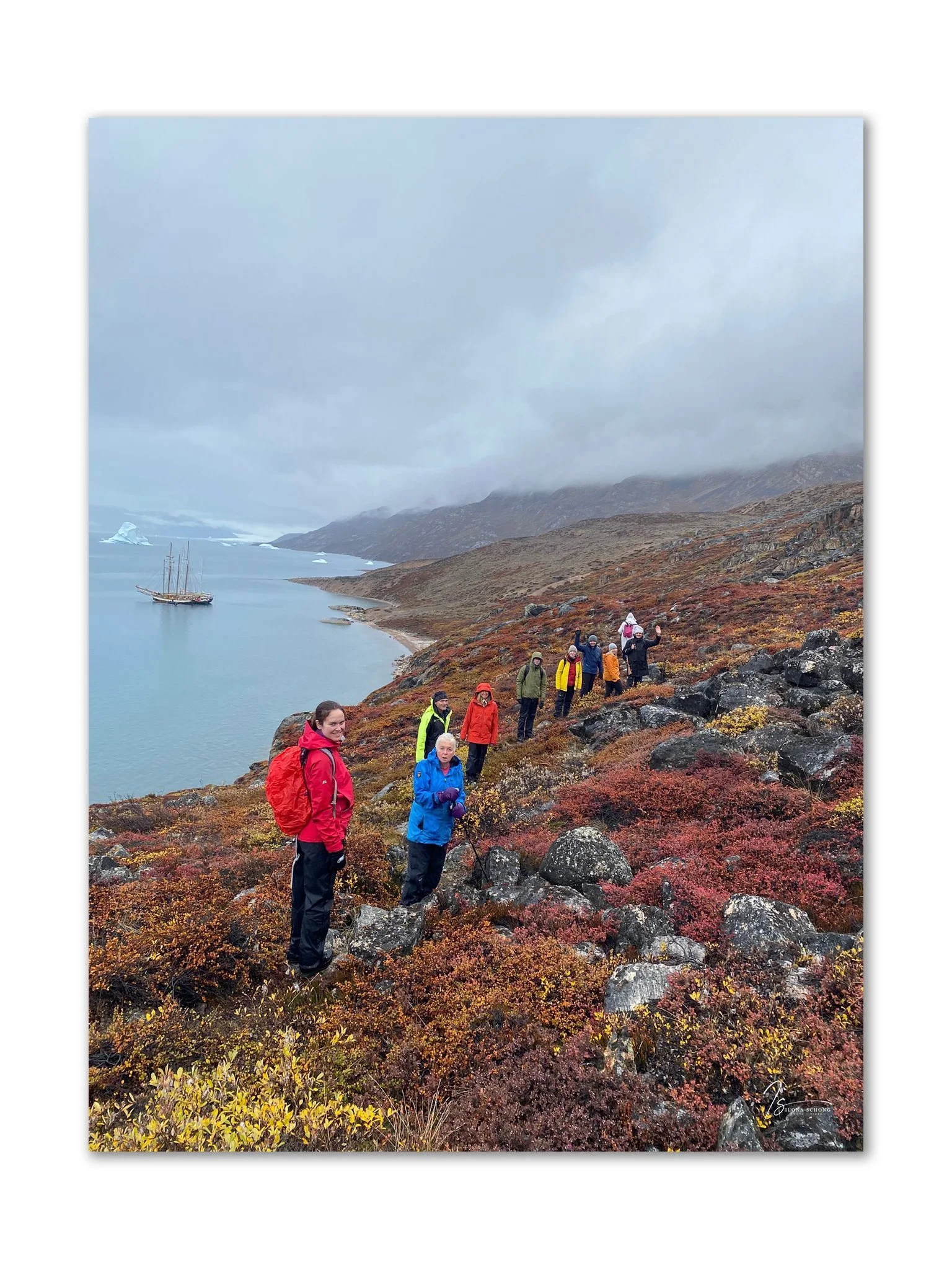
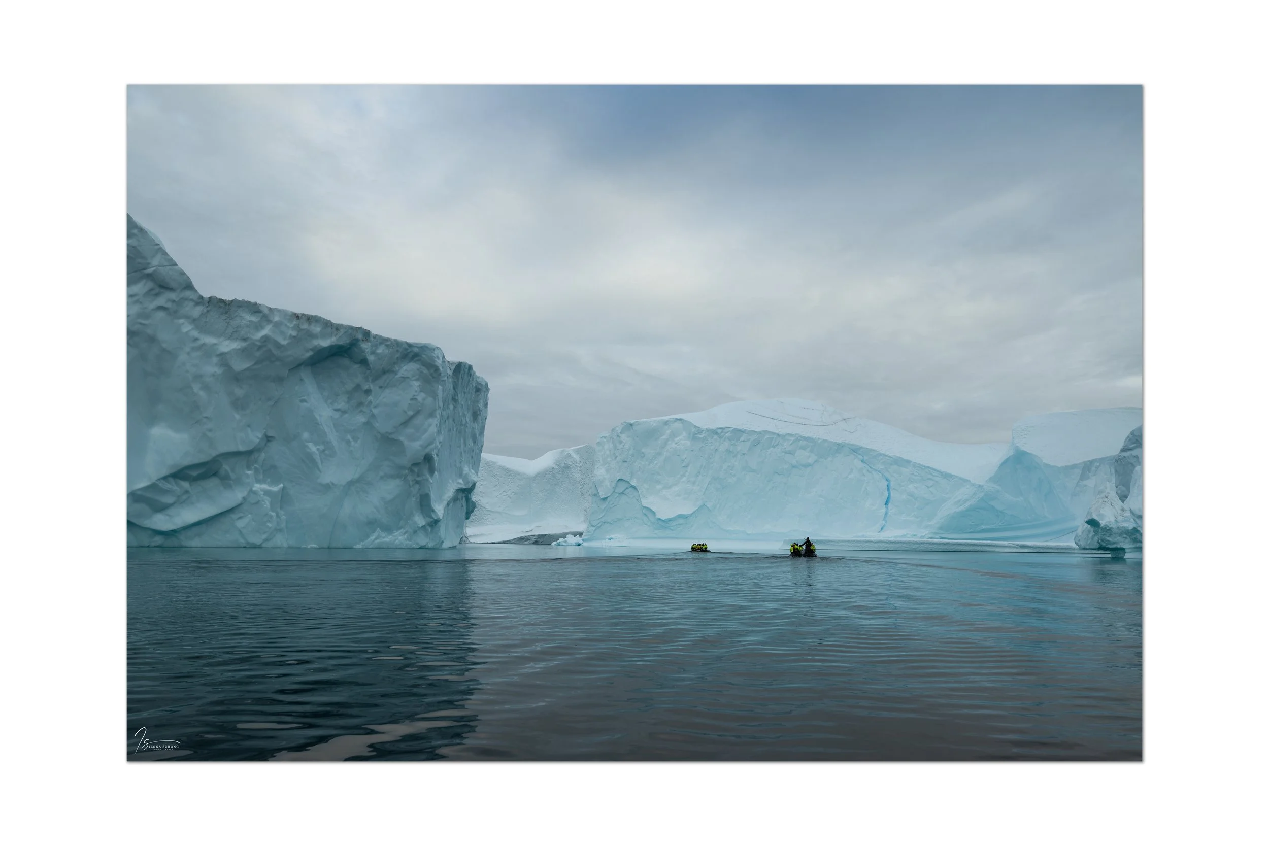
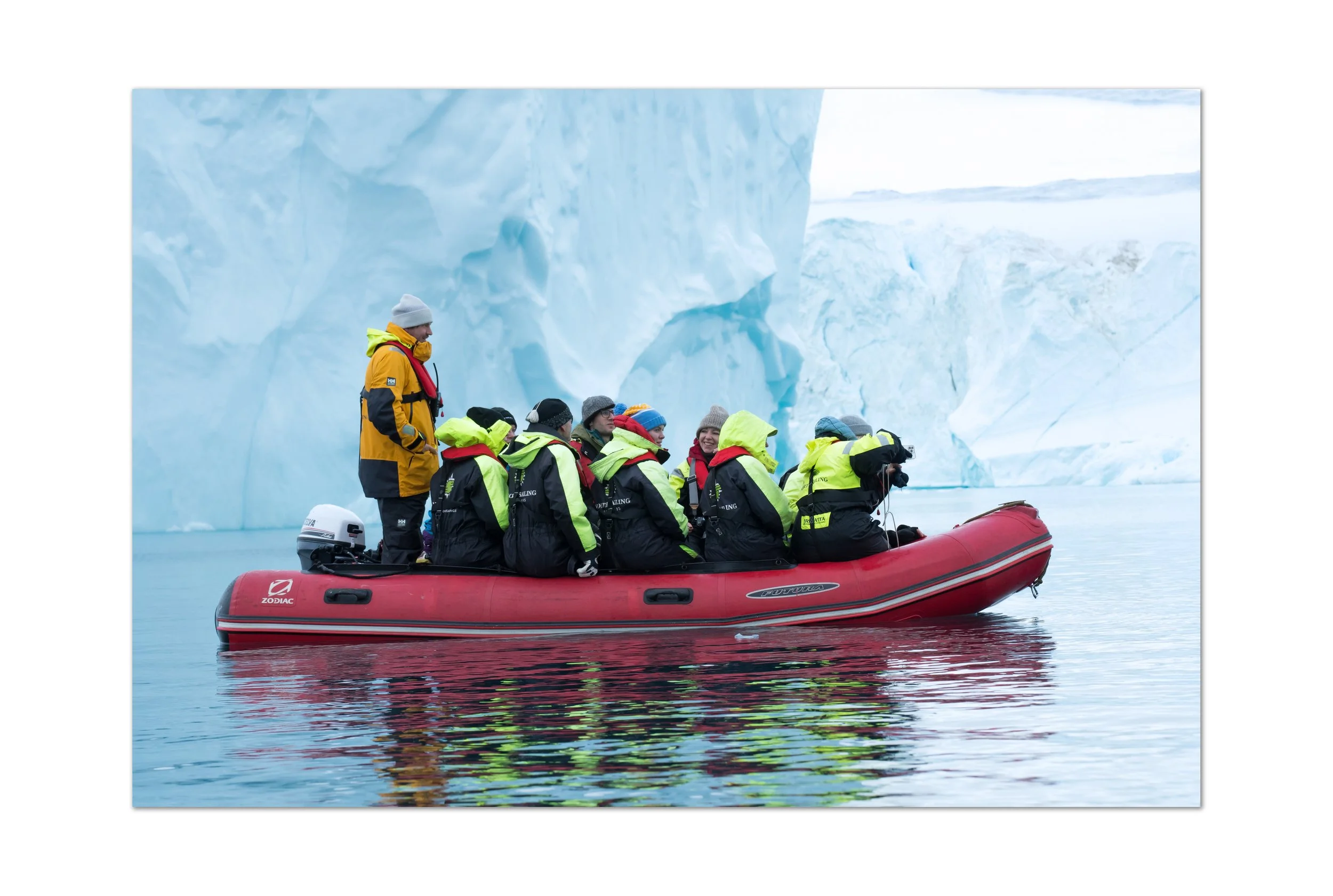
We dropped anchor in a sheltered spot among the Bear Islands, and we were able to take the Zodiac ashore to stretch our legs and explore the Bear Islands on foot.
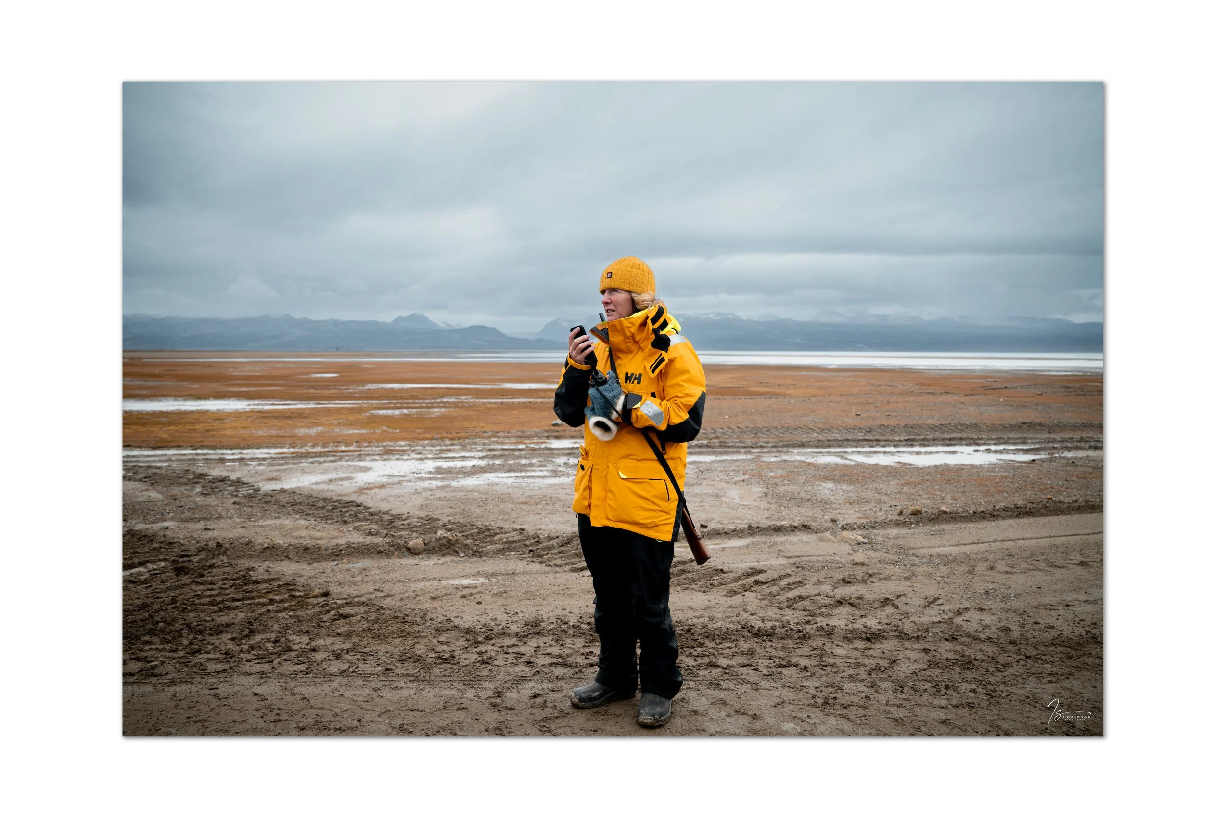
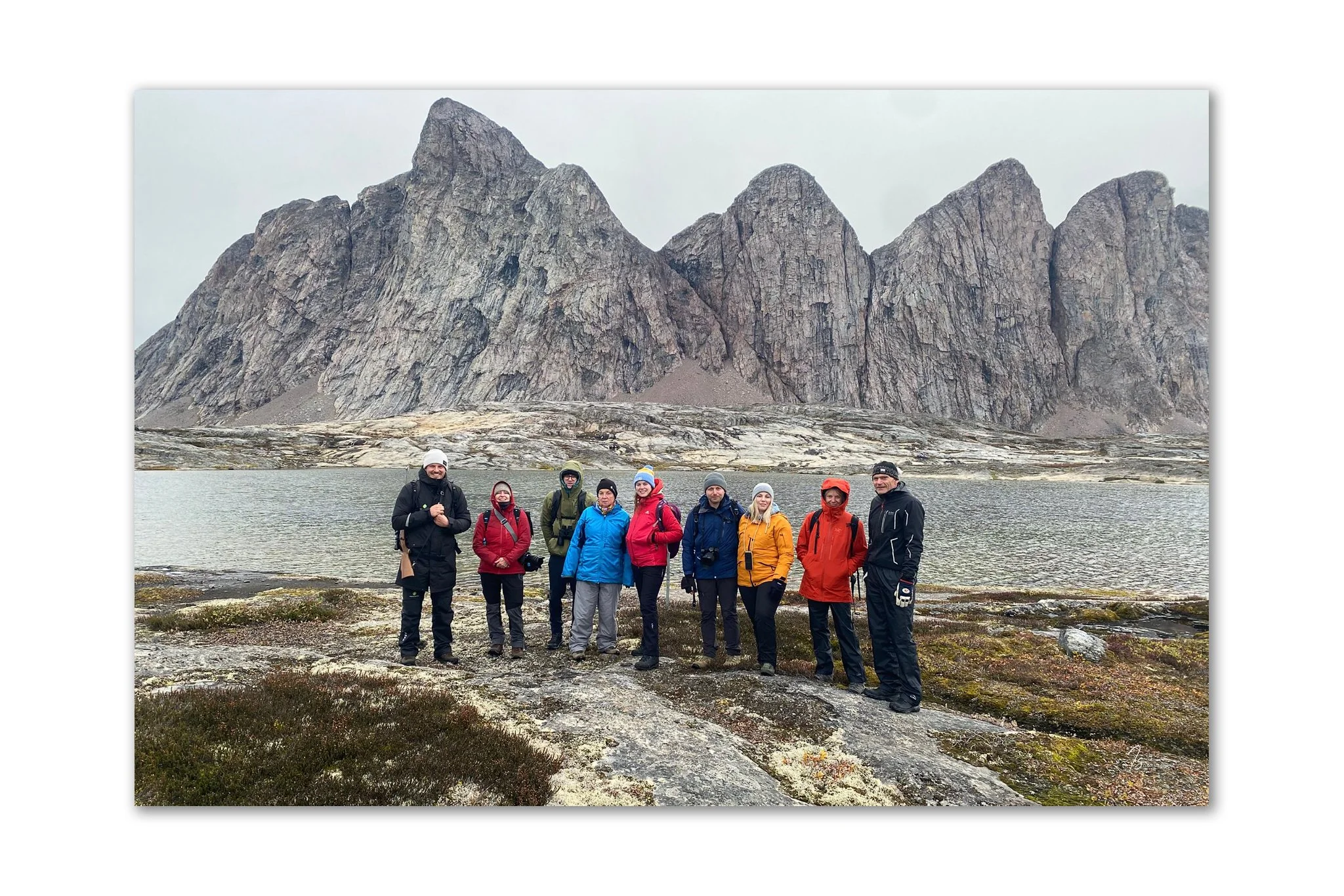
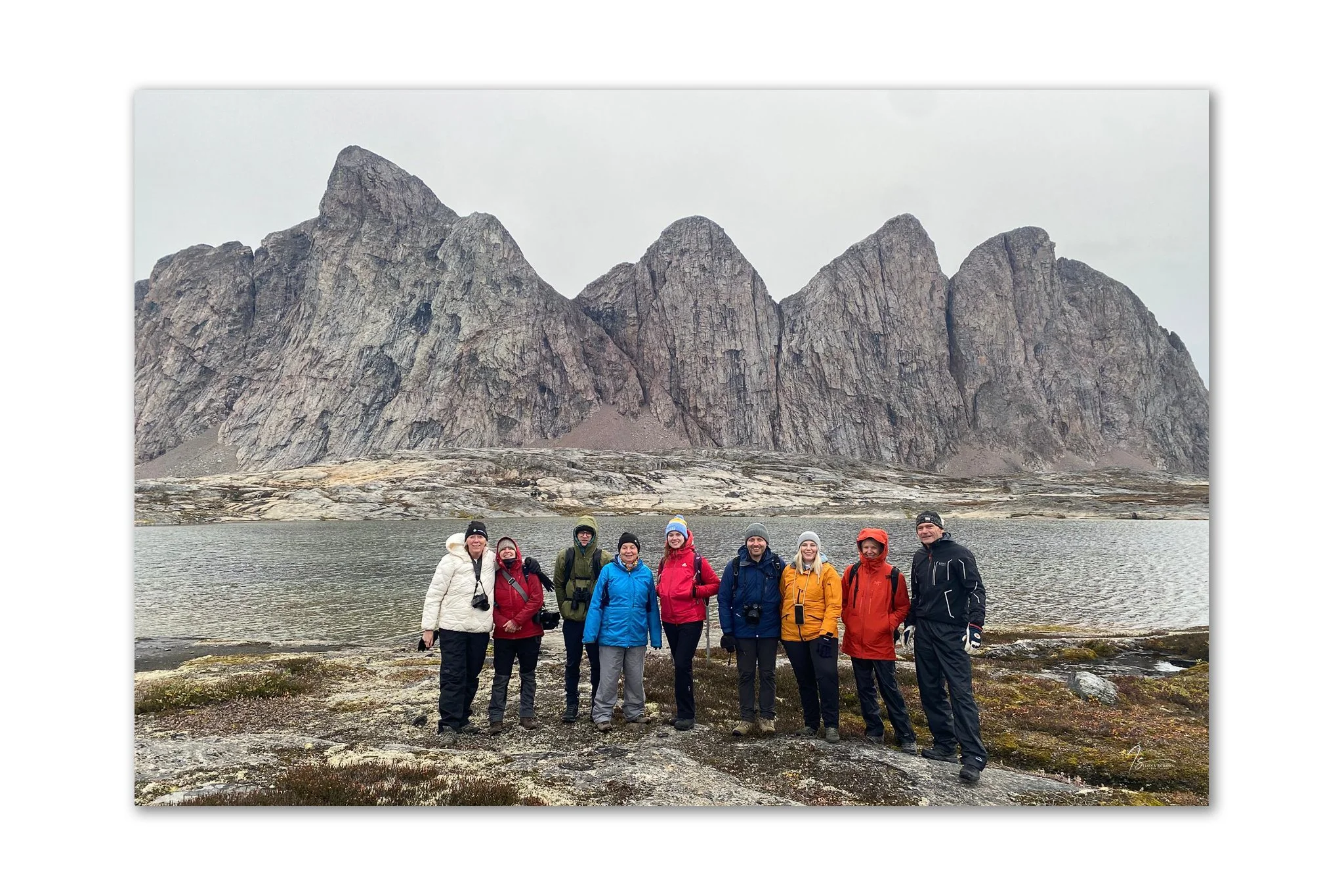
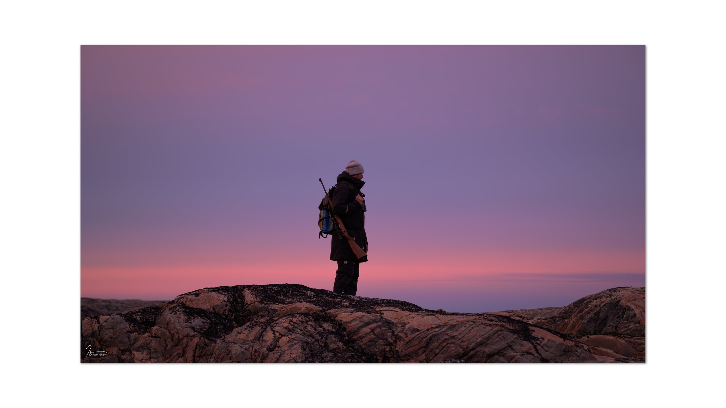
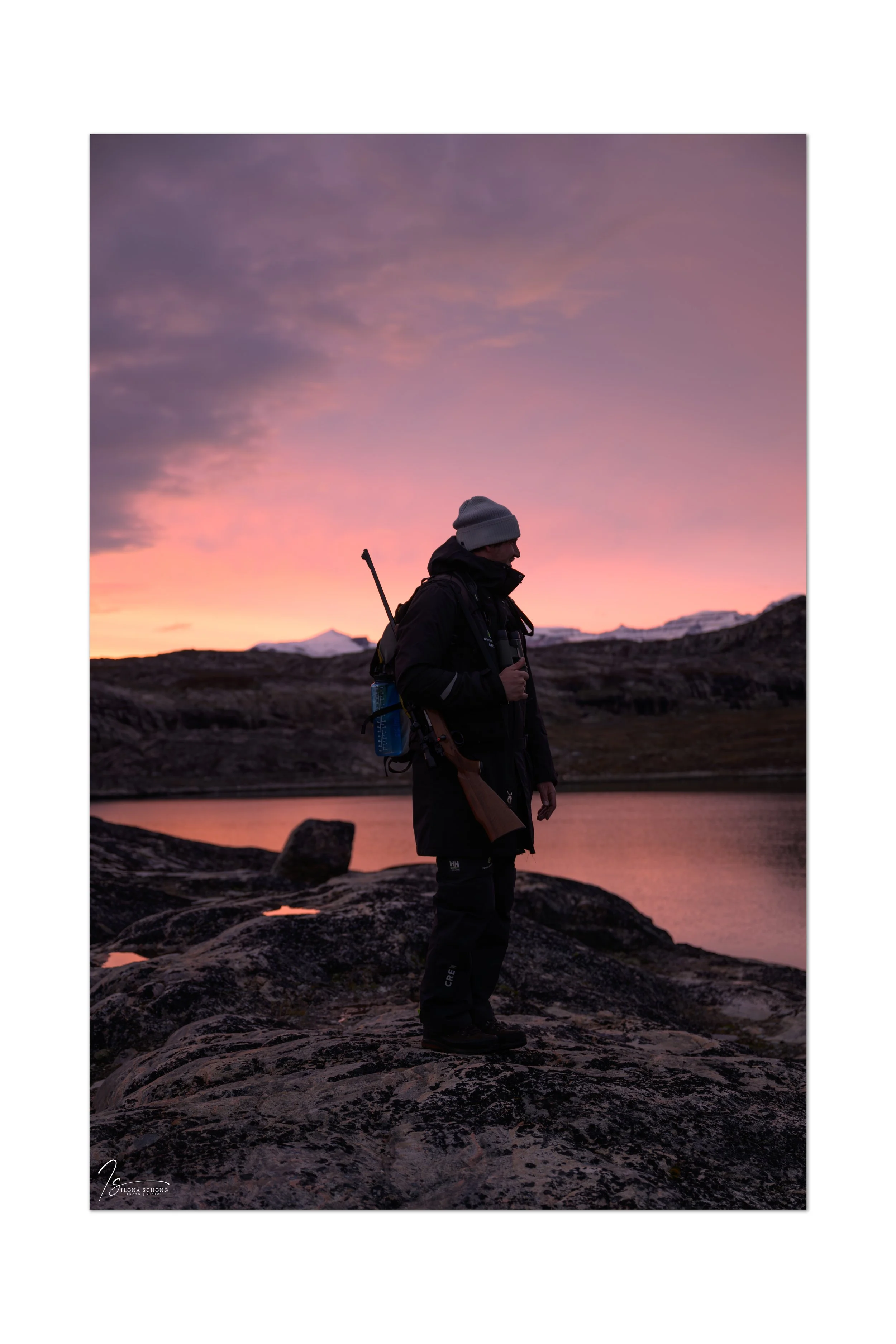
As you can see in the photo, the expedition leader carries a rifle at all times, because this entire area is polar bear territory. That means: don’t stray from the group, and when approaching the edges of hills, wait until the expedition leader has given the all-clear.


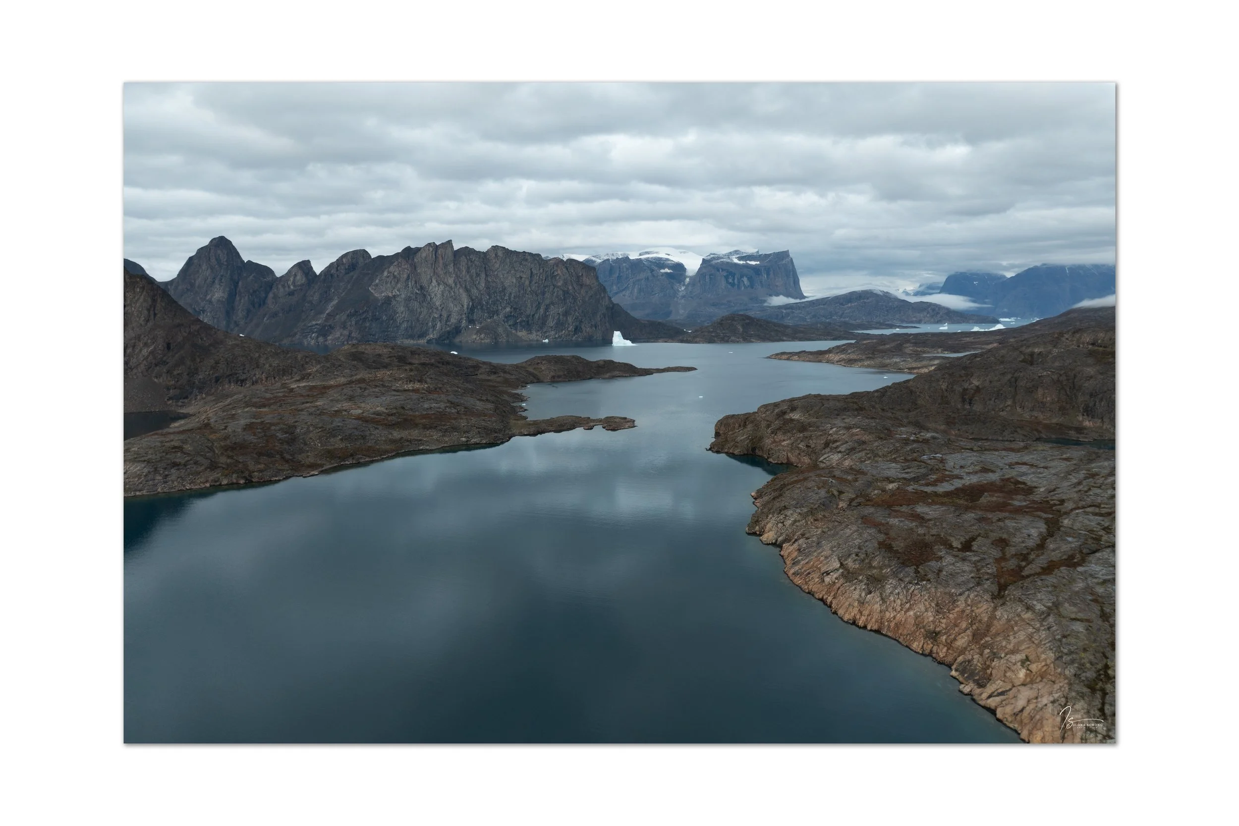
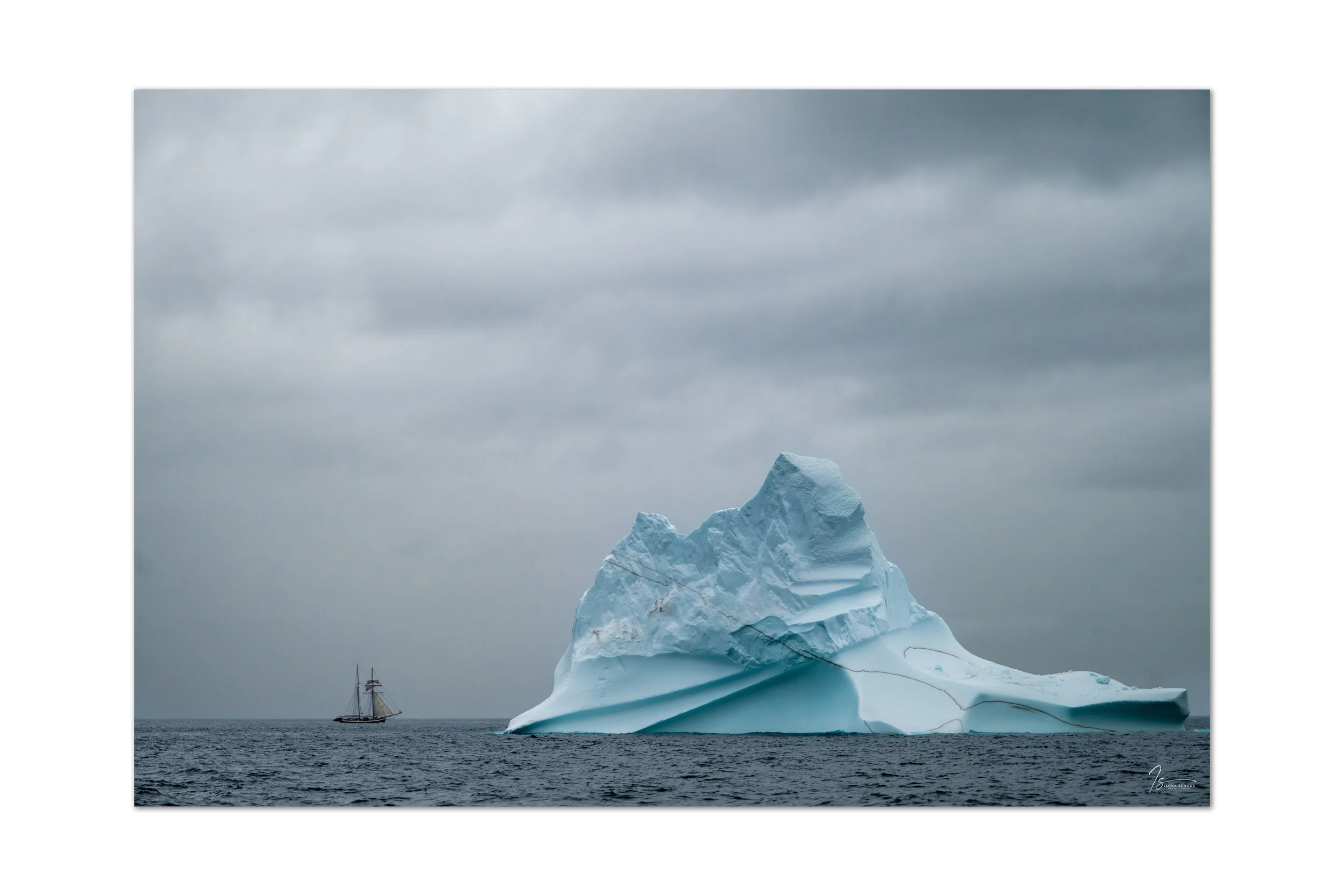
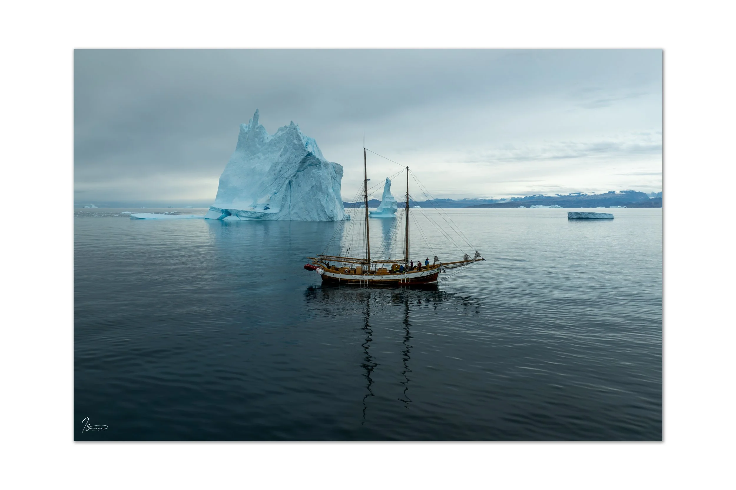
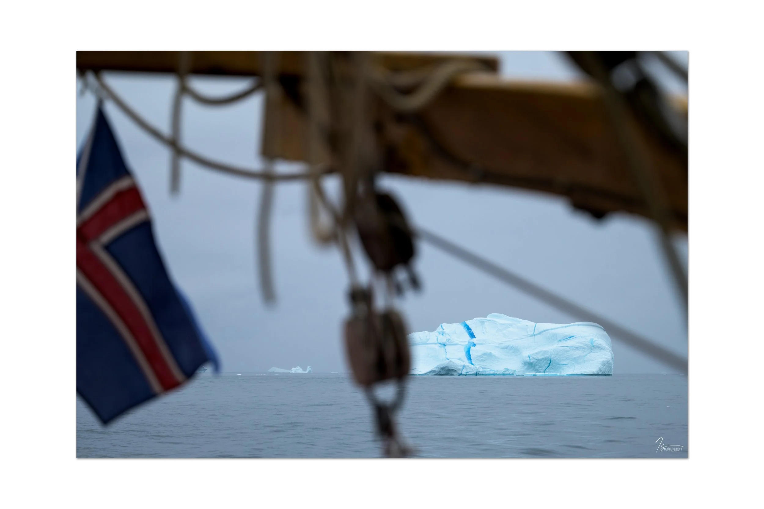
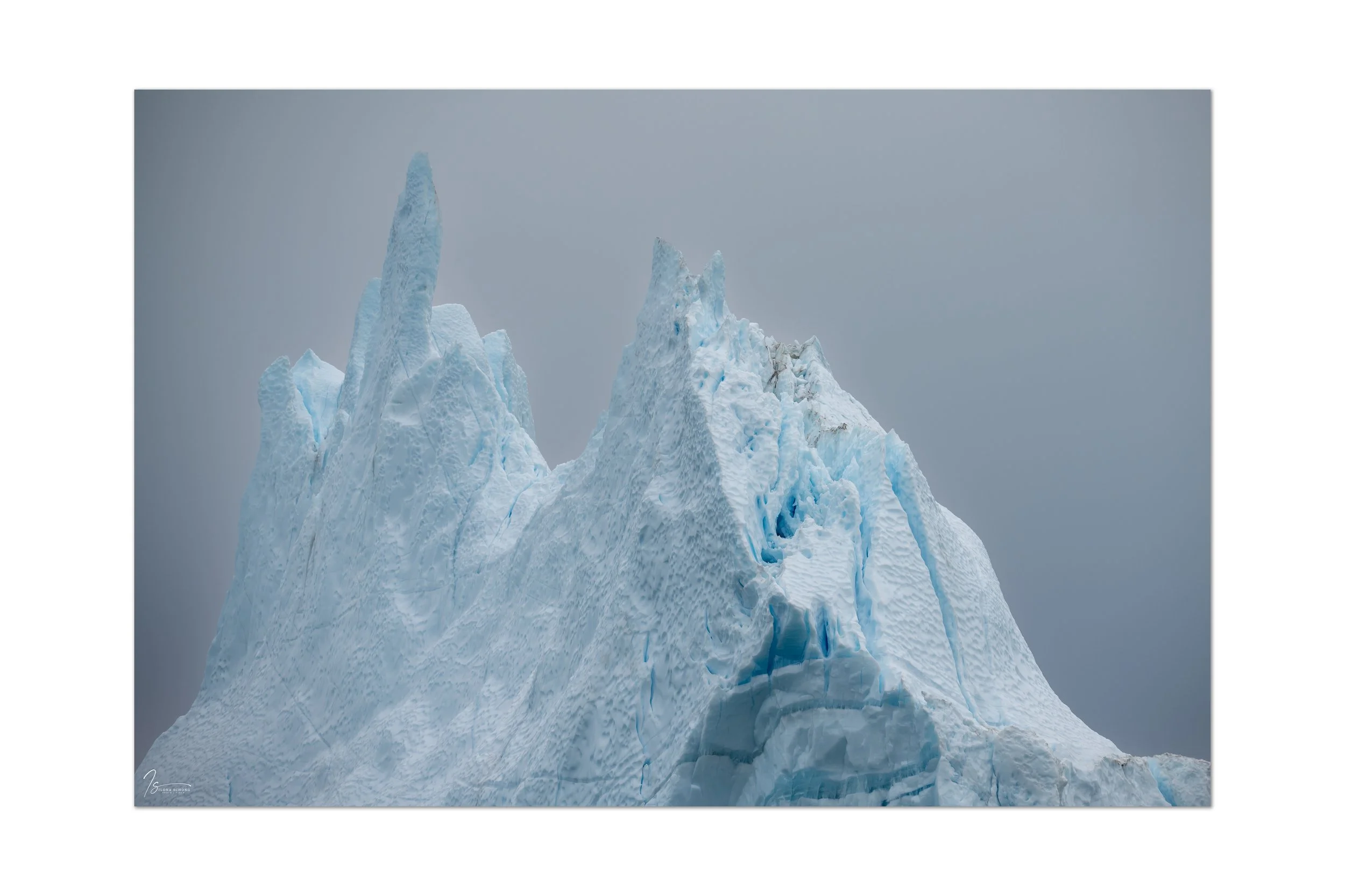
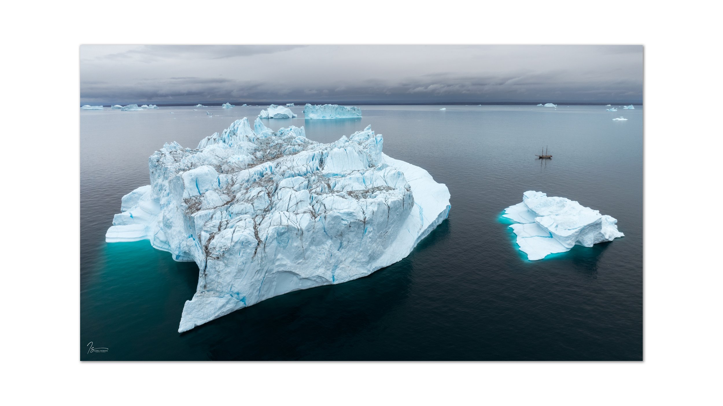
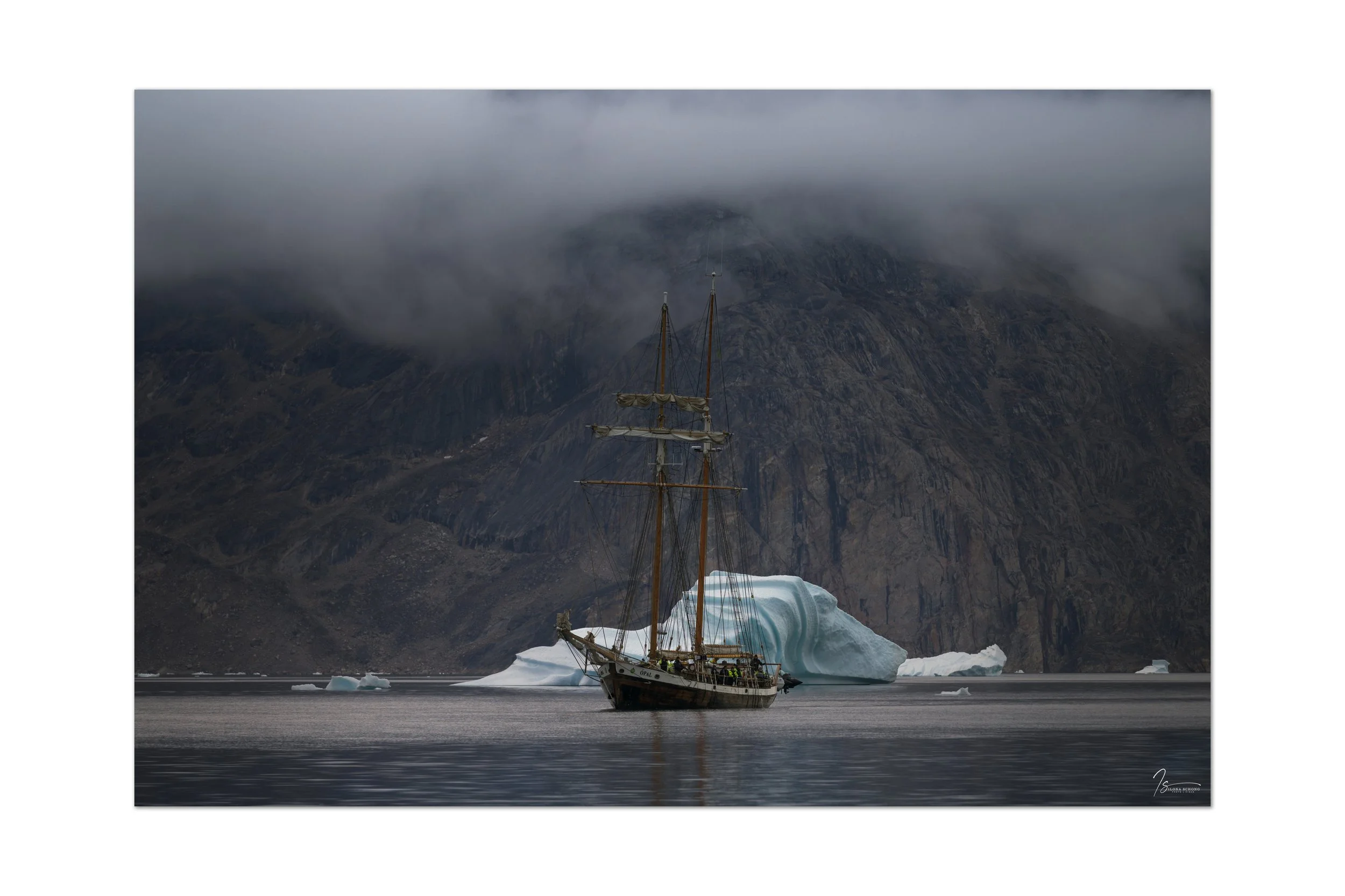
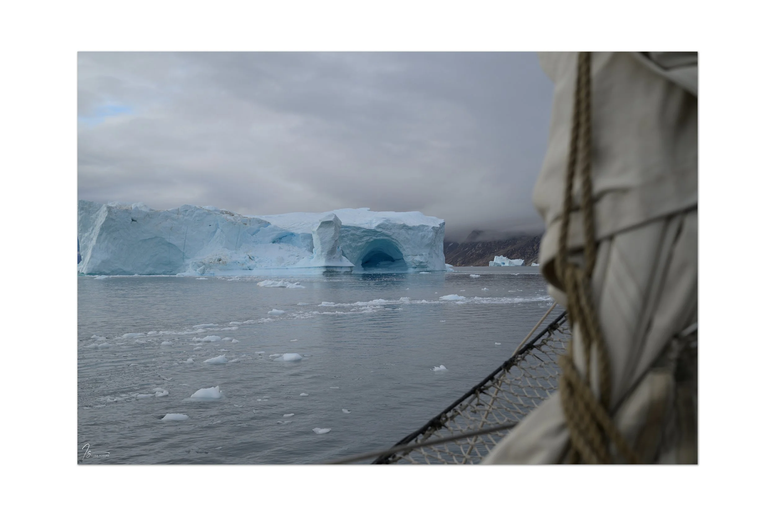
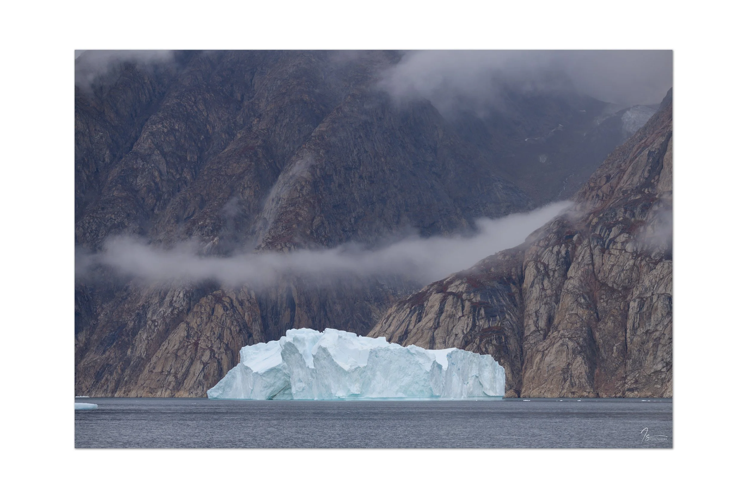
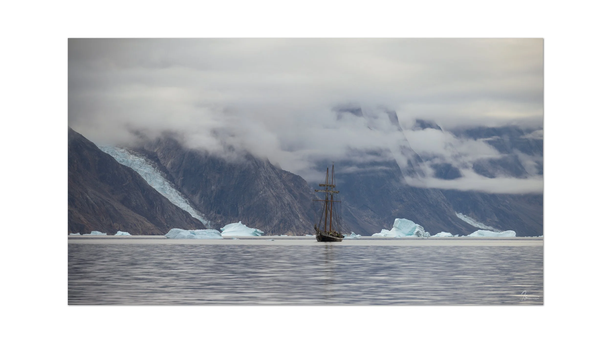
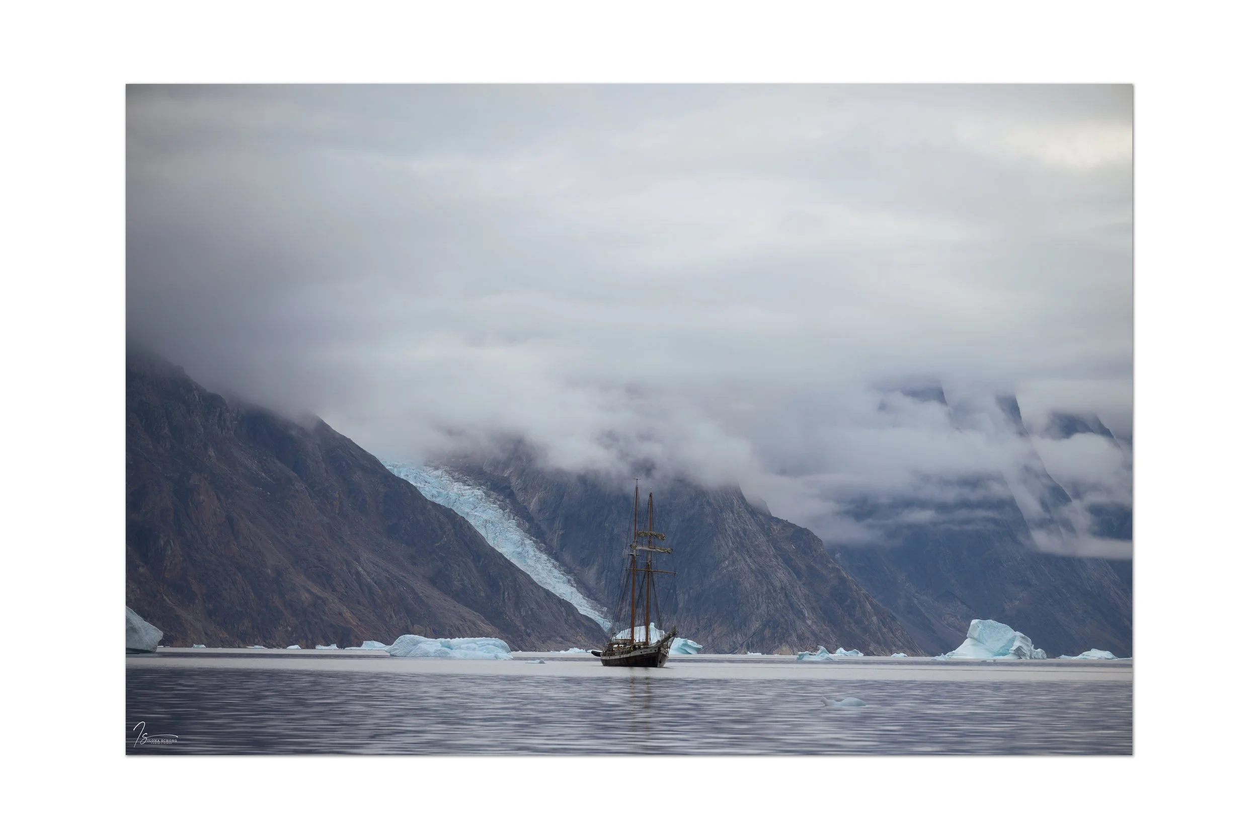
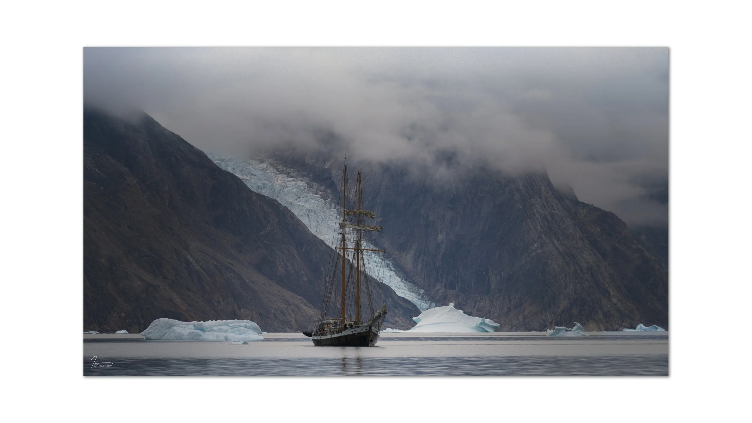
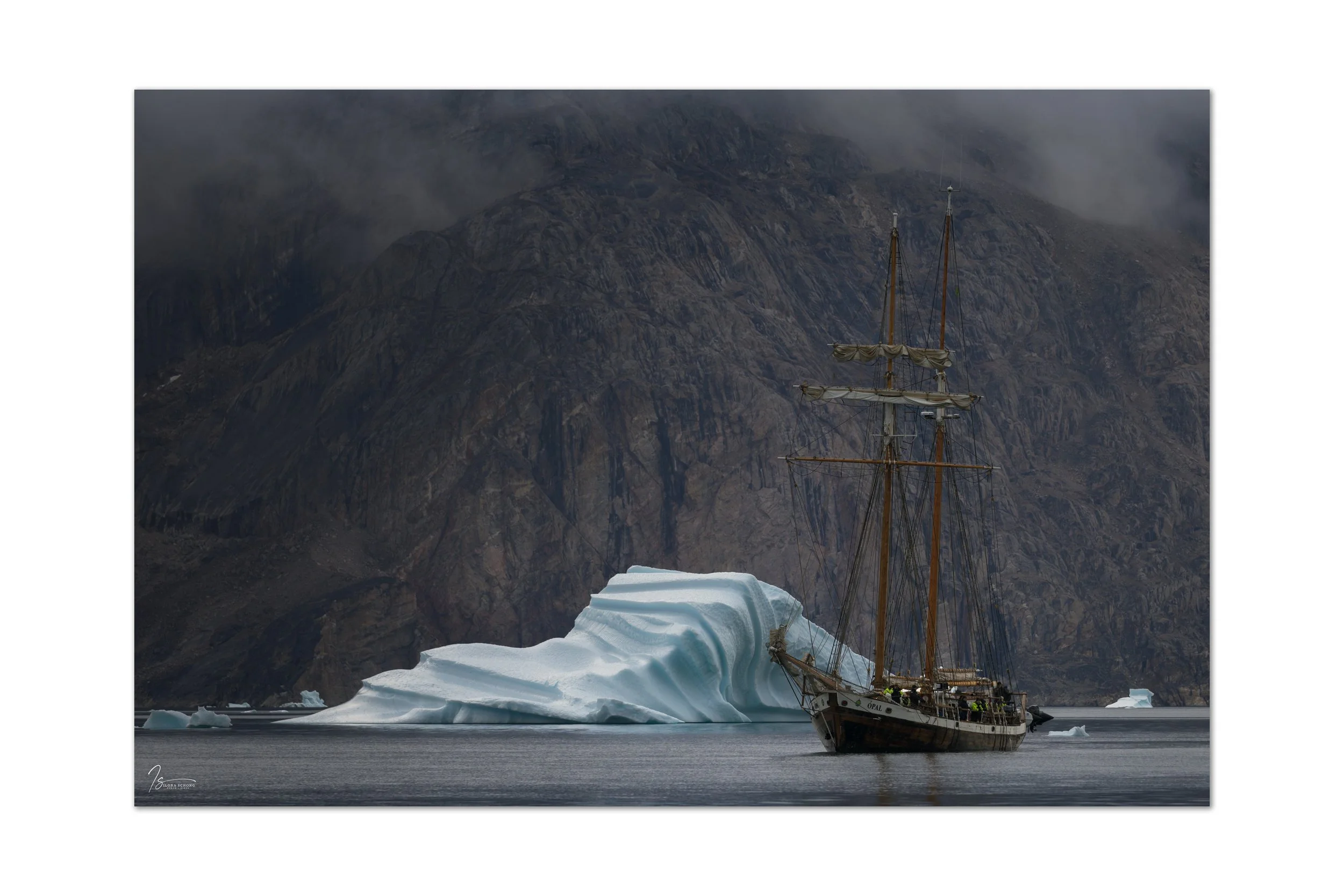
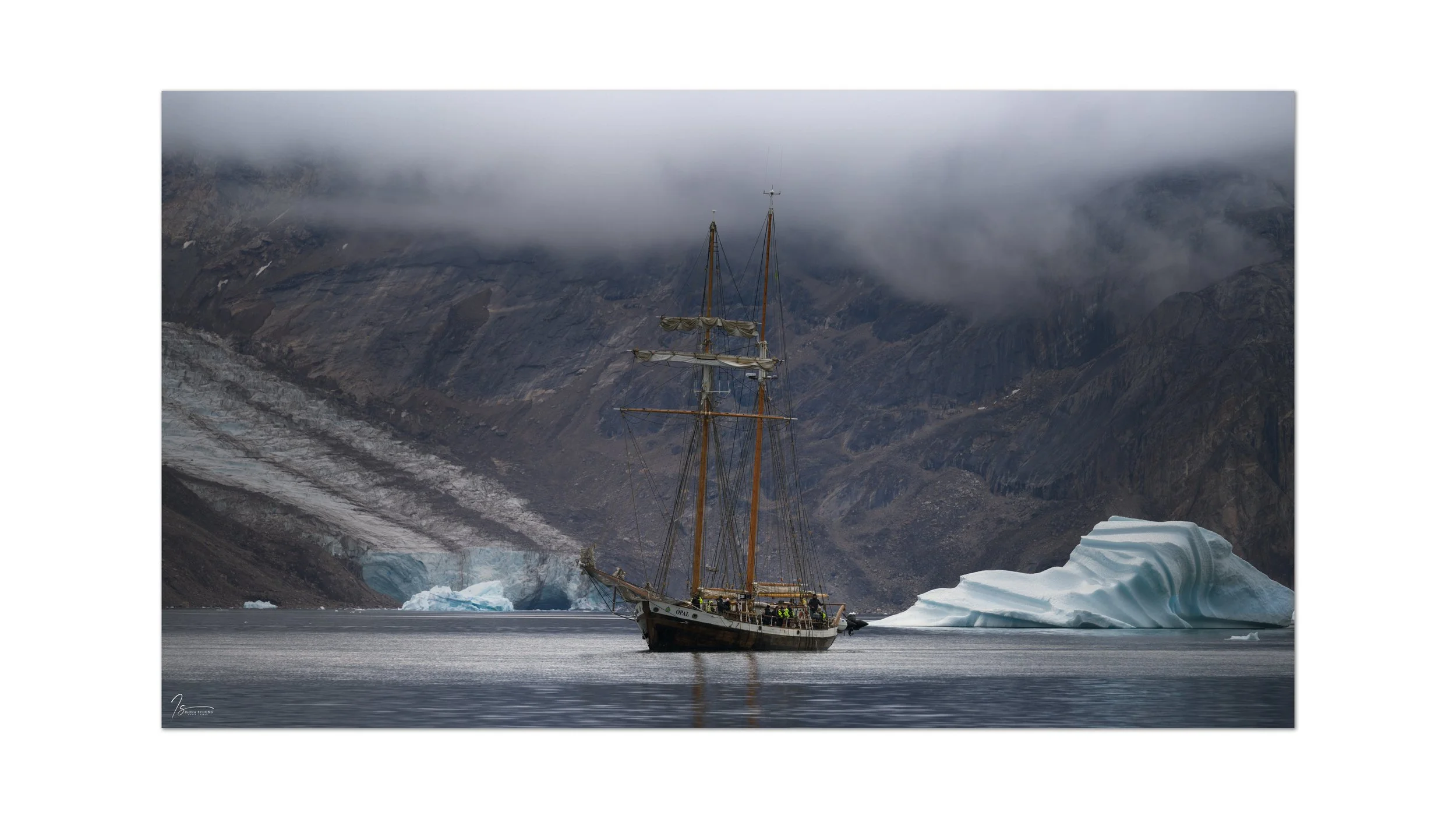
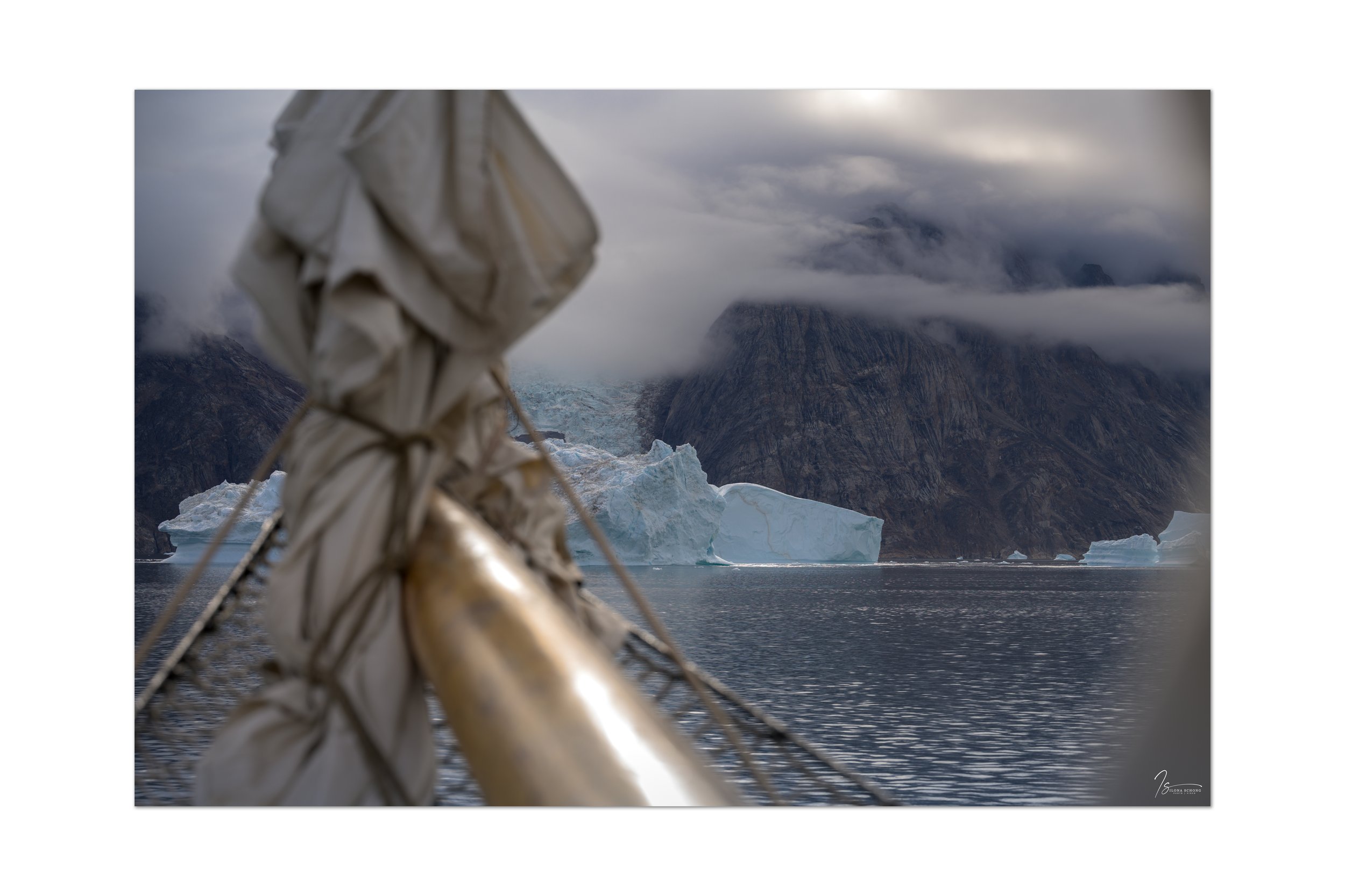
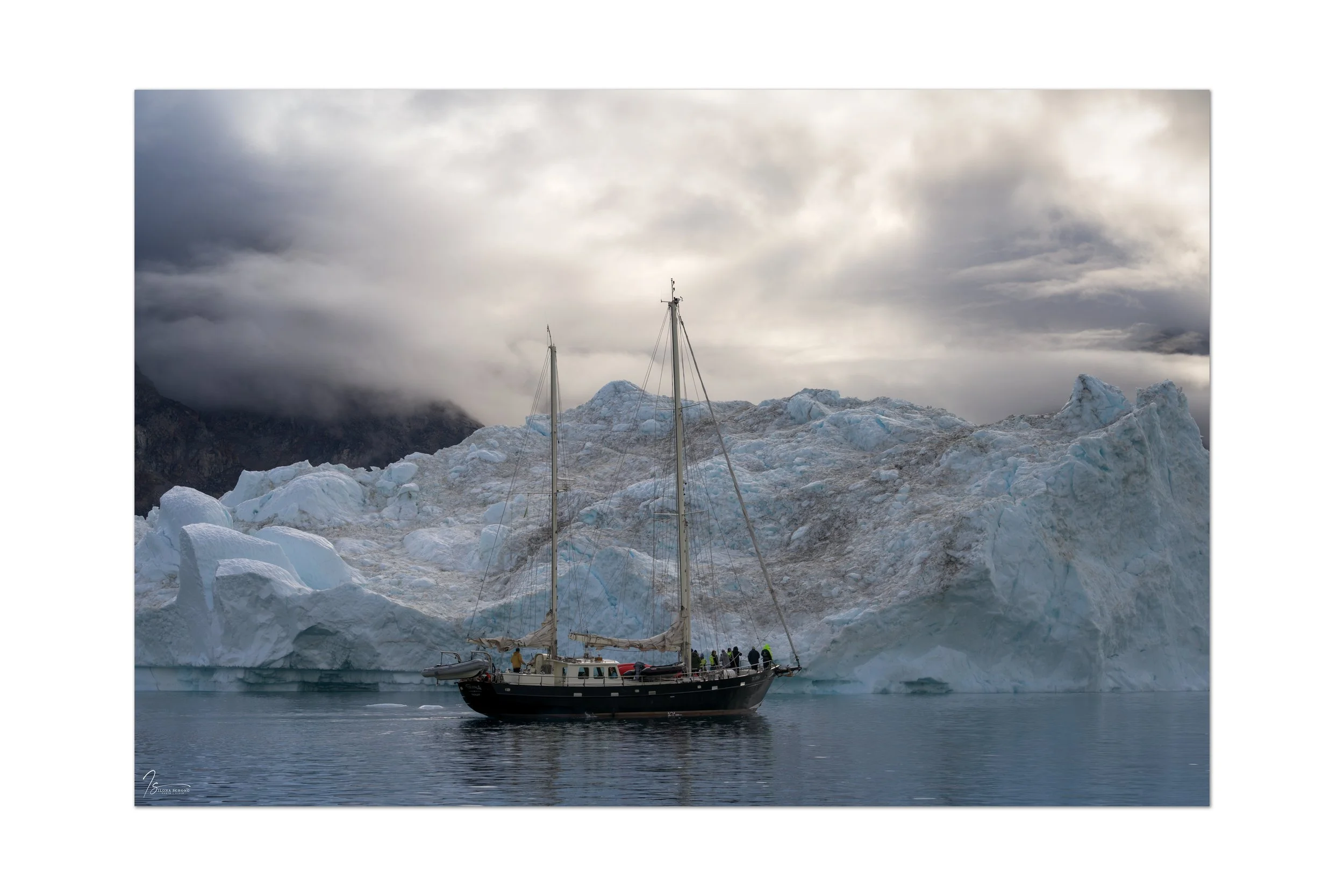
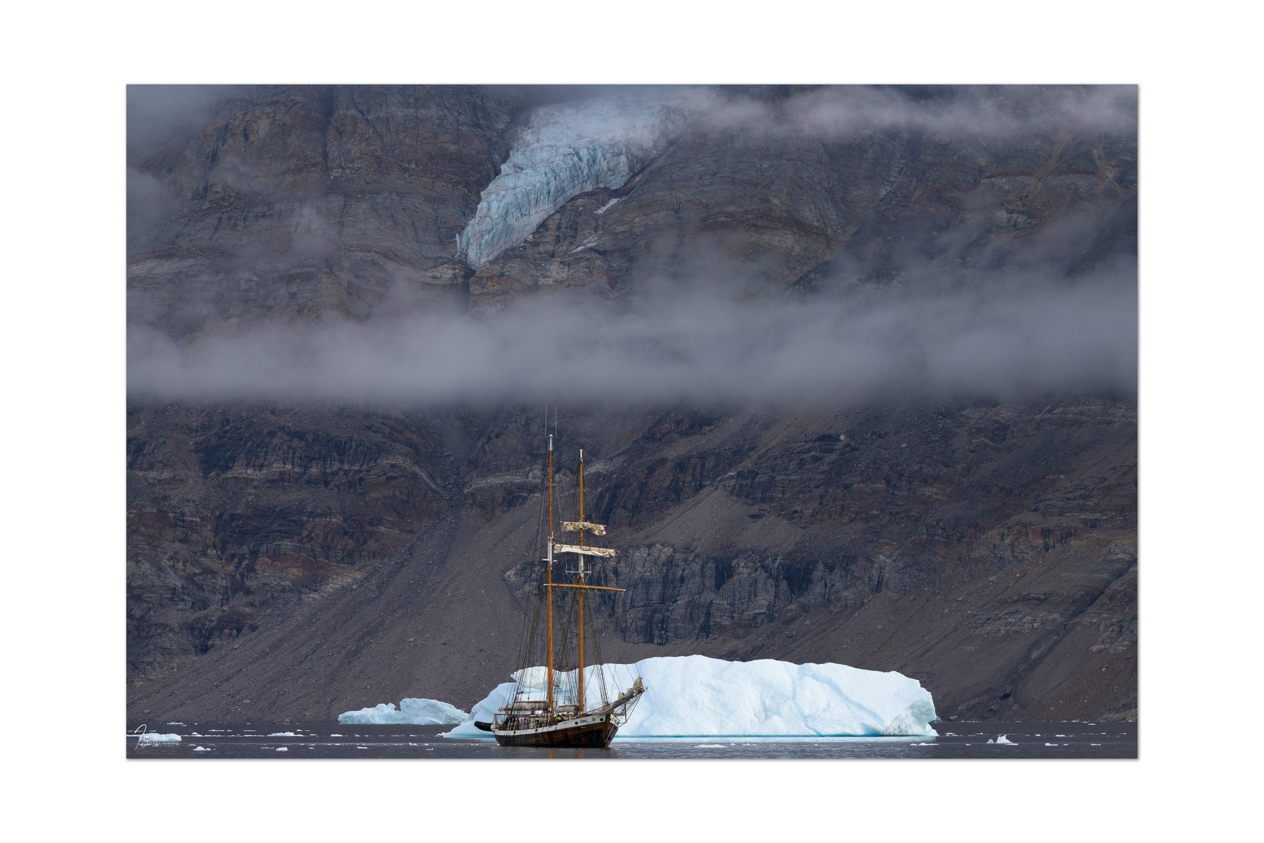
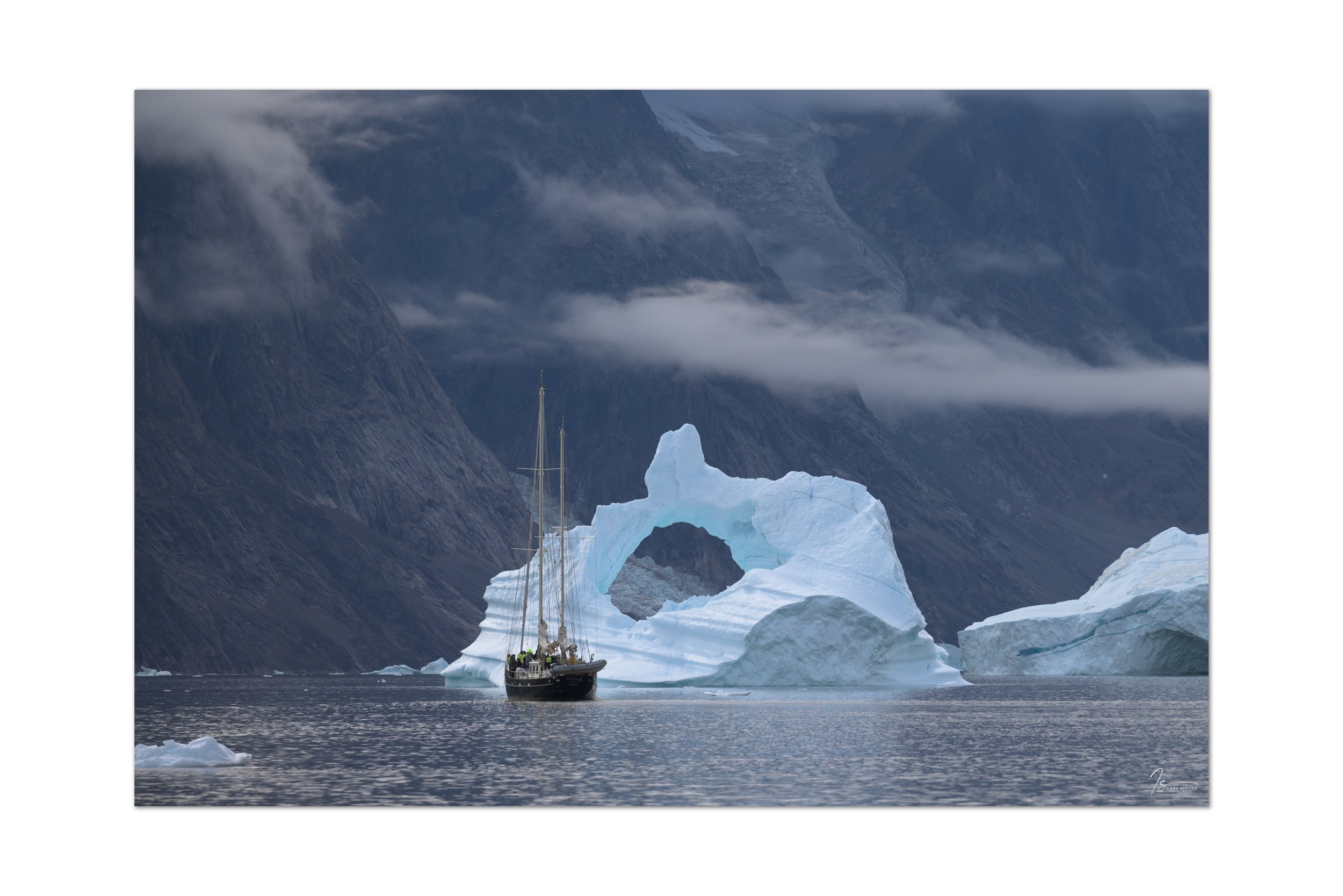
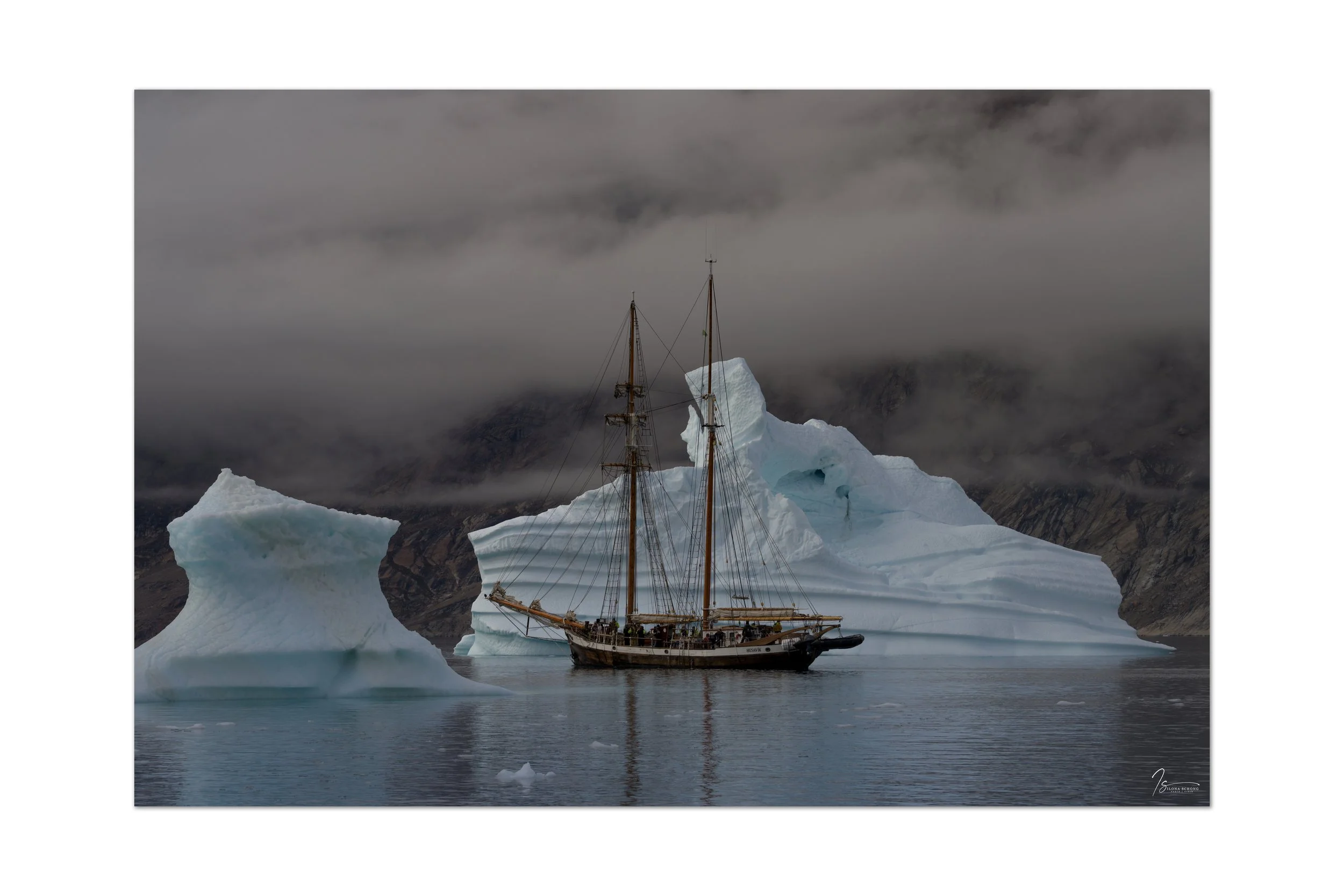
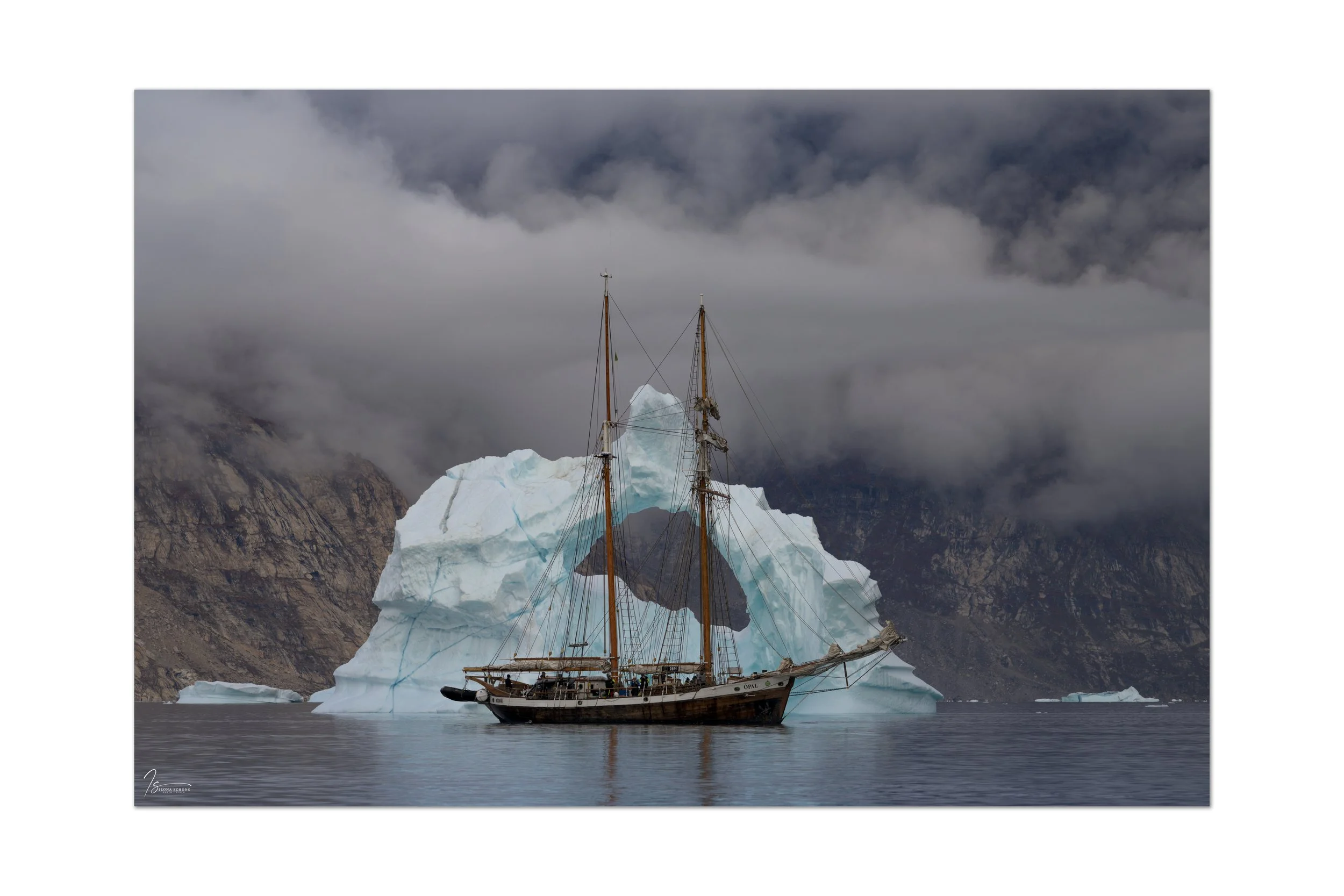
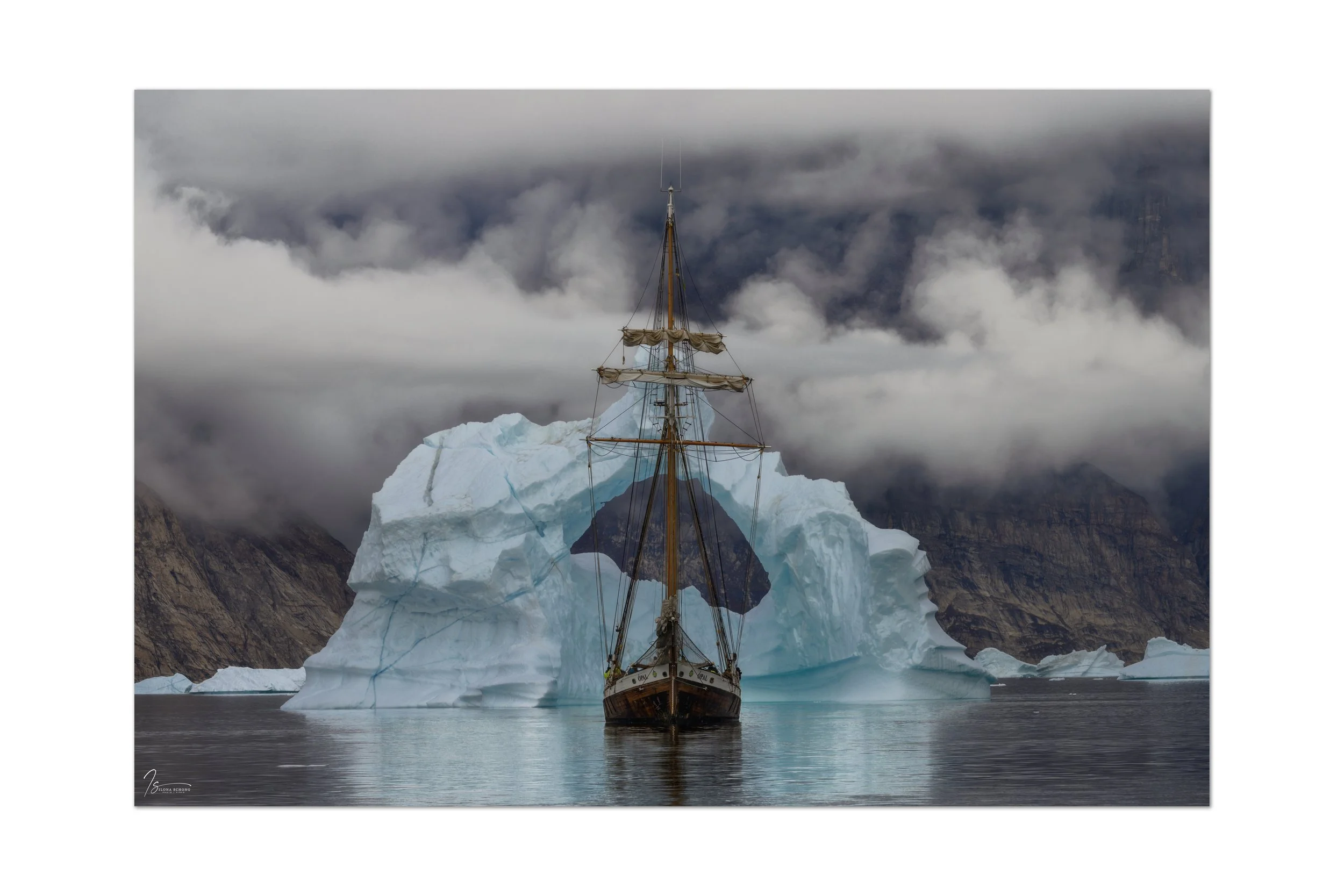
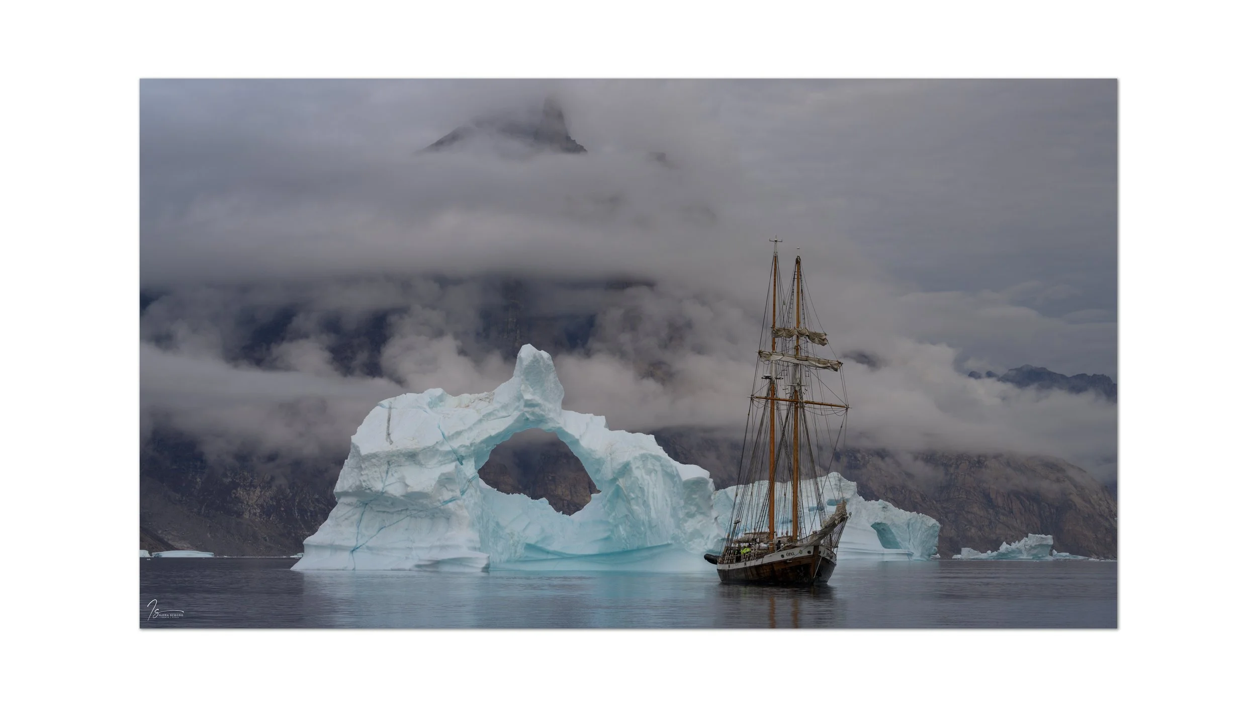
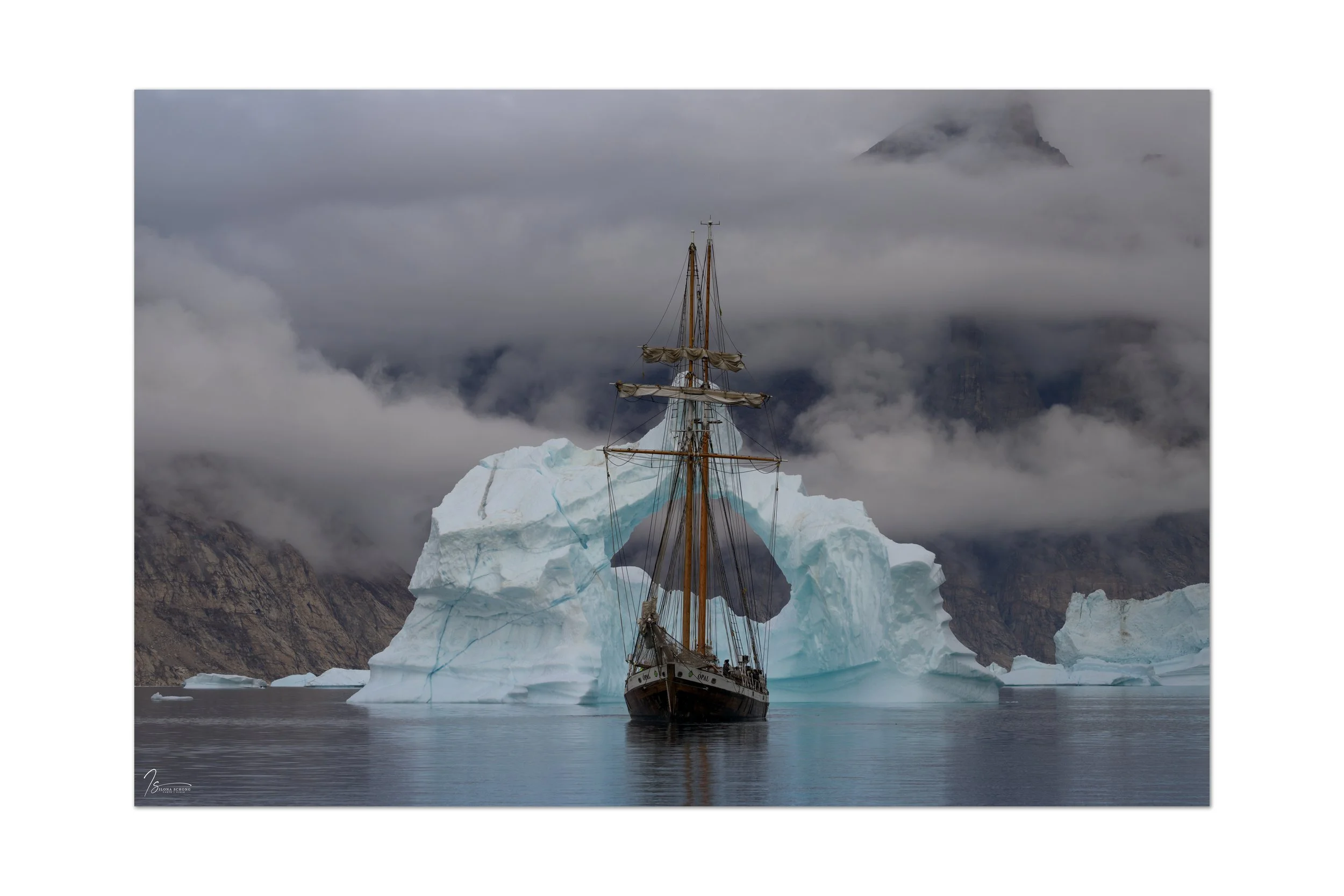
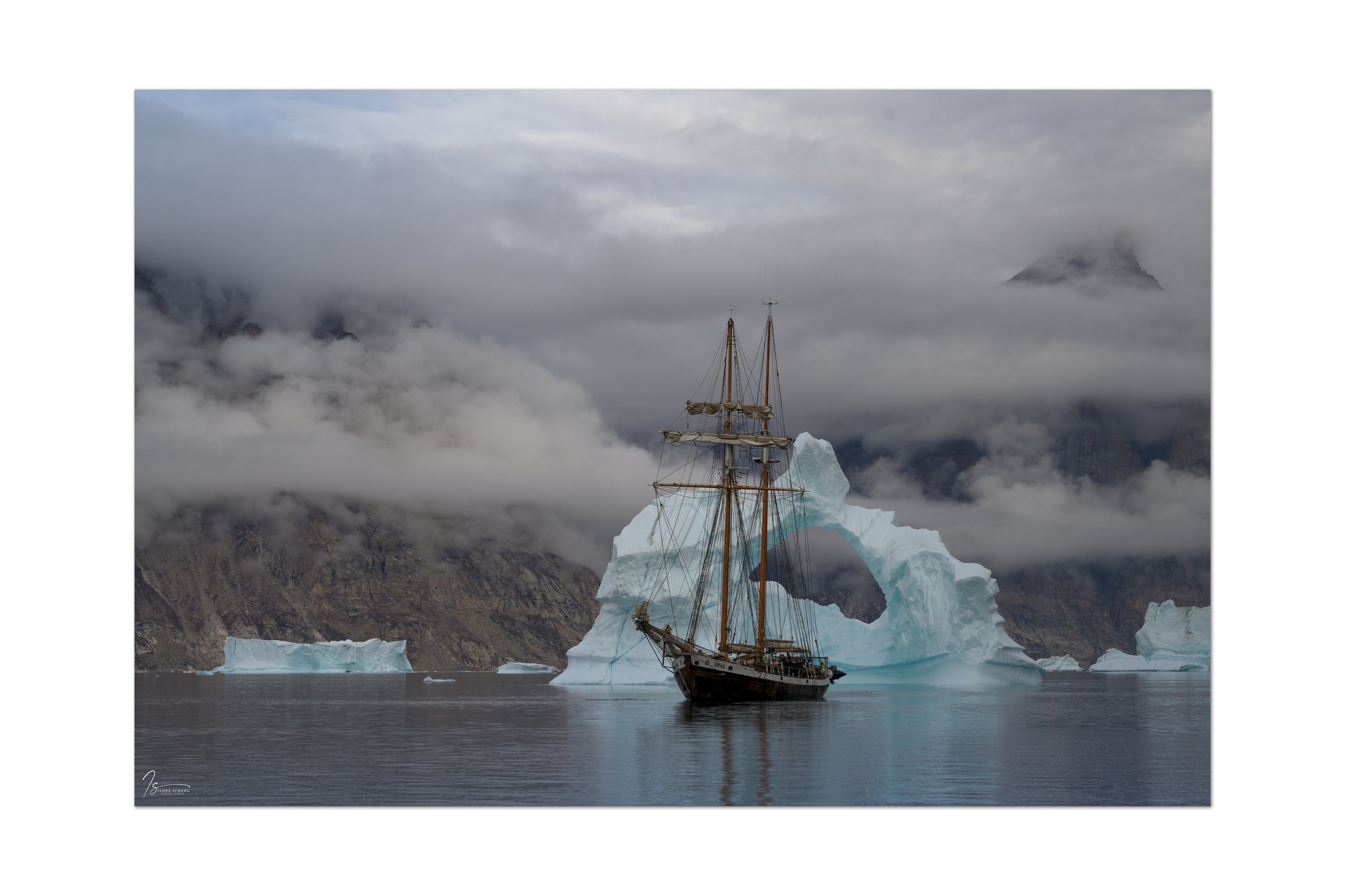
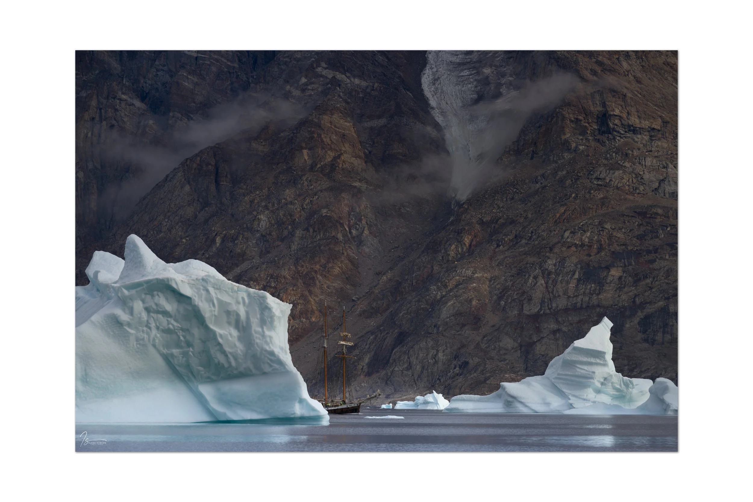
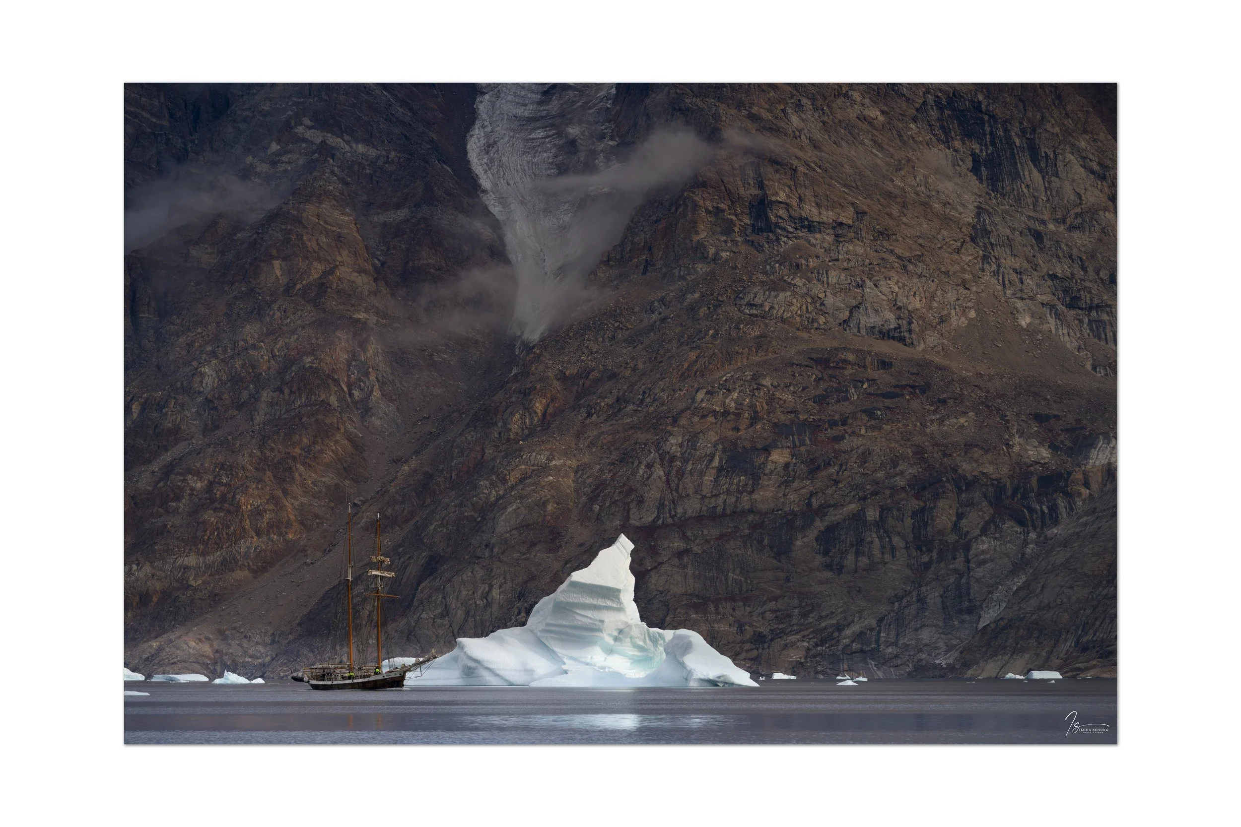
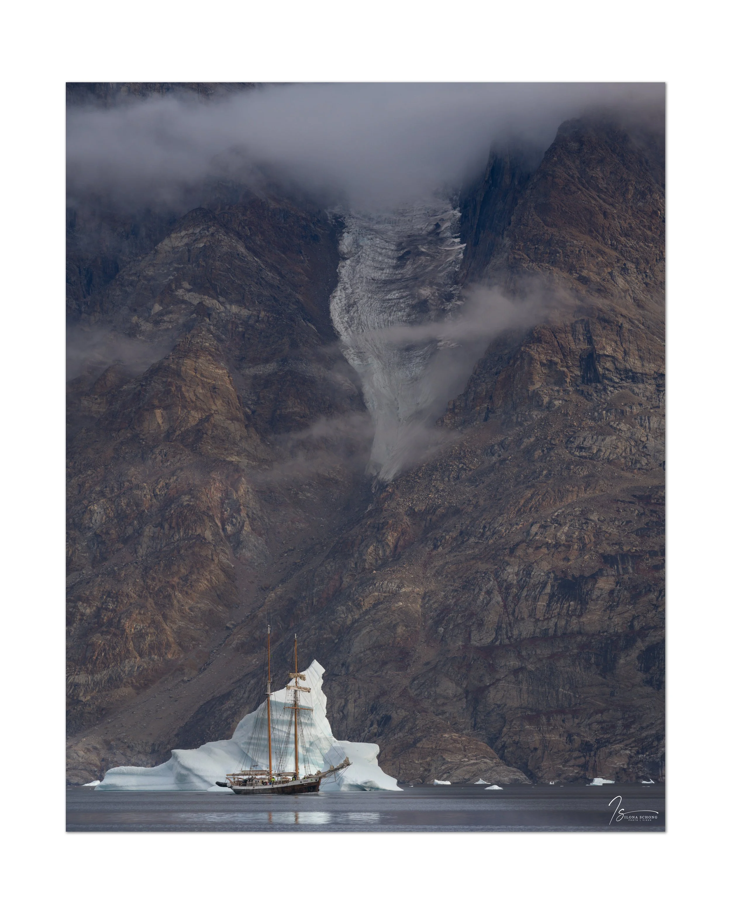
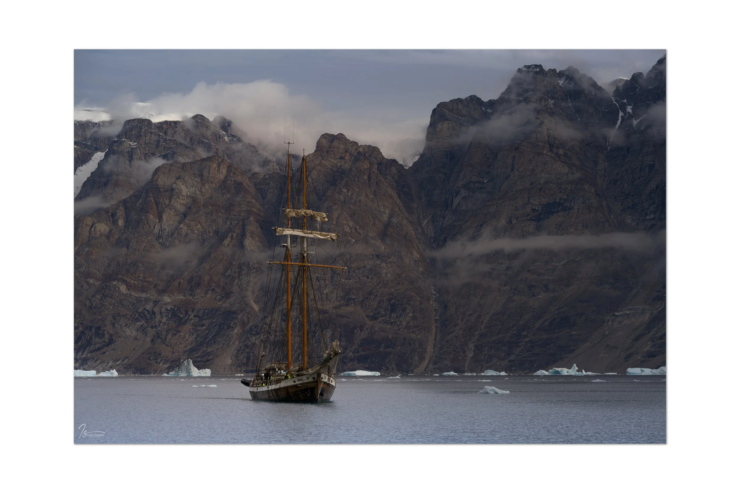
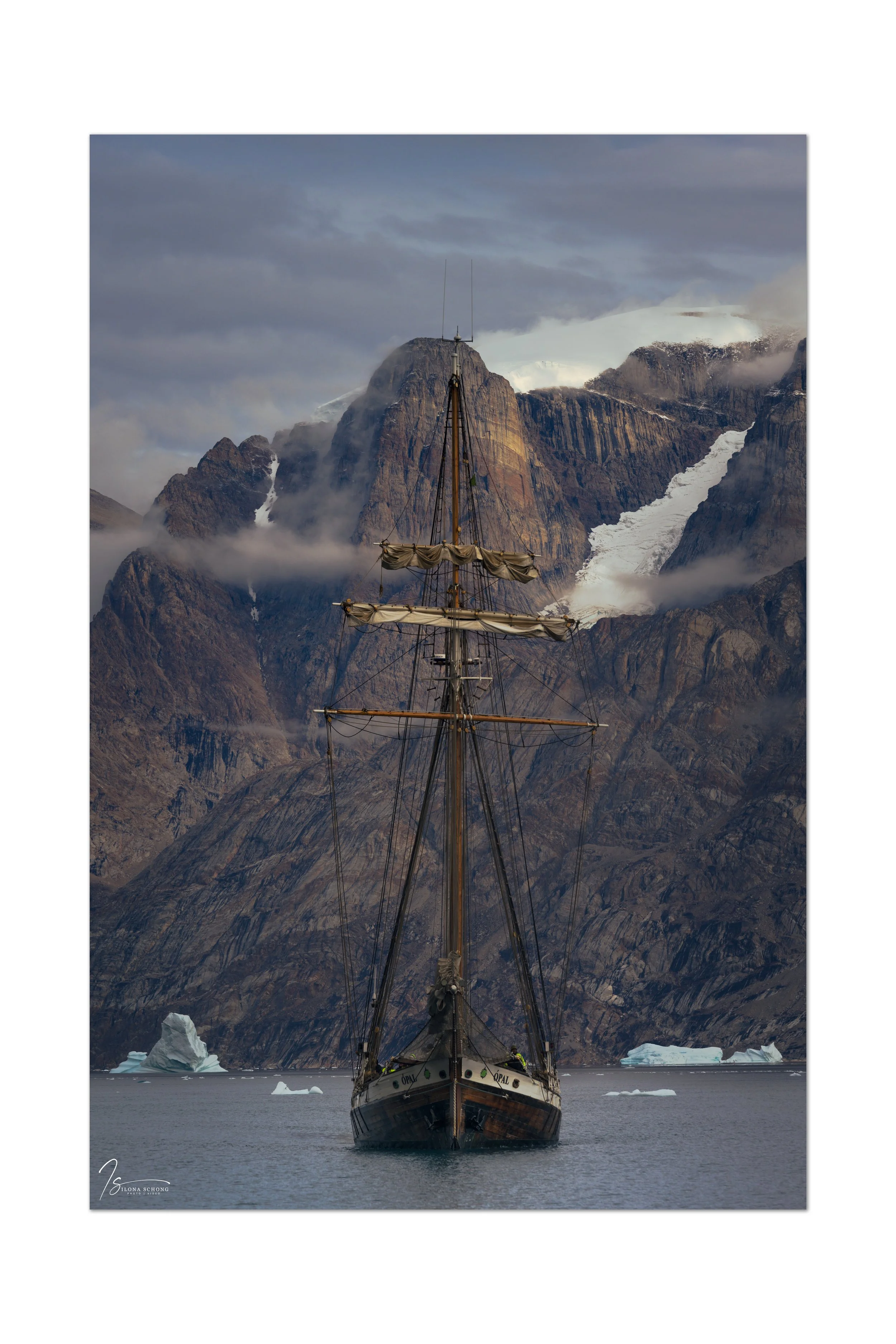
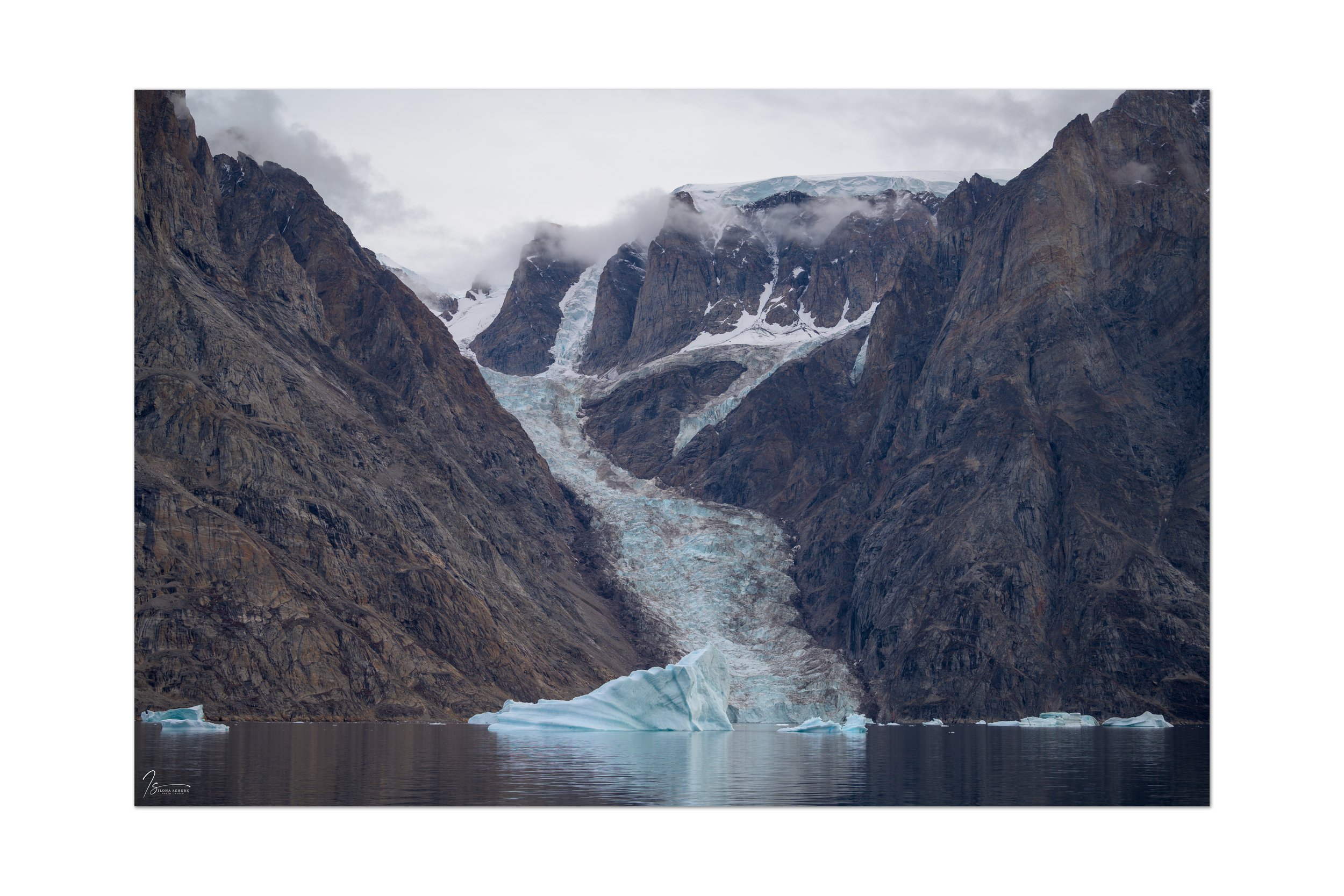
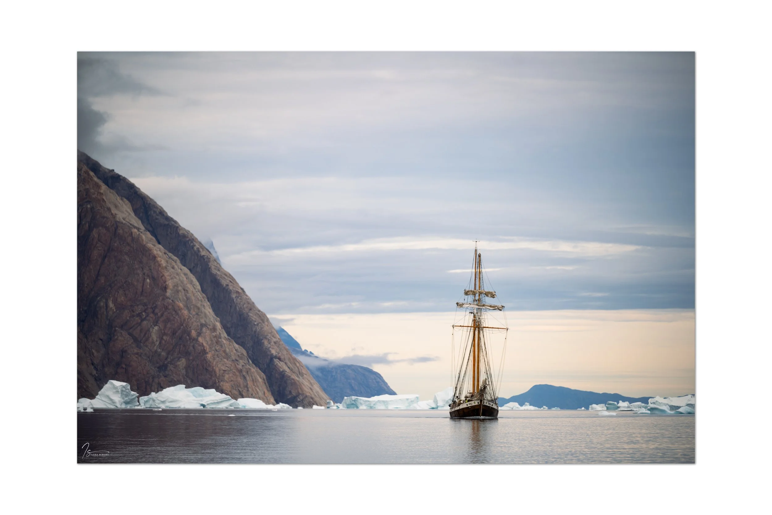
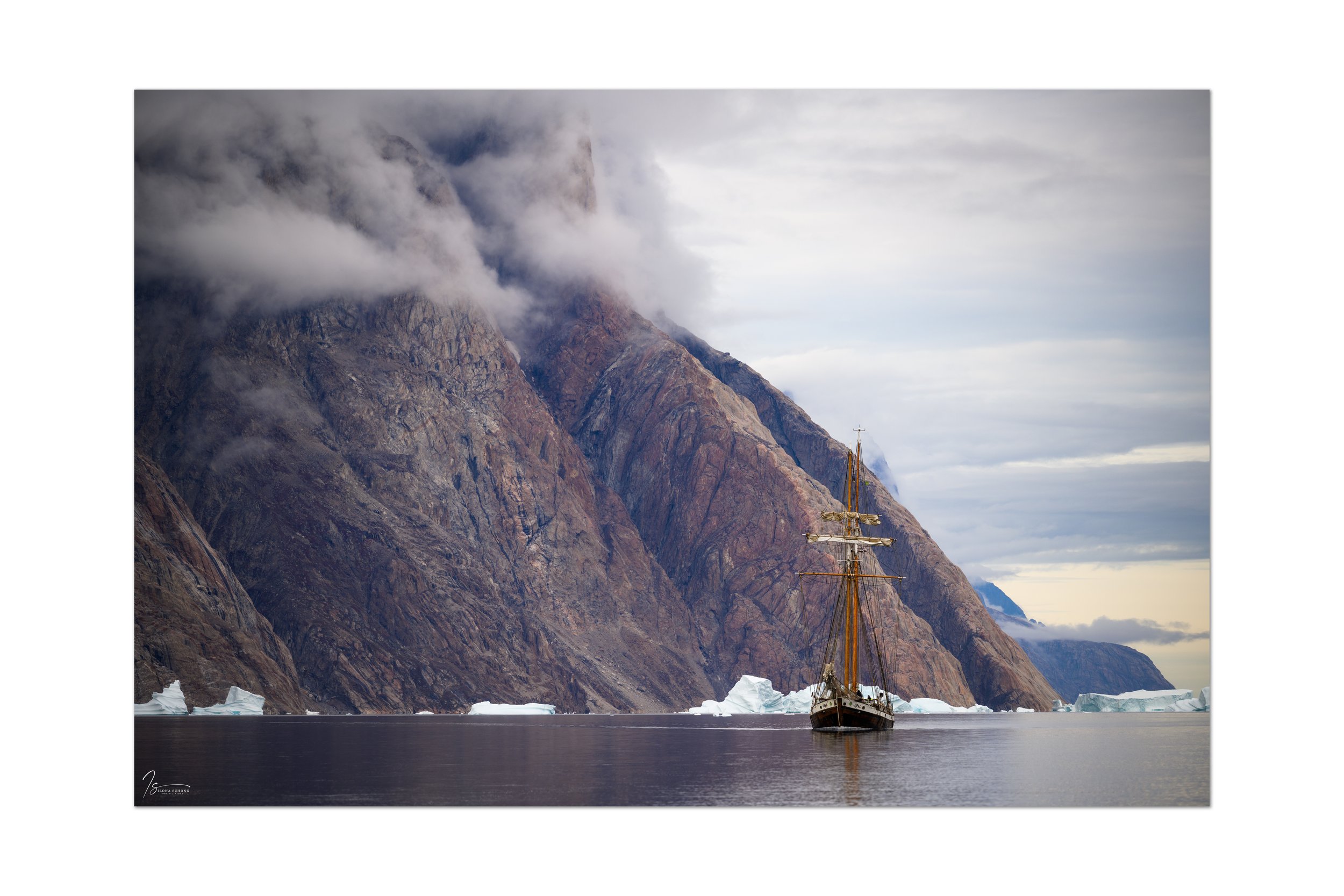
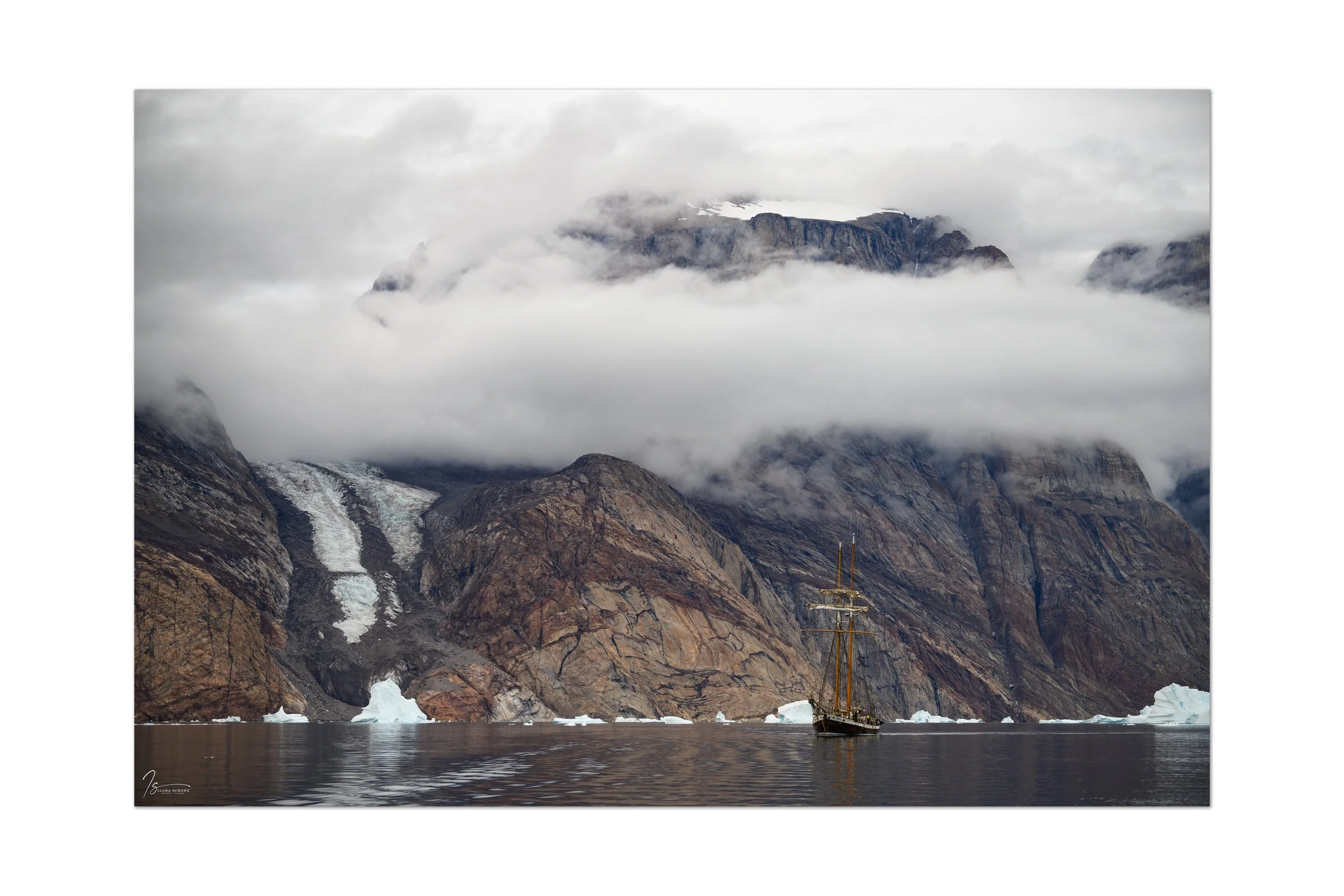
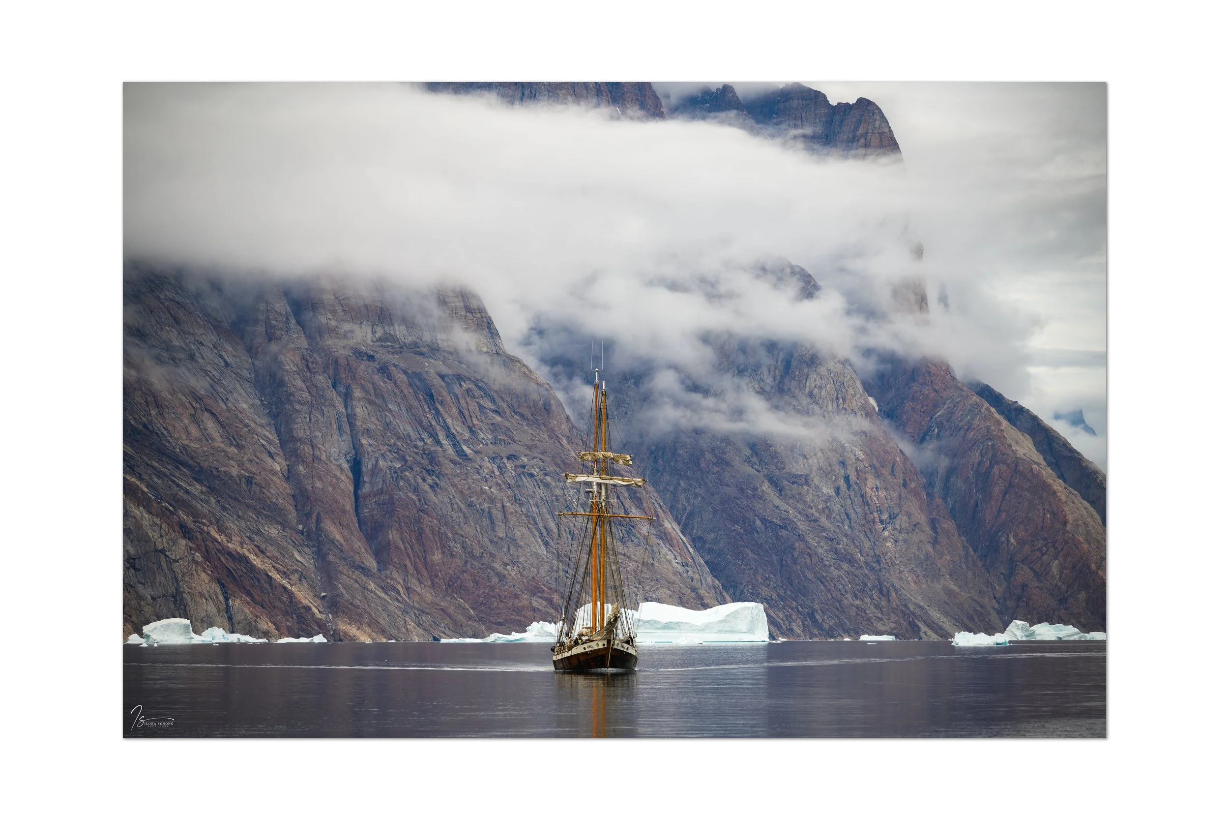
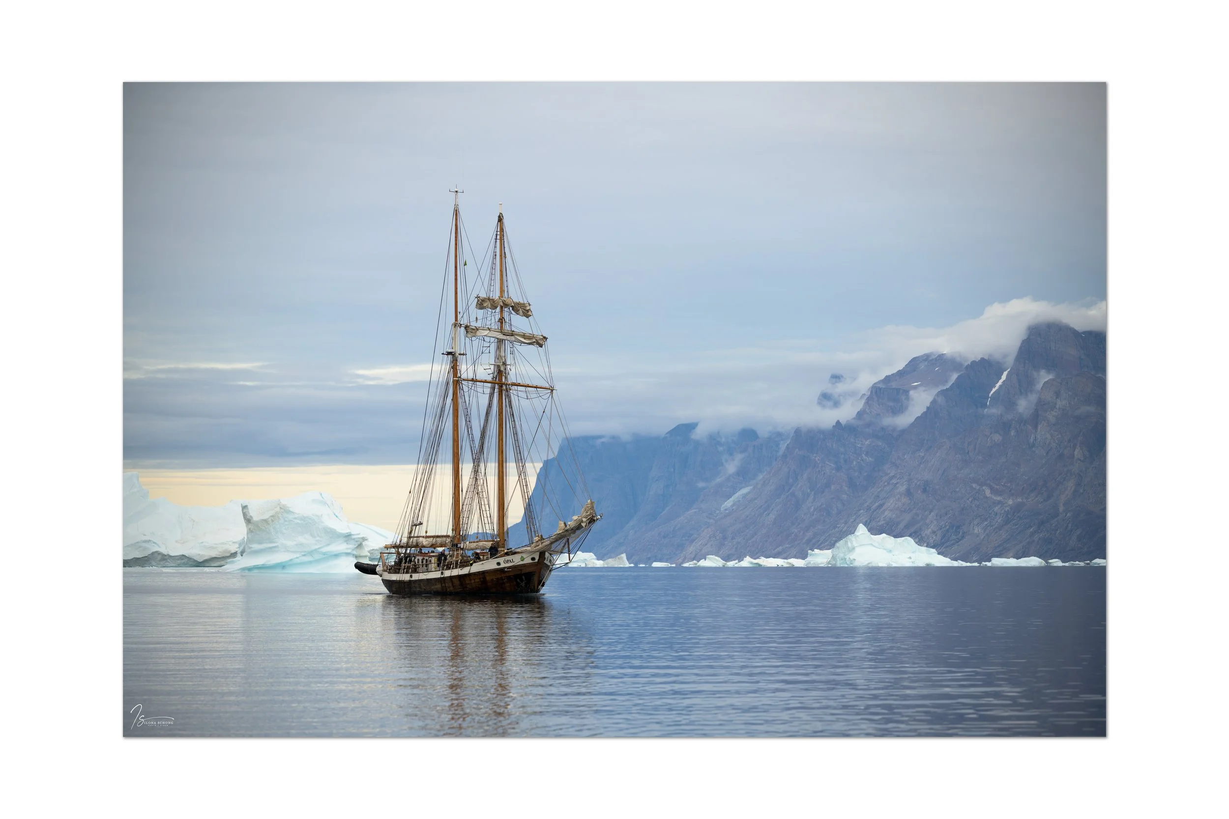
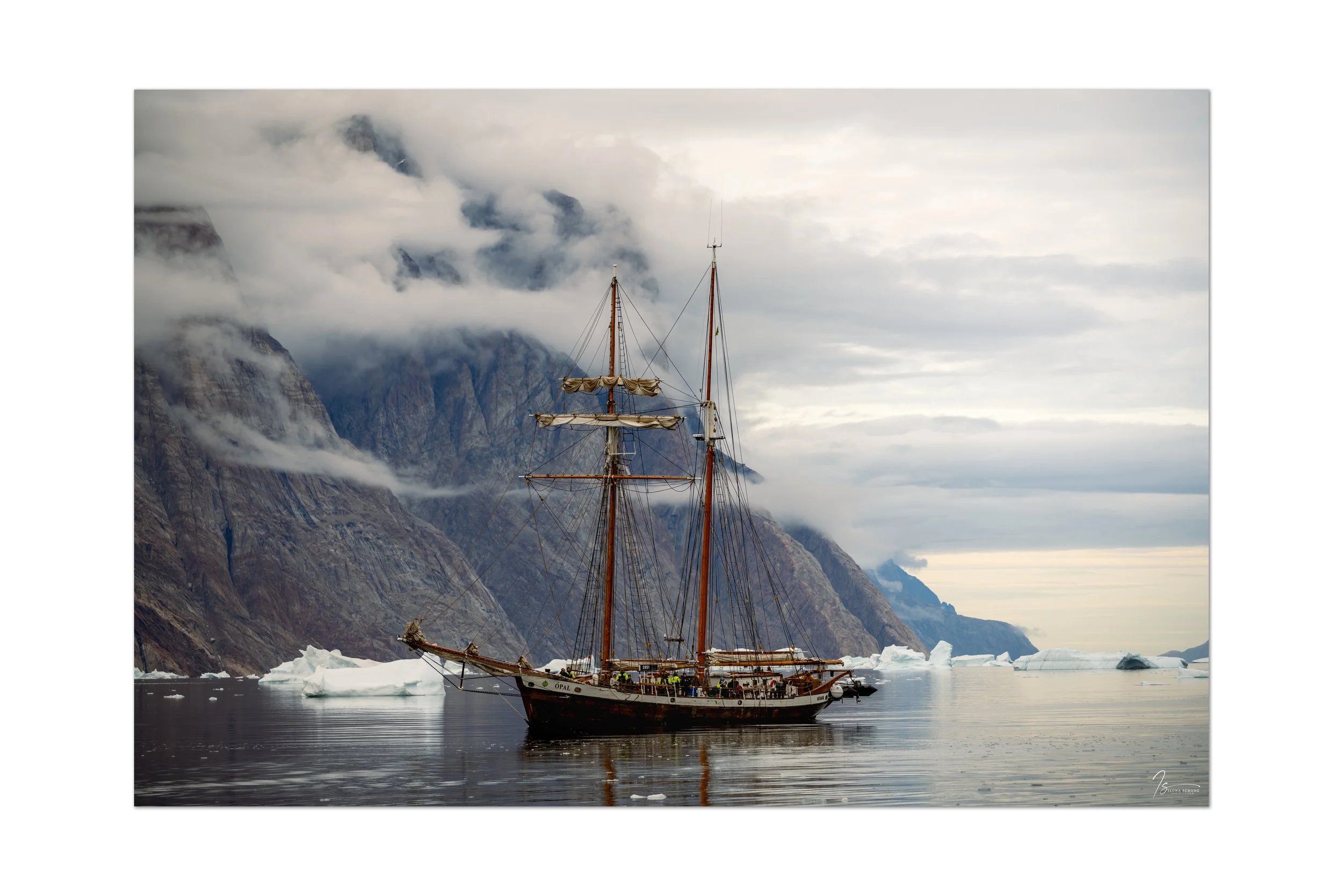
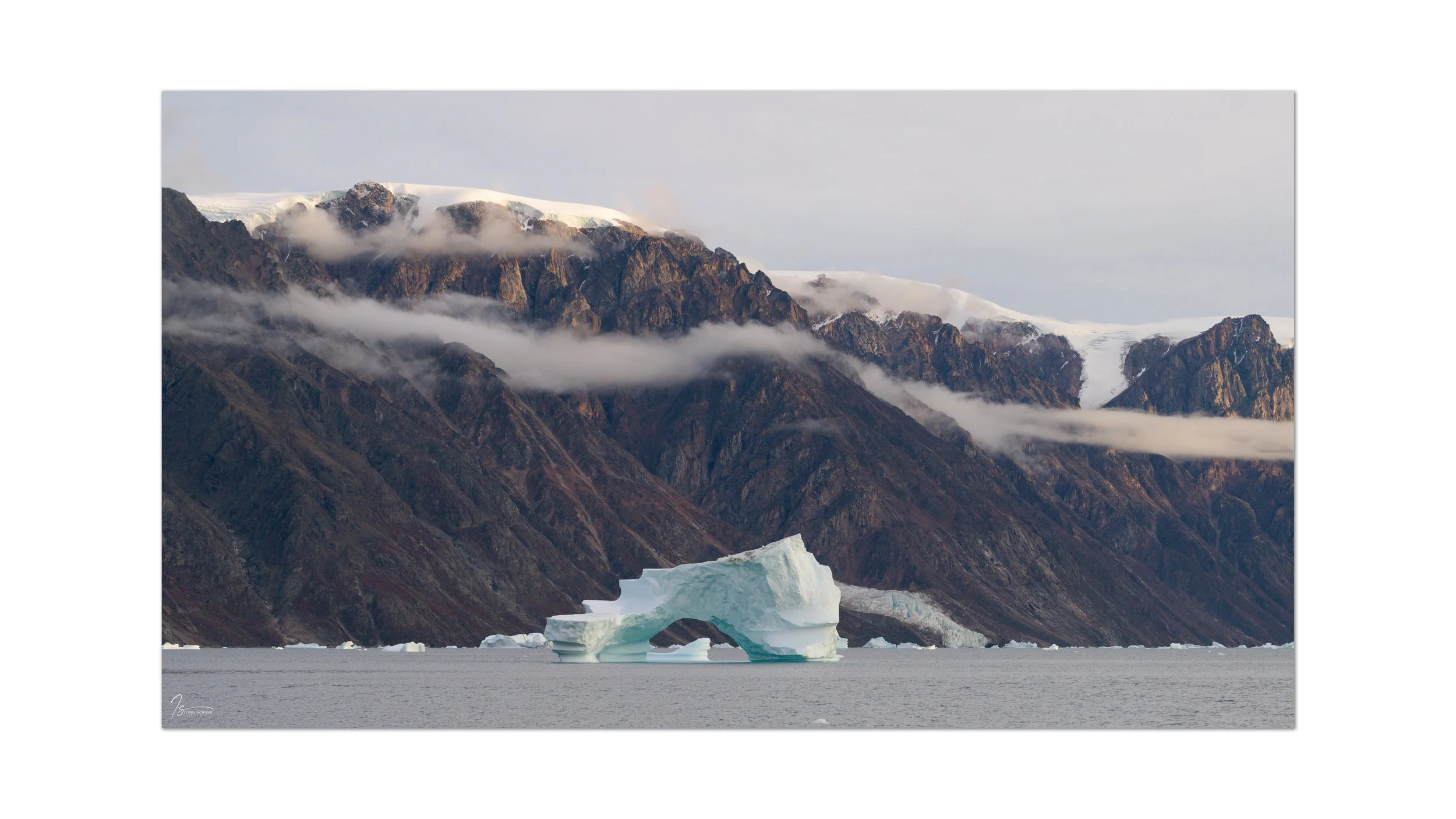
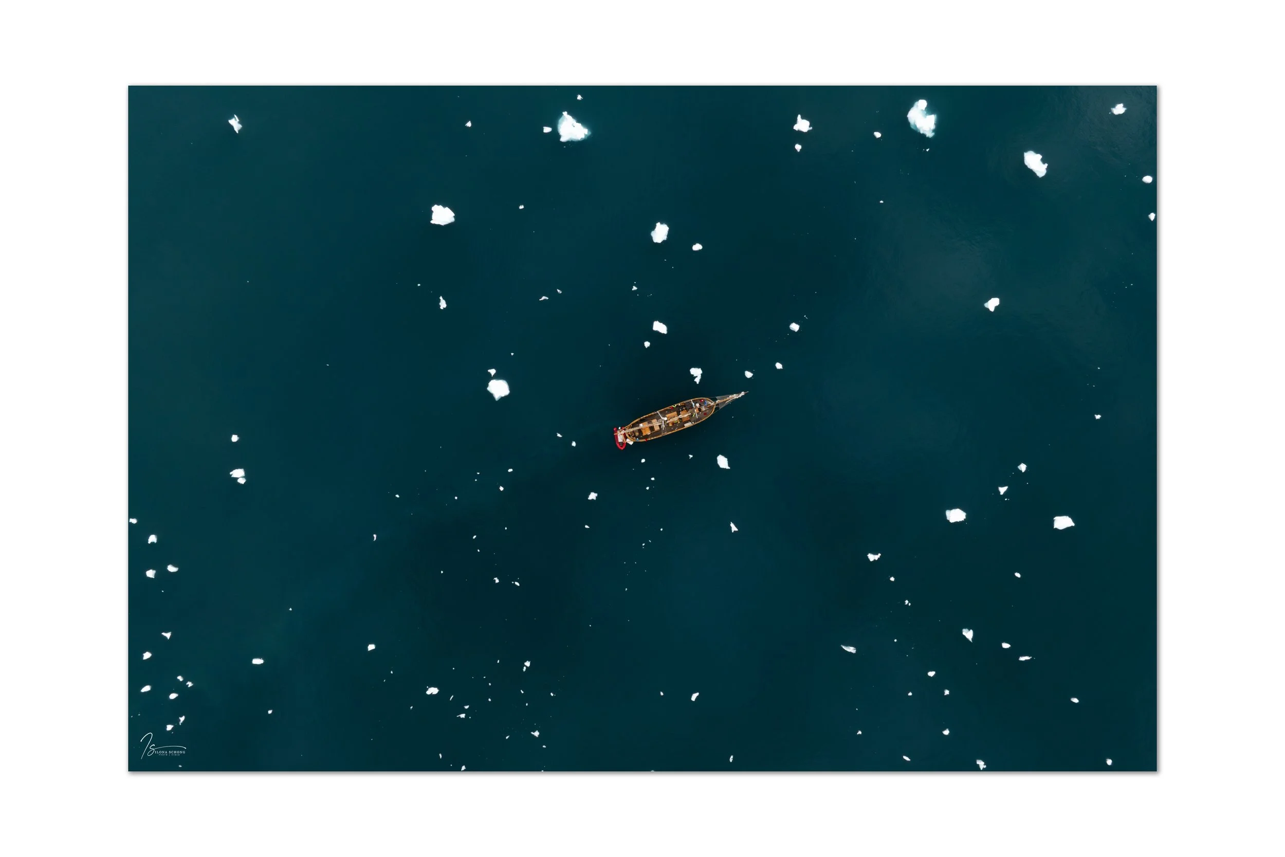
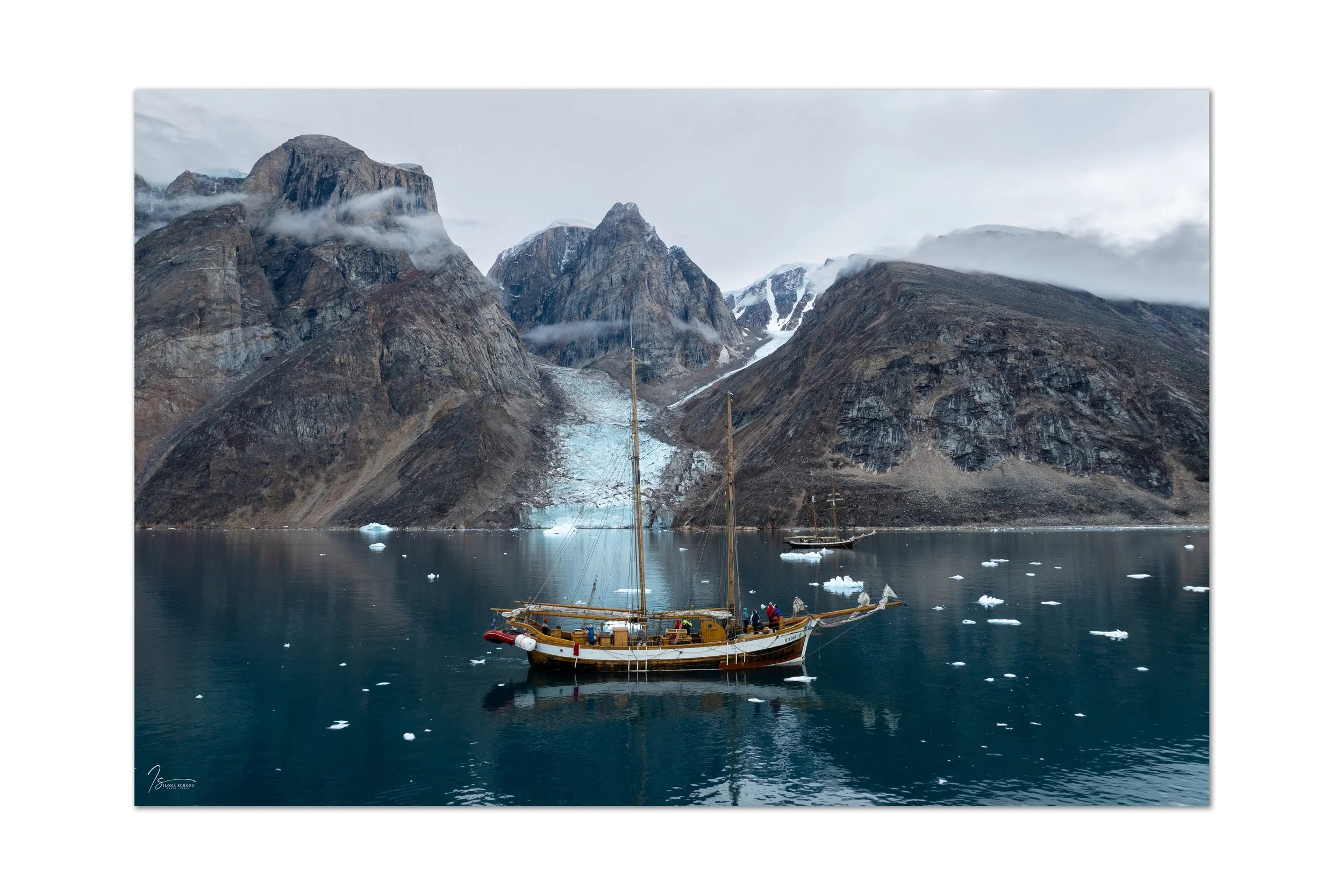
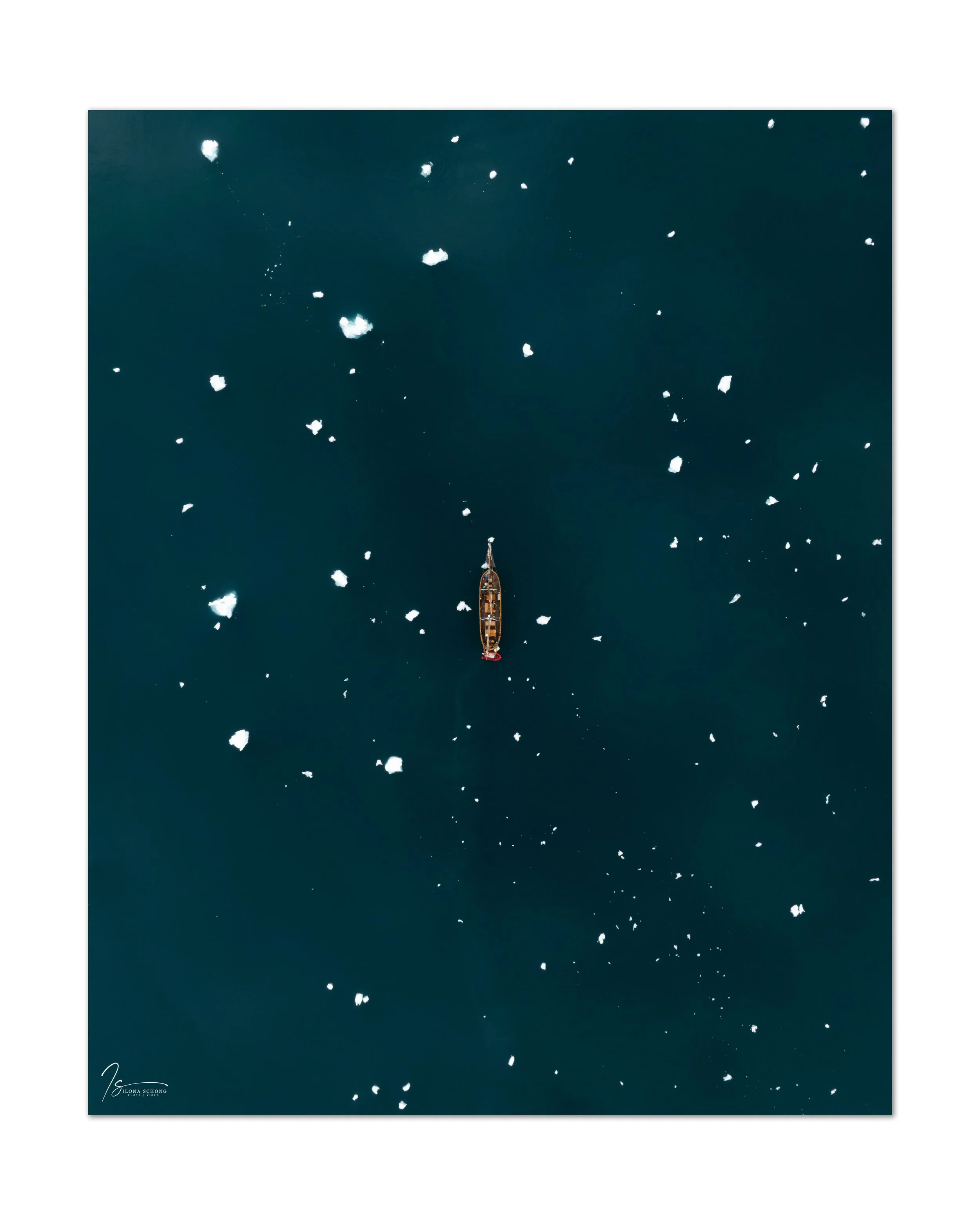
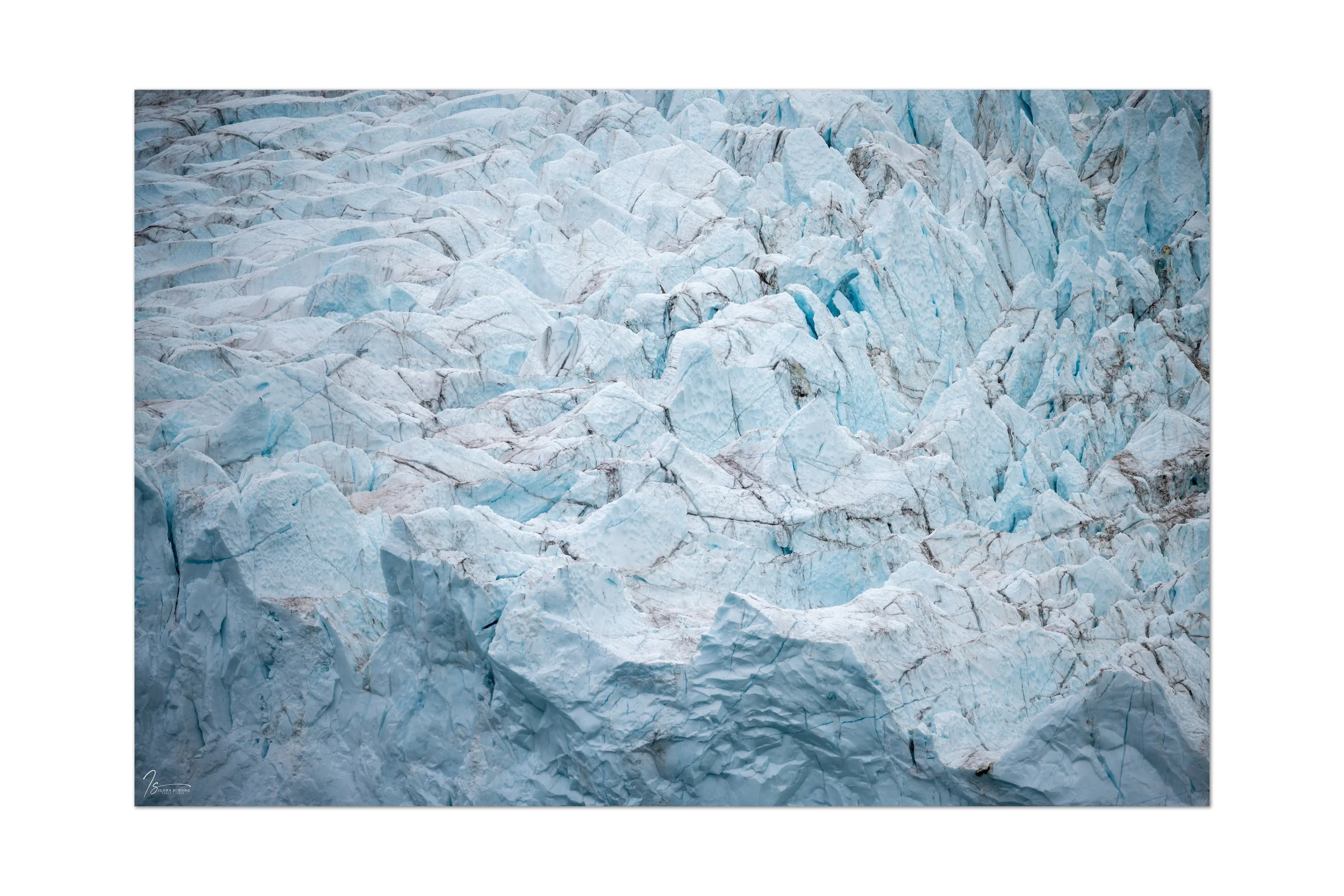
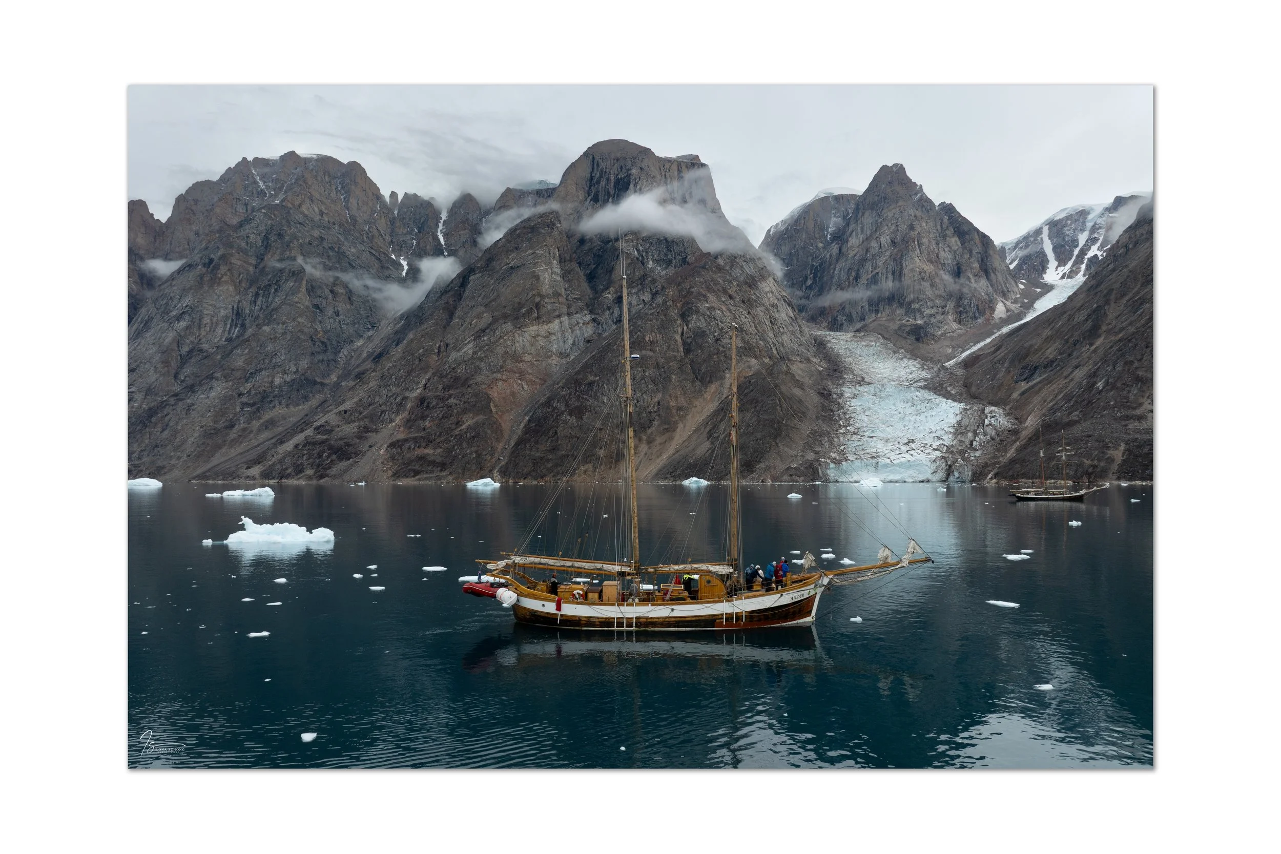
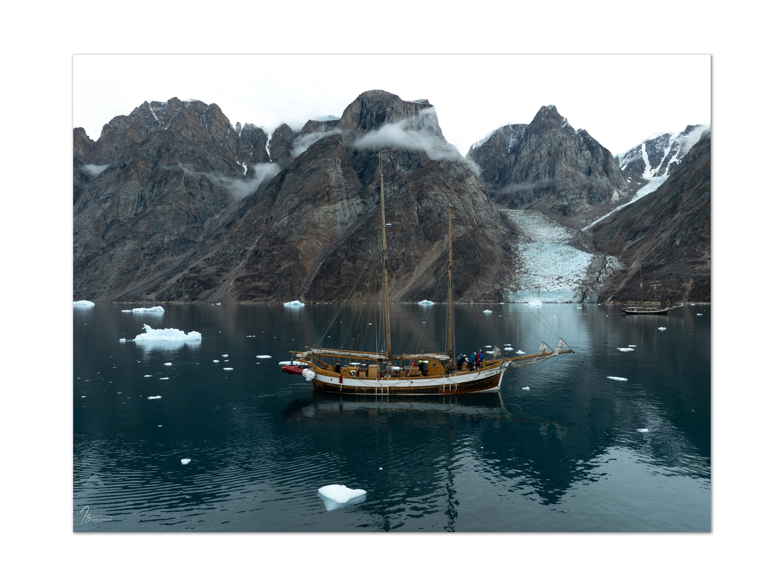
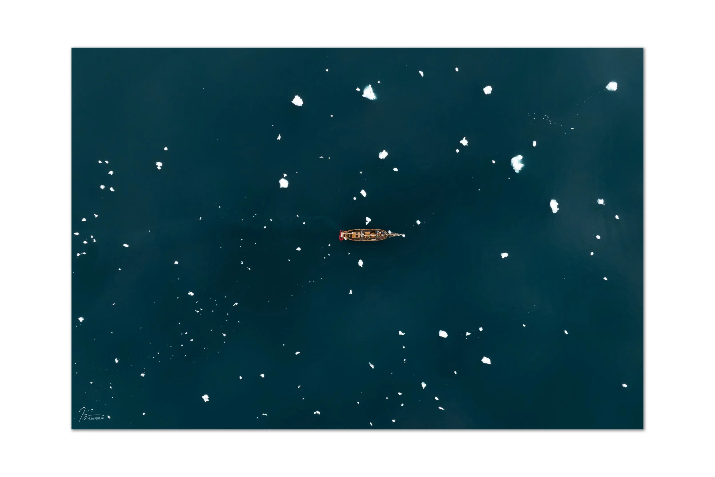
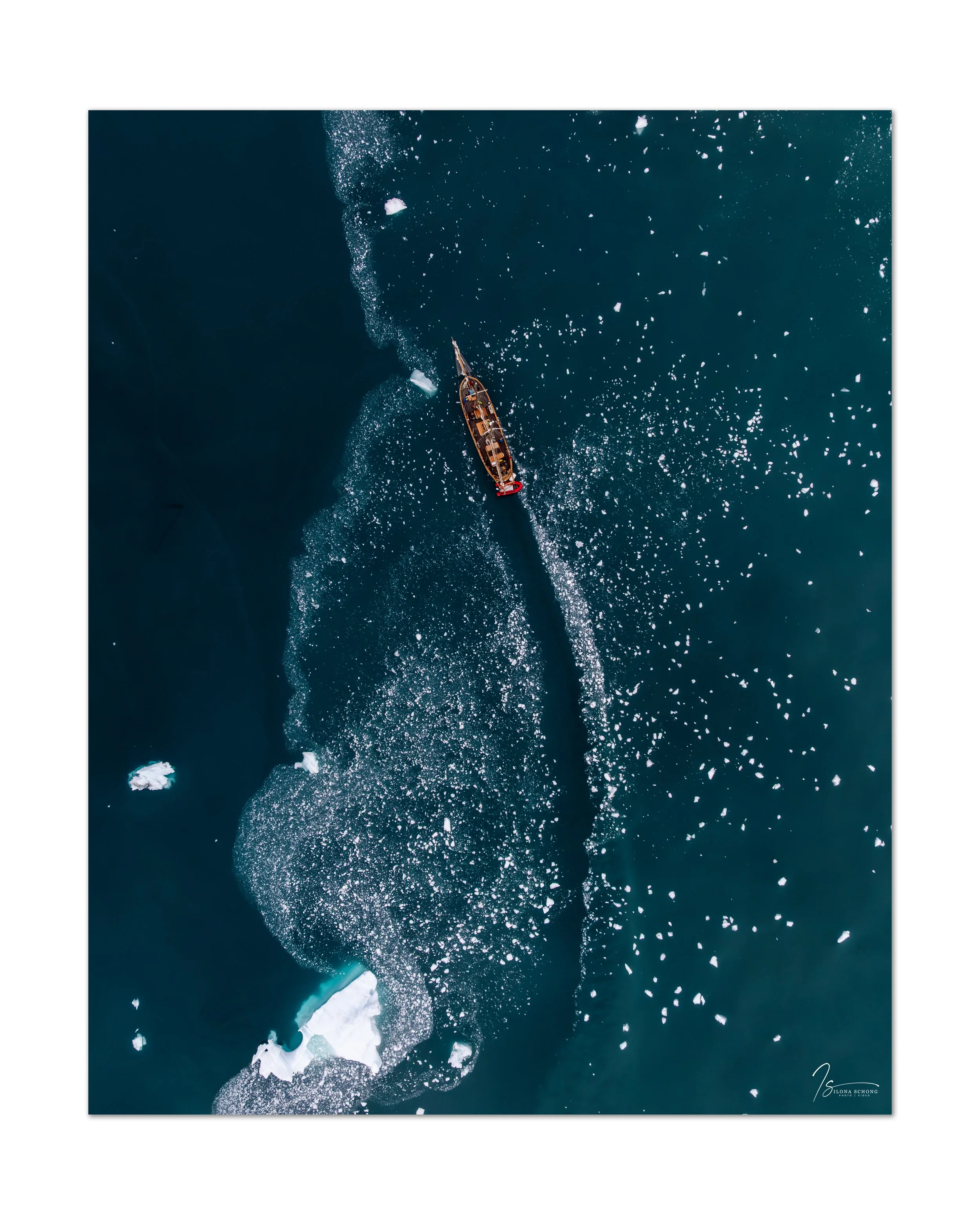
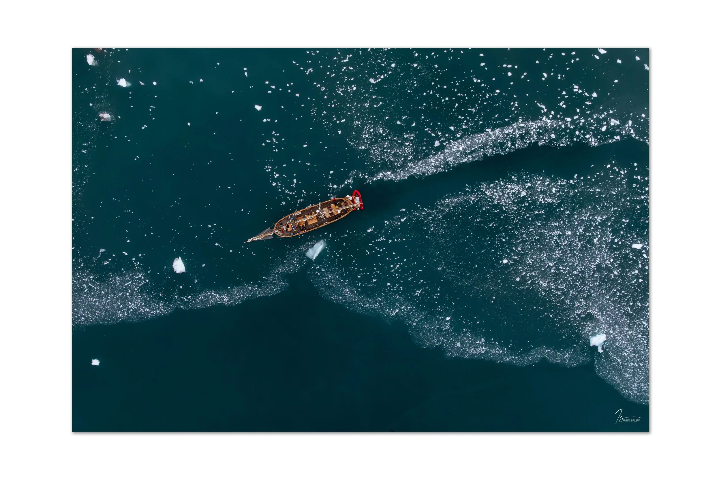
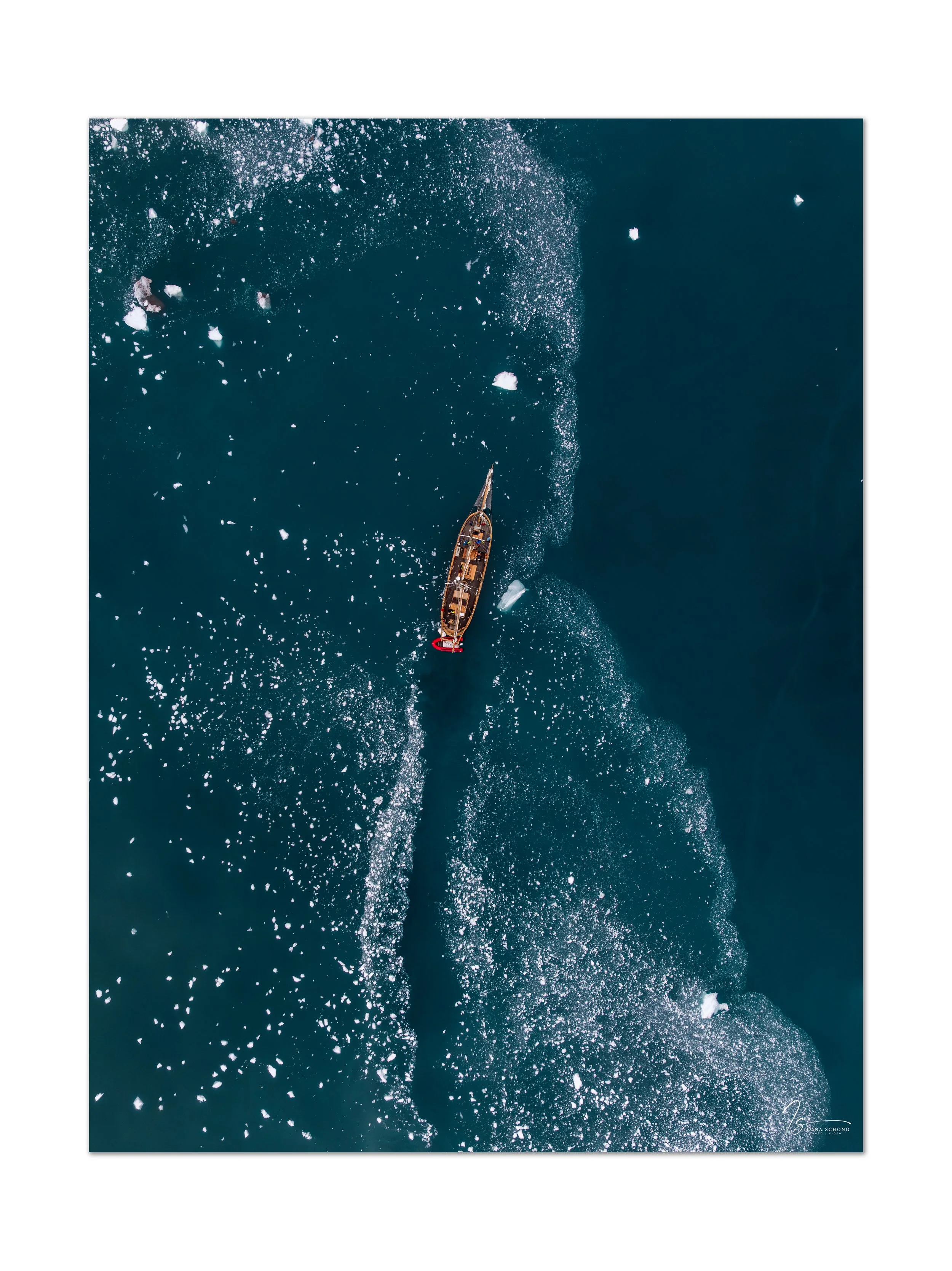
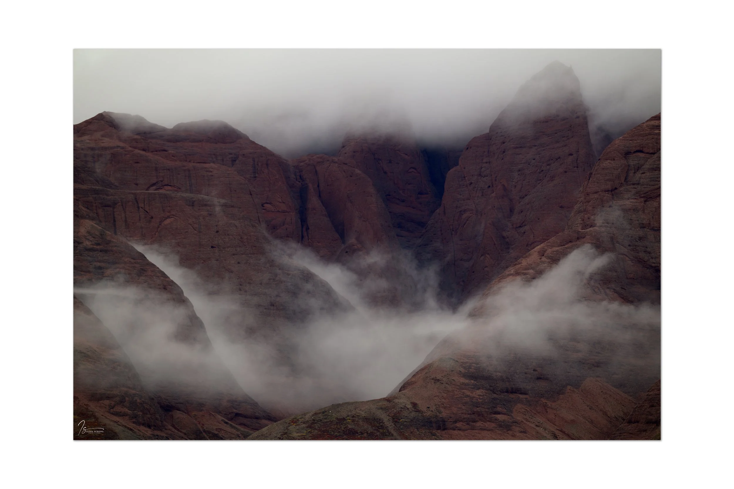
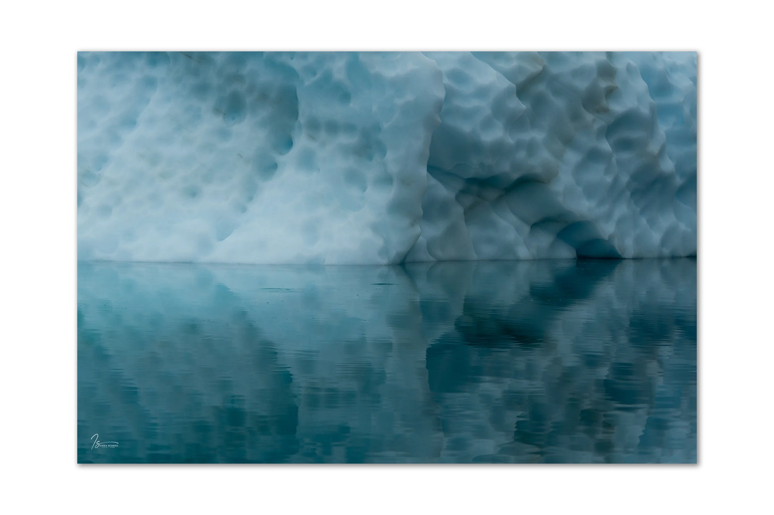
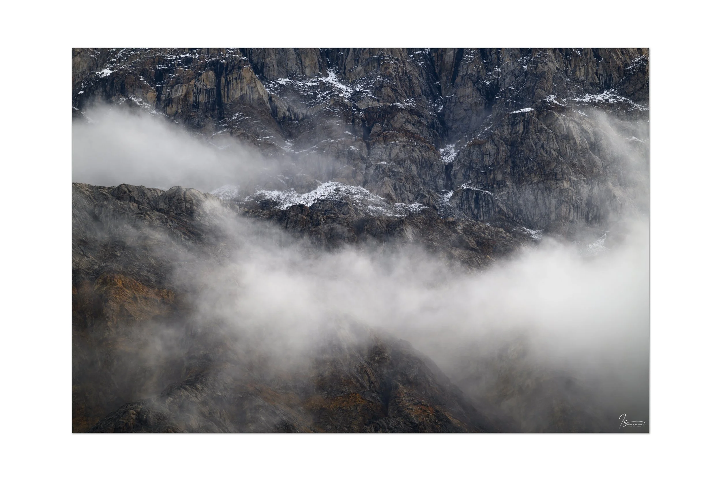
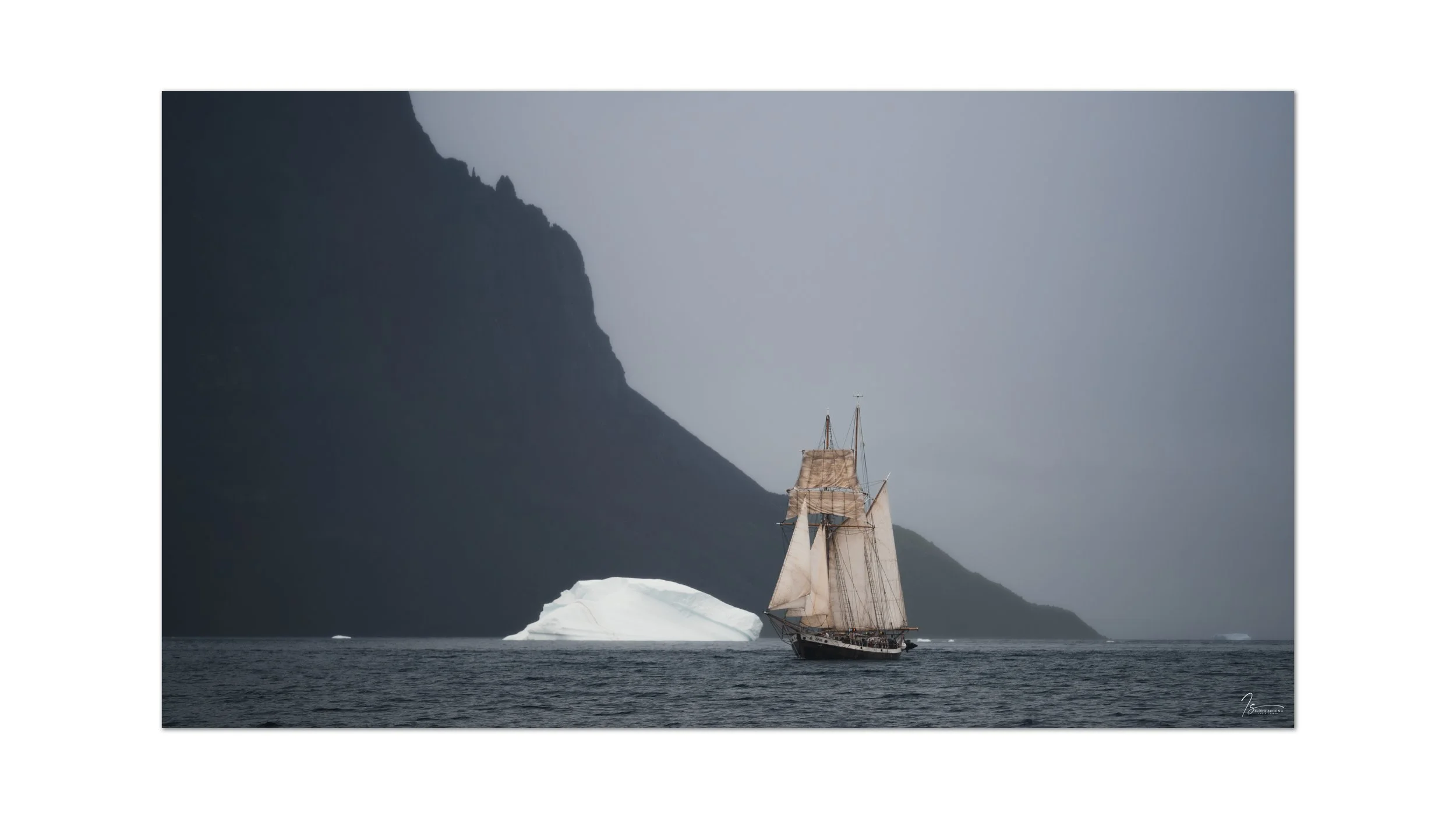
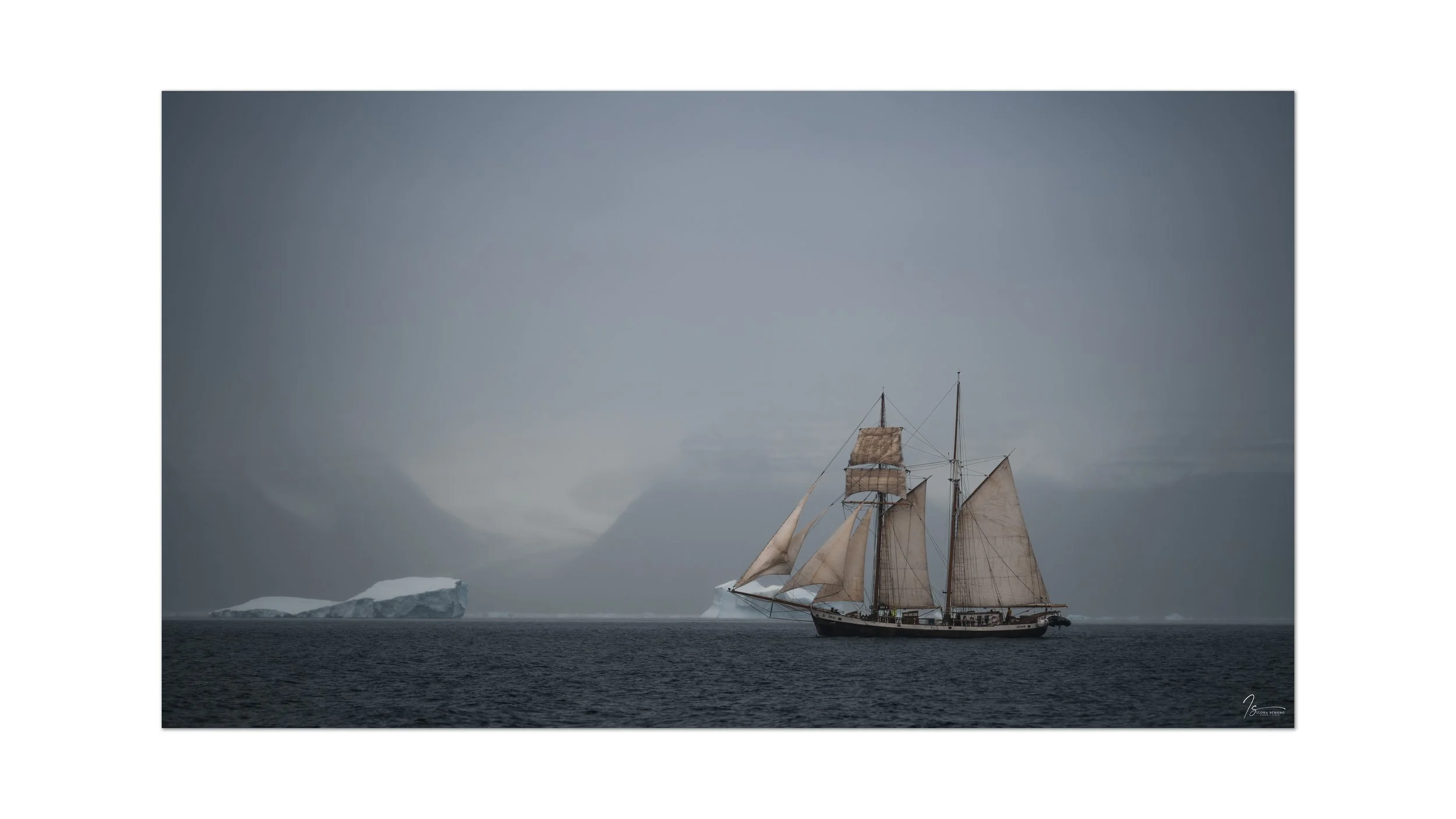
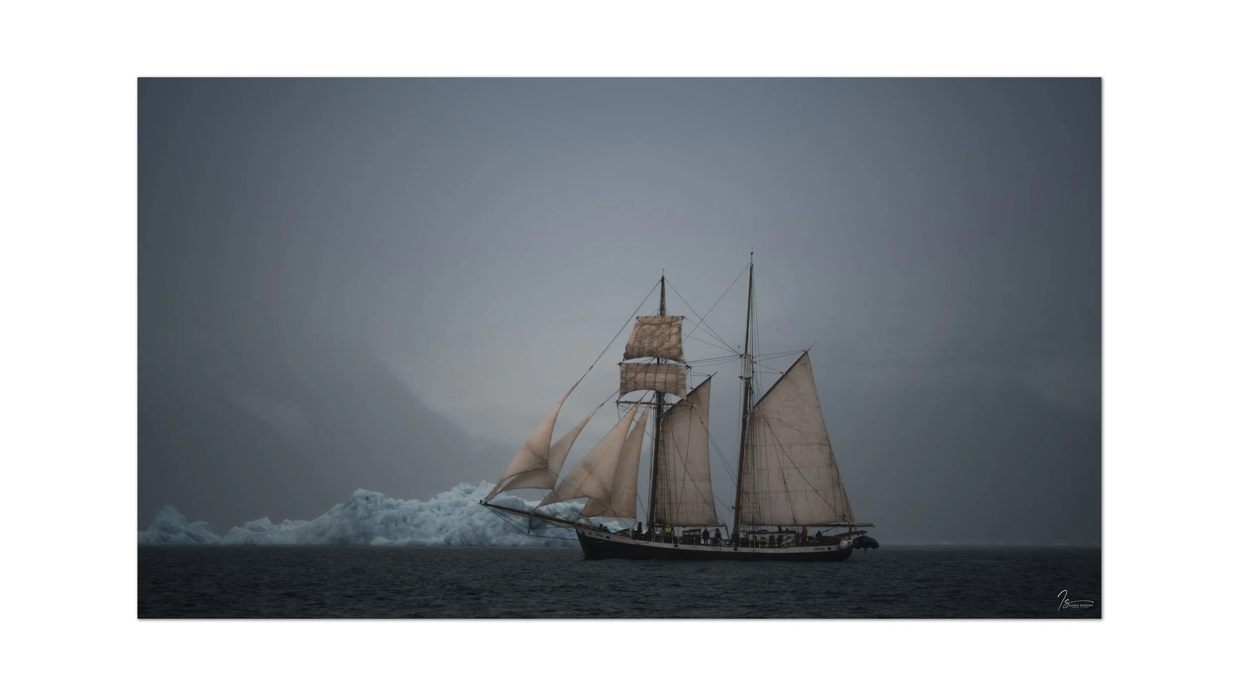
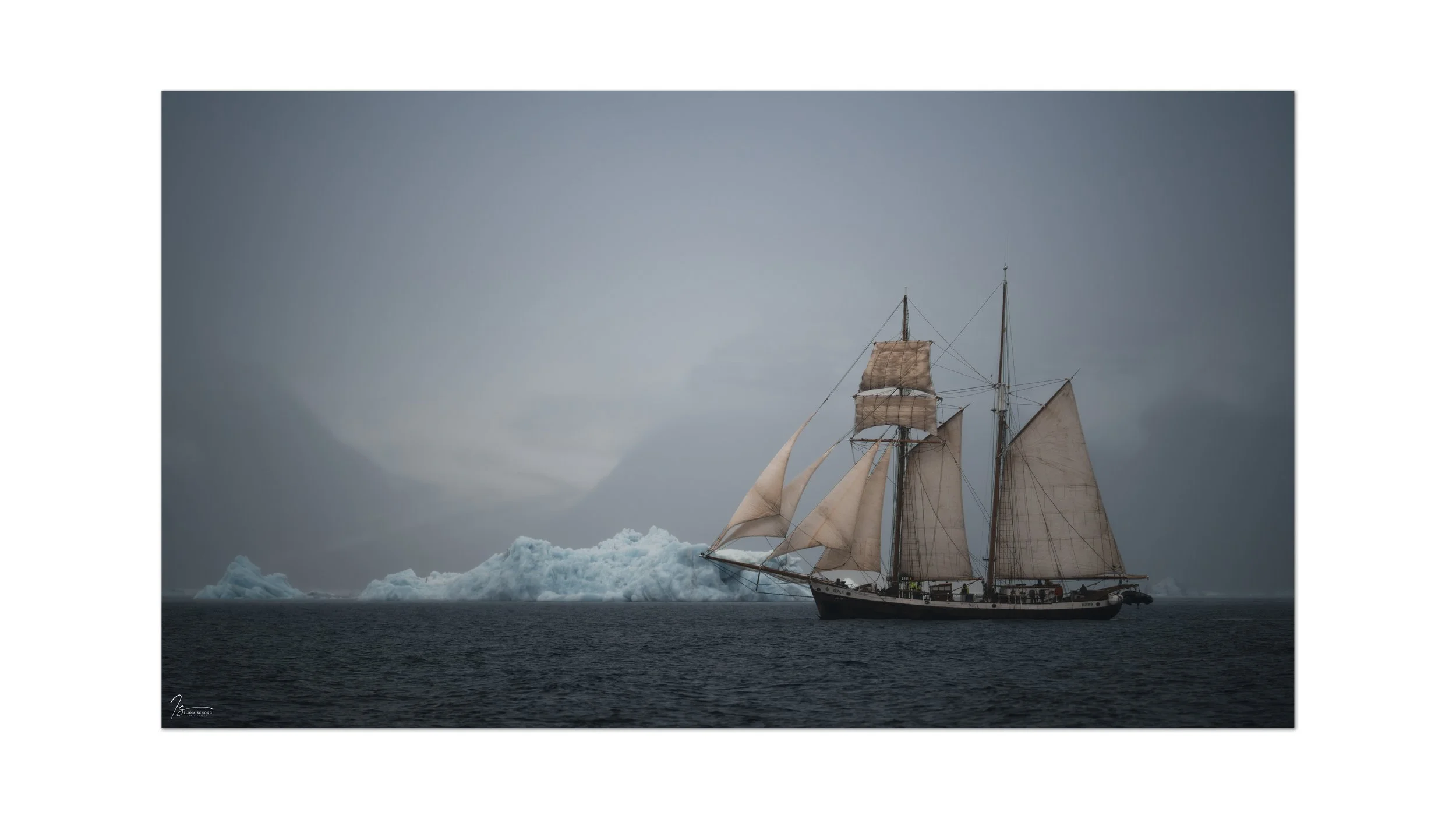
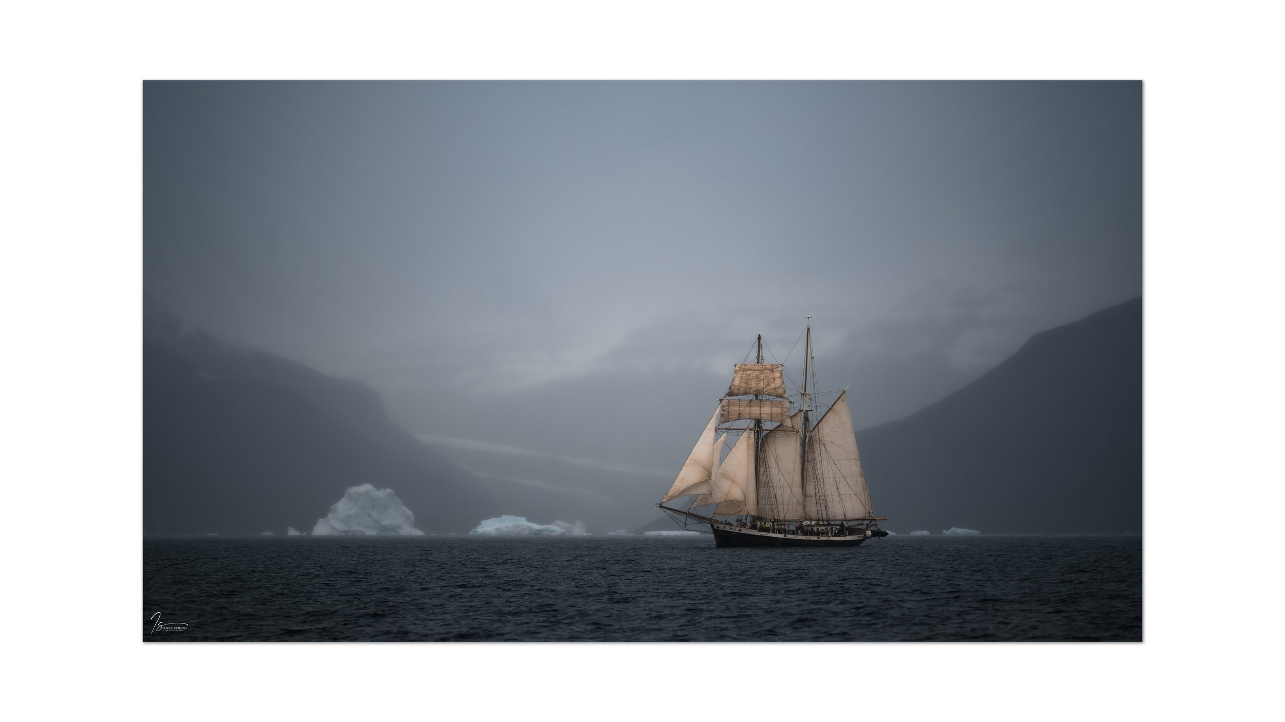
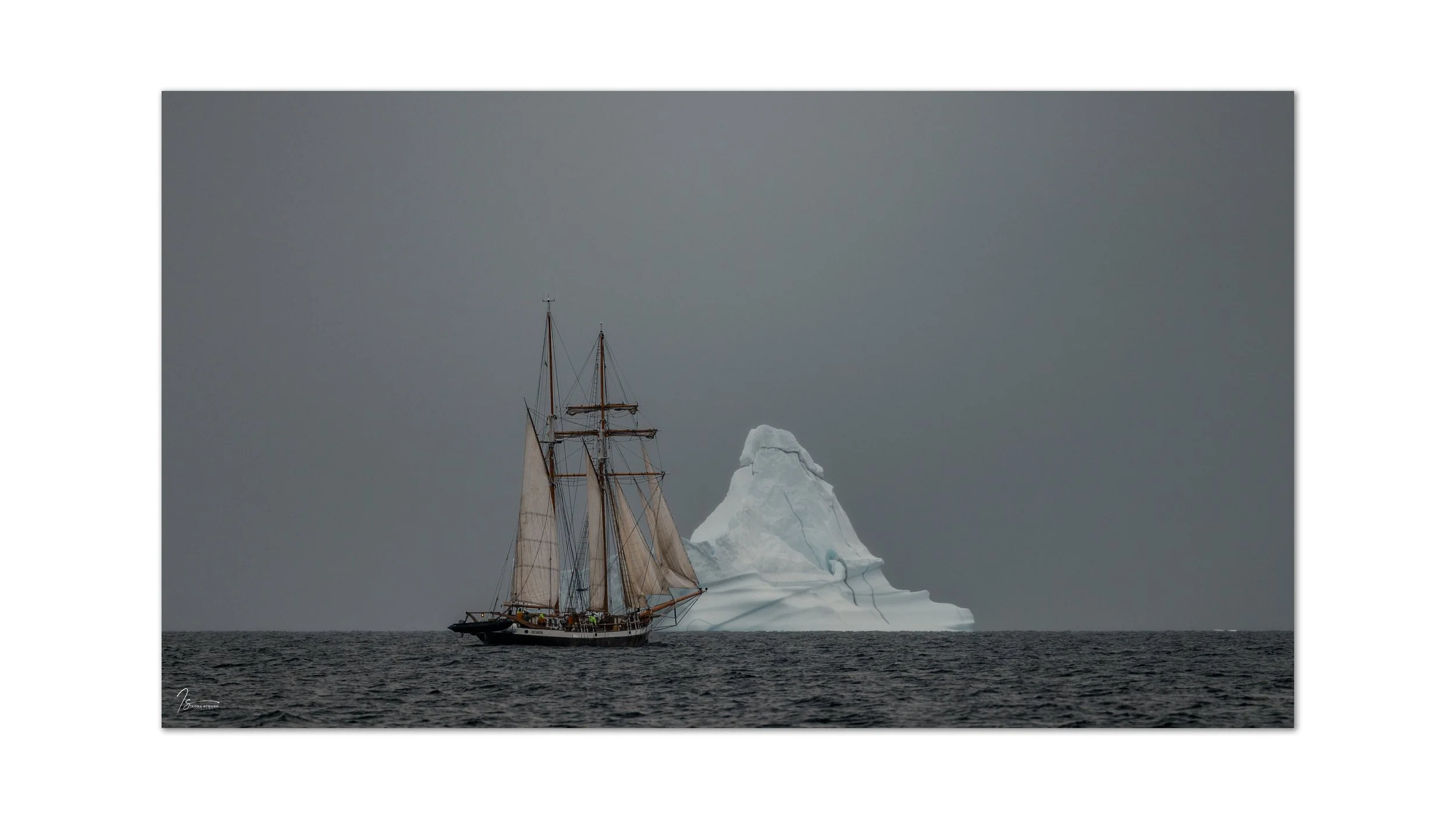
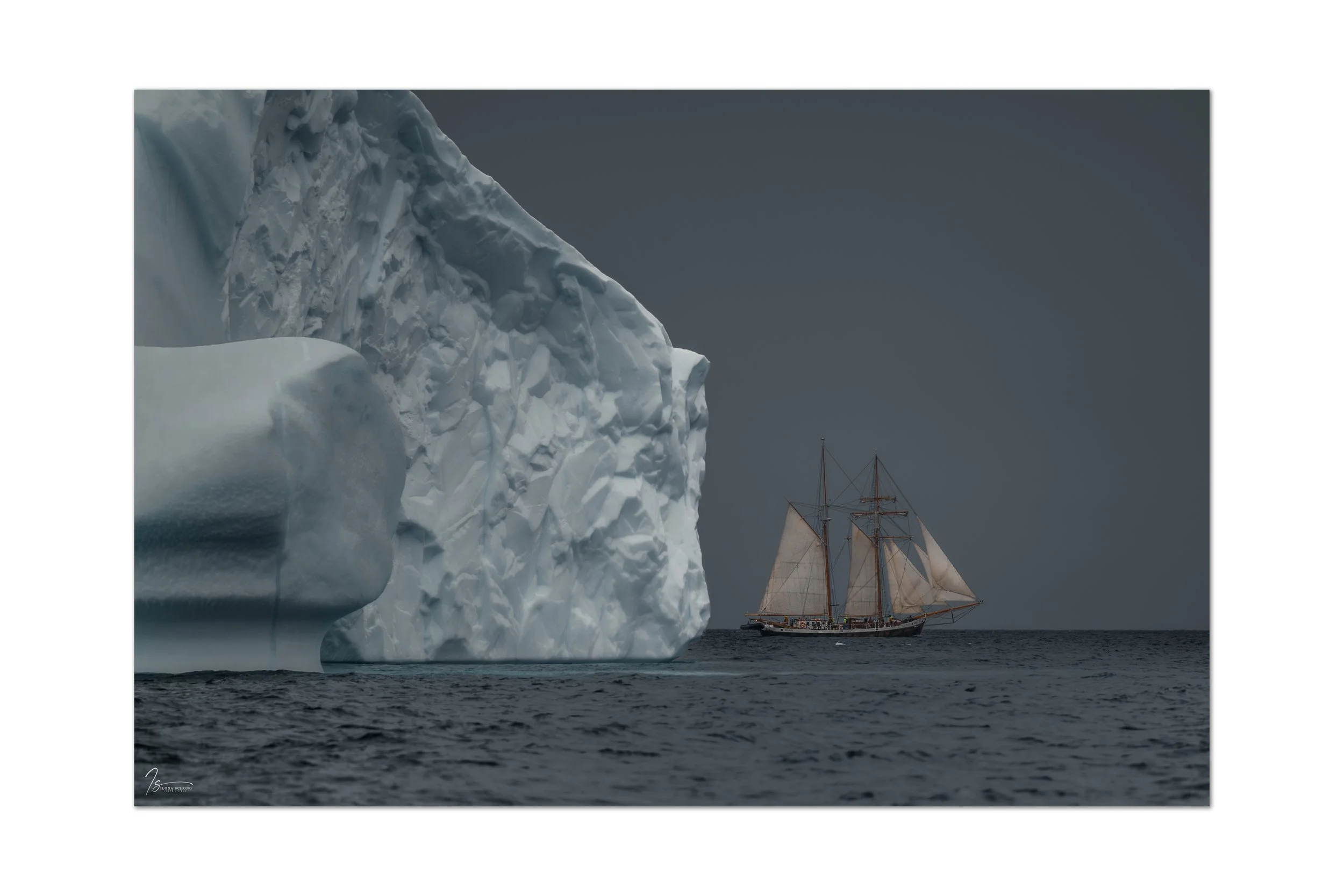
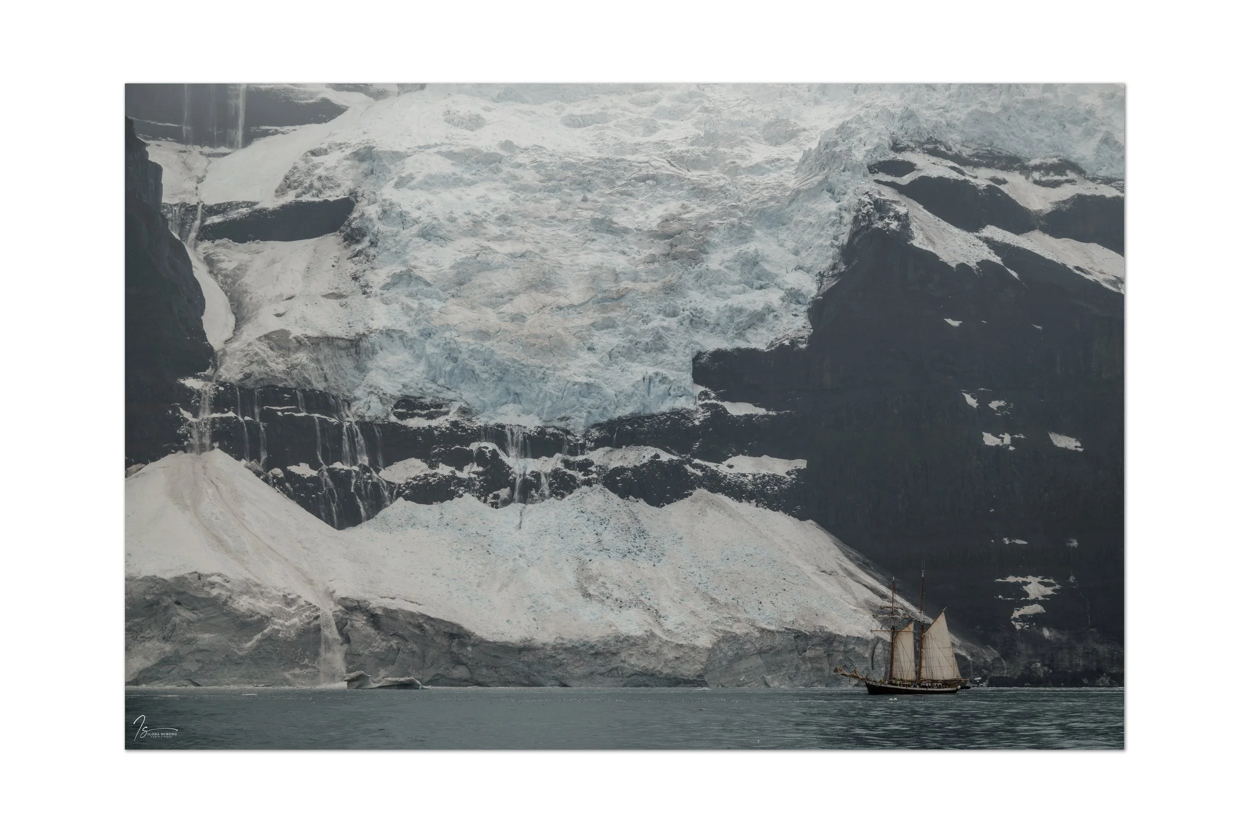
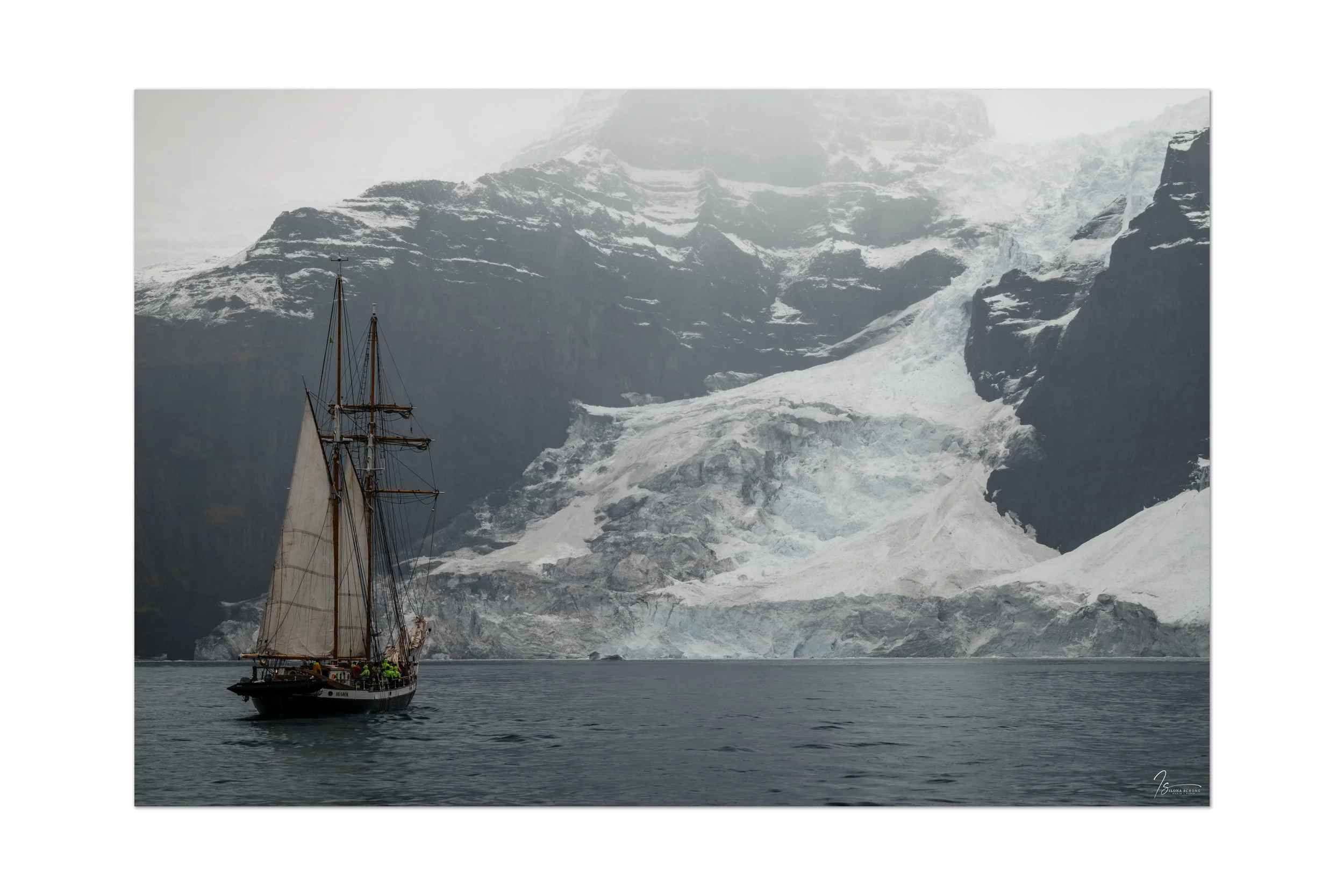
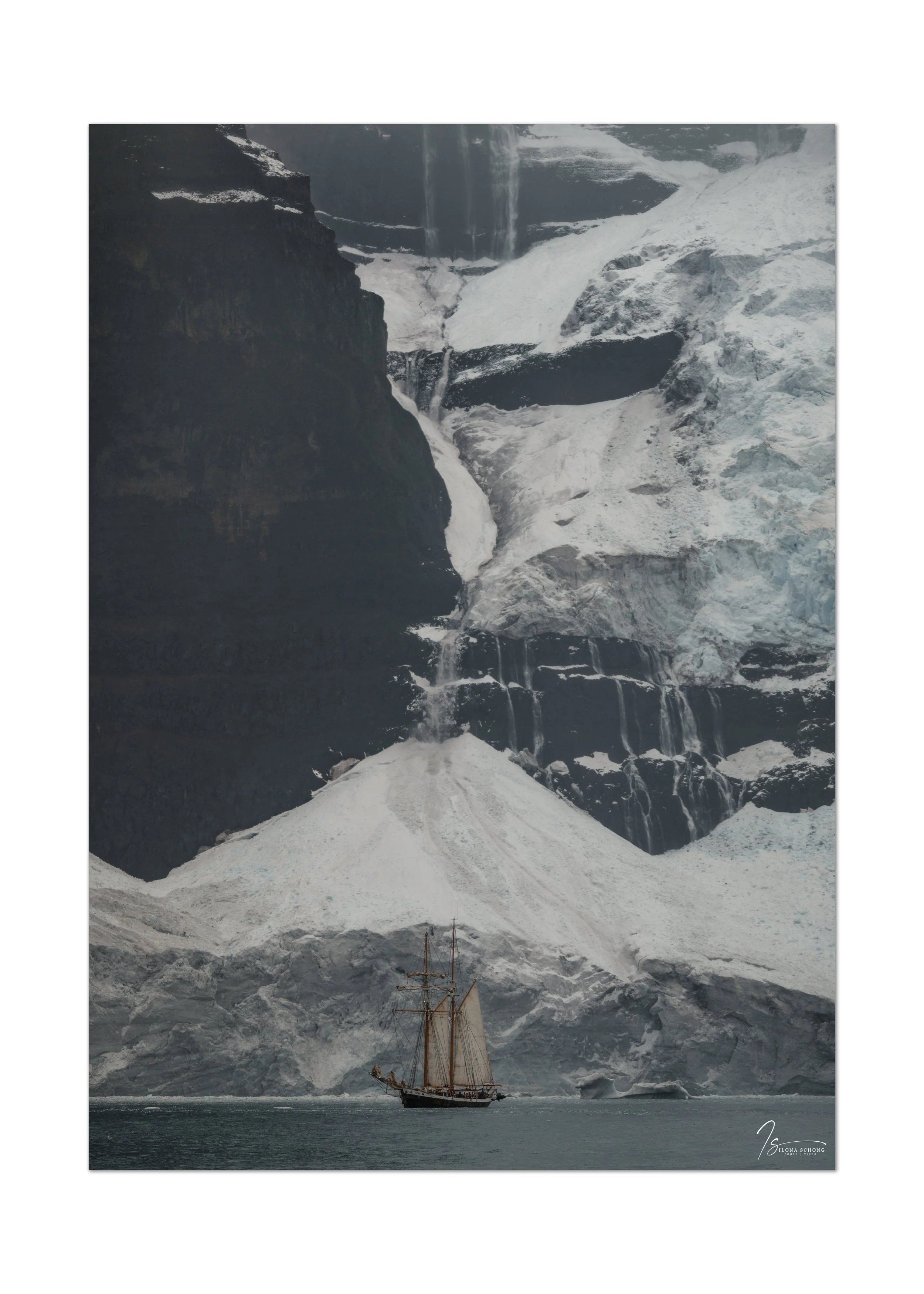
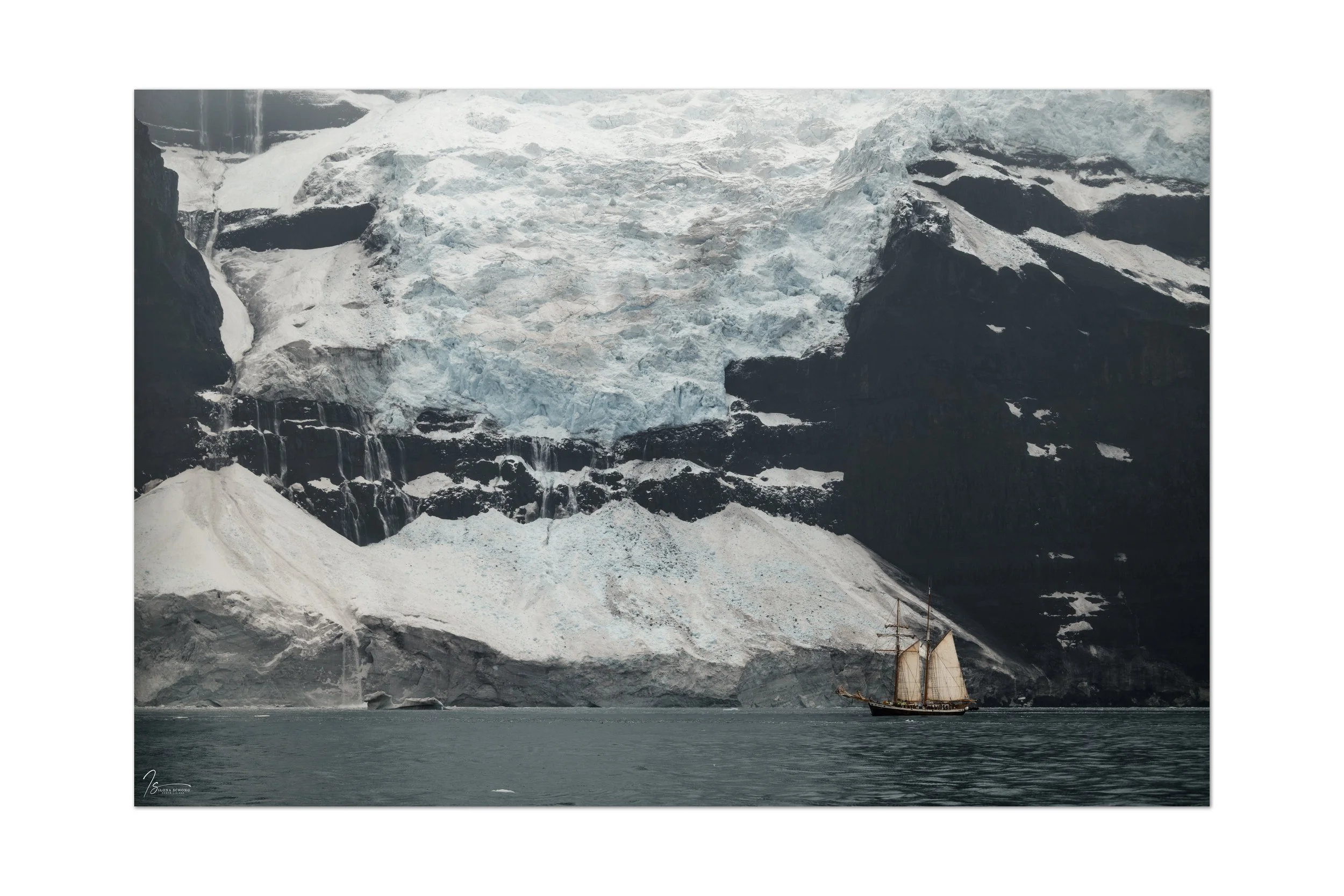
I was really looking forward to the third day. We were going to sail through the breathtakingly beautiful Øfjord, surrounded by the cliffs of Renland and Milne Land, which in some places rise as high as two kilometers. The weather was on our side, with low-hanging clouds creating beautiful patches of fog. This time, there turned out to be many more icebergs in the Øfjord than in other weeks, which offered some great opportunities.
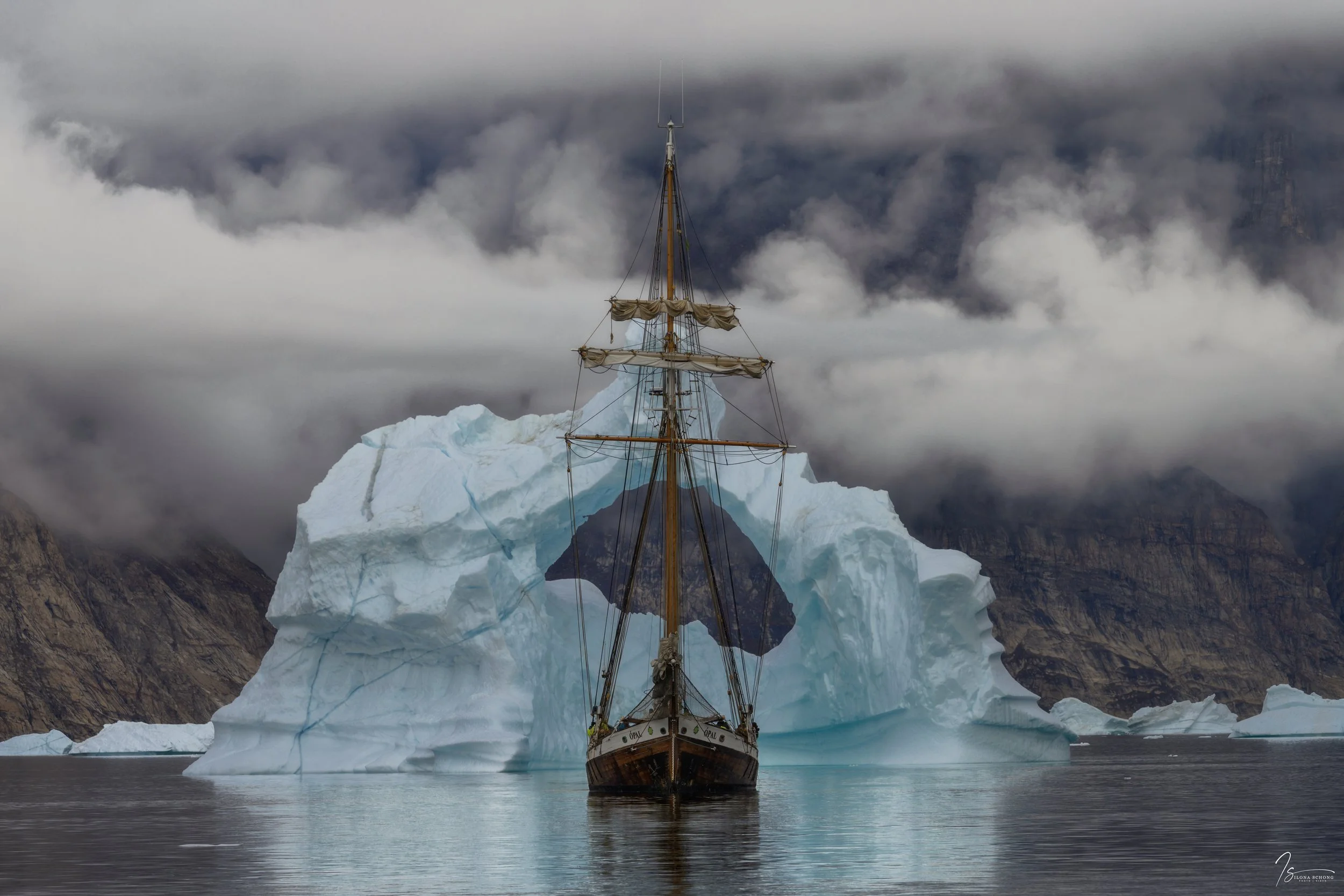
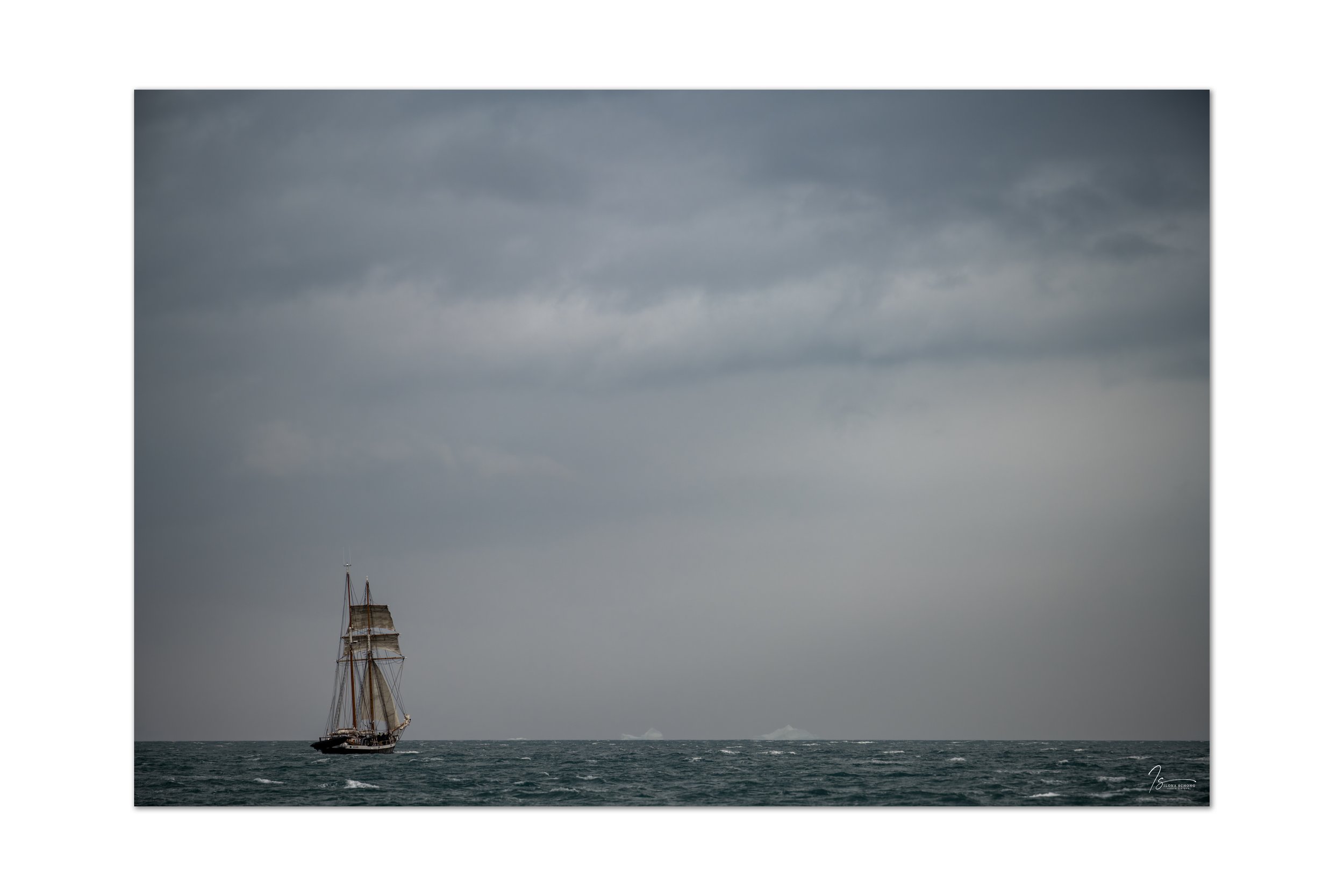
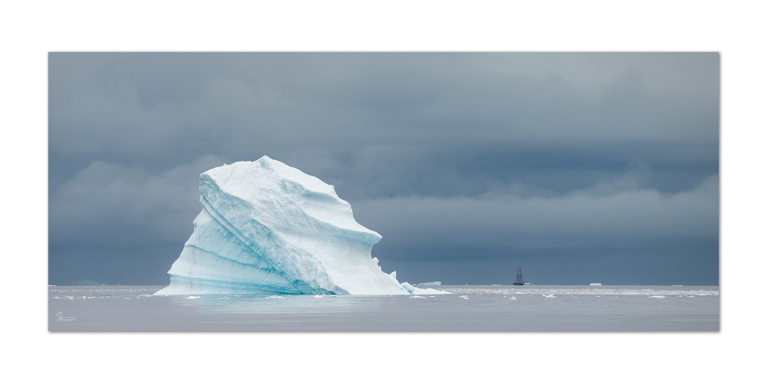
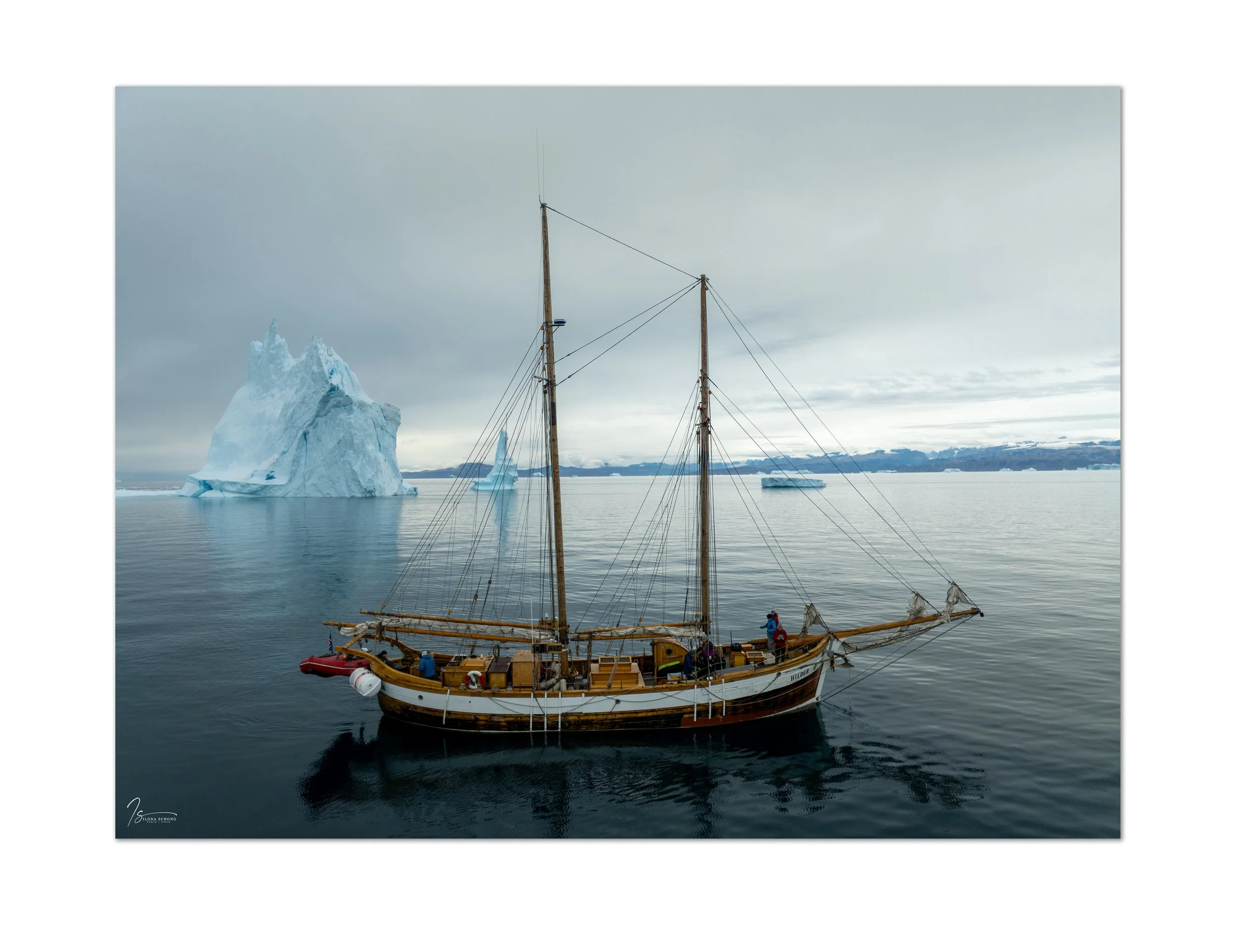
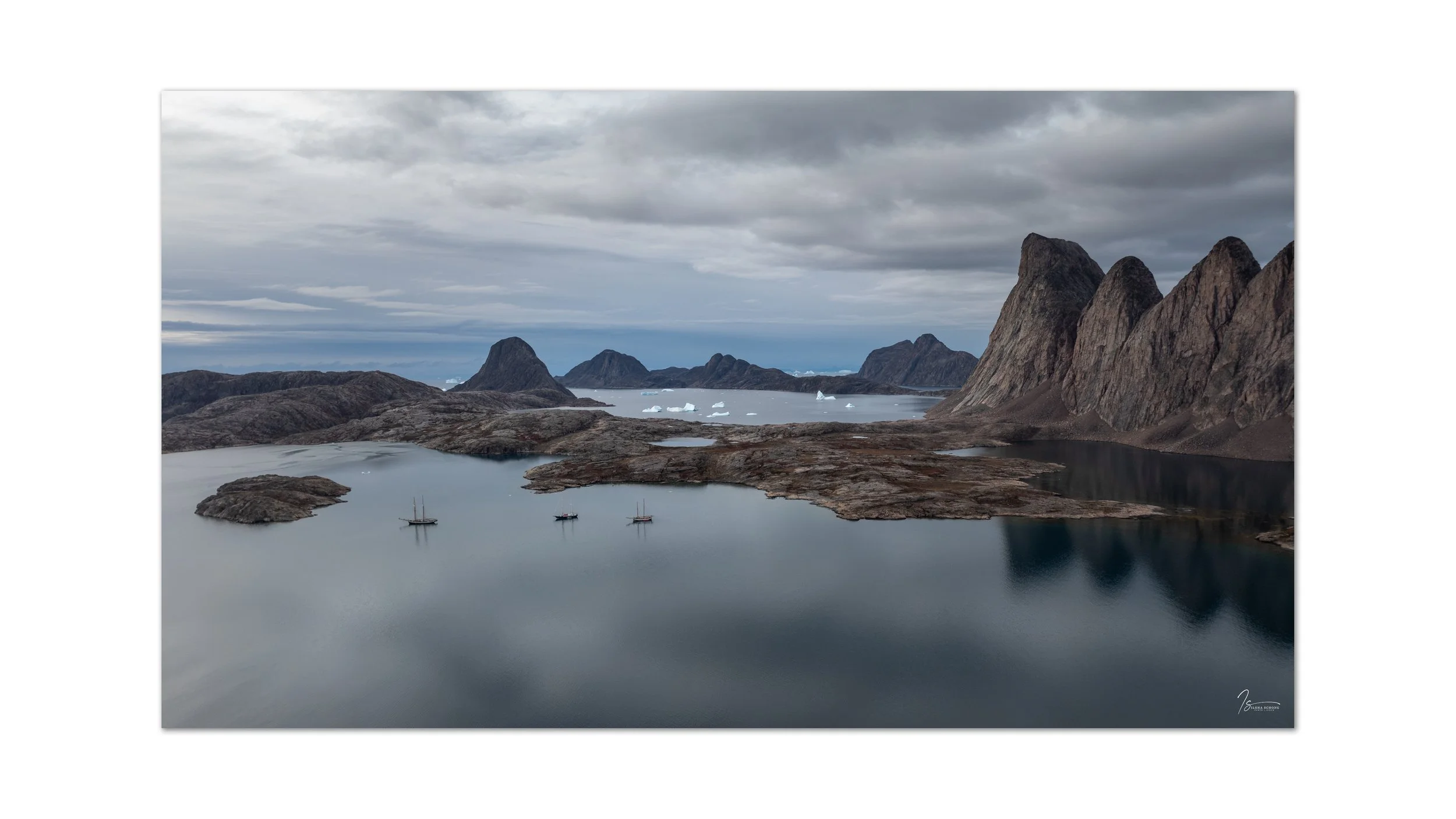
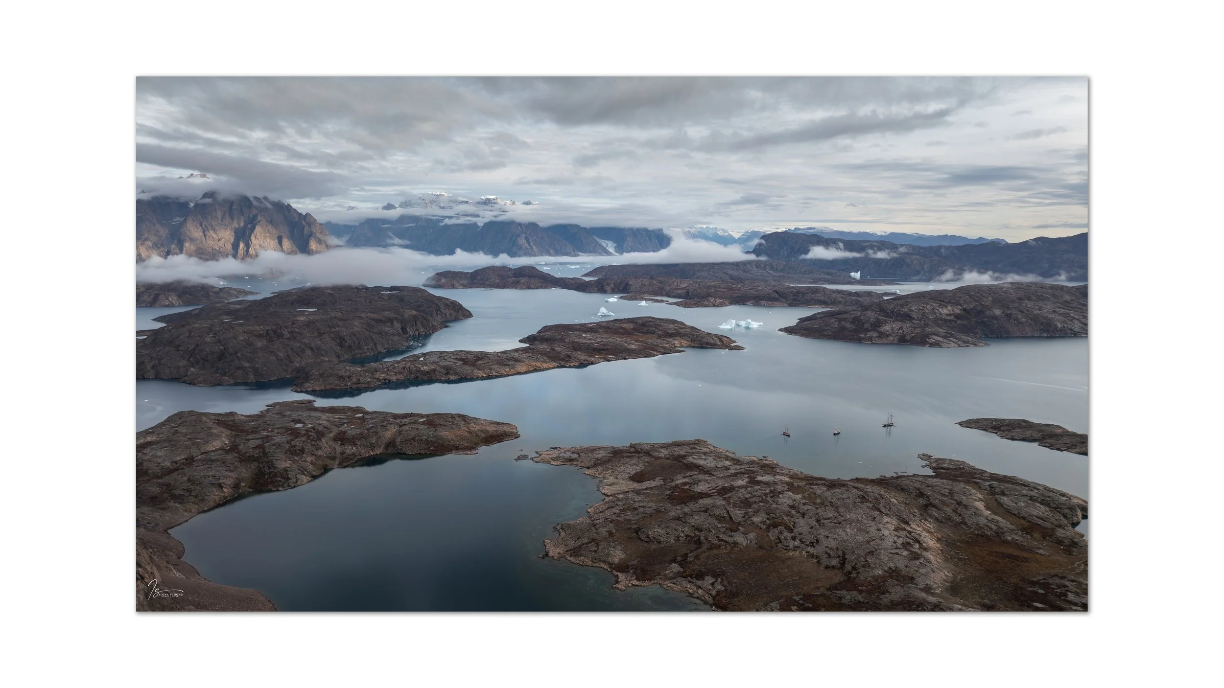
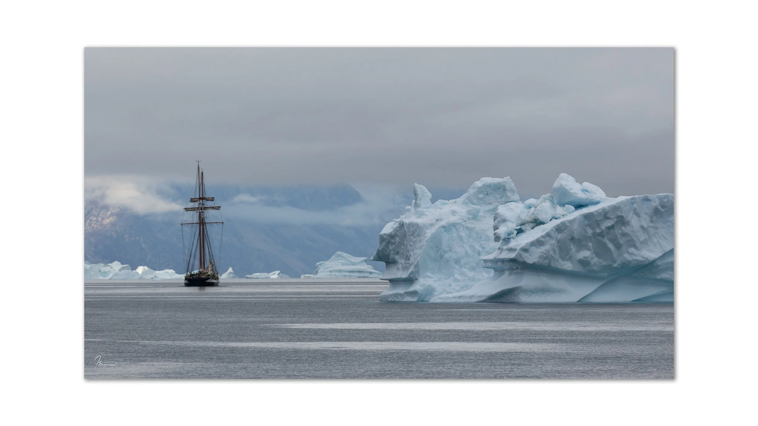
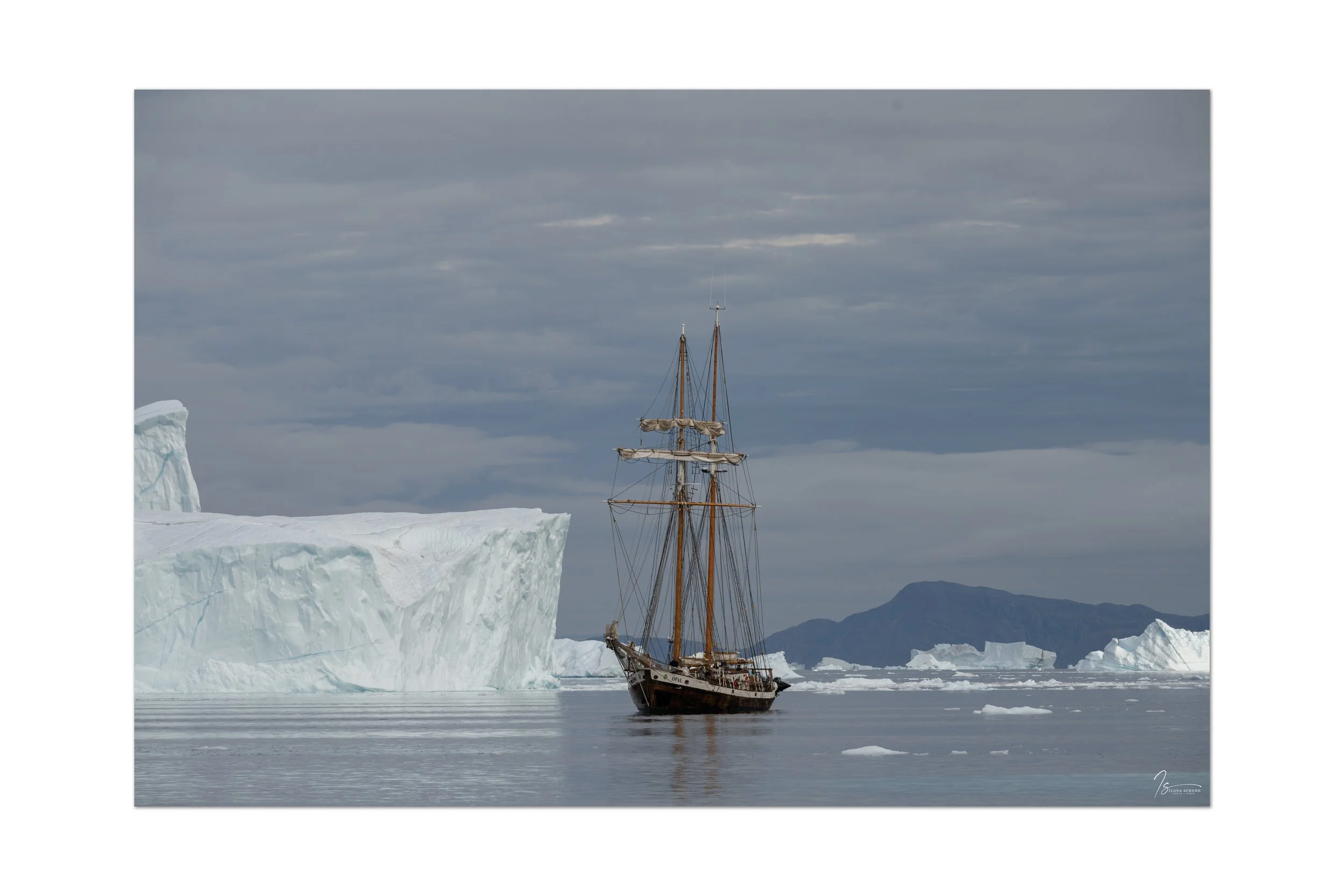
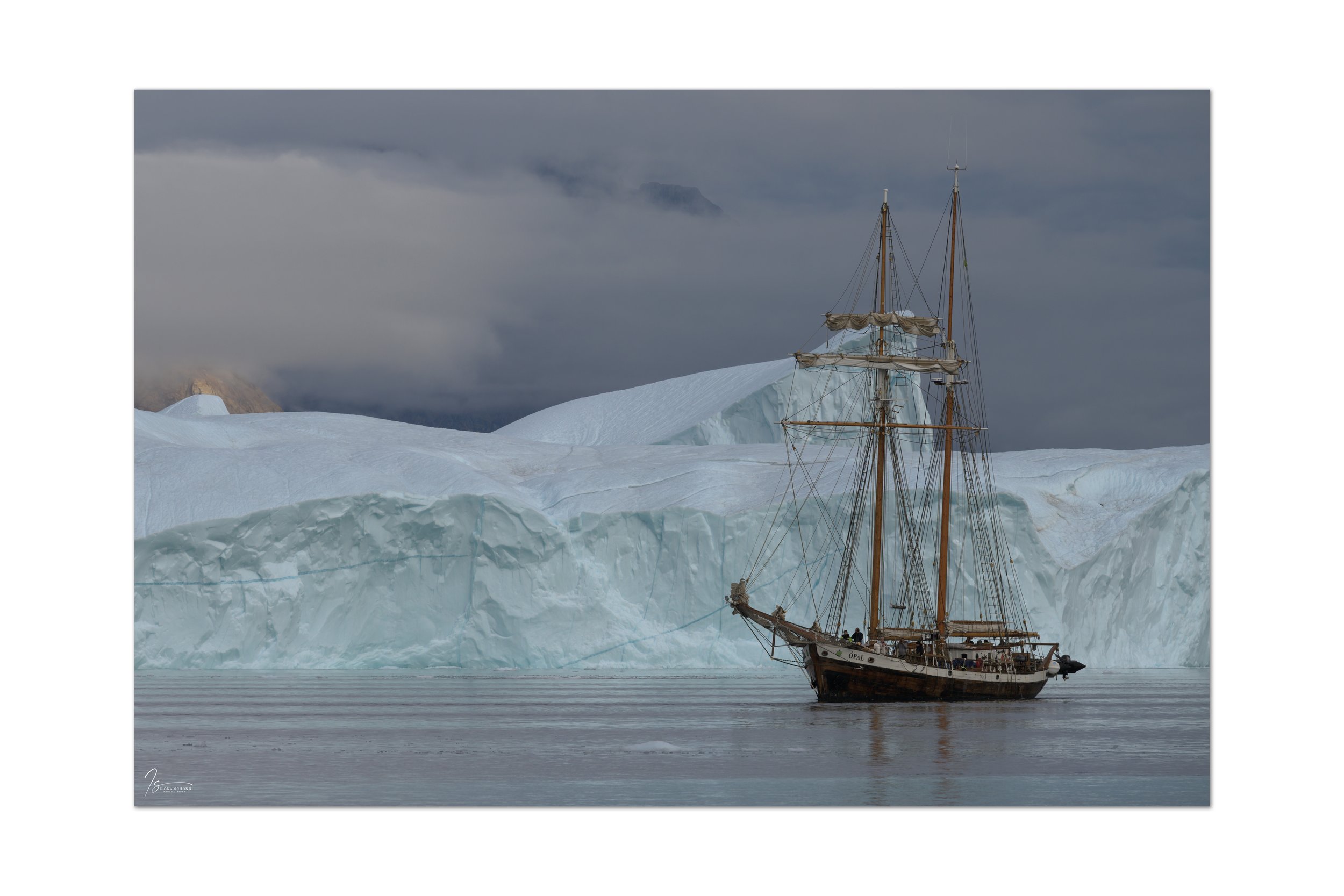
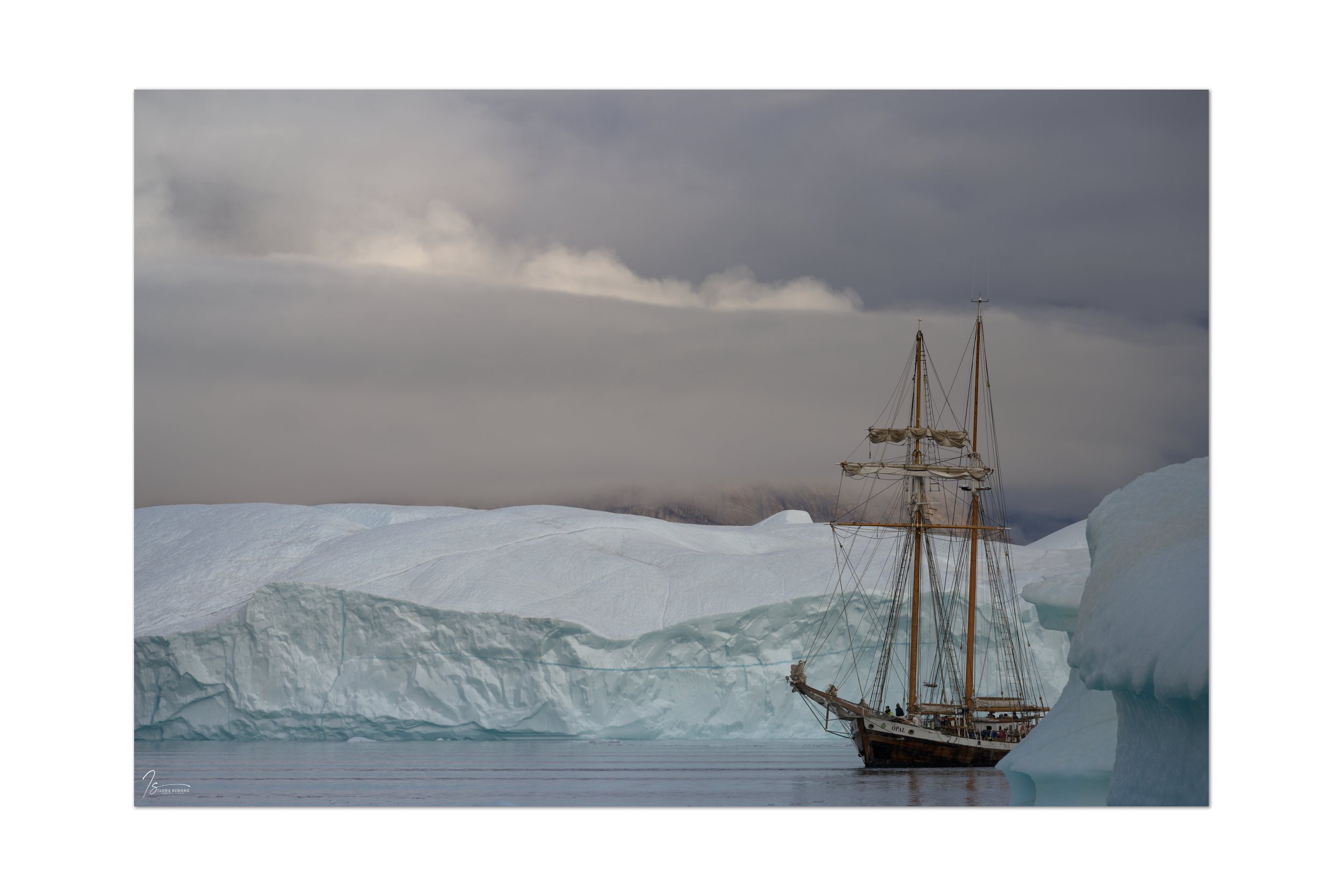
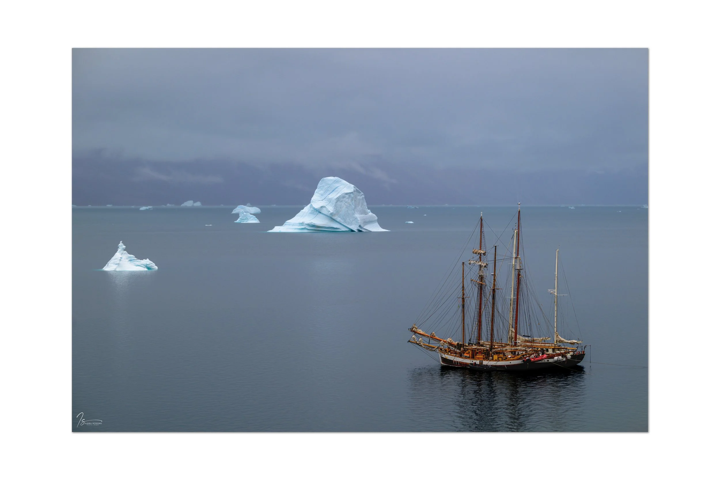
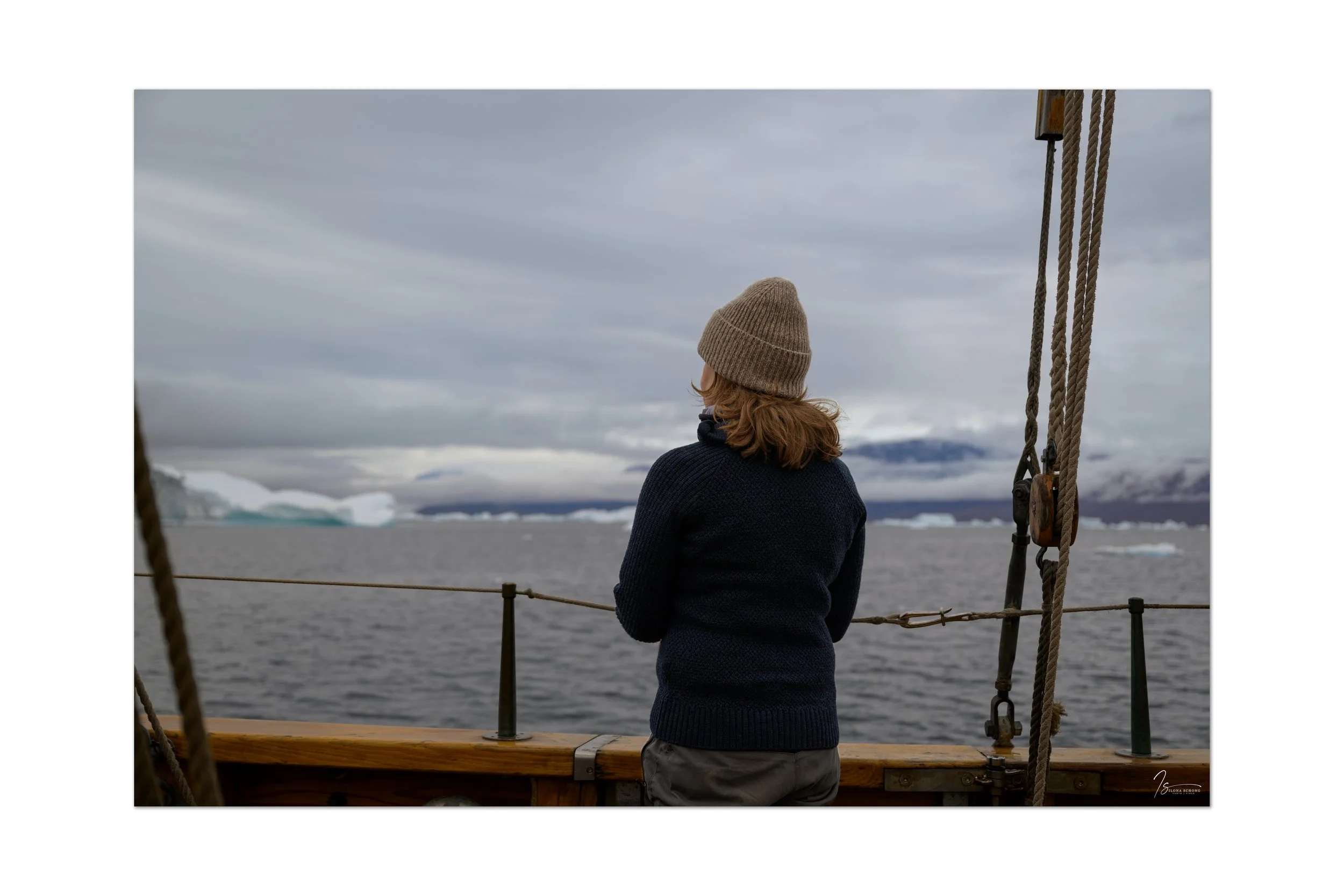
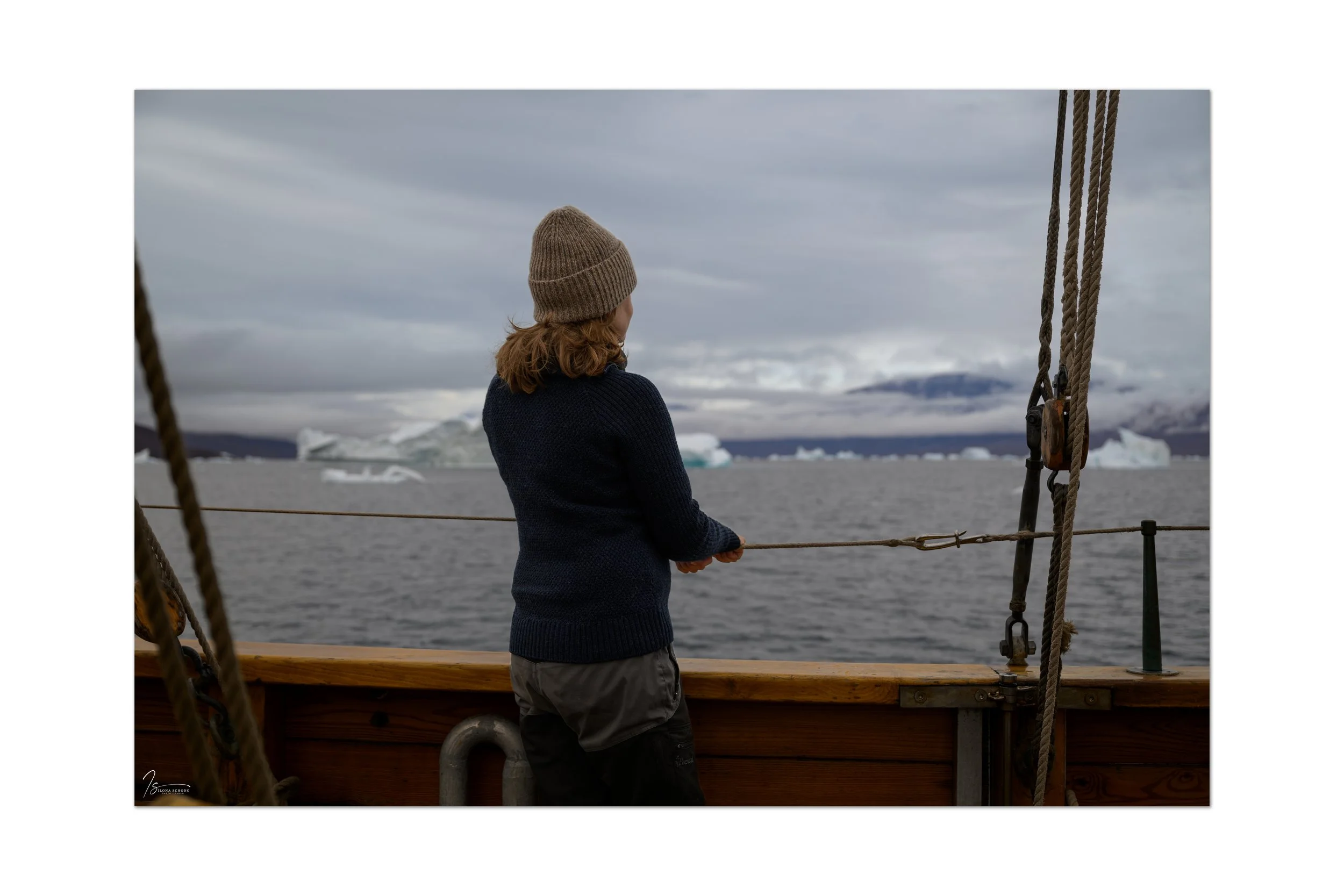
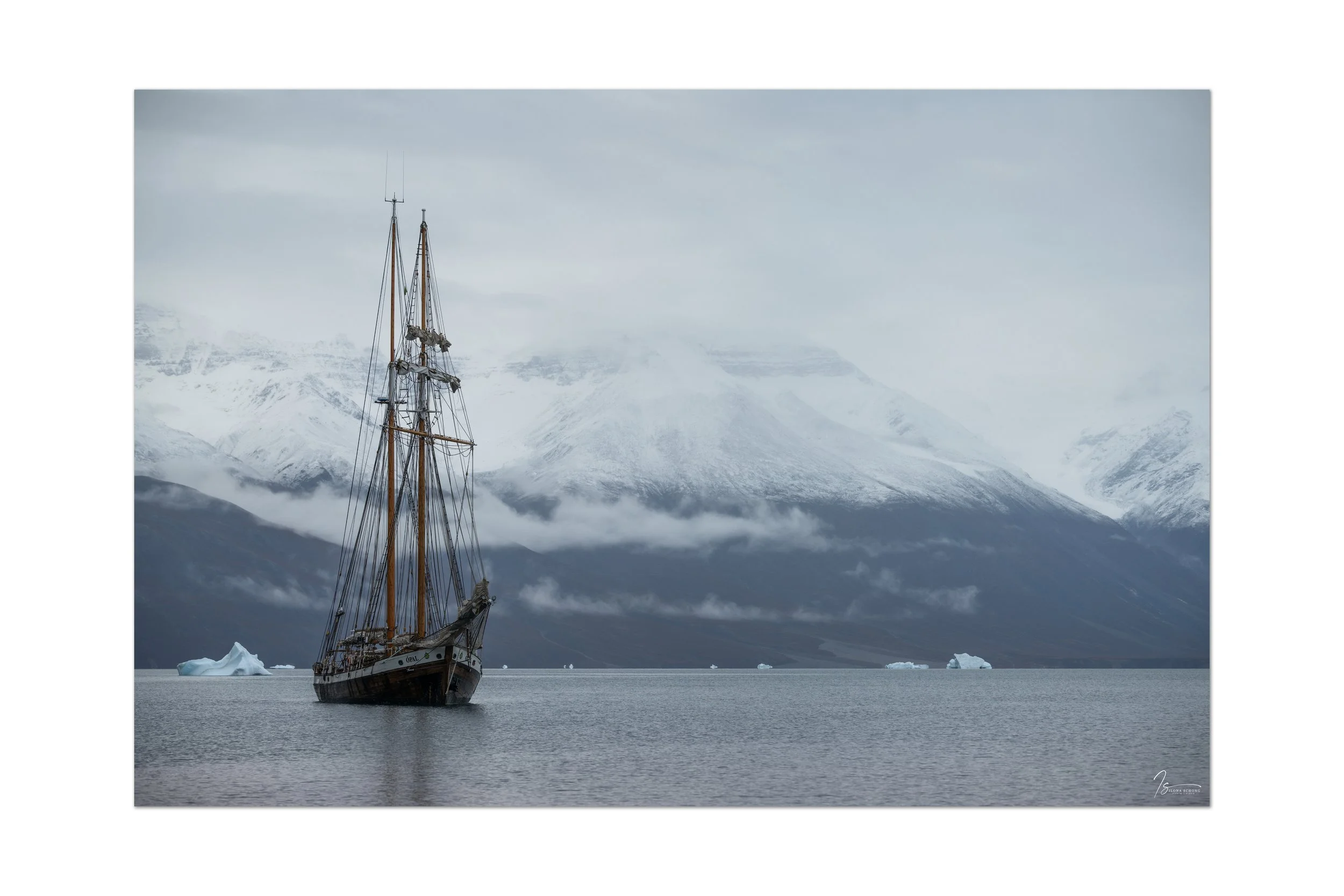
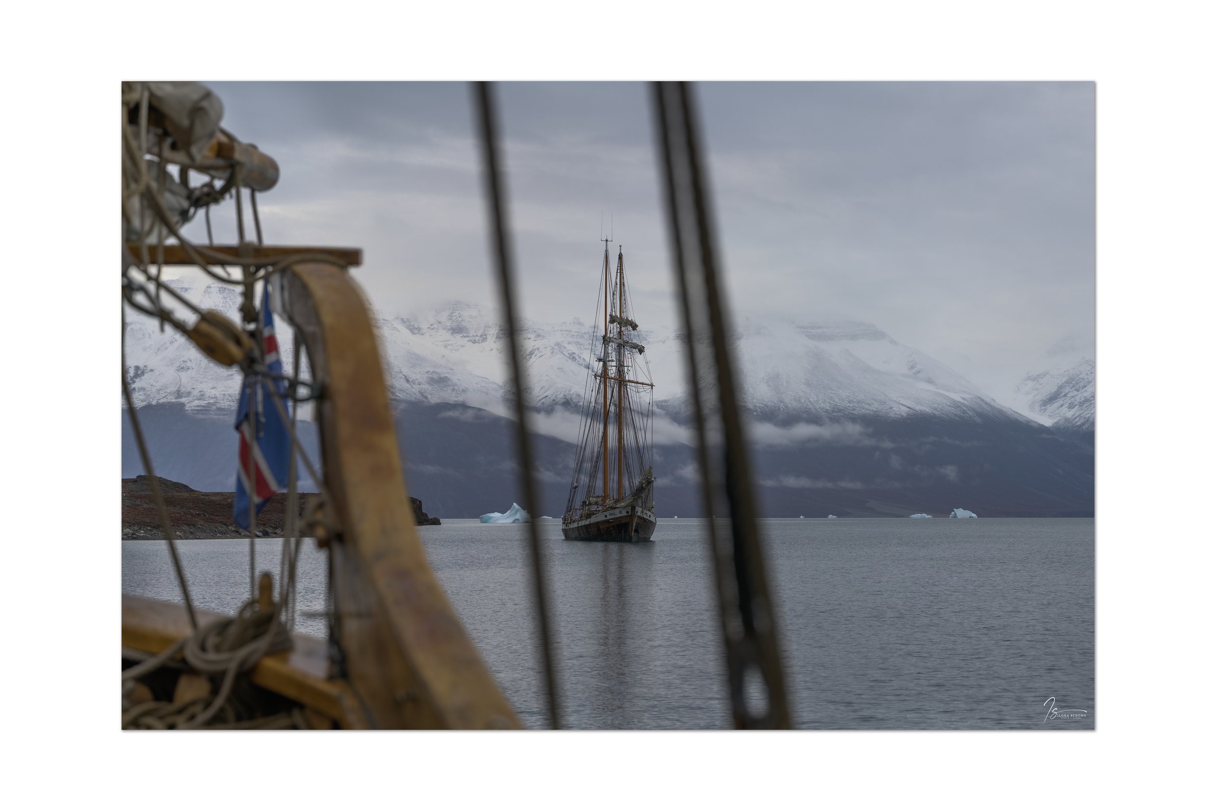
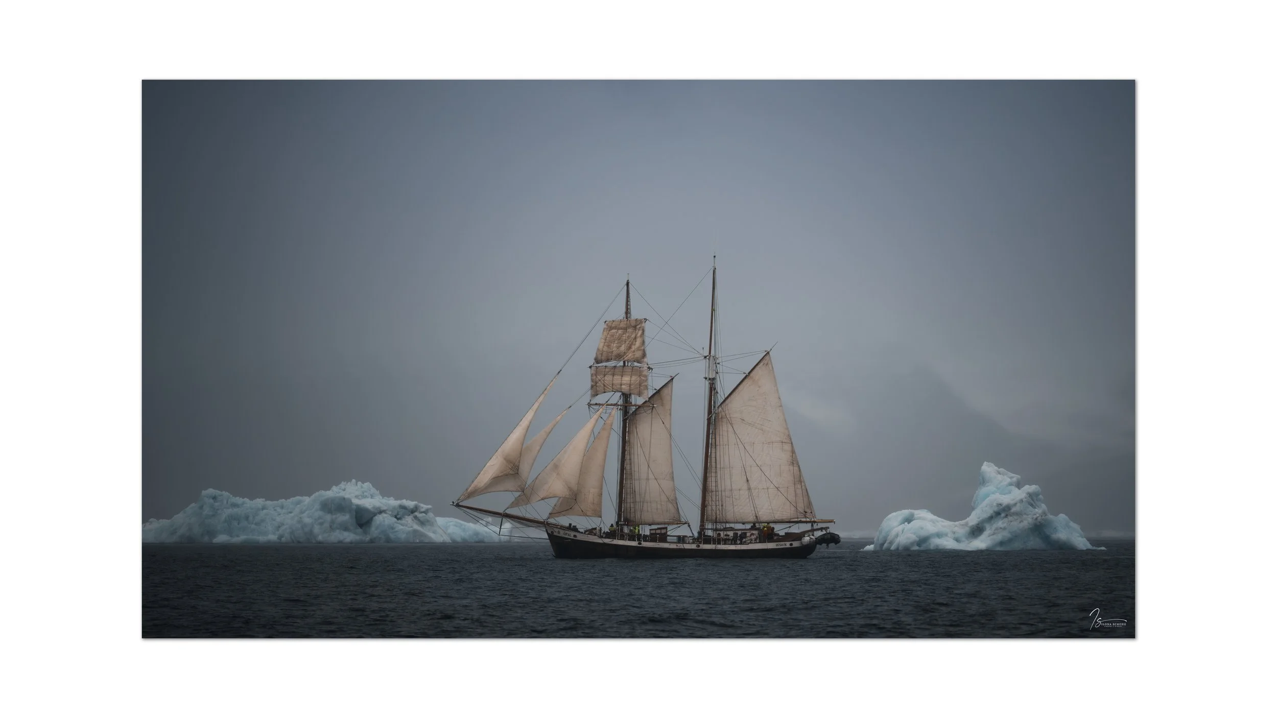
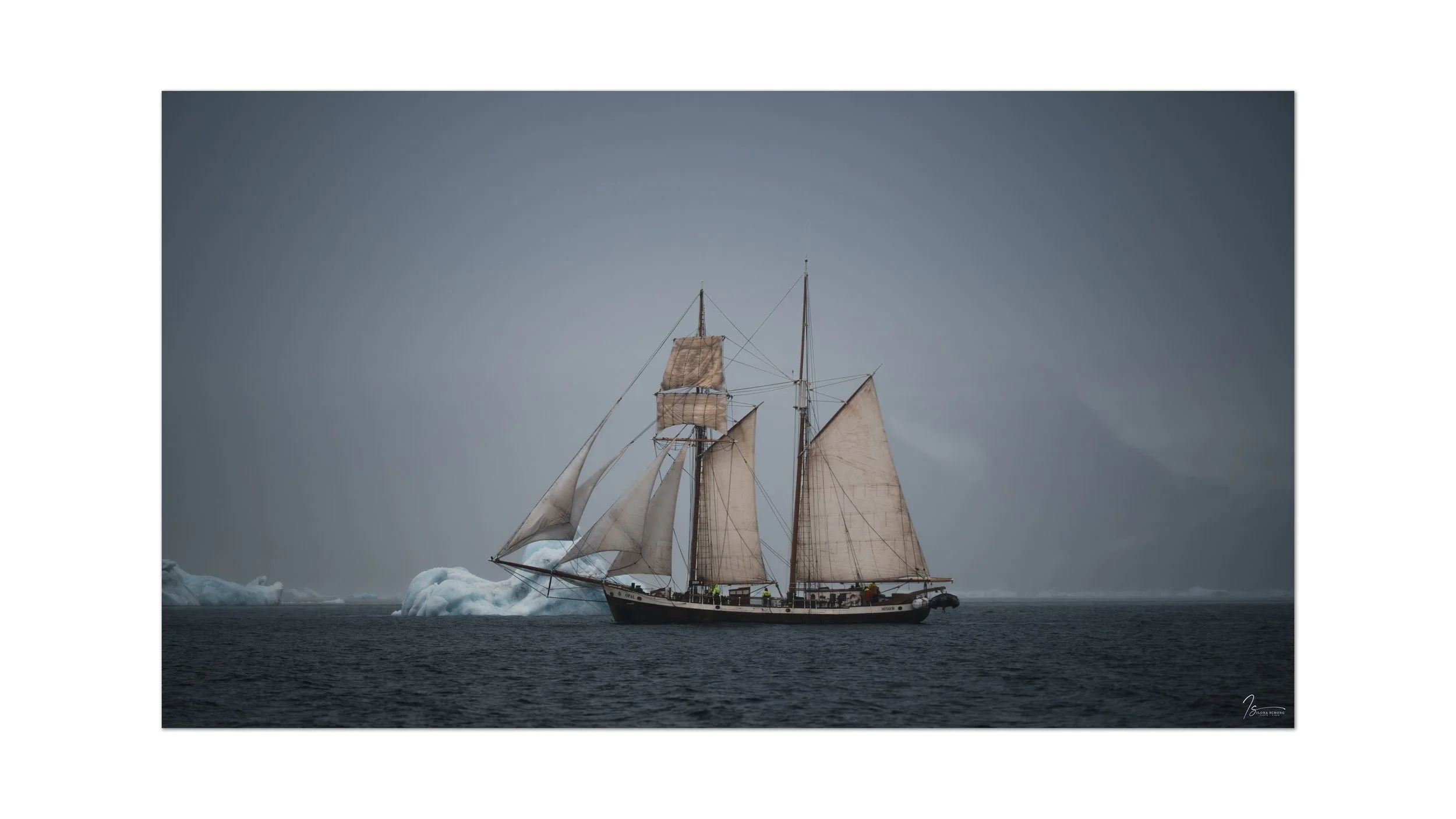
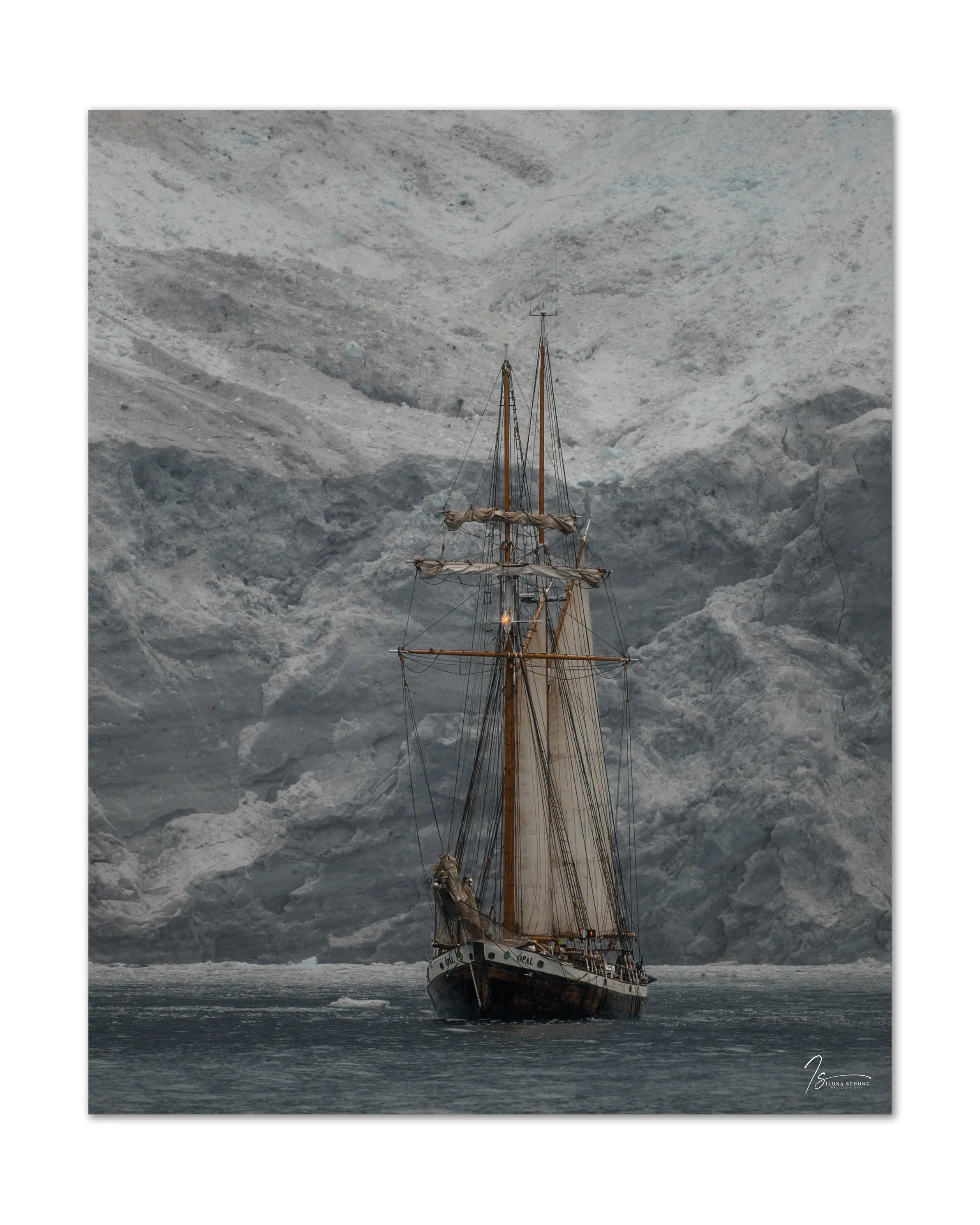
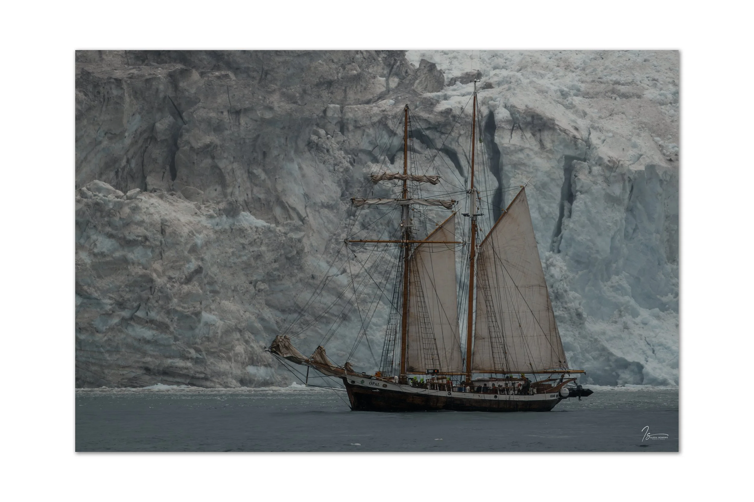
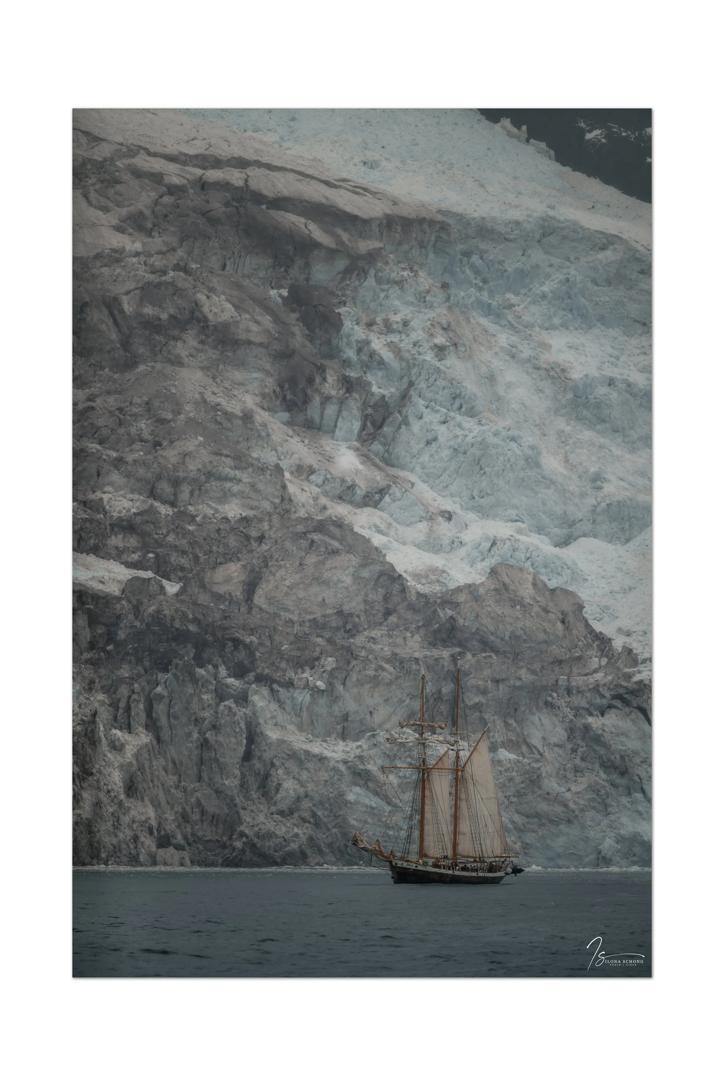
For me personally, this was the best part of the trip, especially since we traveled a large portion of the route aboard the schooner Ópal, which made for a fantastic photo opportunity. We stopped at several beautiful icebergs and glaciers.


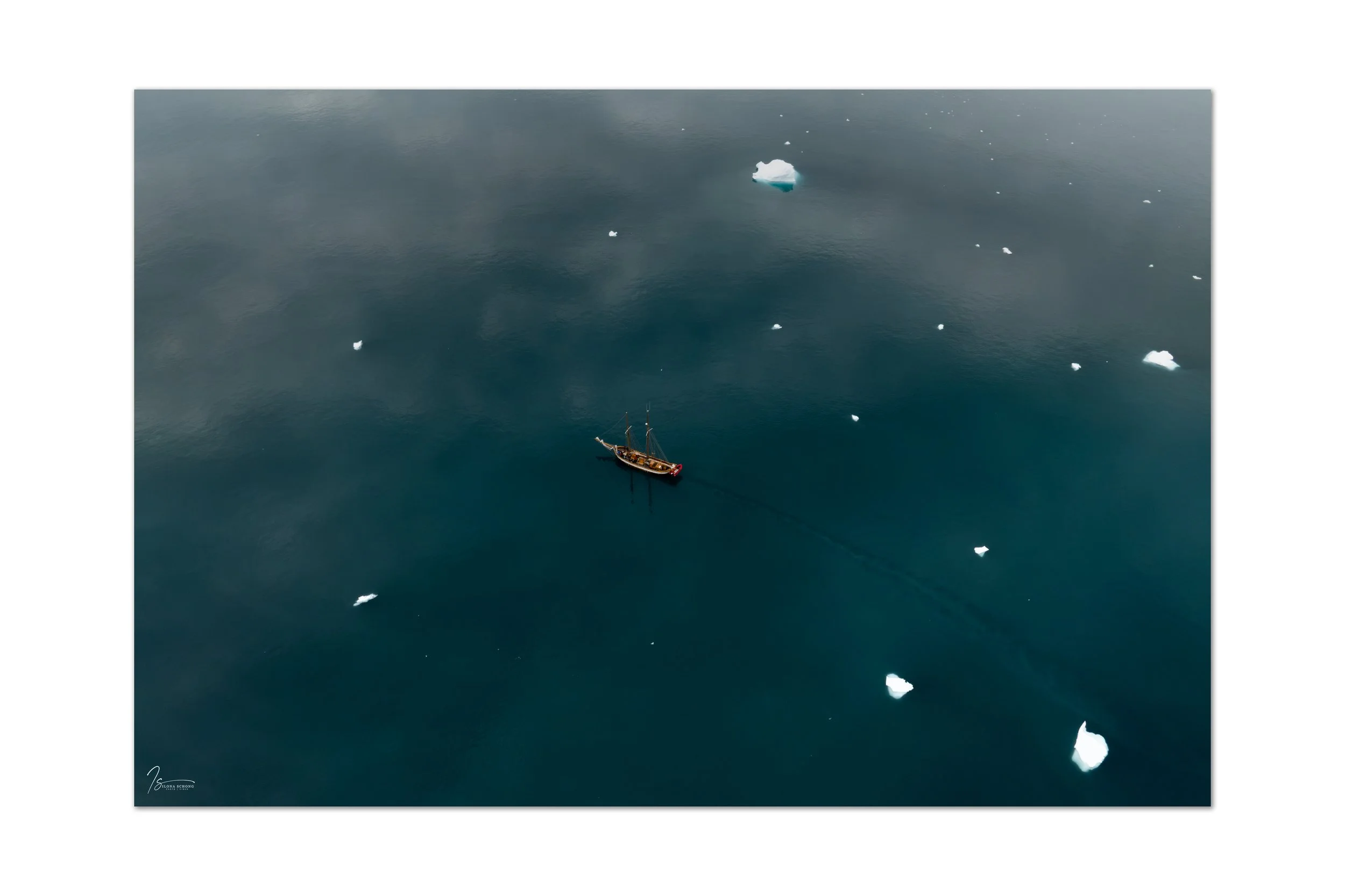
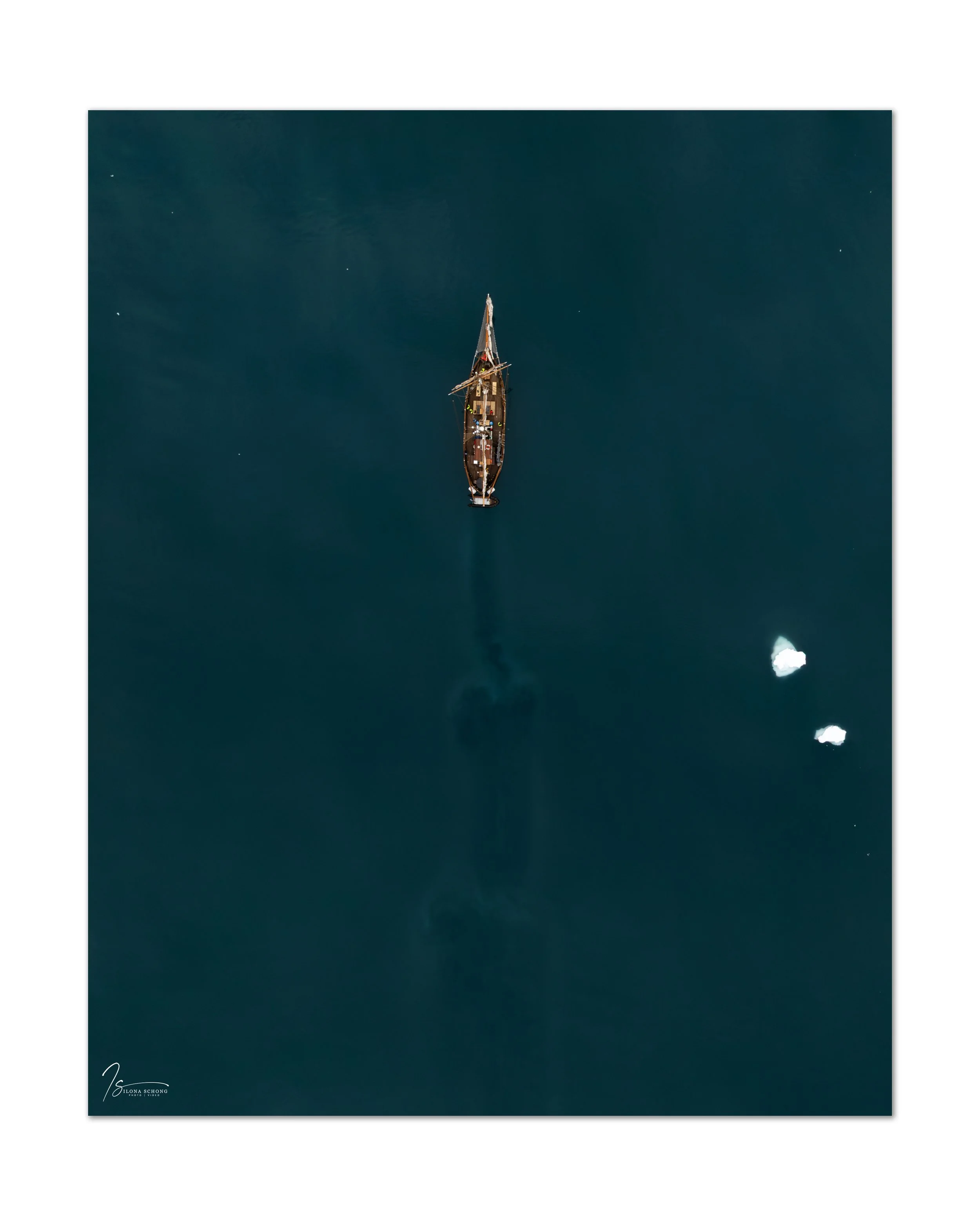
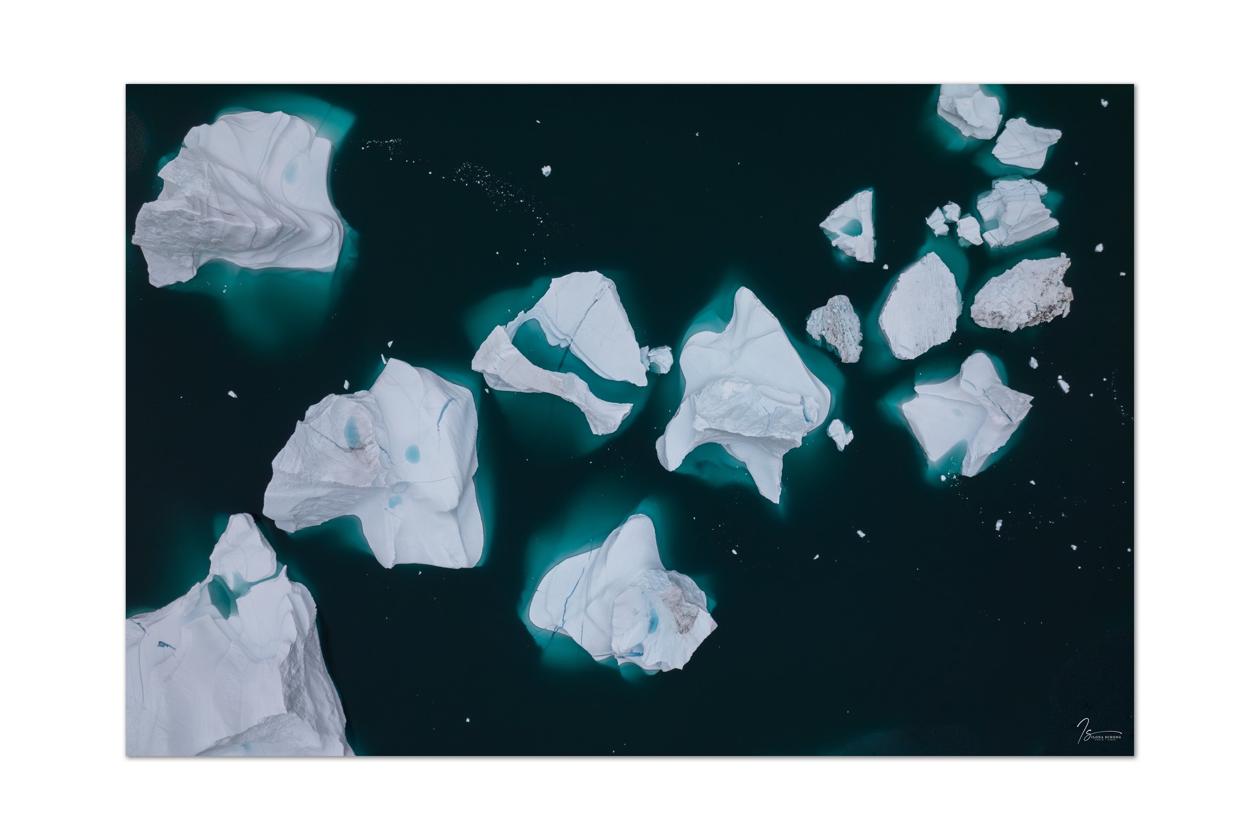
The Øfjord also provided an excellent opportunity to send the drone up into the air.
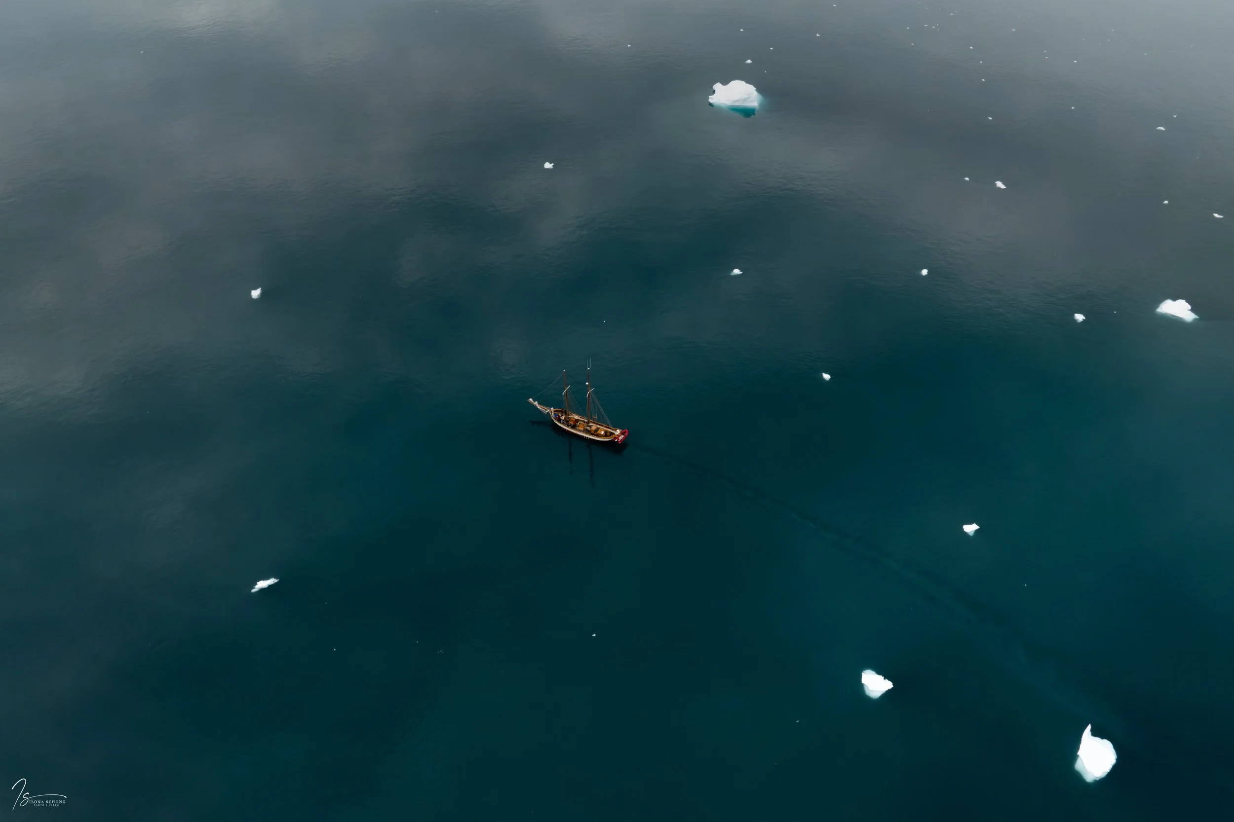
A drone still offers an amazing view, though I find it really stressful when I'm on a moving boat.
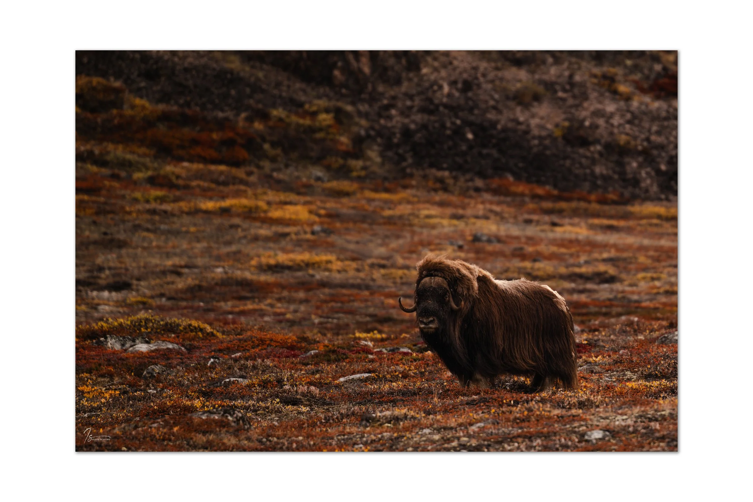
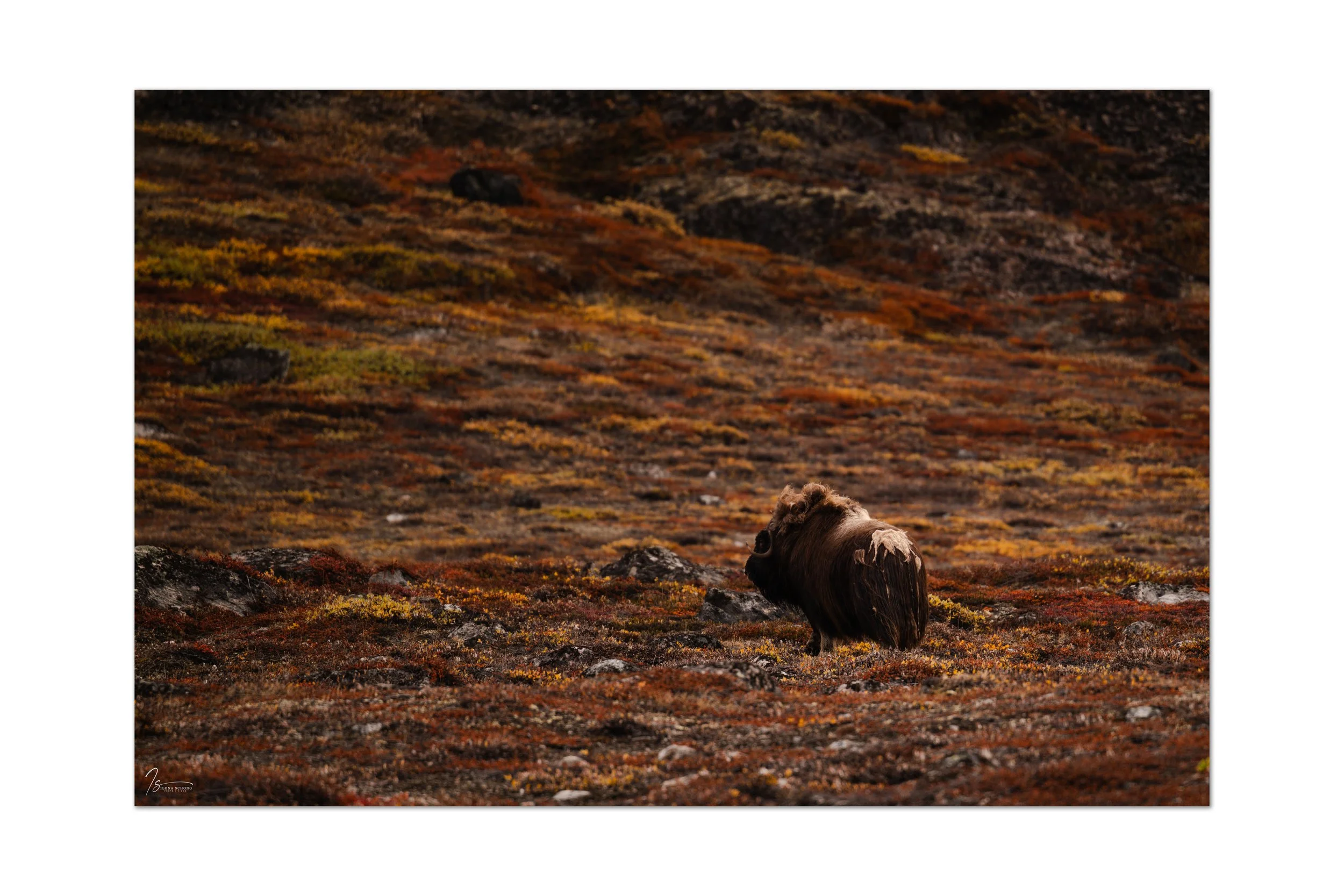
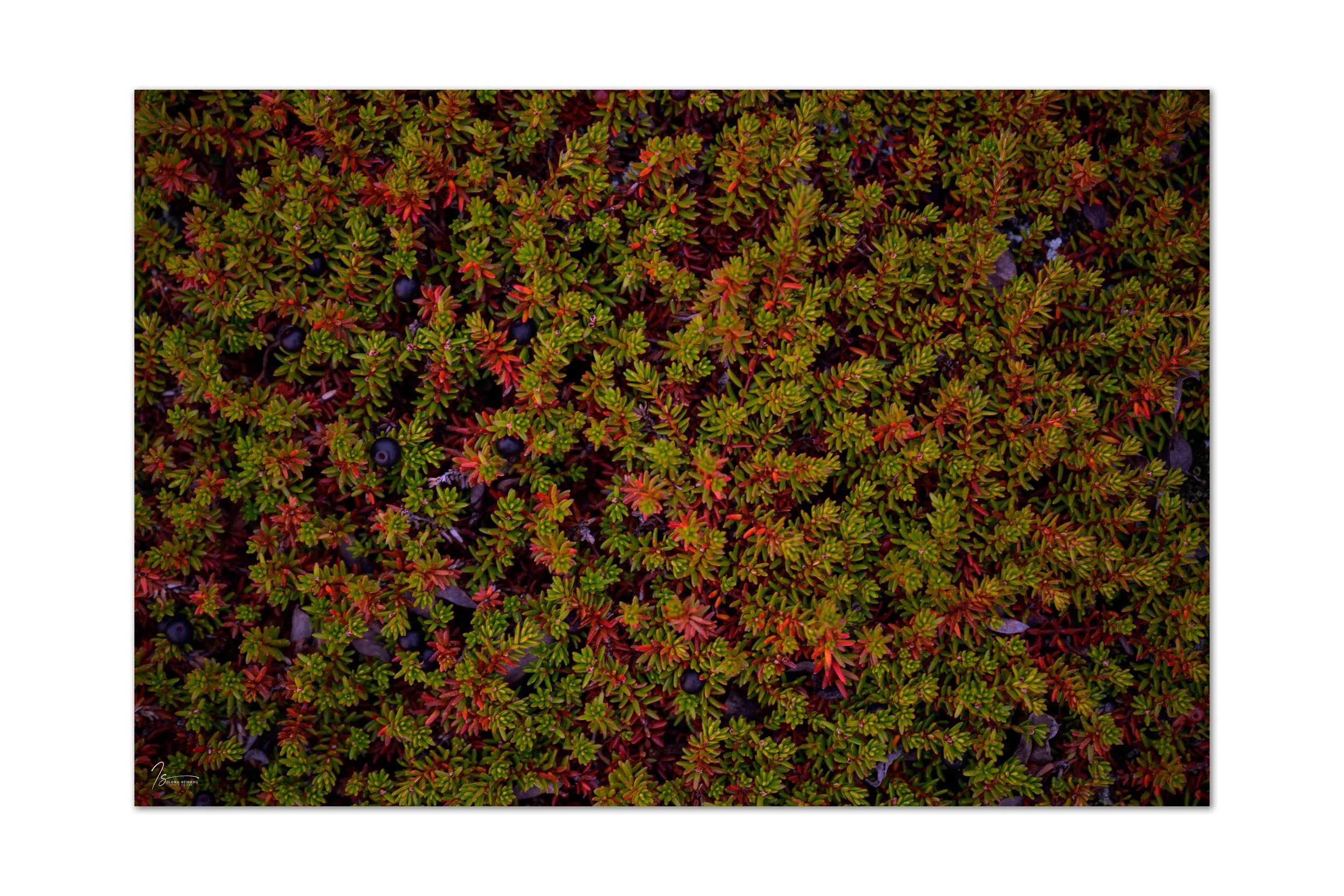
Our anchorage was Harefjord, where, unusually, all three boats were moored side by side, allowing us to visit one another. There we also saw our first muskoxen, amidst vegetation that had already taken on beautiful autumn colors.
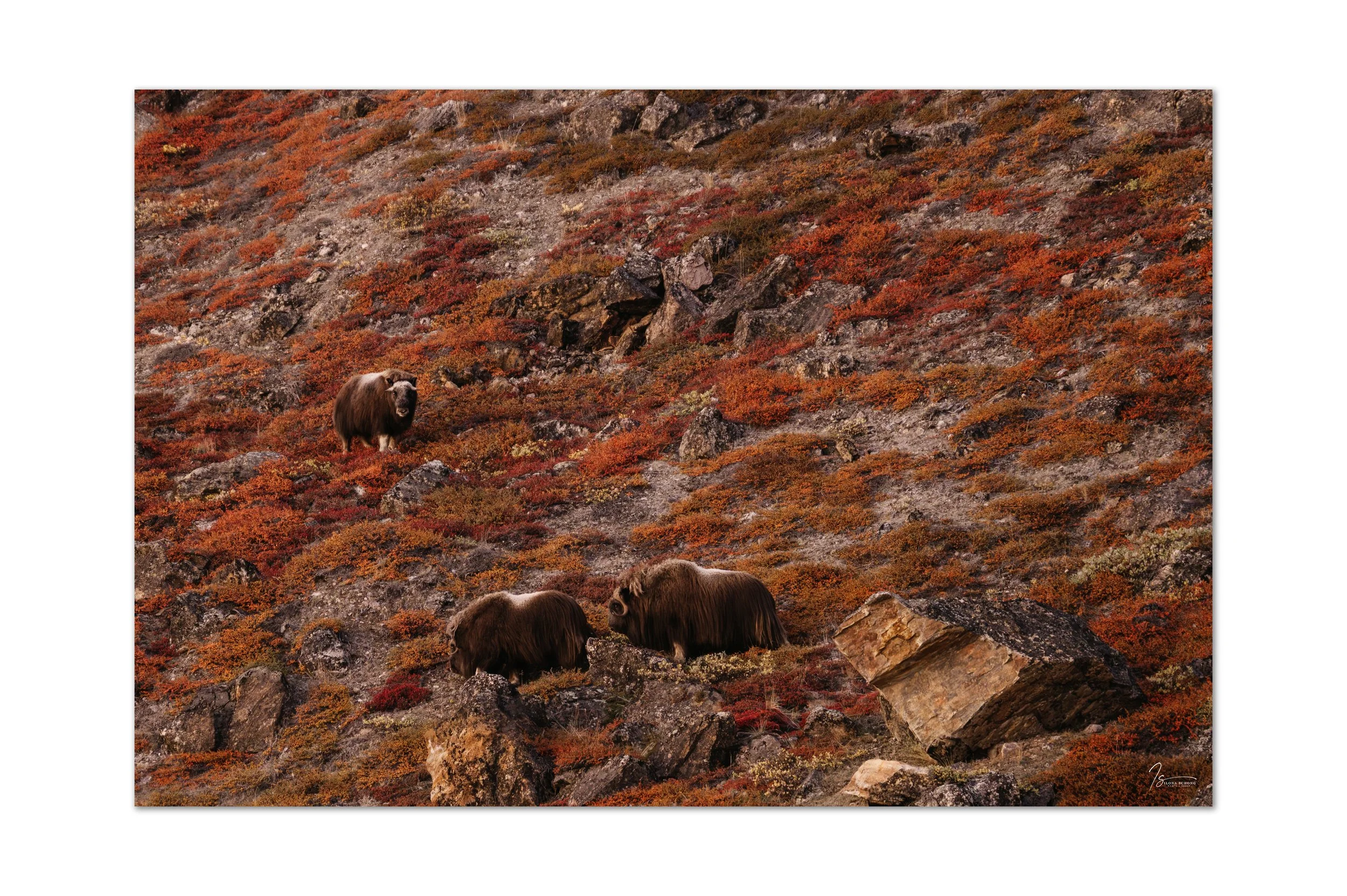
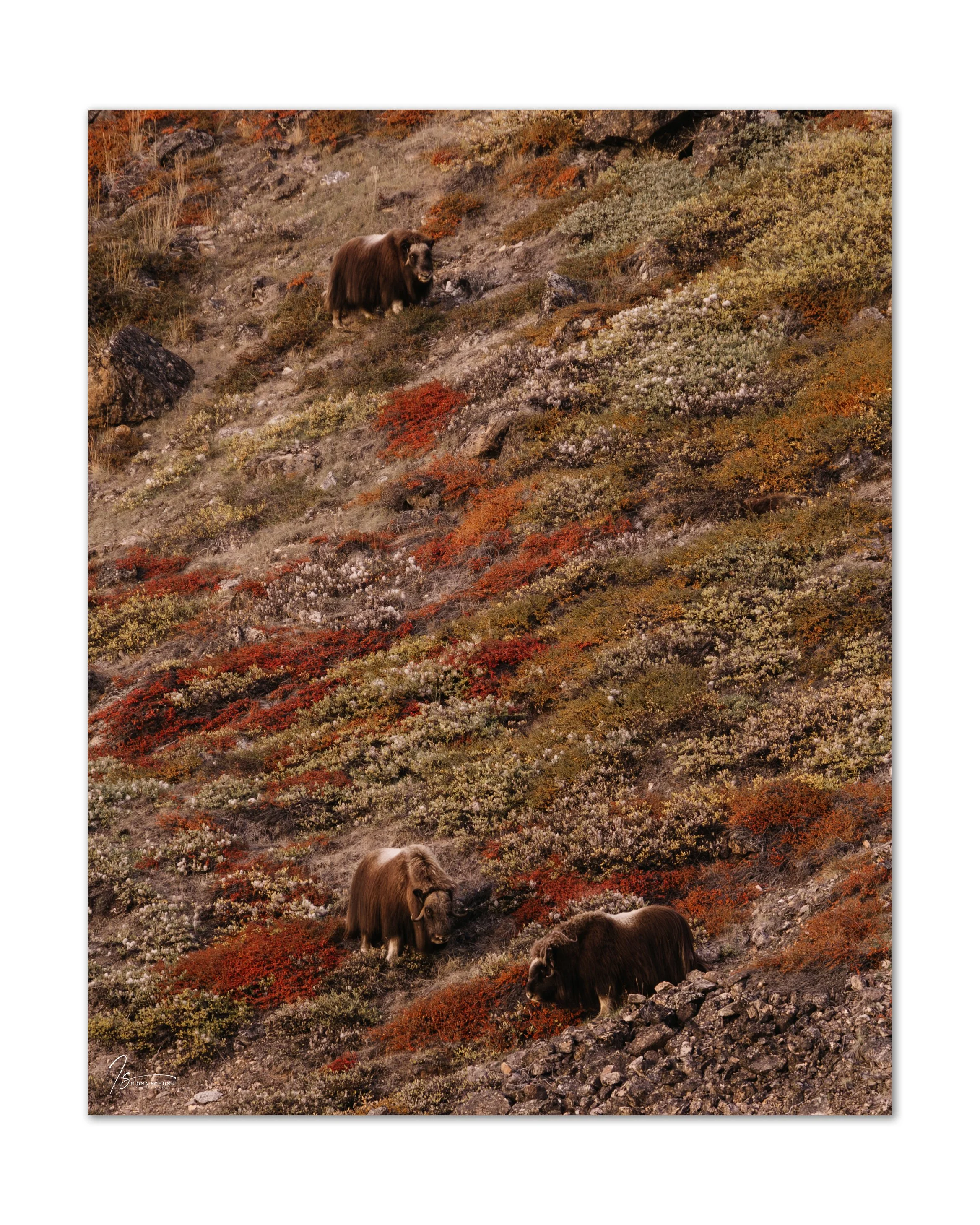
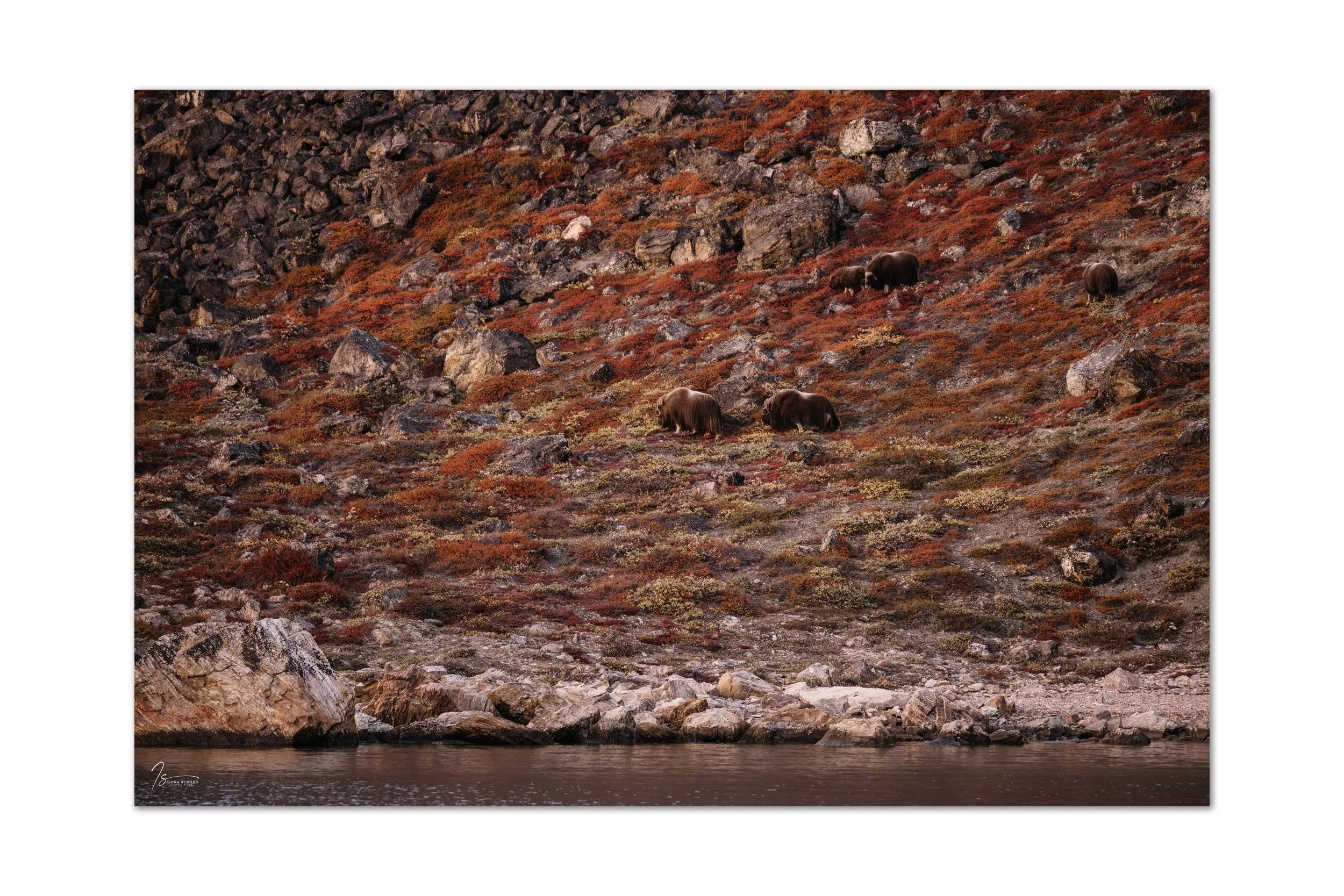
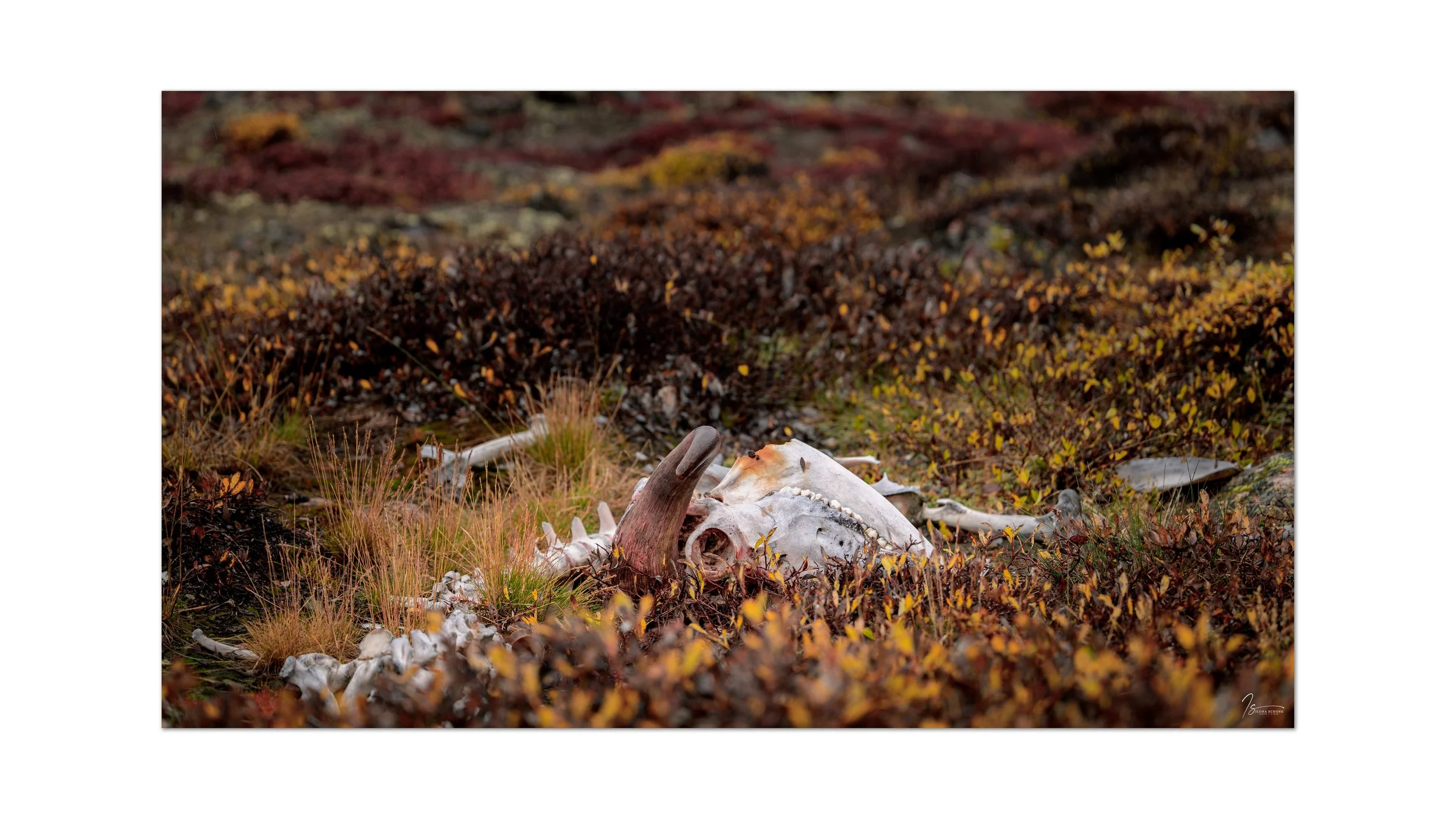
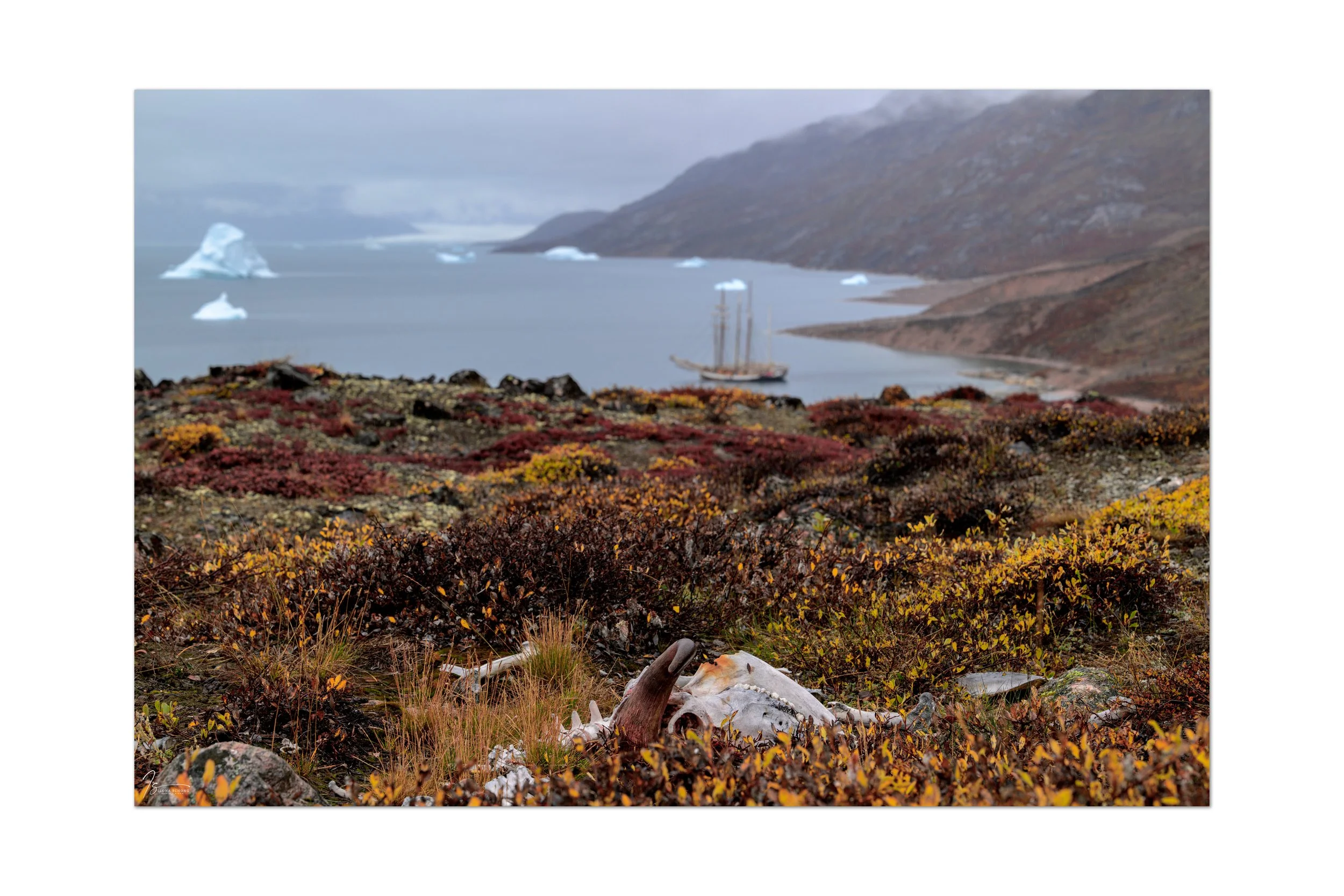
The next morning, we first went ashore in the zodiac for a refreshing morning walk. The fall colors were beautiful; some of the vegetation was bright red. We also came across the carcass of a muskox.
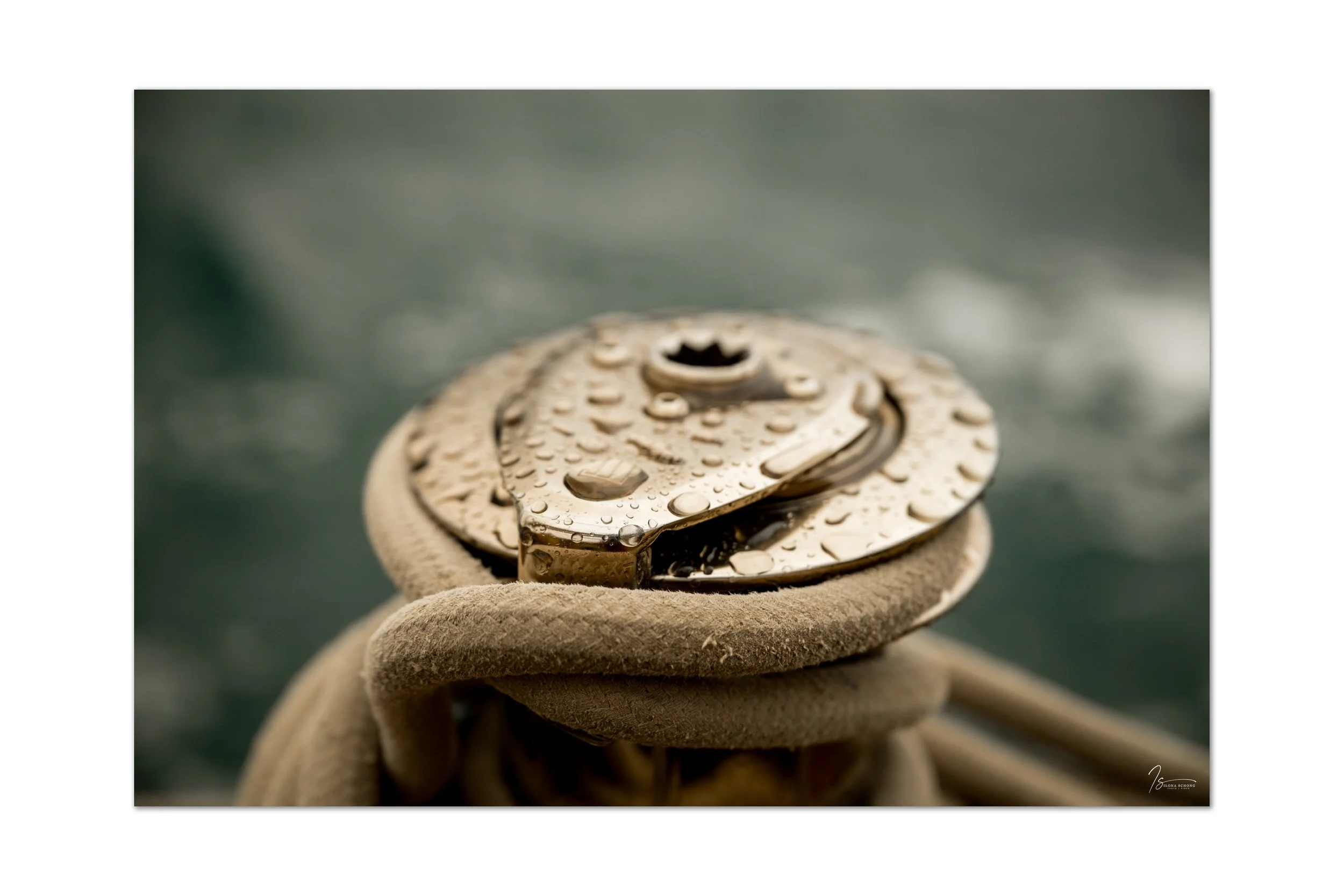
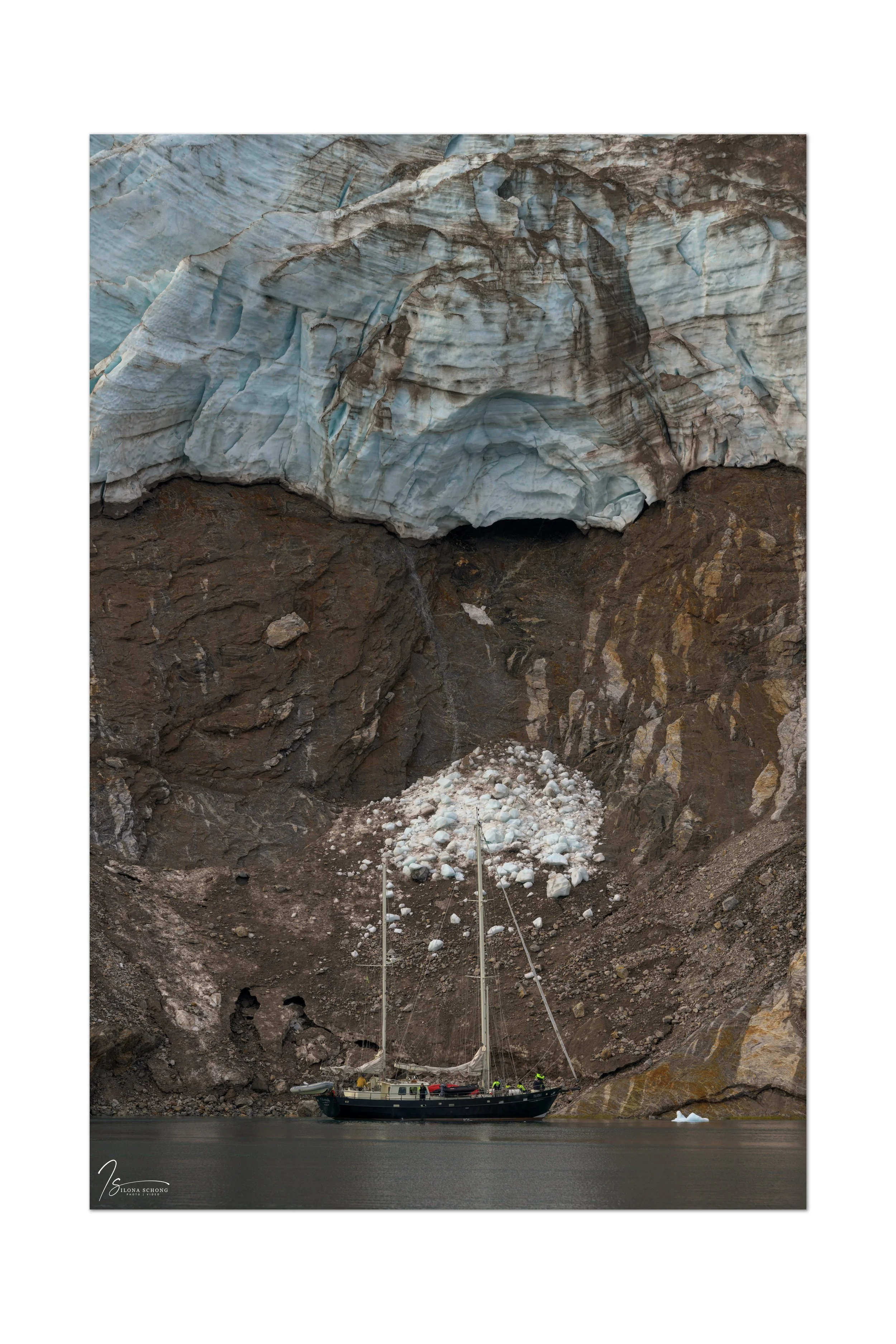
After that, water was first taken on at a nearby waterfall. Although the Hildur has a water desalination unit on board that can convert seawater into fresh (drinkable) water, the other ships, the Ópal and the Tilvera, fill their tanks with water from the glaciers. However, the Hildur also has an extra water tank on deck, which was filled immediately. The water here is so clean and clear that it is drinkable without purification. After that, the voyage began through the Rødefjord toward Røde Island.
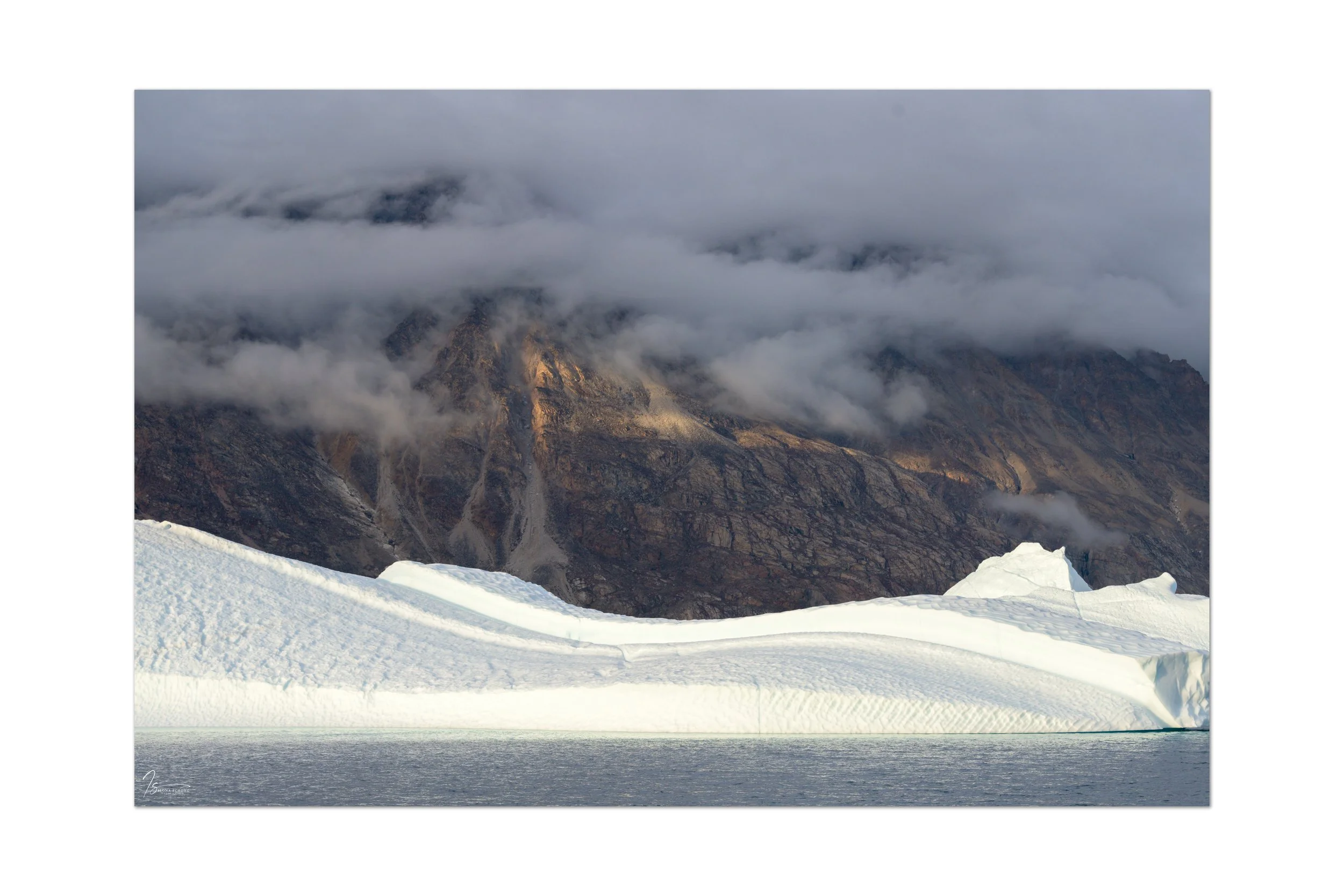
All of East Greenland has an interesting geological history dating back 3 billion years. The collision of the Eurasian and North American tectonic plates shaped eastern Greenland, with its high mountain ranges. At that time, the entire region was located not far from the equator. The climate here was warm and not dry, and iron oxide, known as hematite, formed, which has a reddish-brown color. This is evident in Rødefjord and on Røde Island, which owe their names to this red sedimentation.
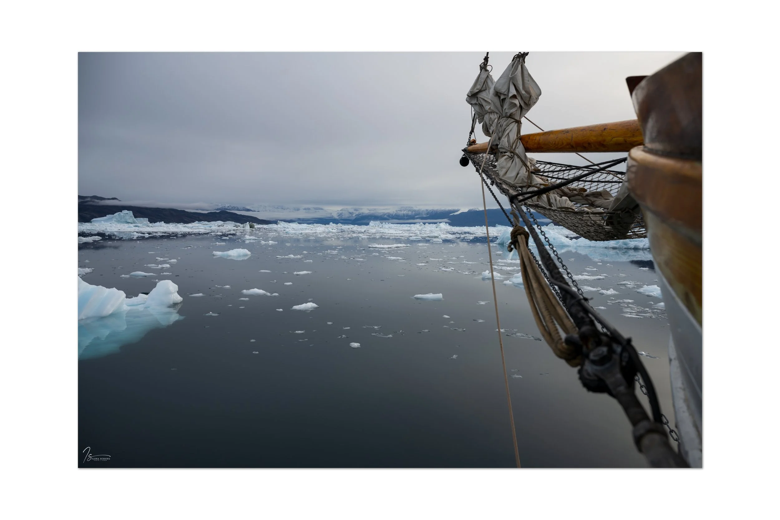
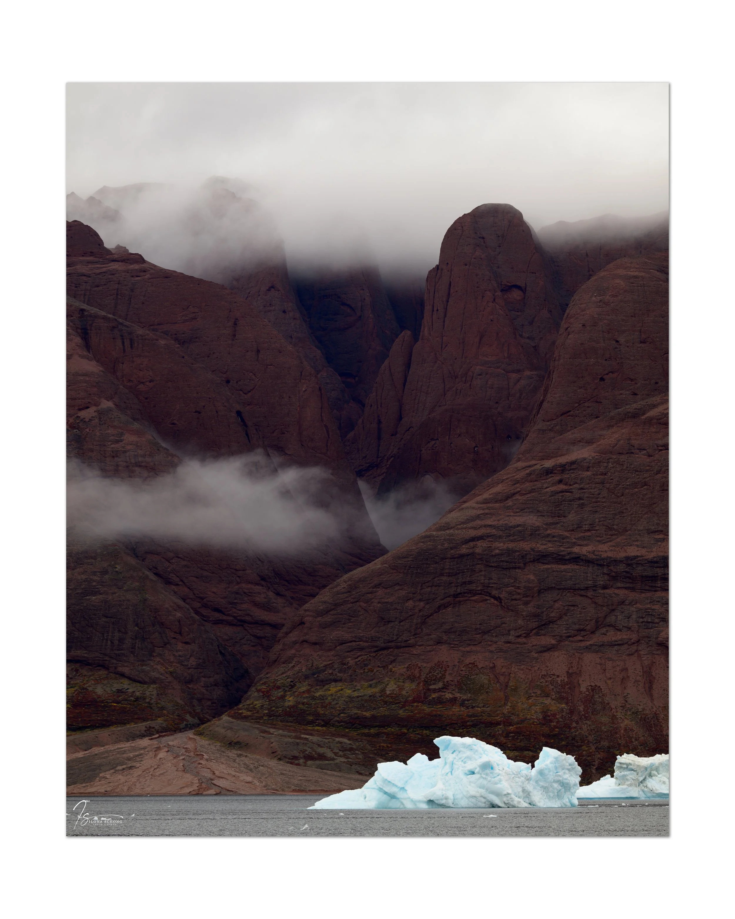
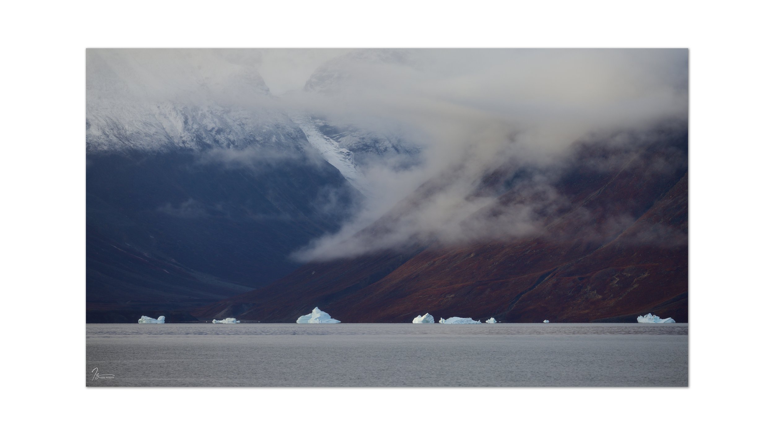
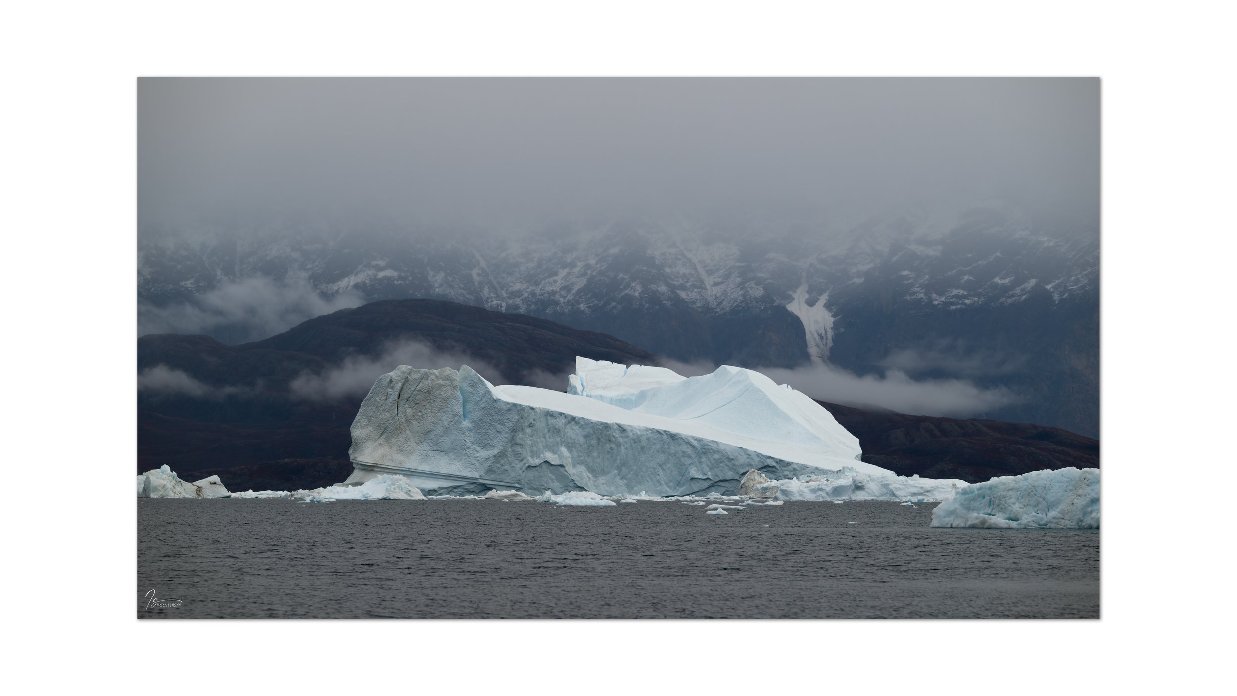
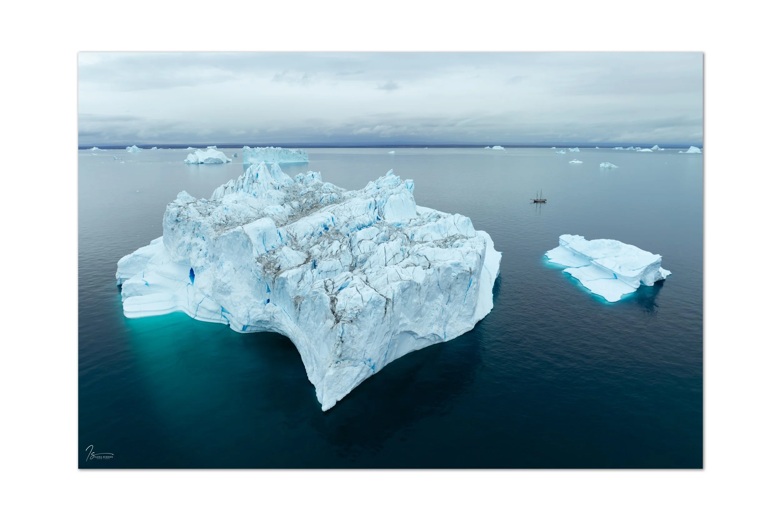
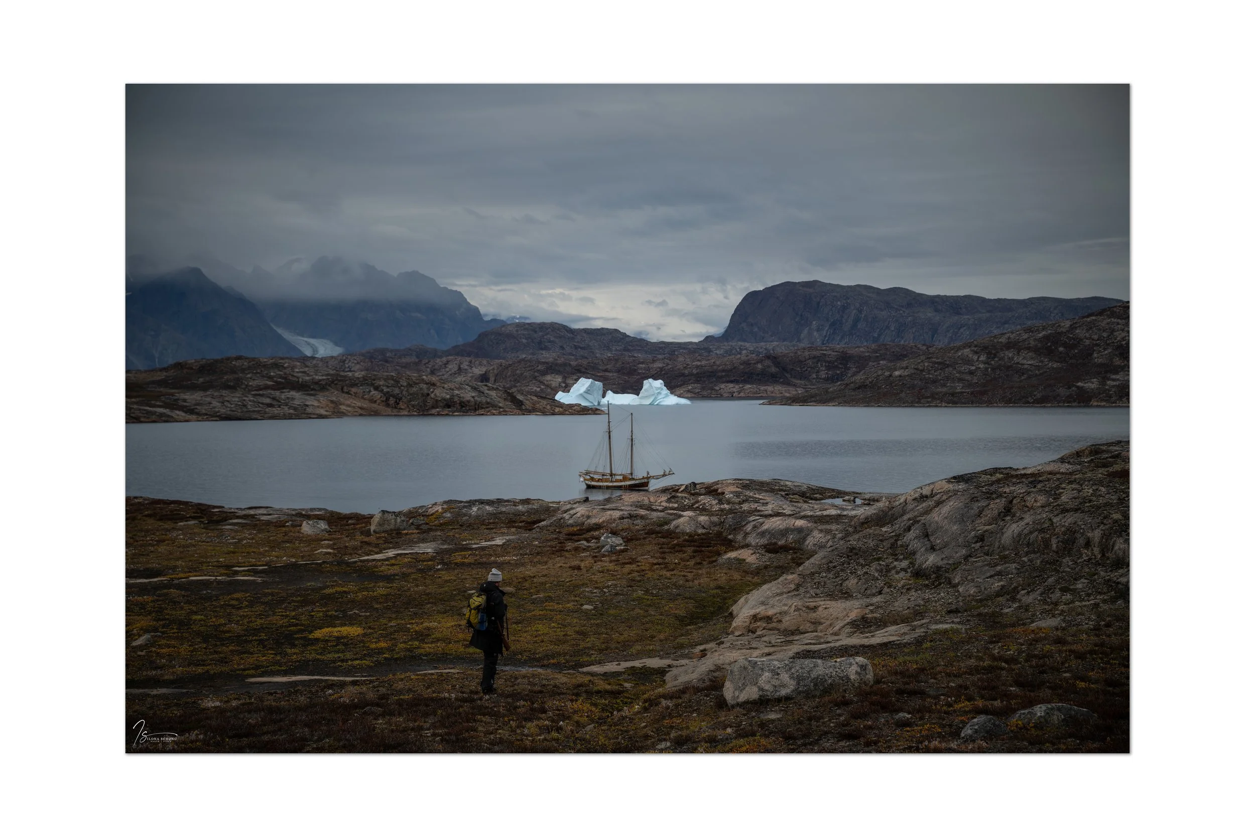
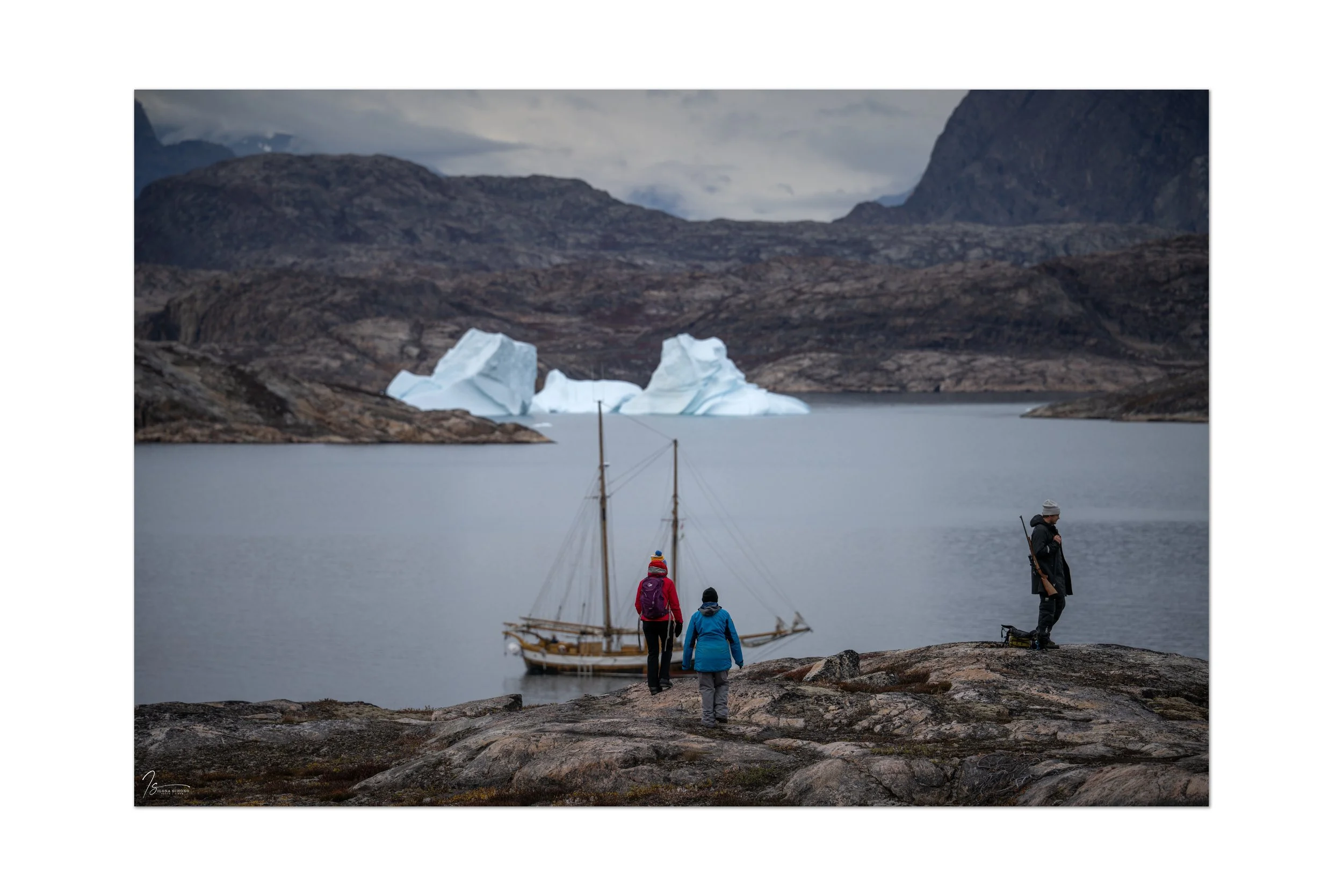
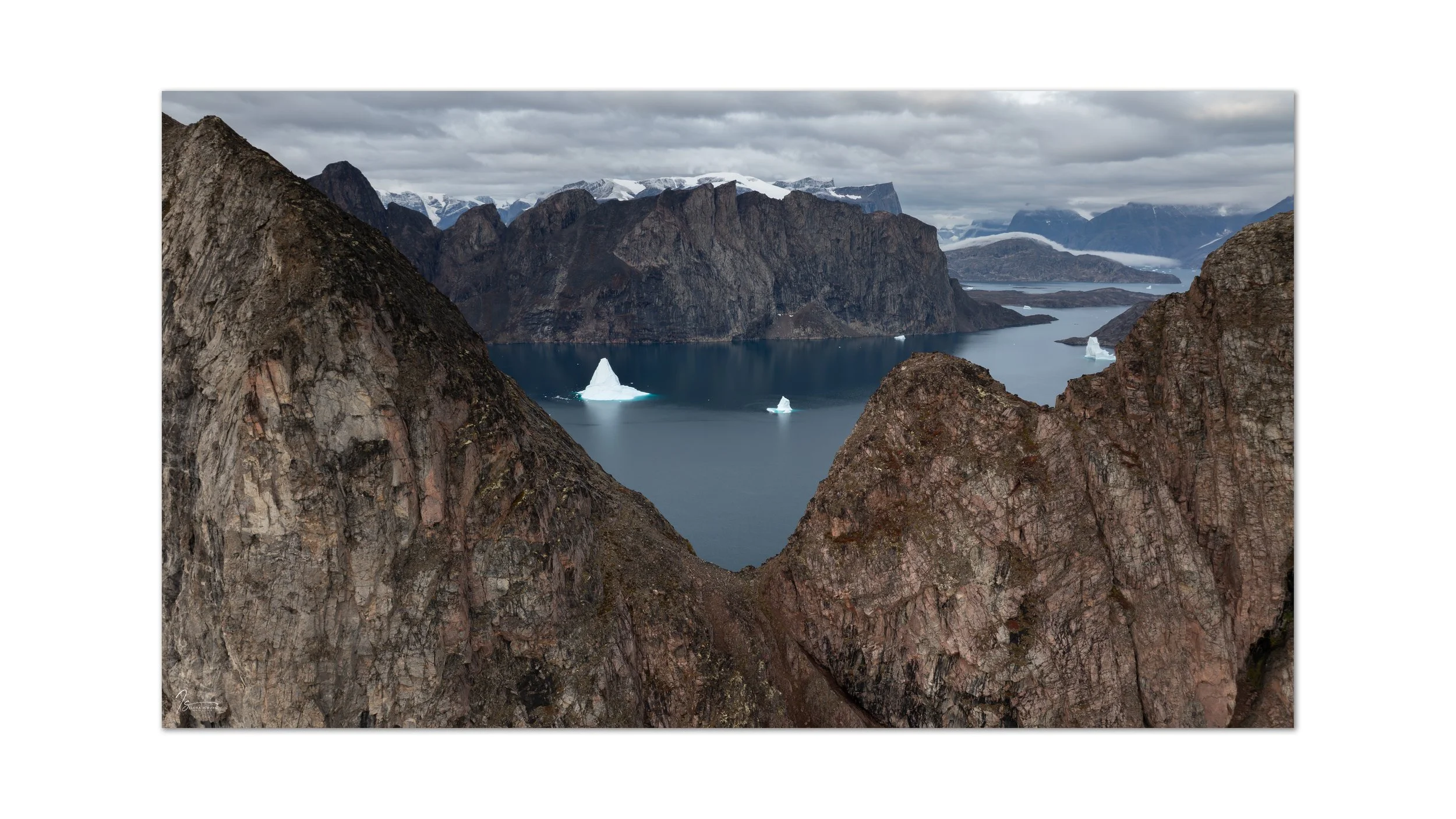
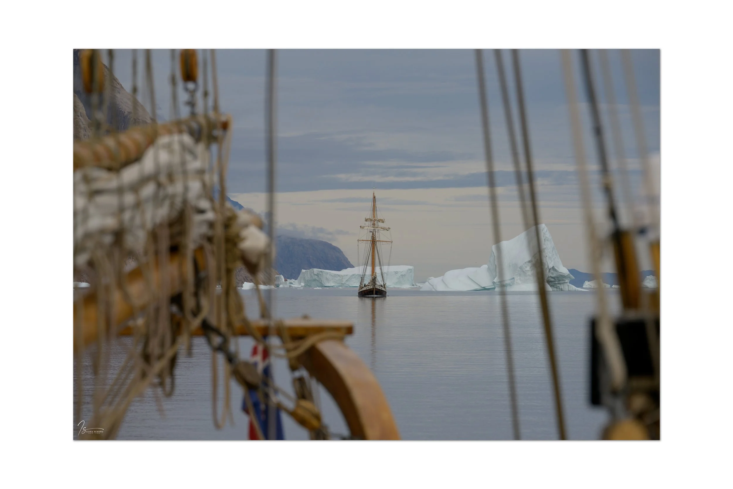
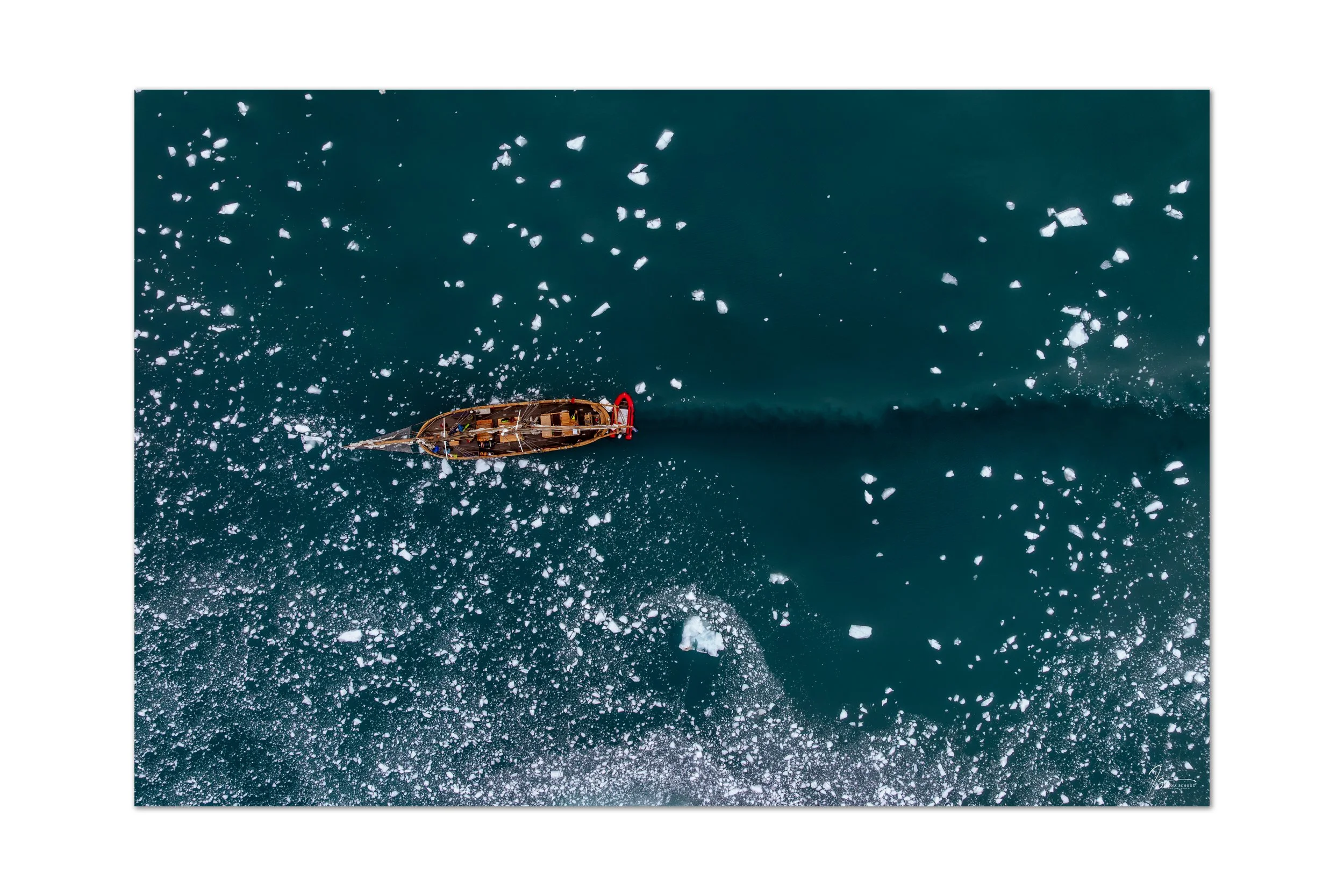
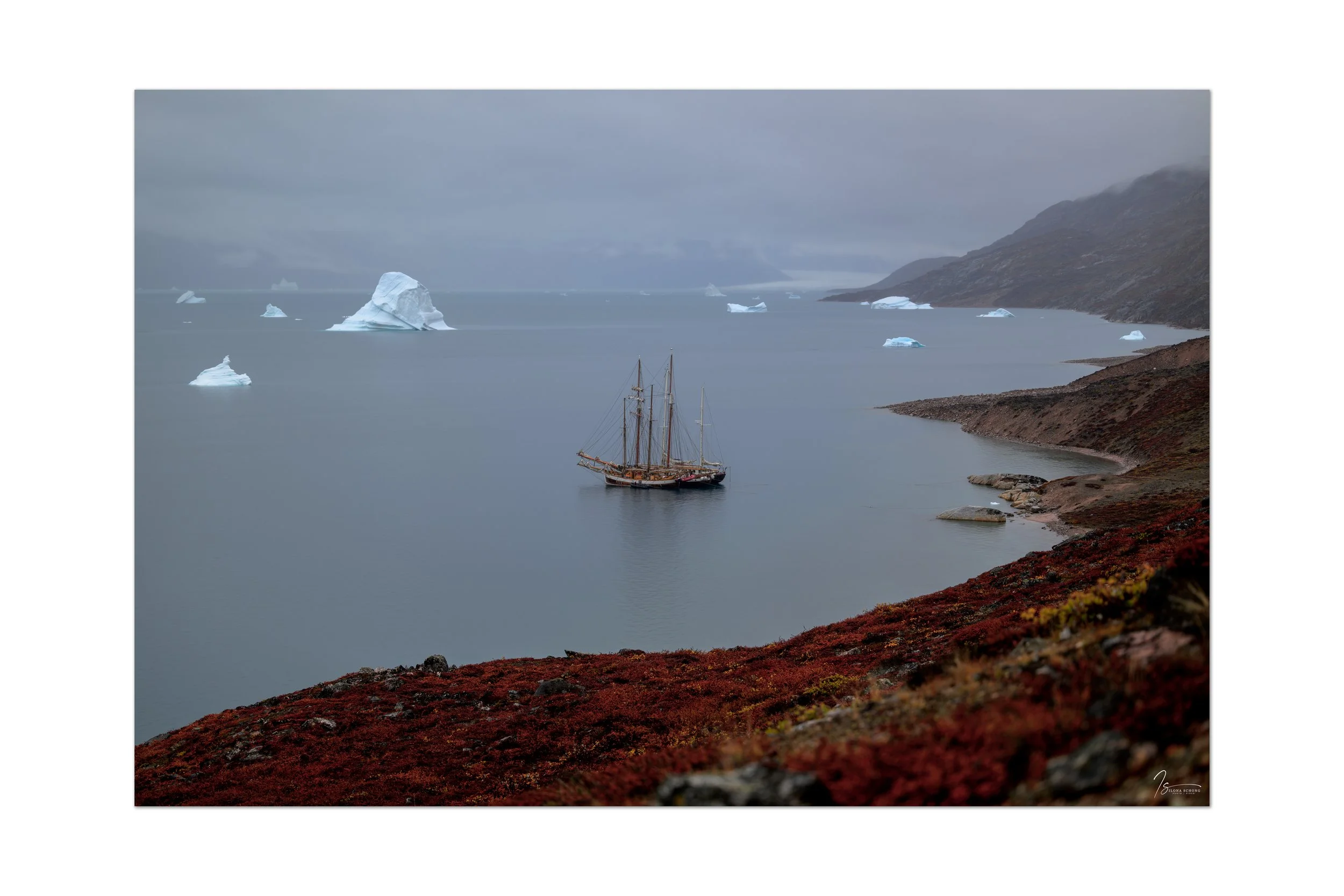
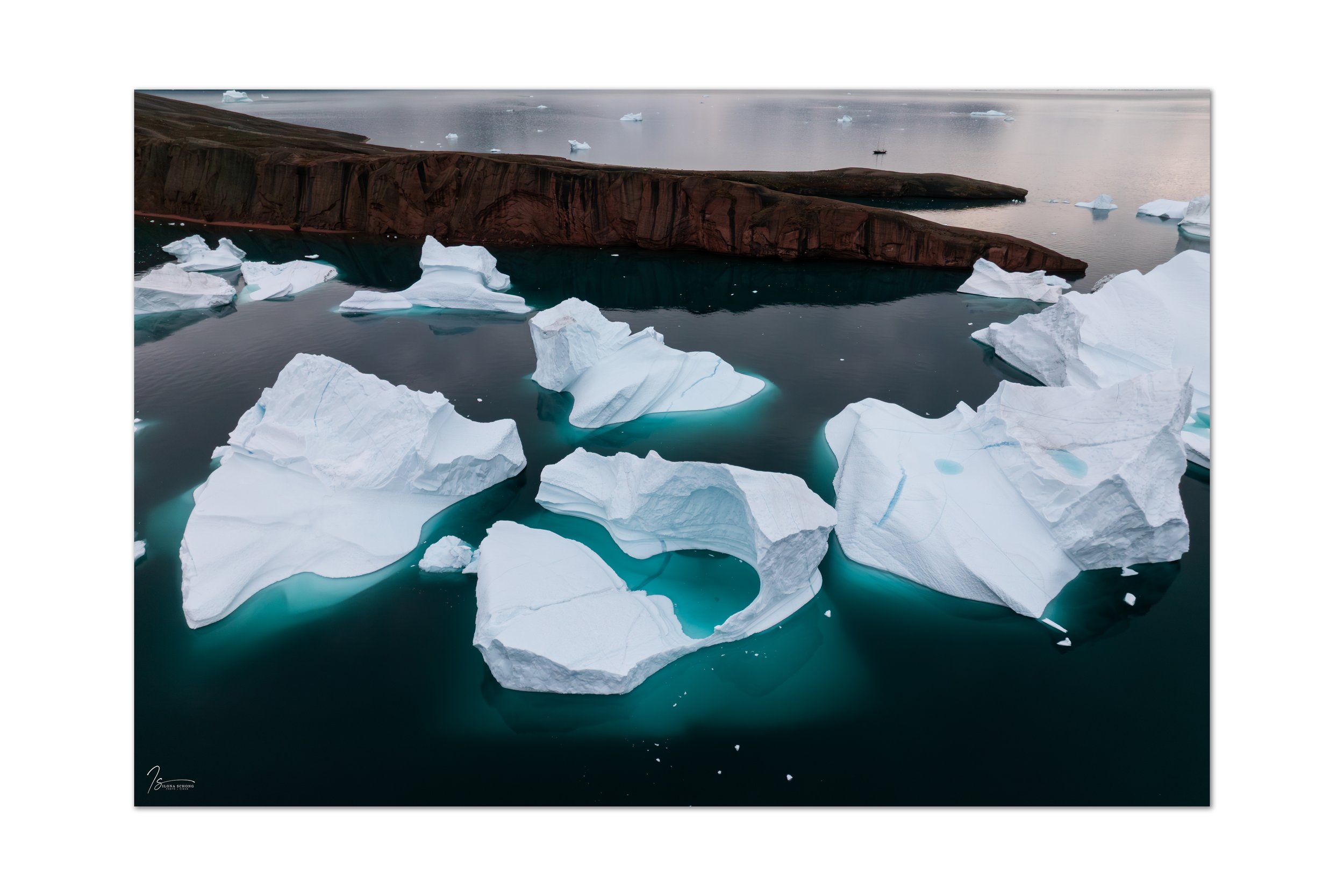
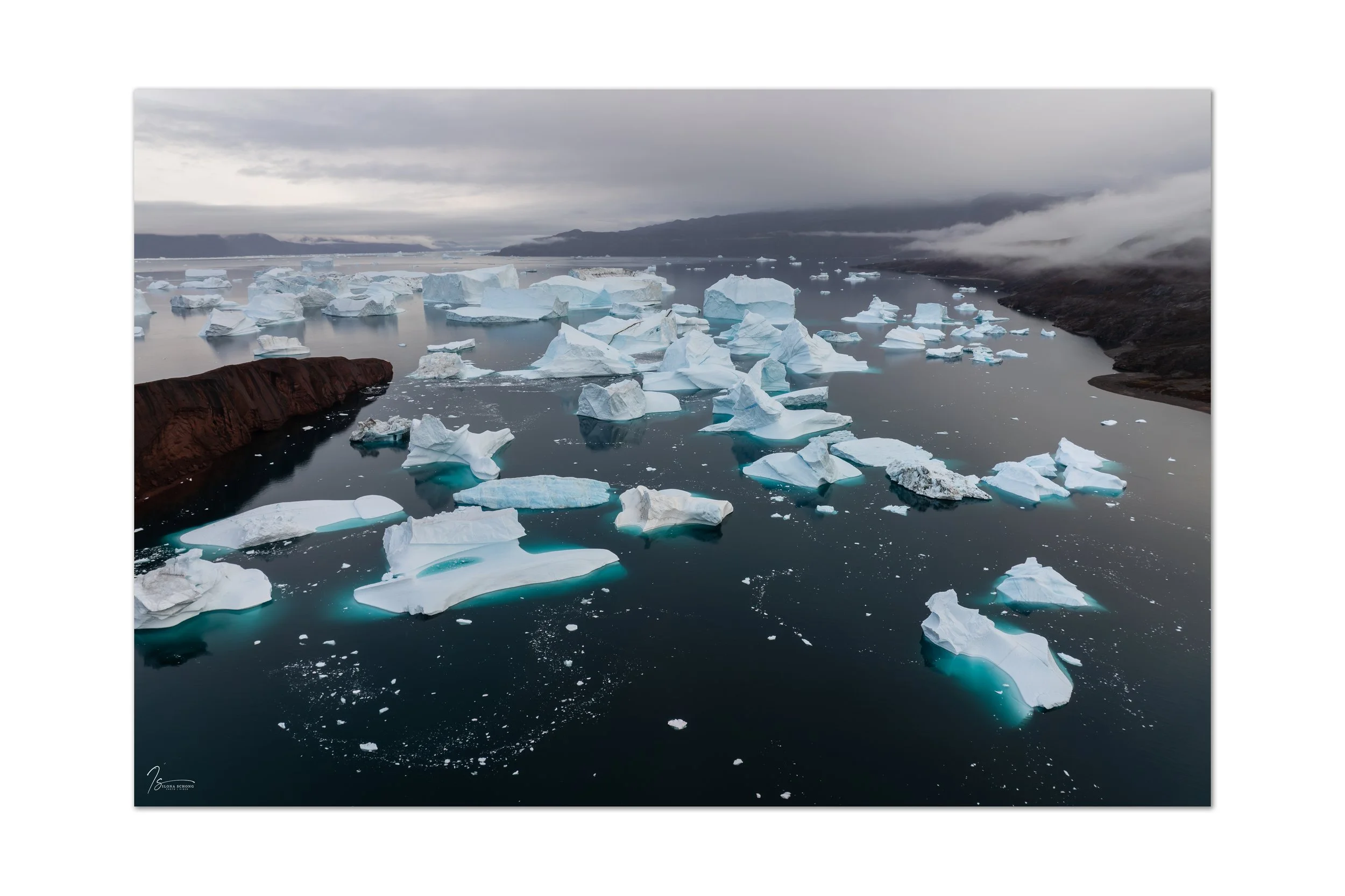
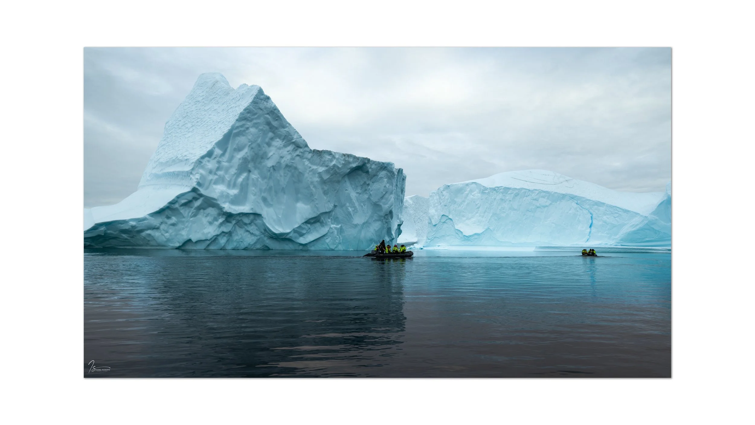
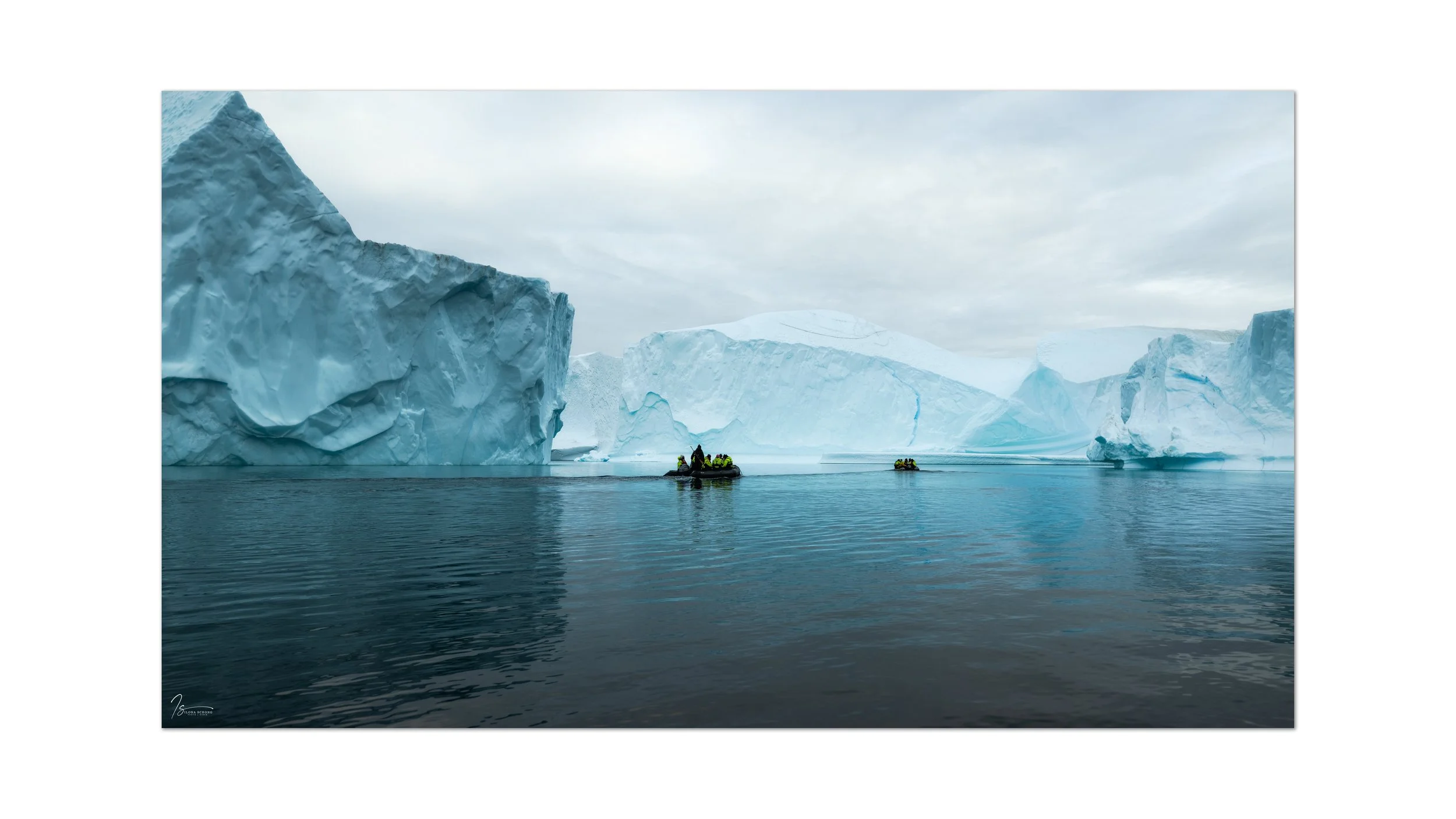
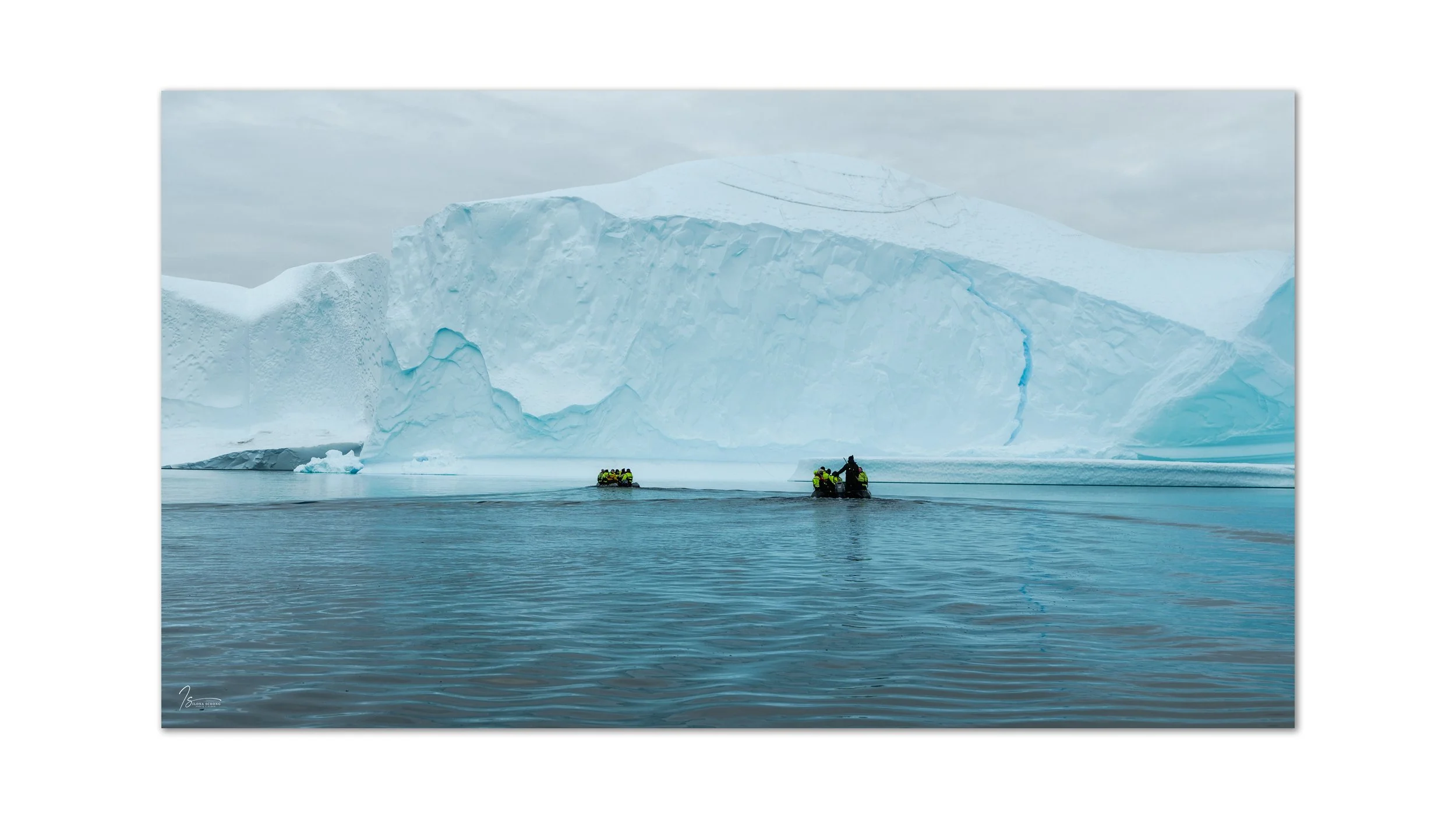
The mouth of the Rødefjord is filled with icebergs that originate from the Vestfjord. The icebergs get stuck near Røde Island, forming an iceberg graveyard there. Upon arriving at Røde Island, just before dark, we had time to hike all the way to the top, where we could see all the icebergs.
The next morning, we went on a Zodiac tour. It wasn’t without danger, because every now and then a towering iceberg would collapse with a deafening roar or tip over, which was a terrifying sight and also caused high waves. As we headed back toward the anchored Hildur in the Zodiac, a muskox was grazing against the mountainside. With the Zodiac’s engine off, we paddled gently toward it and were able to get some good photos of him (or her?), until he spotted us and quickly took off.
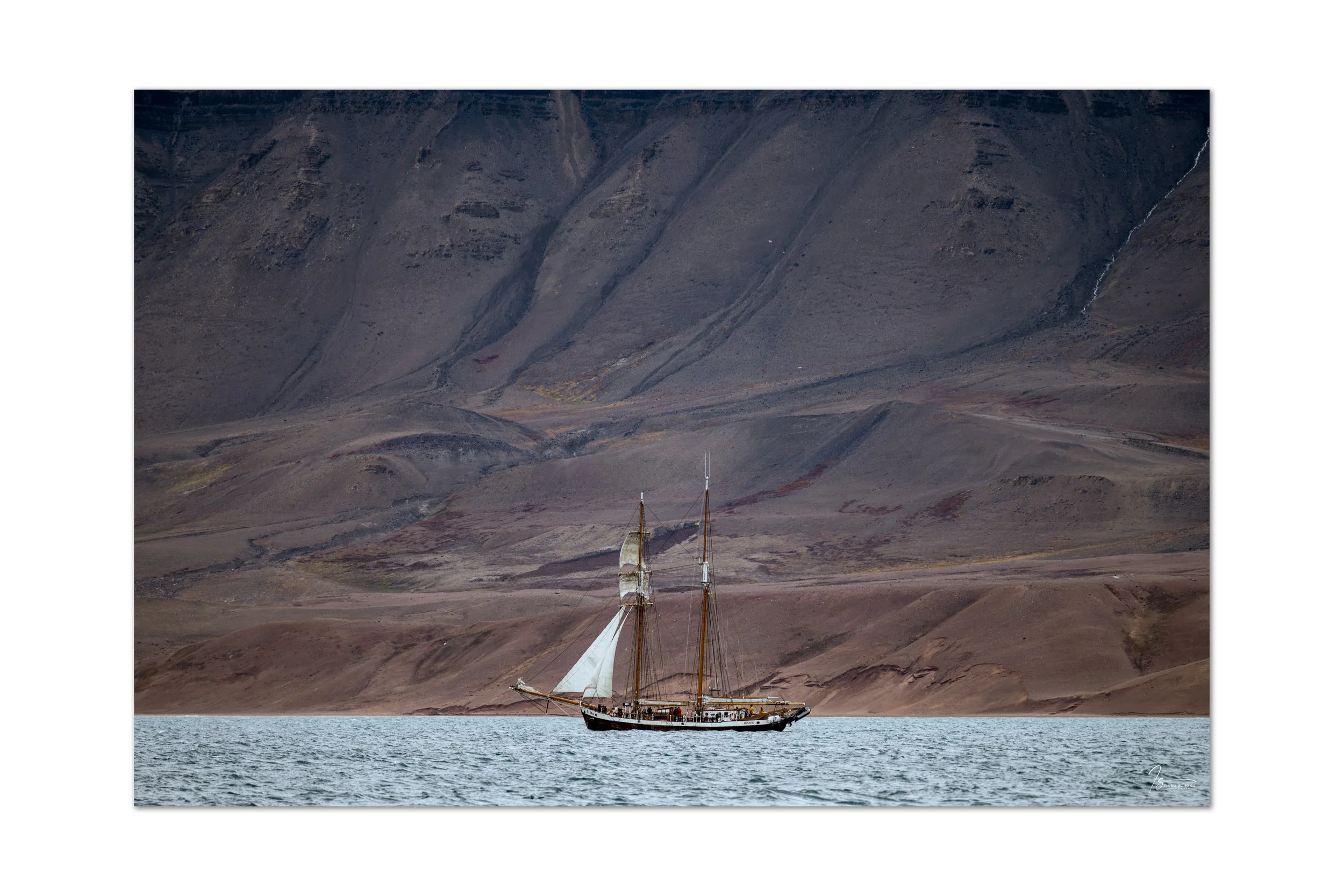
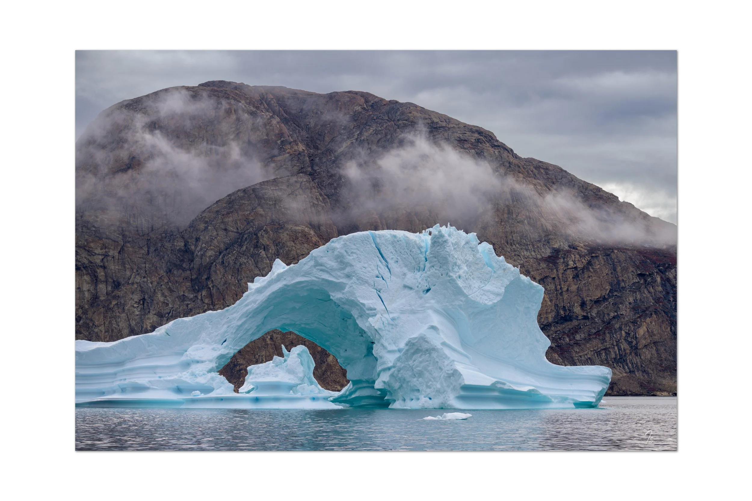
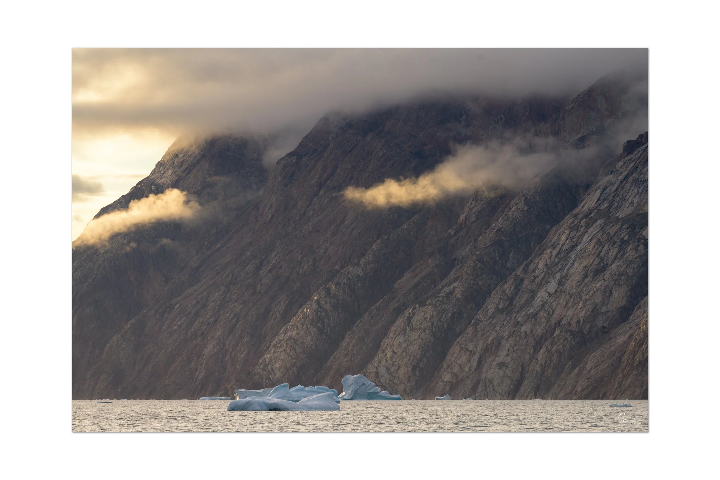
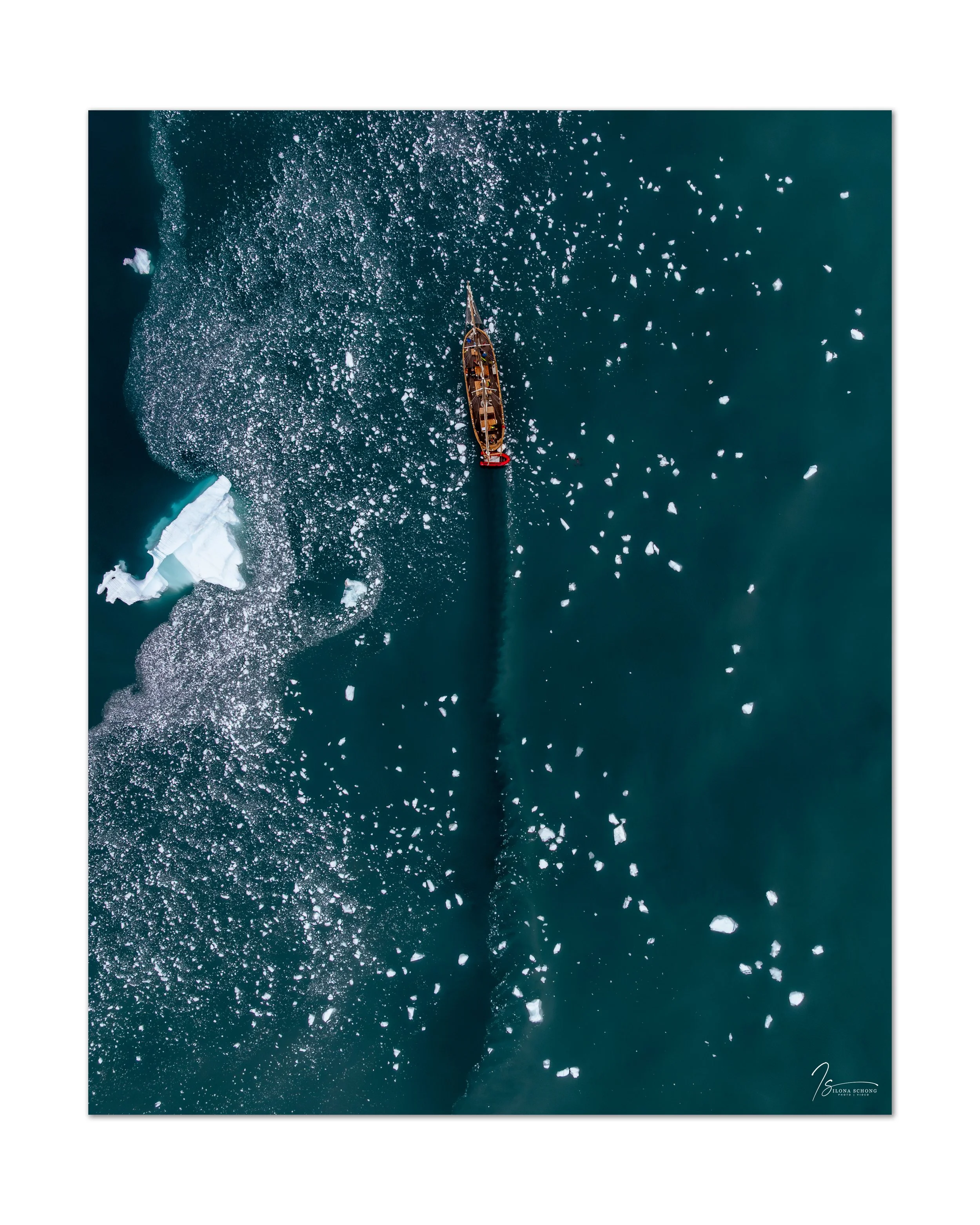
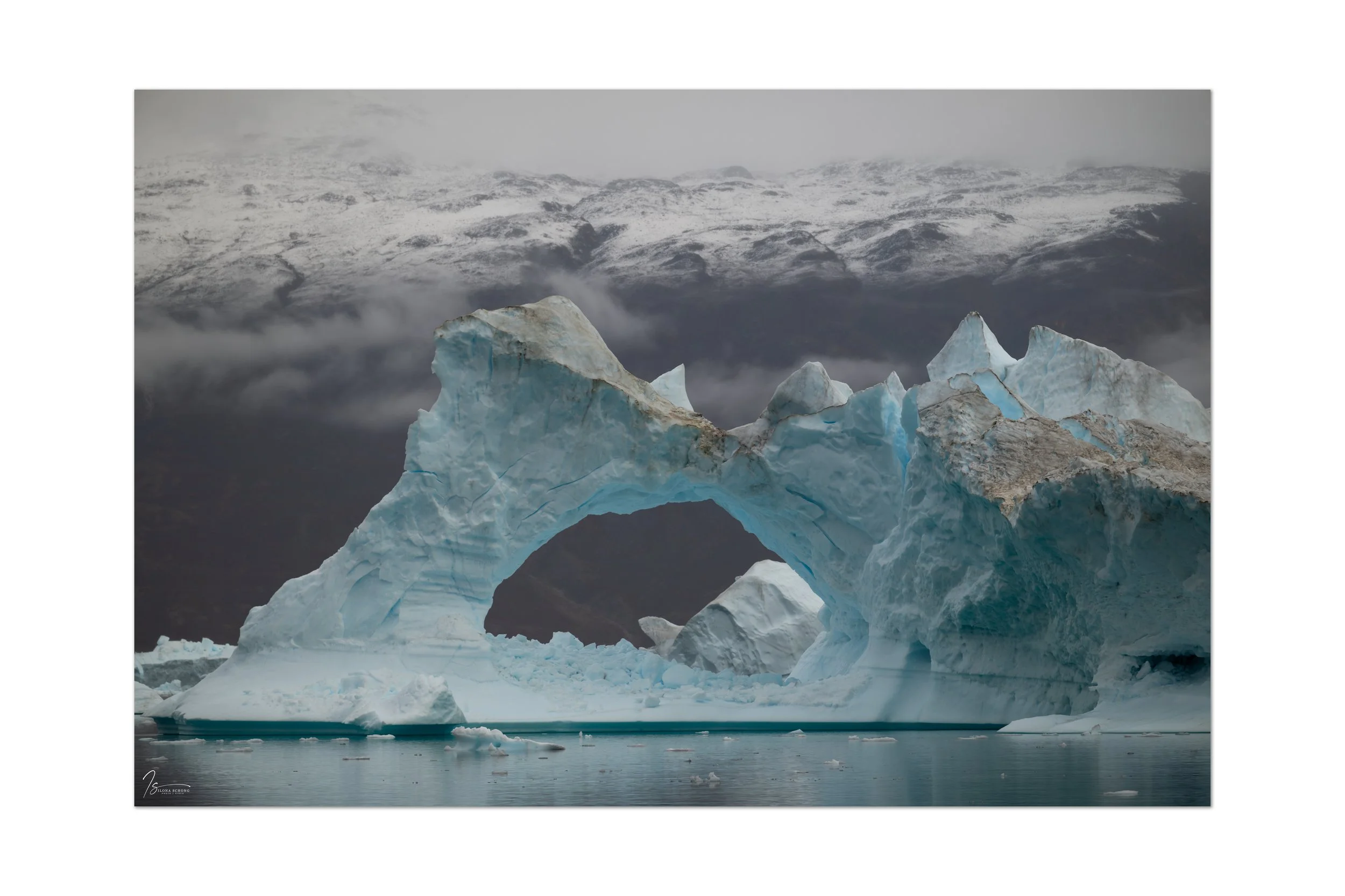
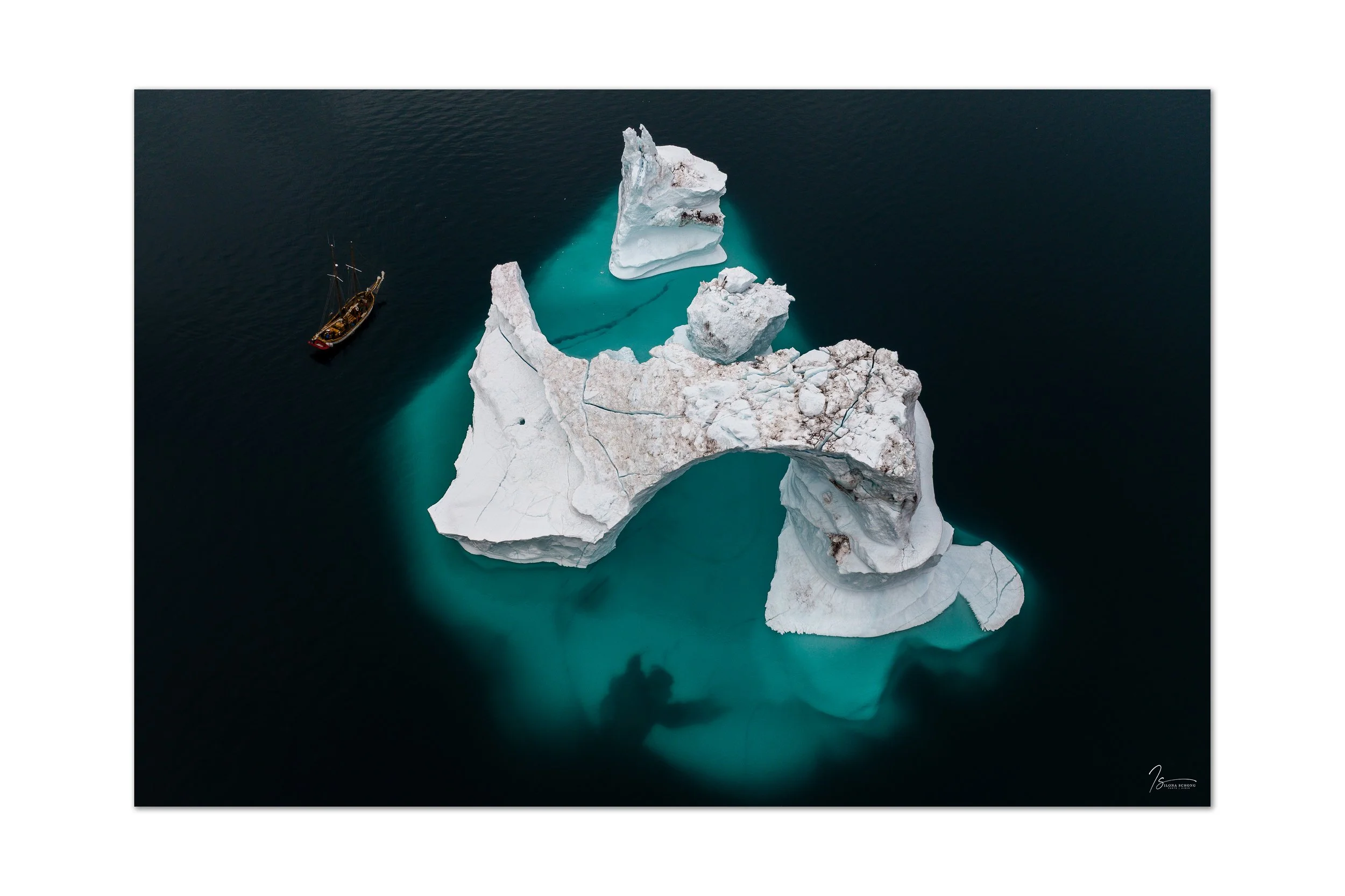
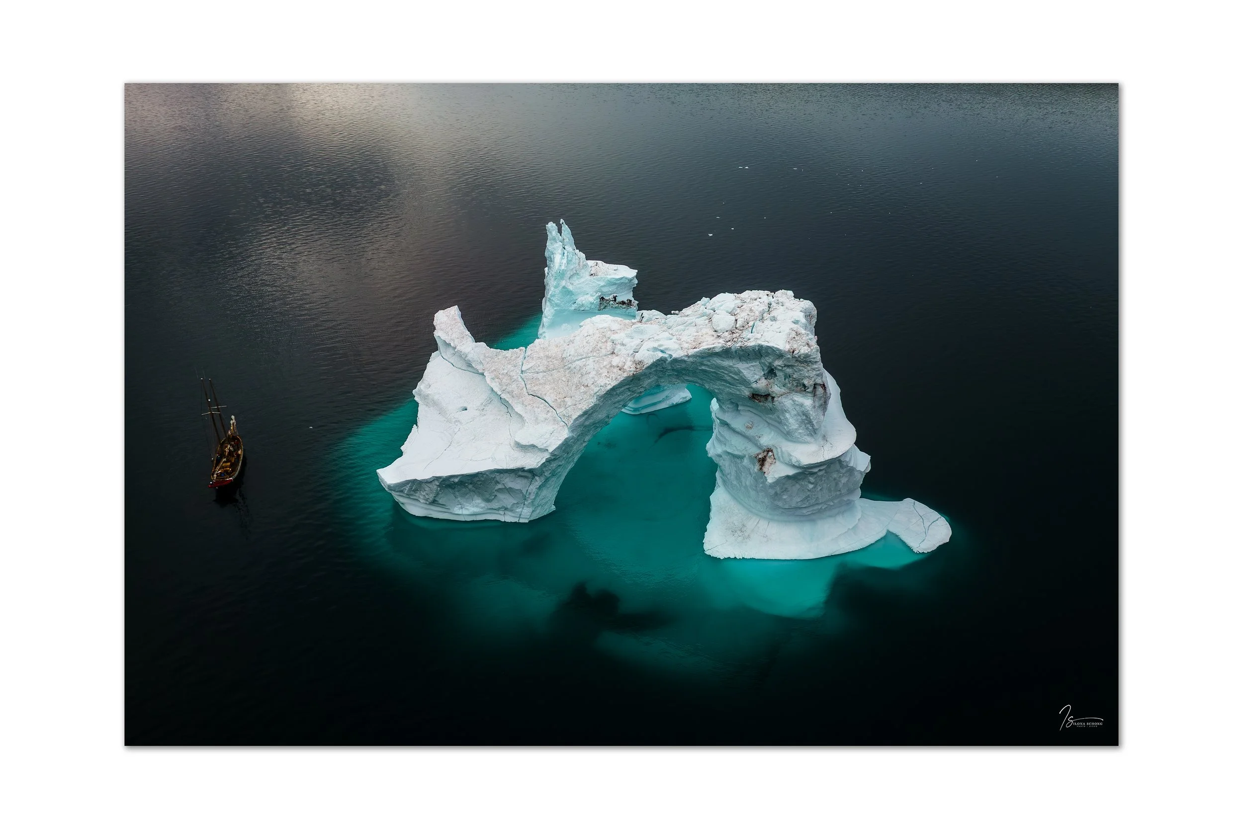
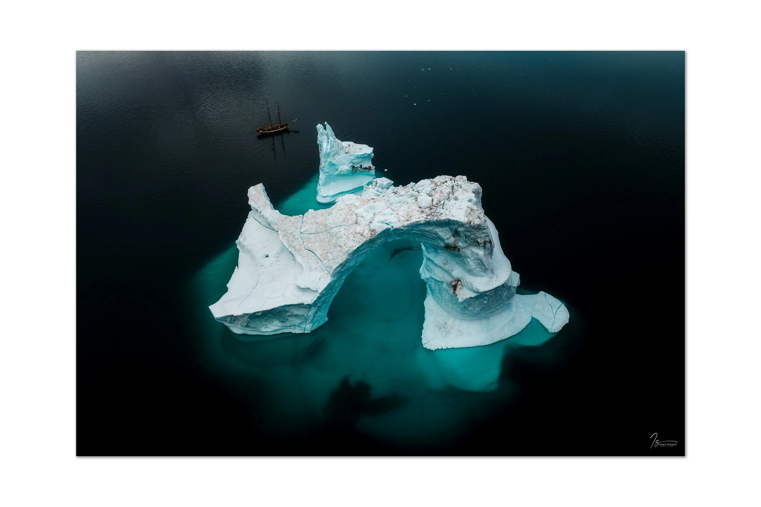
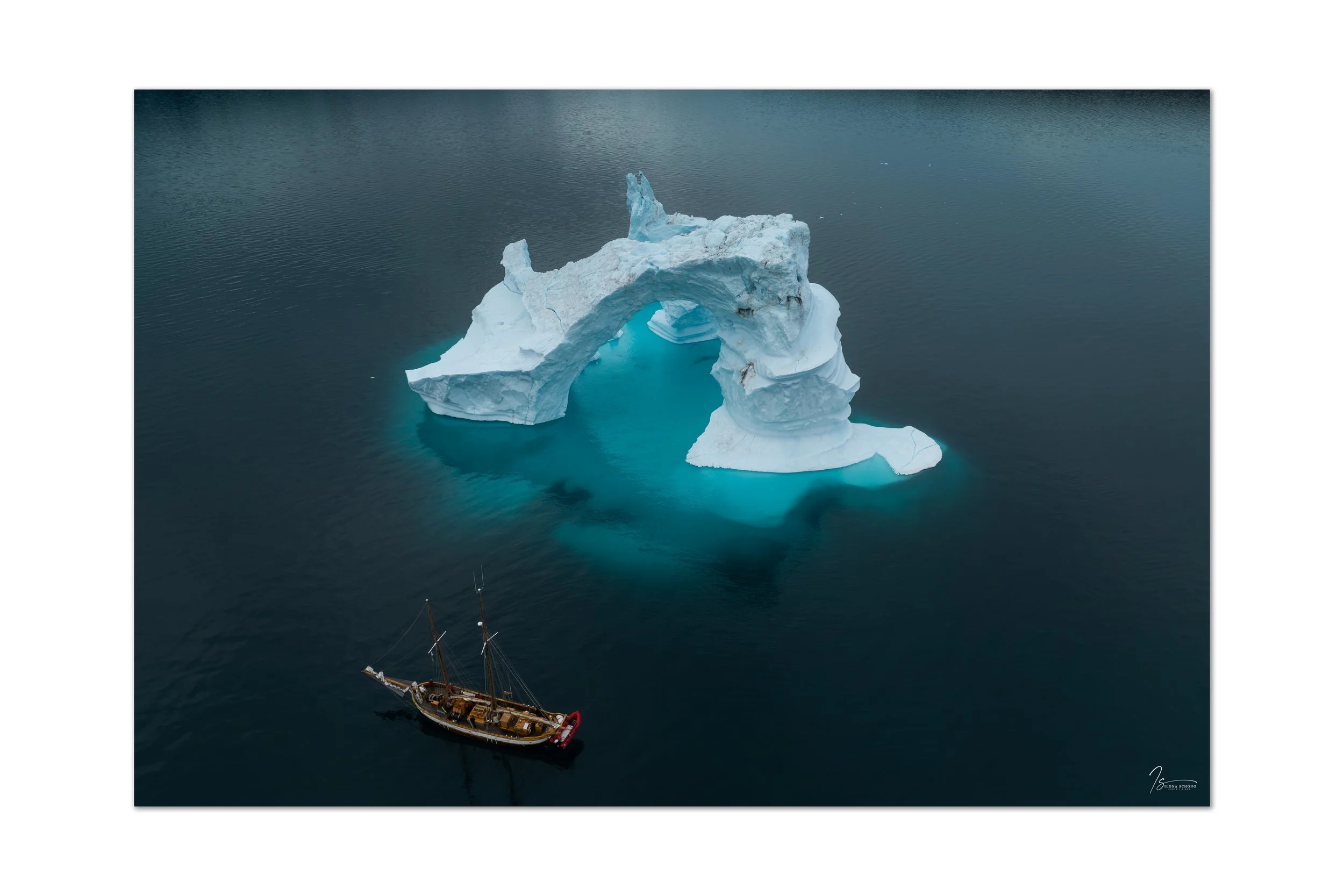
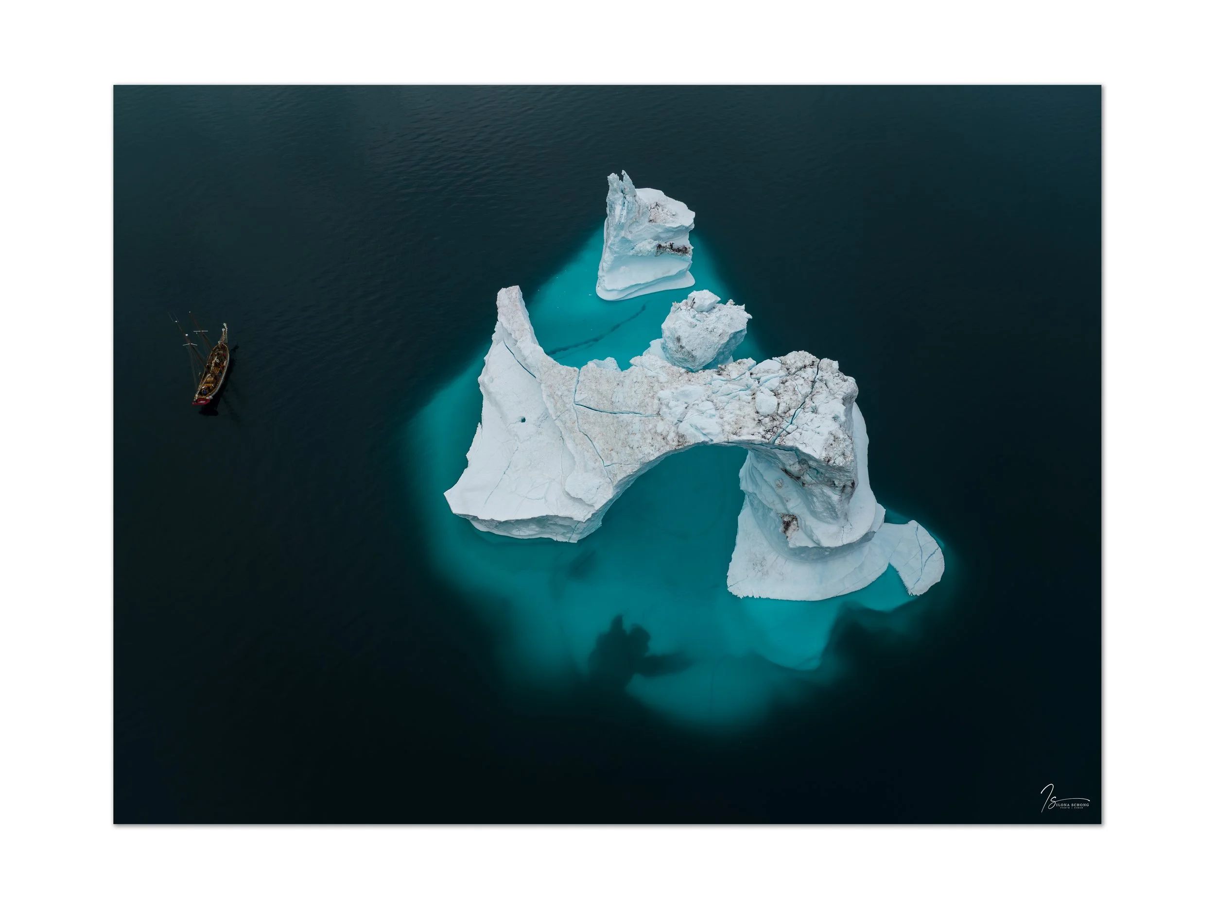
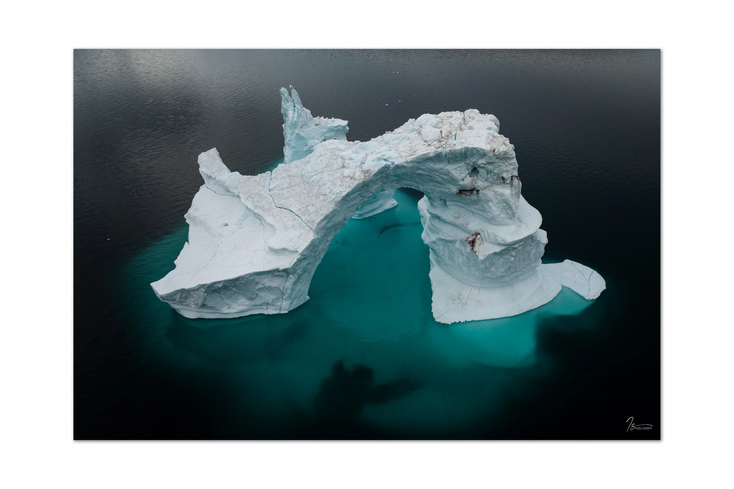
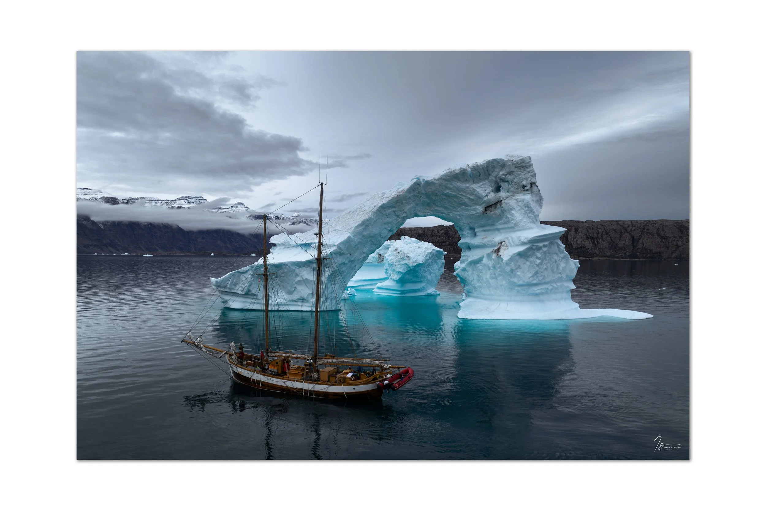
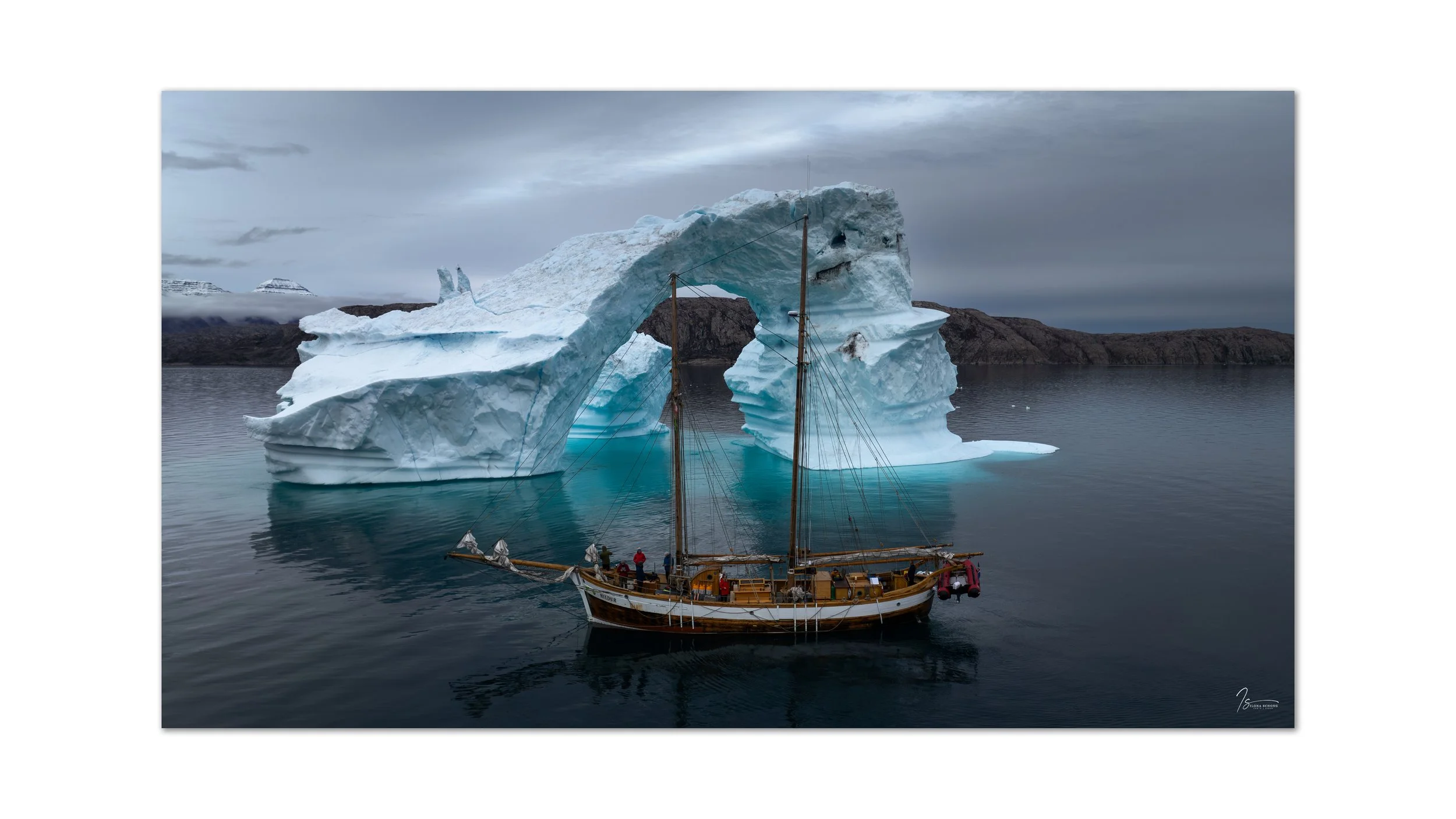
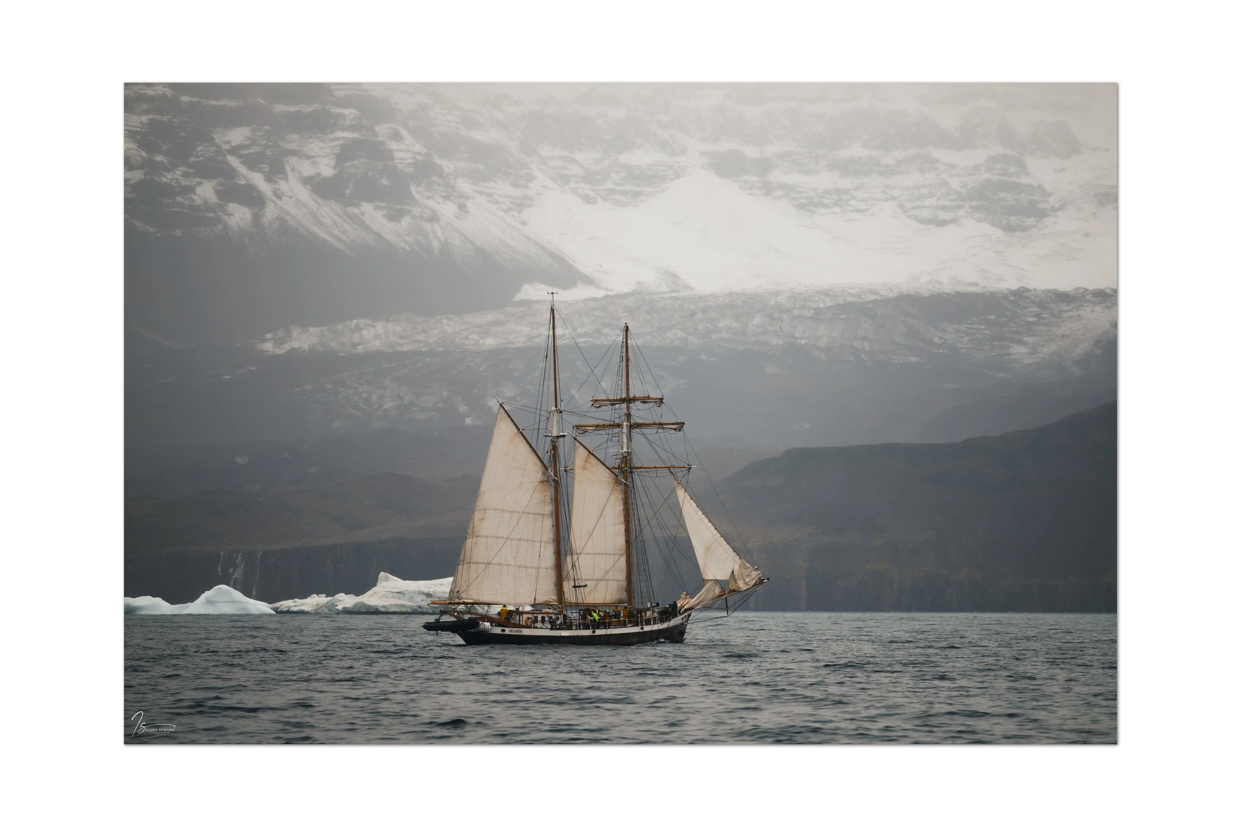
The journey continued through the Føhnfjord, with its 900-meter-high cliff walls on both sides. By this point, having grown somewhat accustomed to—and spoiled by—the stunning landscapes, the journey itself wasn’t all that spectacular, until we spotted a magnificent arch-shaped iceberg at the end. Naturally, we had to fly the drone there, which yielded some great photos.
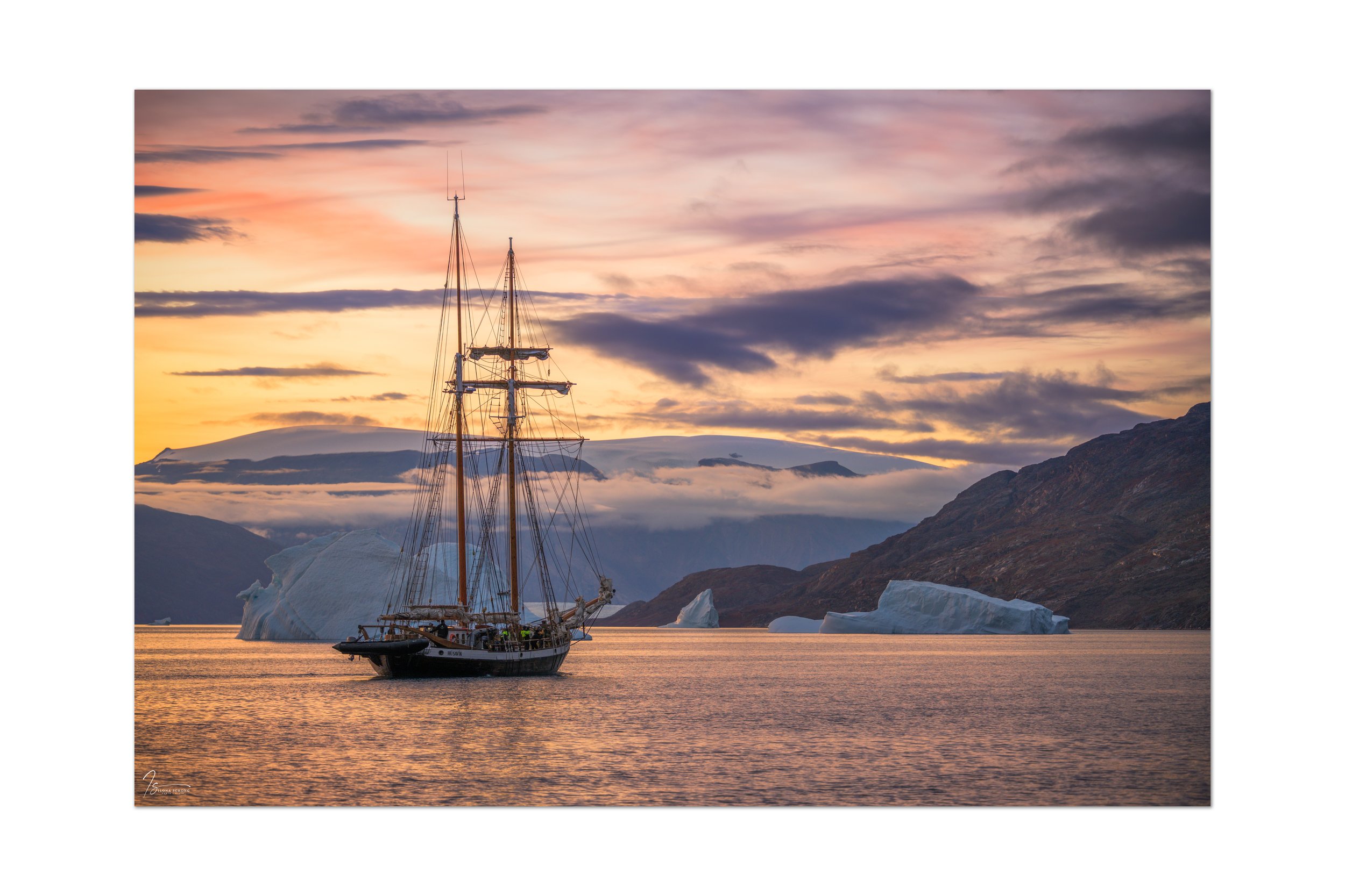
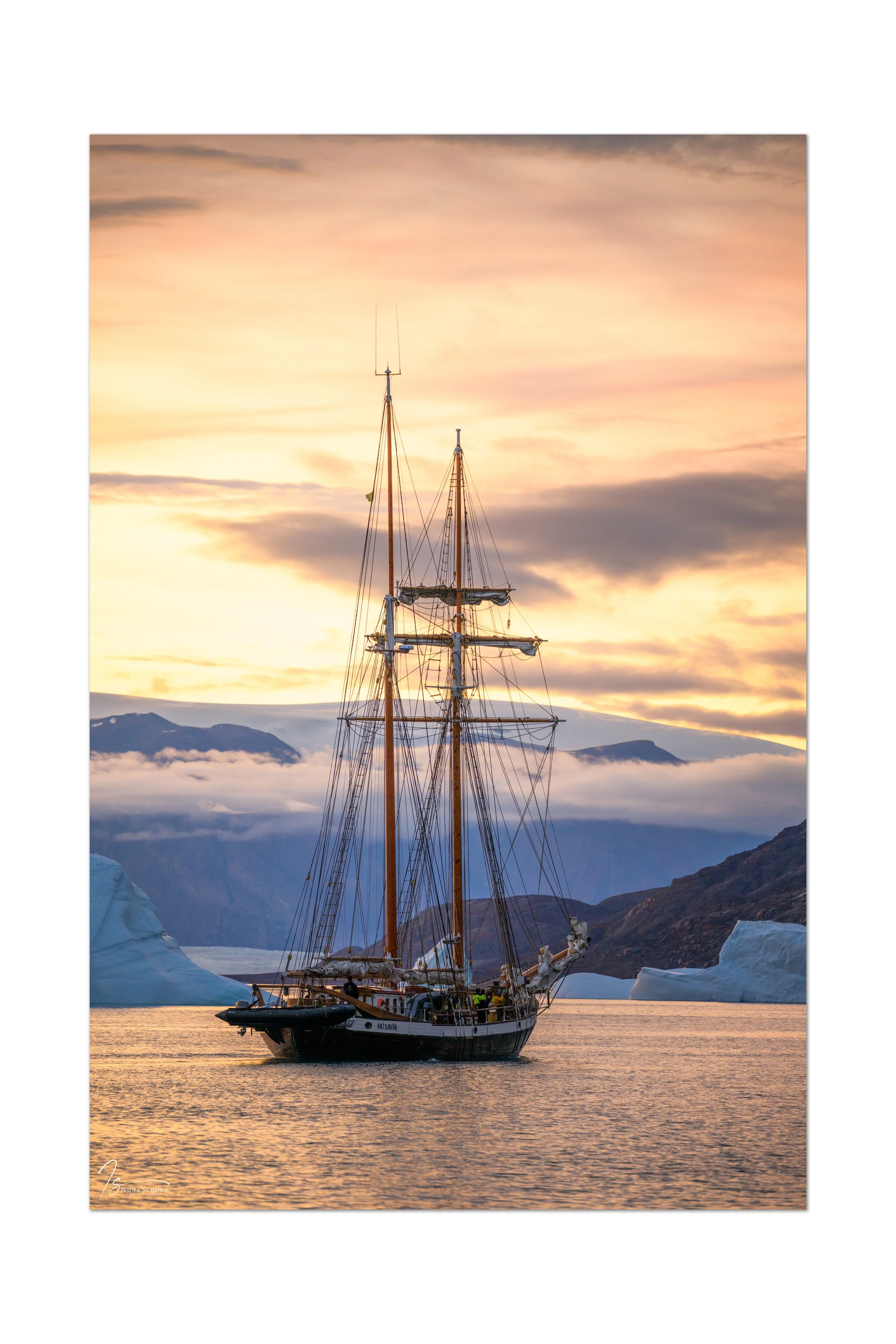
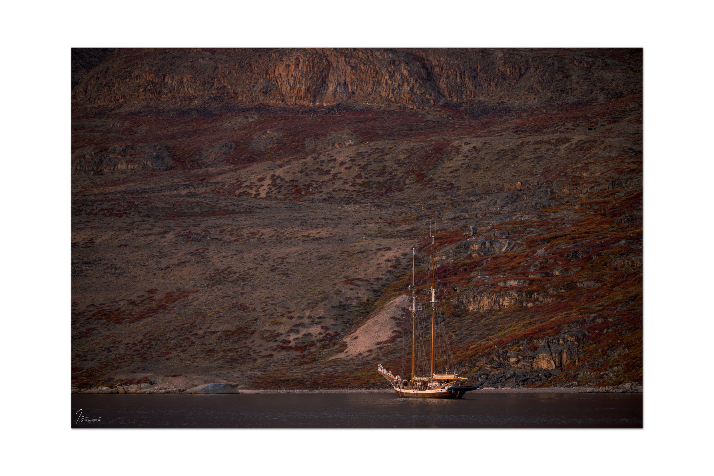
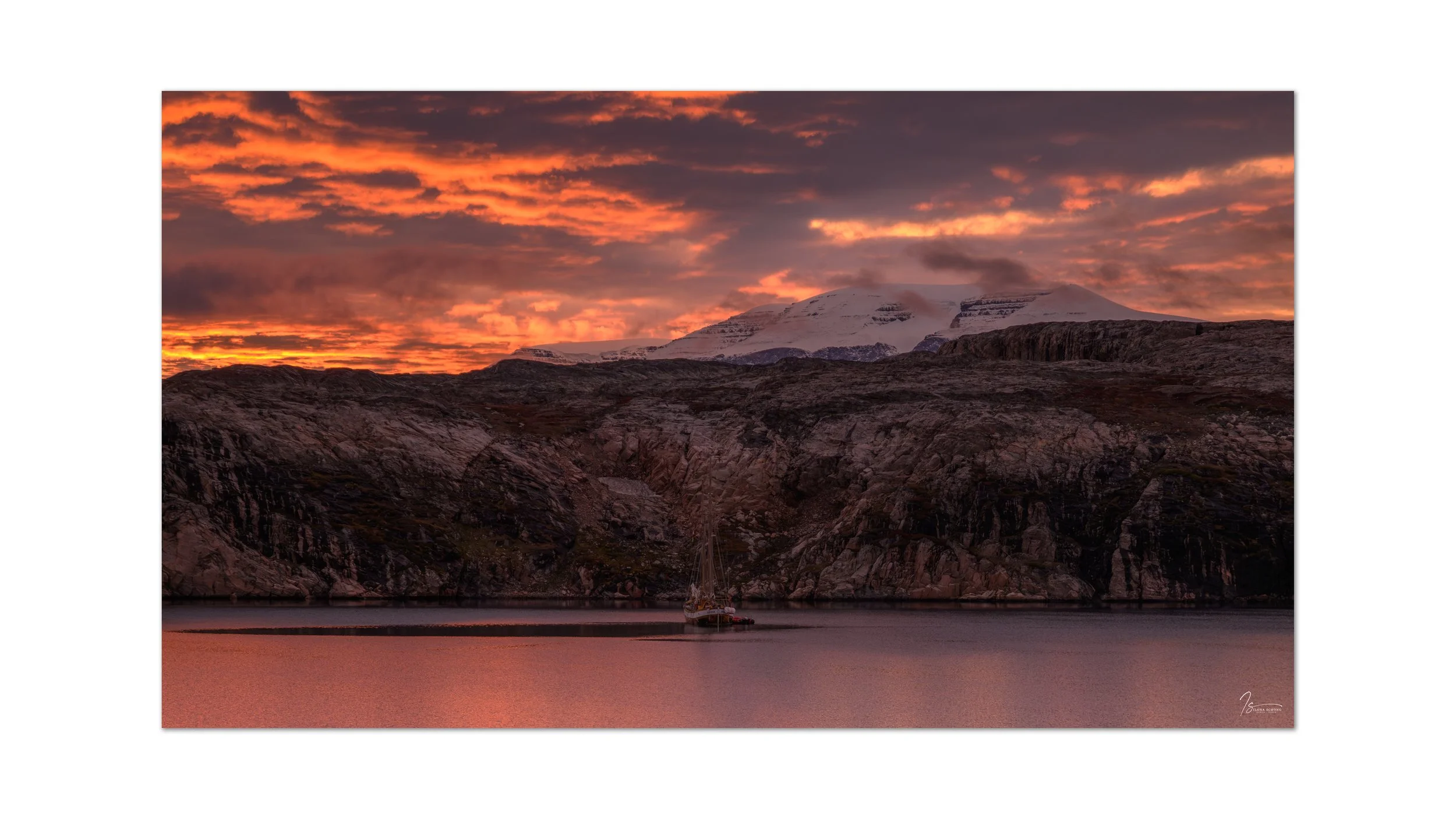
Our anchorage was the naturally formed Hekla-Havn, where we had the opportunity to visit an old Inuit settlement and the winter camp of the first scientific expedition to Scoresby Sund—more than 100 years ago—as we watched the sunset turn truly colorful for the first time. The first signs of human presence, after all those days. A strange sensation!

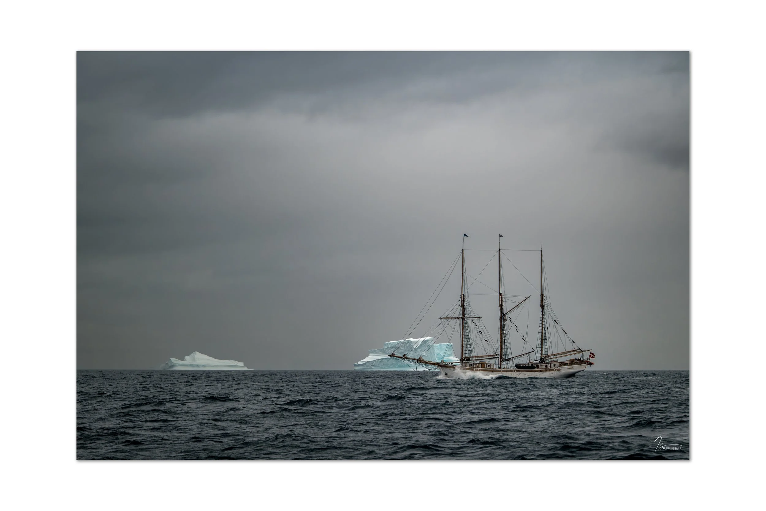
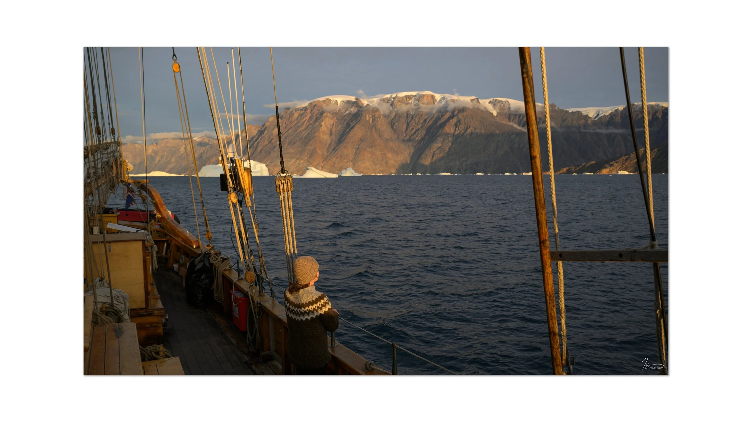
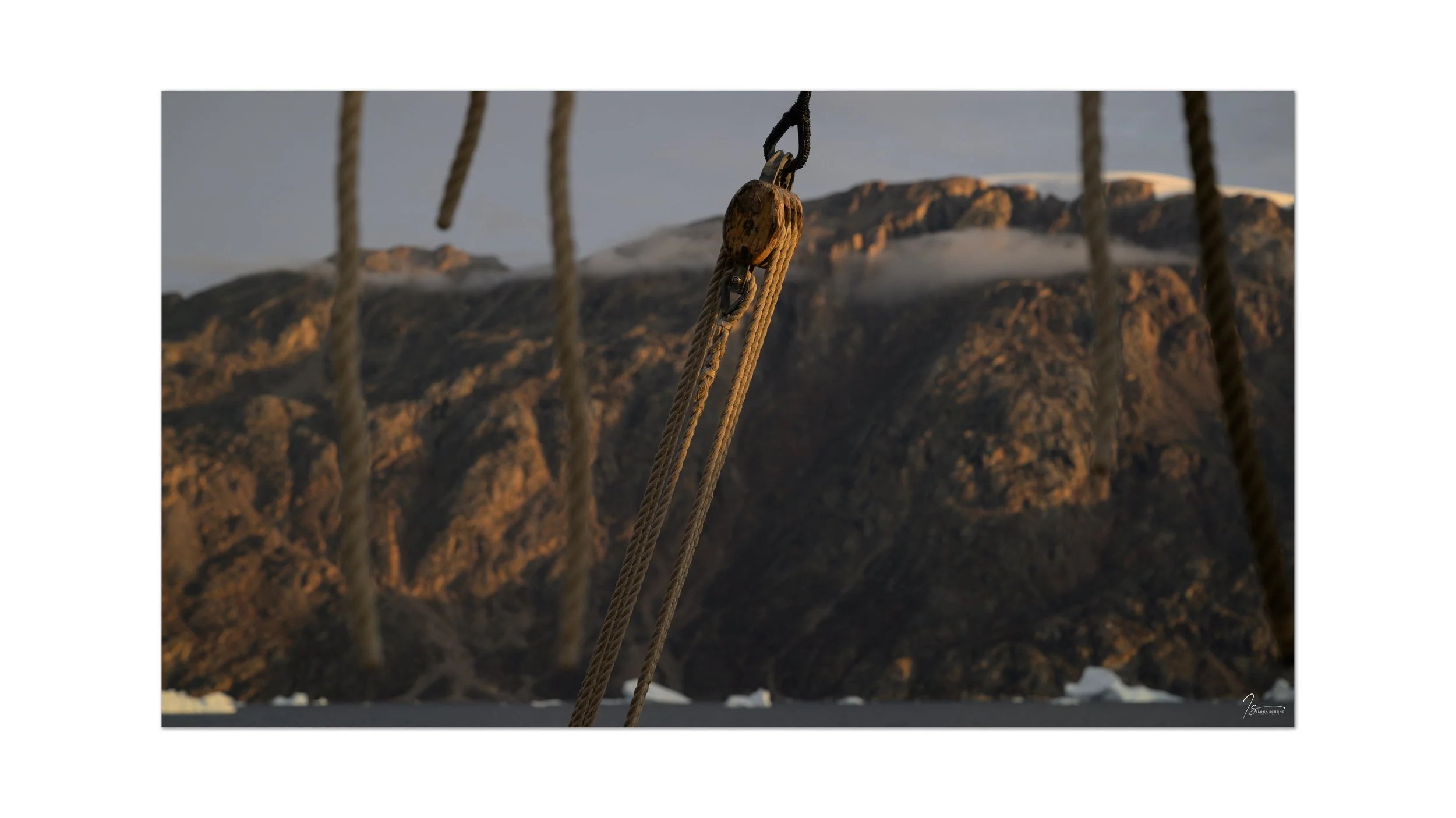
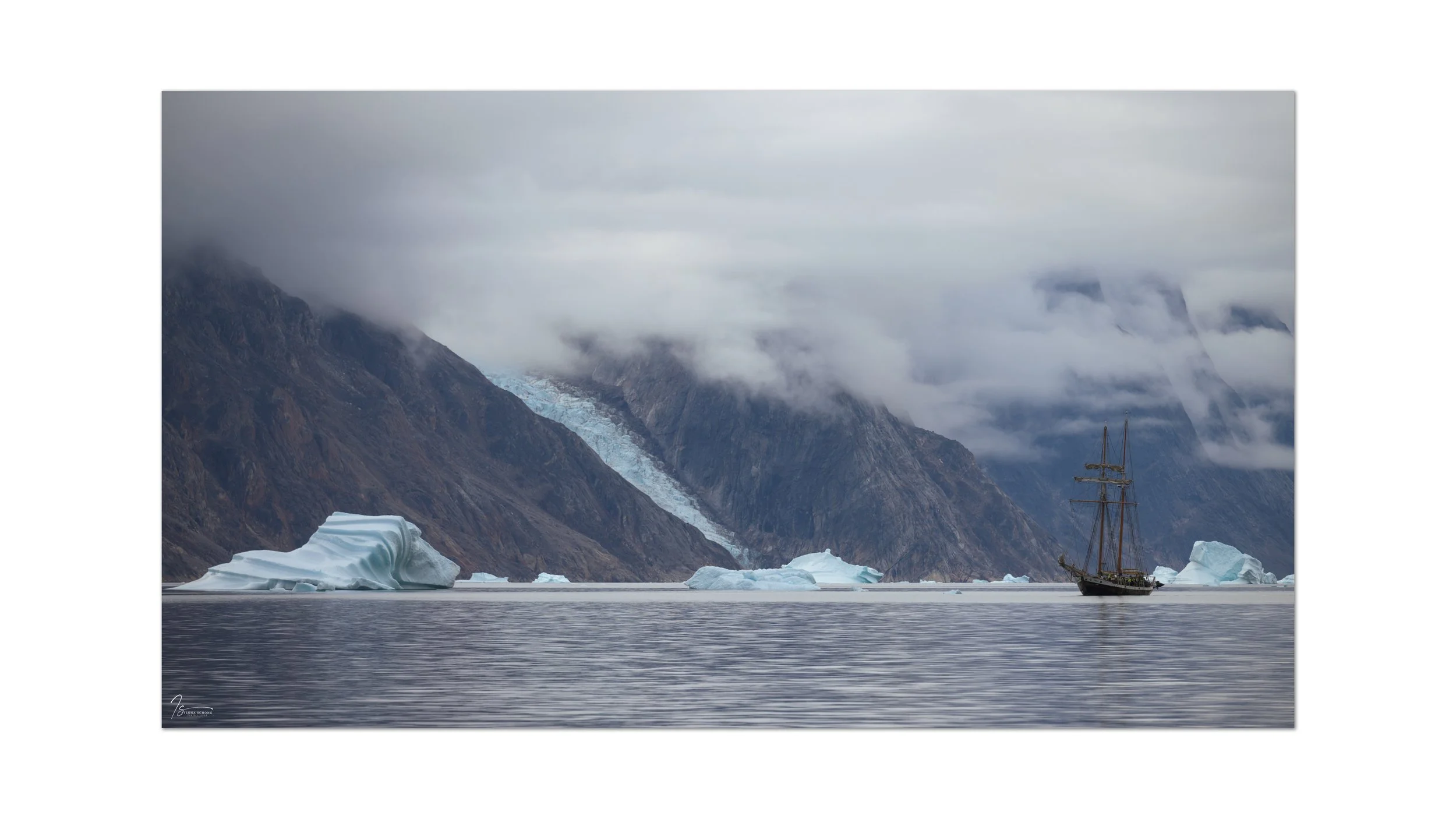
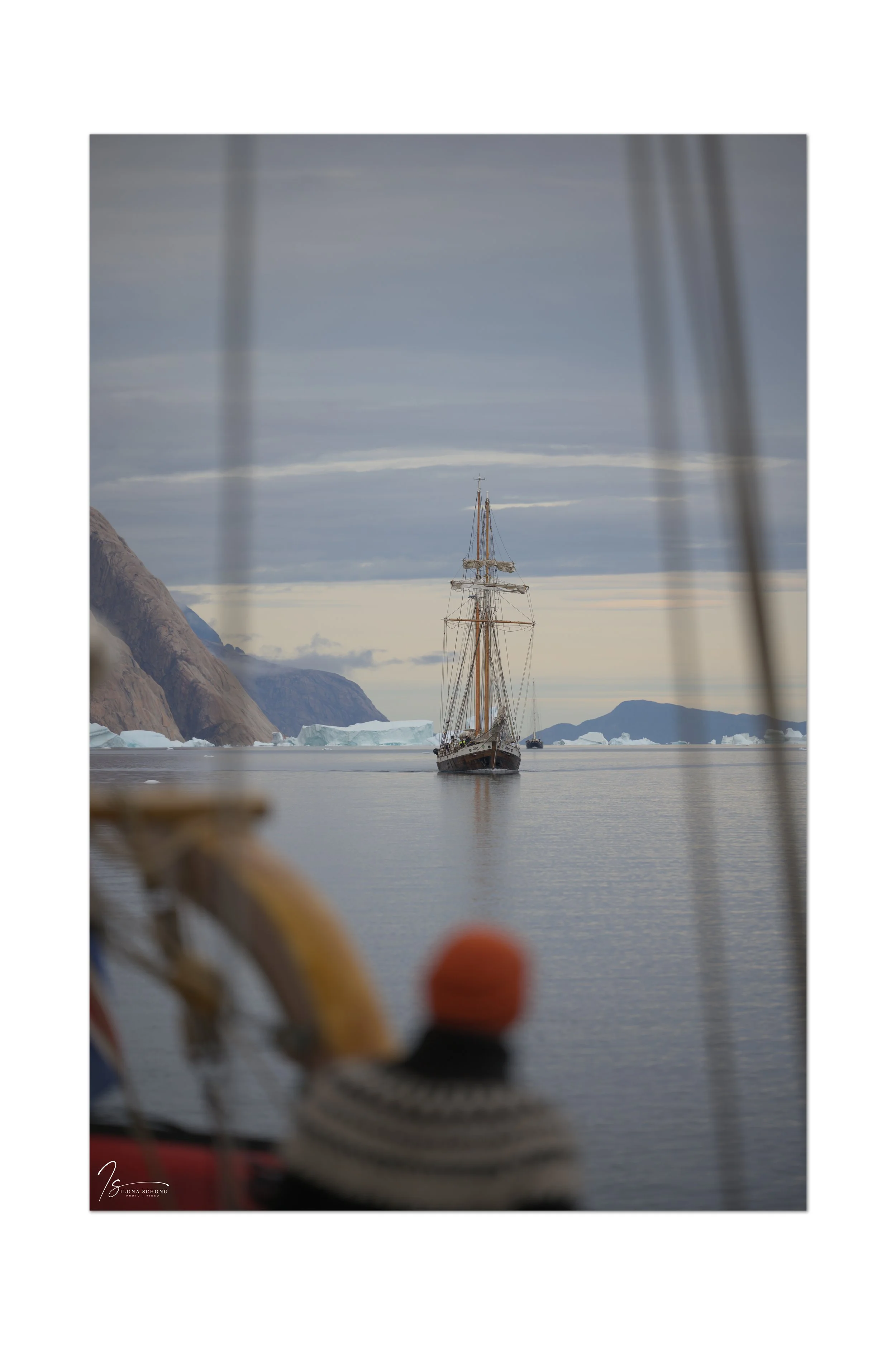
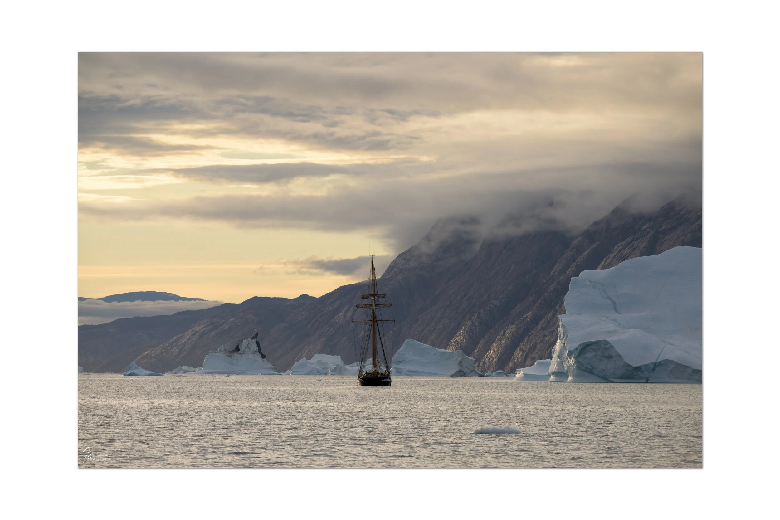
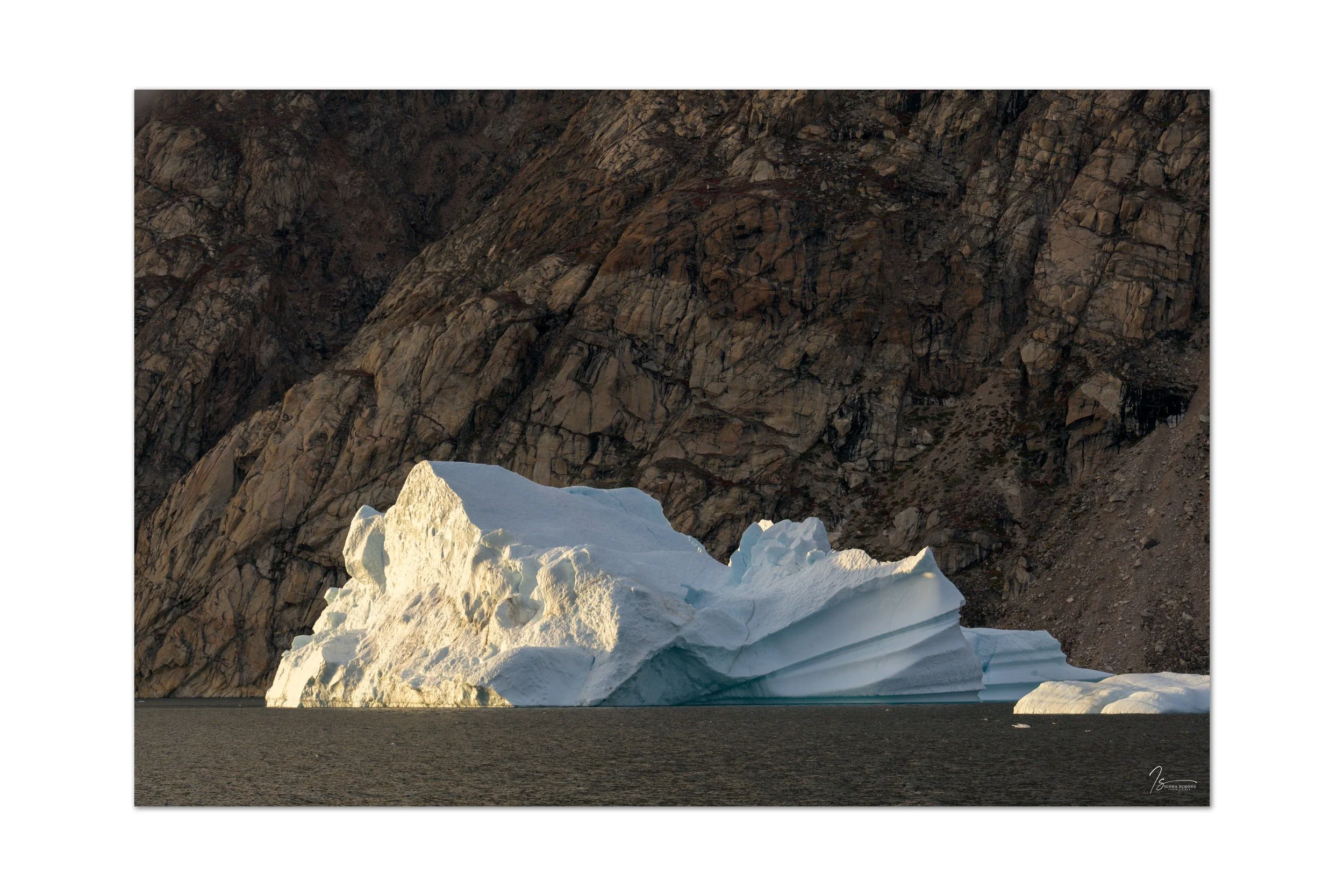
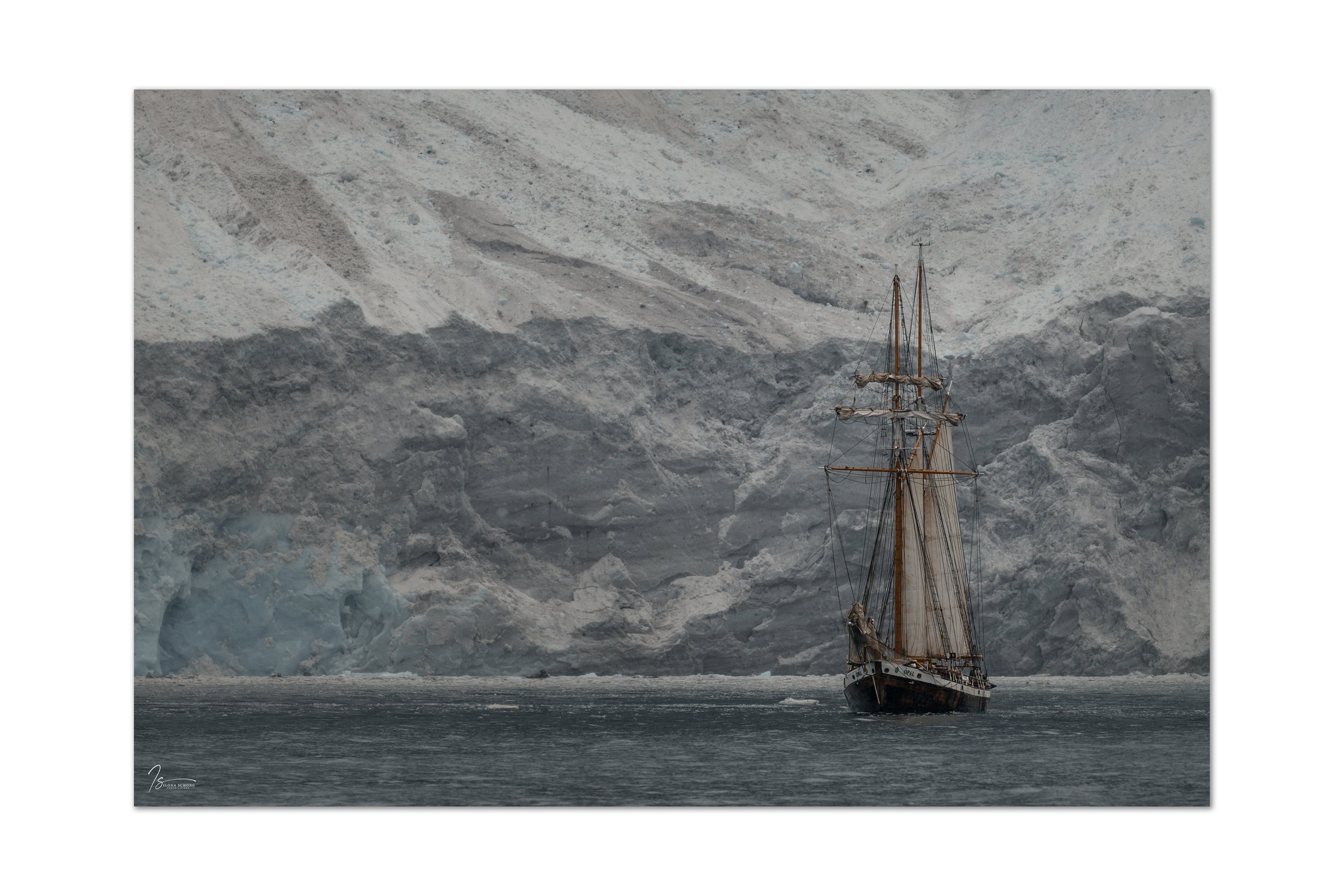
The next morning, already the sixth day, we weighed anchor at 4:30 a.m. A long day of sailing lay ahead, heading for the Volquart Boons coast—this time with black mountains in the distance—toward the massive Sol Glacier. From there, a long crossing to Ittoqqortoormiit. We were heading into an area of stormy weather and rain. Along the Volquart Boons coast up to the Sol Glacier, conditions were initially still quite manageable. The Ópal hoisted all sails, which was of course fantastic to see and photograph, though visibility was limited and hazy, which was naturally a shame.

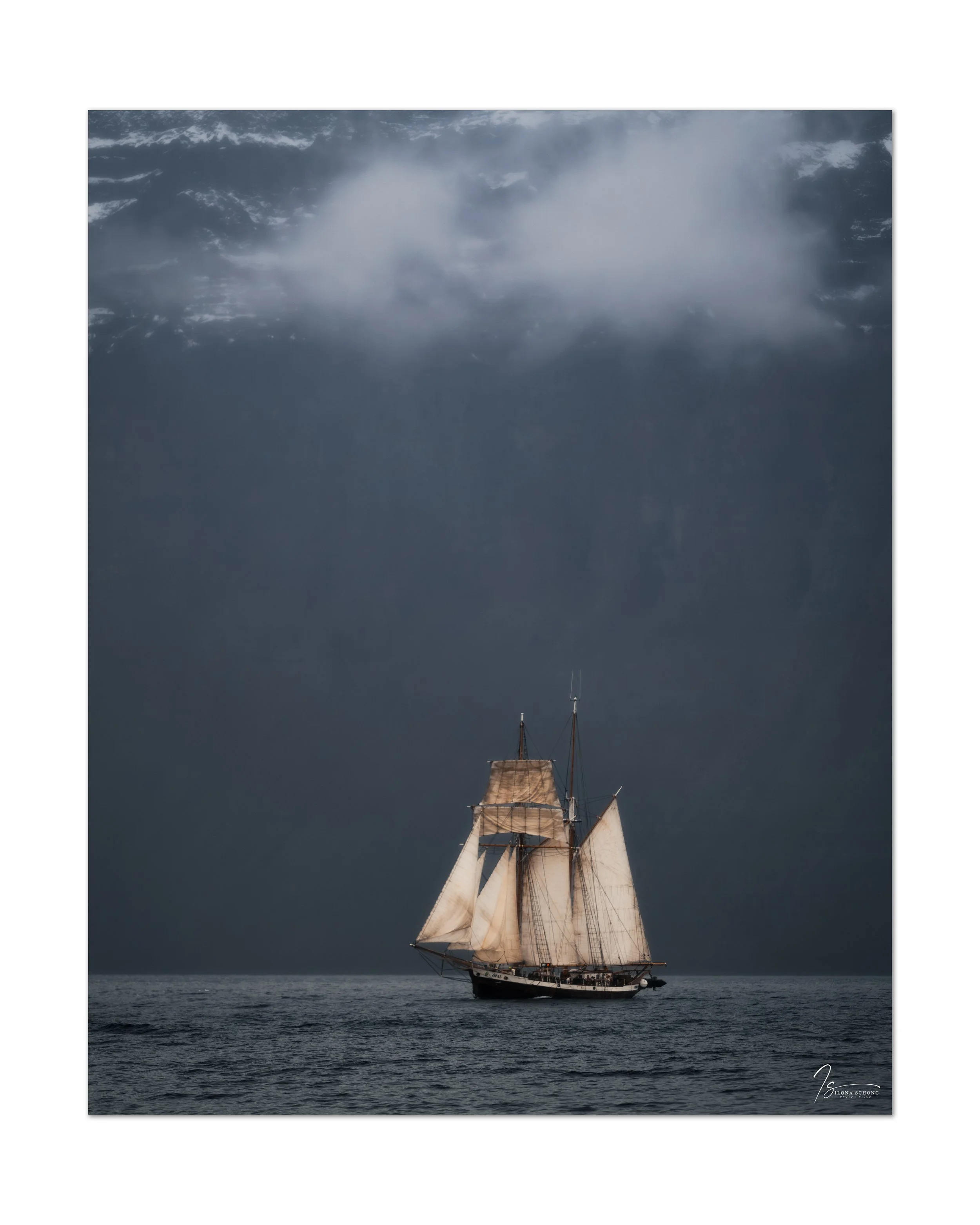
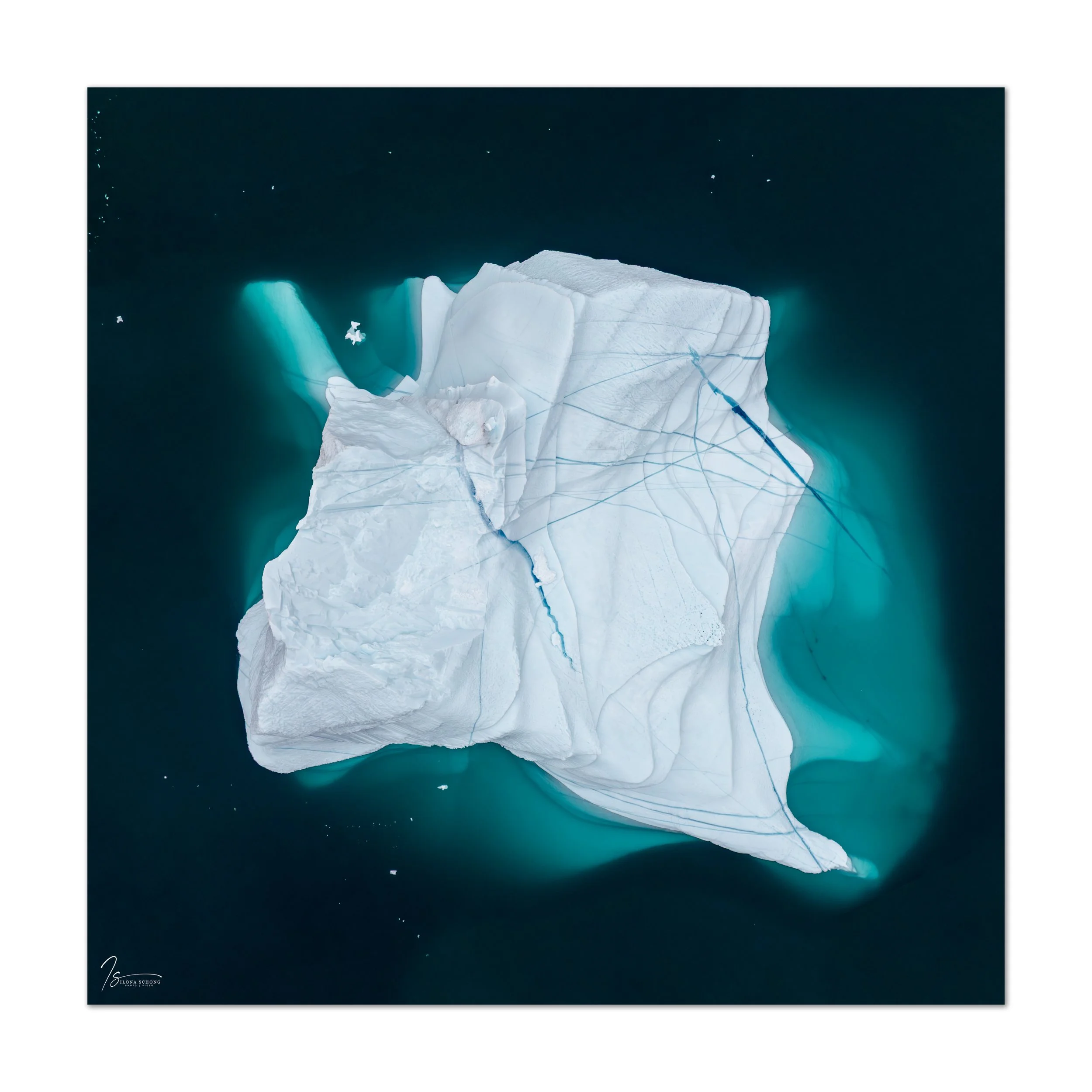
By the time we arrived at Sol Glacier, it had started to rain, which unfortunately made it impossible to fly the drone. Still, I managed to capture my favorite photo of the trip there (see at the top of this blog).
Unfortunately, the long crossing to Ittoqqootormiit then began amid a storm and strong currents, and we arrived in the dark. I didn’t notice much of the crossing itself, as I became very seasick and remained that way for the next two days. The night in the storm was also unbearable. The Hildur was being tossed about in all directions, and there was hardly any chance to sleep or get some relief from the seasickness. Under these conditions, we couldn’t visit Ittoqqootormiit either. The storm was supposed to ease up a bit in the afternoon, so we waited, hoping that the final leg of the voyage toward Constable Point might be a little less rough, but unfortunately, the storm persisted, and we had no choice but to set out anyway.
Usually, the last night is also spent on the boat, but in this case that wasn’t advisable. The crew contacted the airport, and rooms were prepared for us in the wooden barracks and the adjacent containers. Around 11:00 p.m., in stormy and dark conditions, we made the crossing to Constable Point by zodiac with all our luggage and arrived at the airport around midnight after a two-kilometer walk. The Hildur departed that same night around 4:00 a.m. to reach the open sea and make the two-day return journey to Husavik in northern Iceland. I can safely say that I didn’t envy them and was glad to have my feet on land. A dramatic end to an otherwise unforgettably beautiful trip with wonderful fellow travelers, for which I am very grateful!